Book reviews for September 2021
By Robert Ellison.

Shadow Land (Gordon Pope Thrillers, #3) by B.B. Griffith
4/5
During the pandemic induced lockdowns last year we started hiking locally using random trails generated by Routeshuffle. Sometimes these were repetitive death marches along indistinguishable avenues (my kids would say 100% of the time). A few have emerged as favorites that I walk regularly and I'm going to add these to the ITHCWY hike collection.
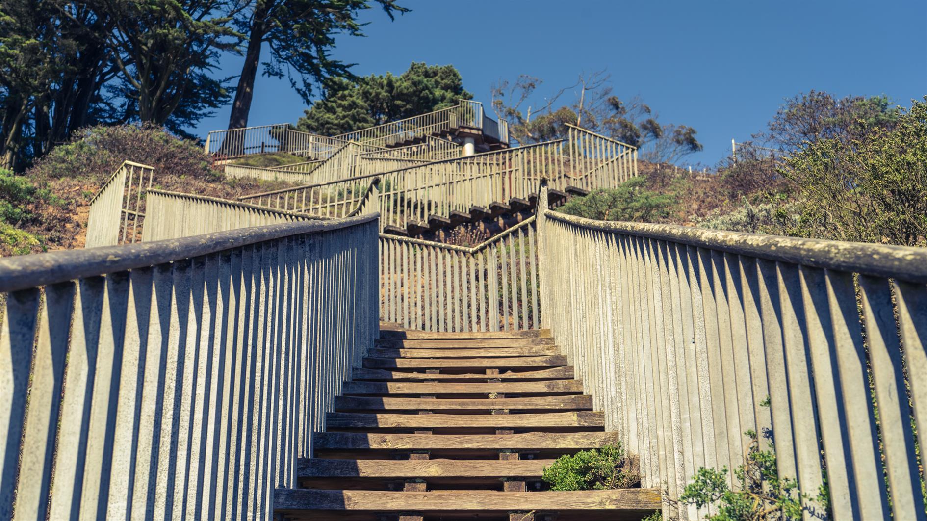
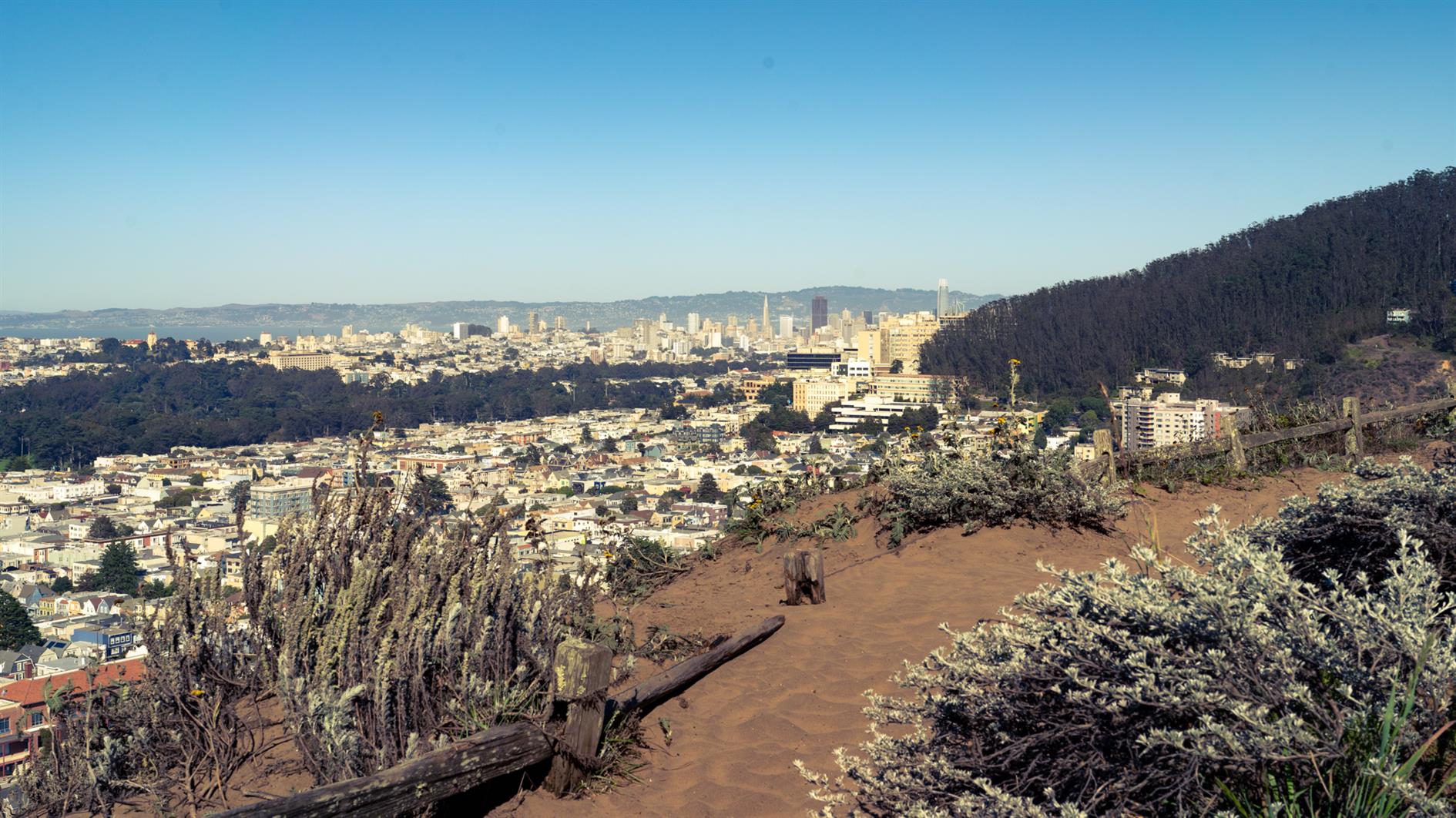
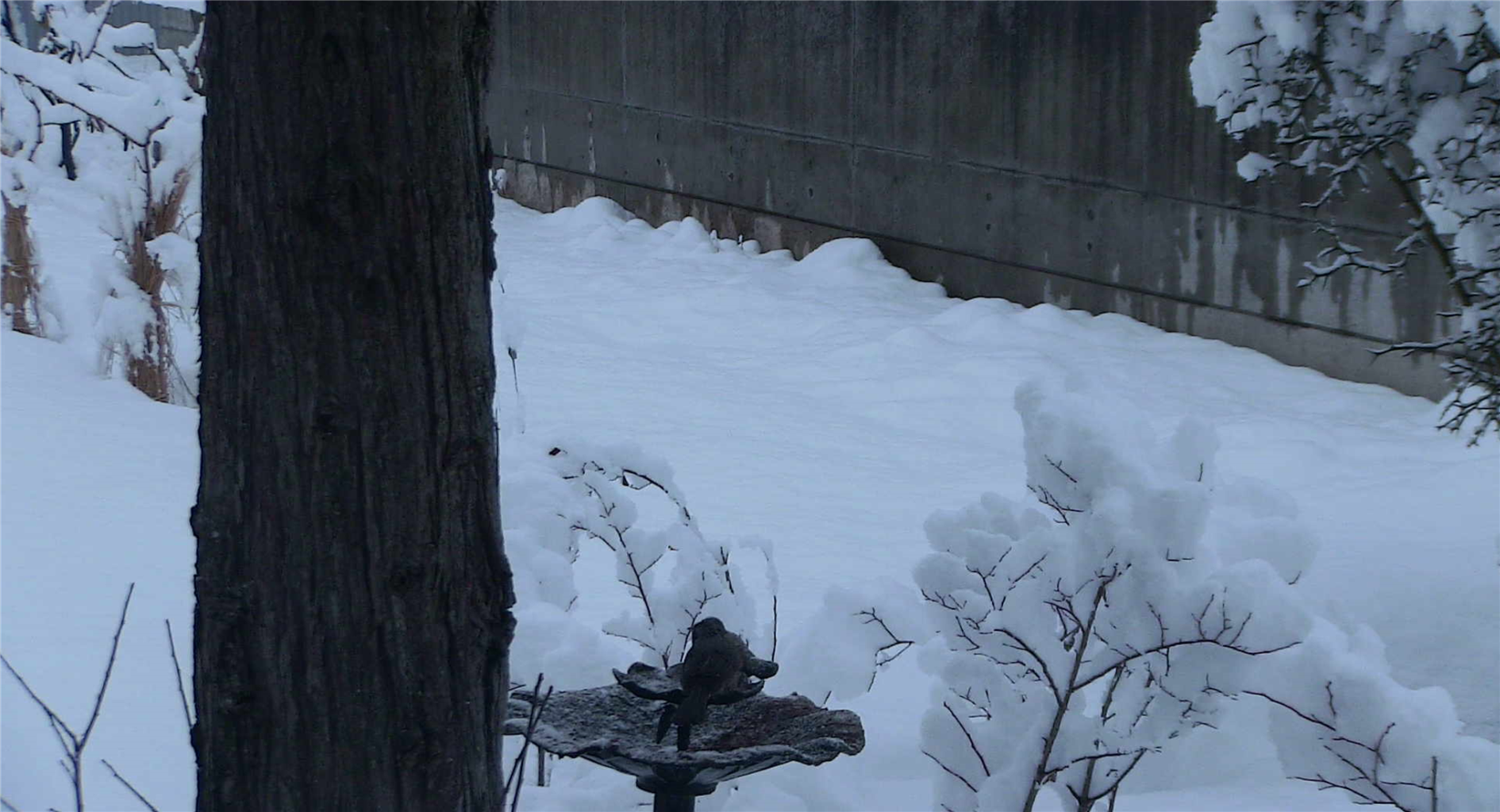
Remnants in the Sunset is a three mile loop named for the islands of rock and dunes visited along the way. The west of San Francisco used to be all dunes and these parks are now all that remains of that original ecosystem.
Walk up 15th Avenue from Taraval to Grandview Park. Go up the steps, admire the view and then down the other side and follow 14th Avenue to Rocky Outcrop Park. This is a wind tunnel with houses on one side and cliffs on the other. Then head up to Golden Gate Heights Park and Larsen Peak at 755 feet. The return leg down Pacheco and Magellan provides views of Hawk Hill which has some unofficial trails but is closed to the public.
(Previously: Grand View of Fog, Post Storm Sunset)
Hike starts at: 37.741905, -122.471336. View in Google Earth.
(Hike Map)
(Published to the Fediverse as: Remnants in the Sunset #hike #sanfrancisco #coronavirus #map Three mile loop hike visiting the Remnants in the Sunset: Grandview Park, Rocky Outcrop Park, Golden Gate Heights Park and Hawk Hill in San Francisco, California. )
4/5
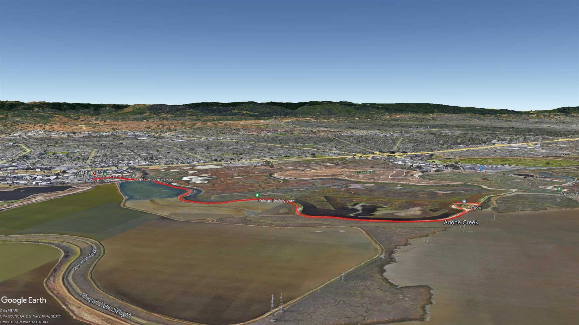
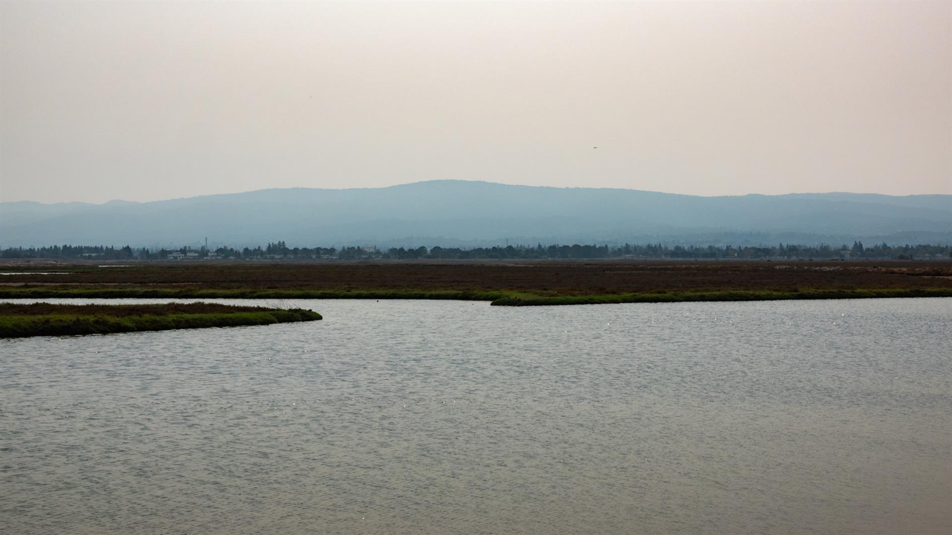
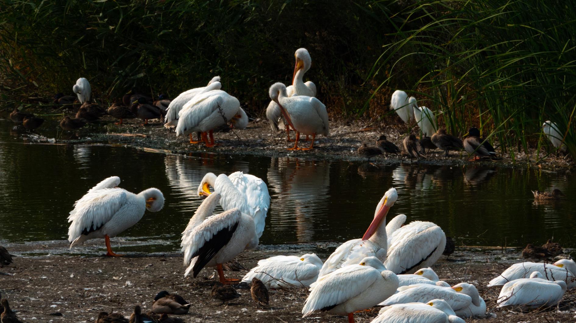
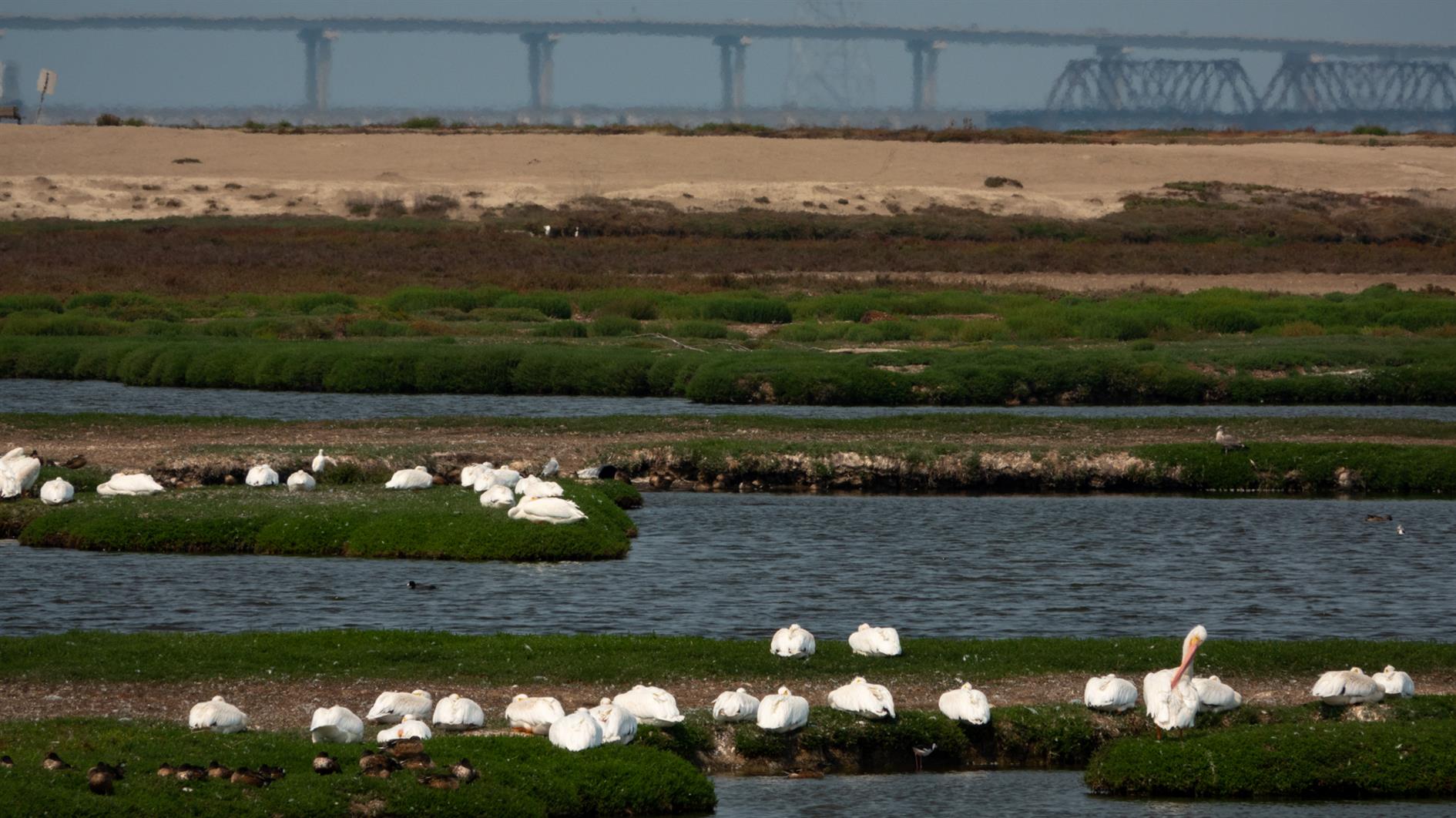
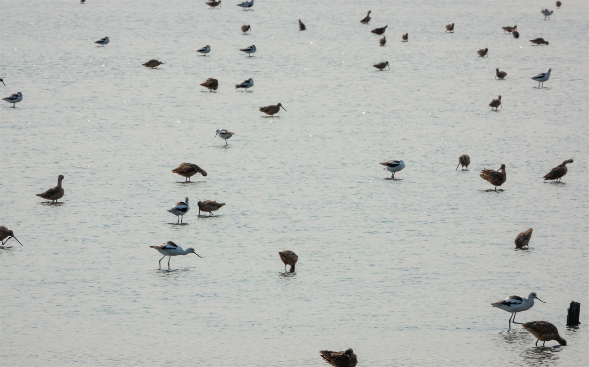
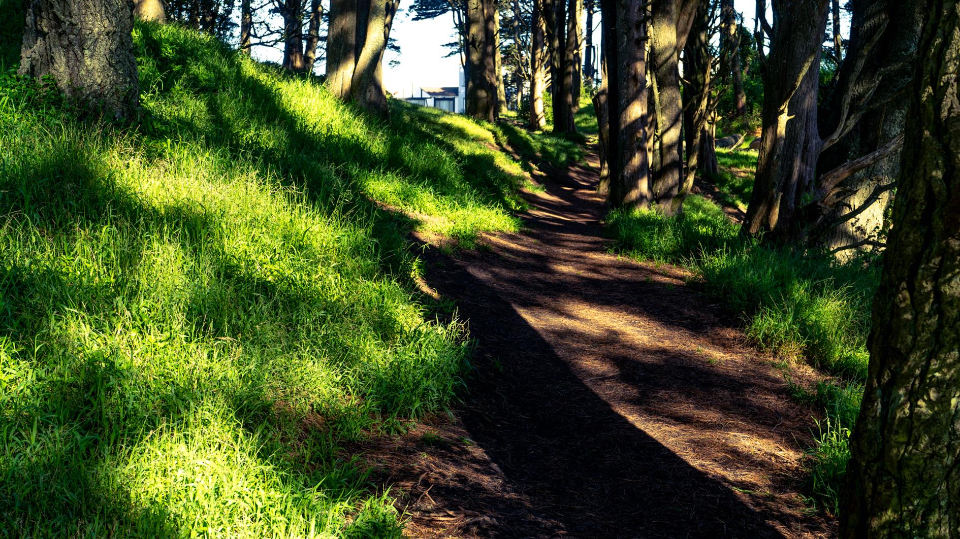
A four mile out and back hike from the Palo Alto Baylands Nature Preserve trailhead. Interesting wetlands with lots of birds and some good views over the bay.
Hike starts at: 37.433507, -122.098799. View in Google Earth.
(Hike Map)
(Published to the Fediverse as: Adobe Creek #hike #paloalto #pelican #map Four mile hike in the Palo Alto Baylands Nature Preserve, California. Wetlands with many birds and bay views. )
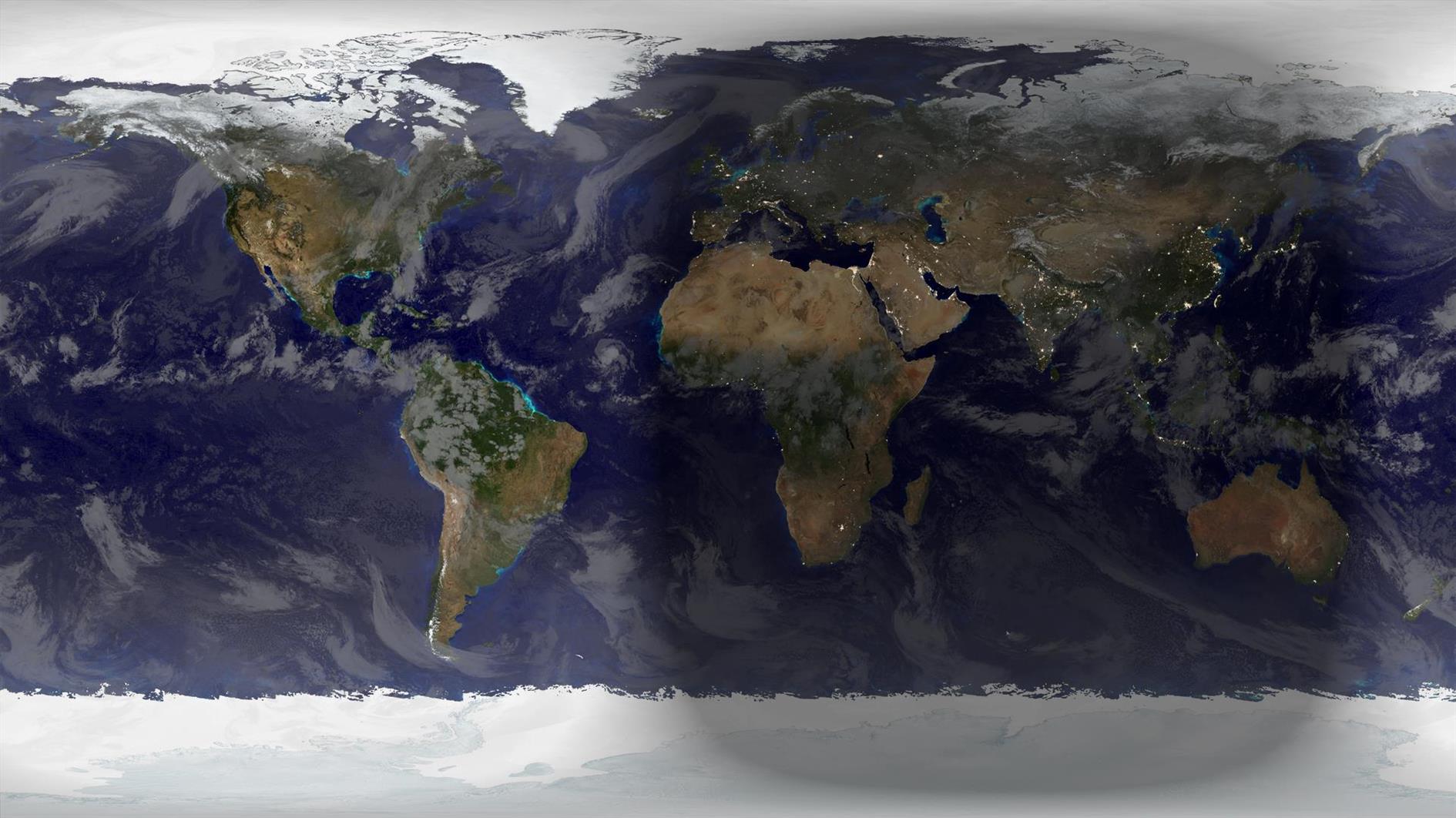
Autumn starts now (September 22, 2021 19:21 UTC) in the Northern Hemisphere, Spring for the Southern Hemisphere. Rendered in Catfood Earth.
(Previously: Autumnal Equinox 2020)
This is the third batch of crystals from our National Geographic Mega Crystal Growing Lab kit (see the previous two).
I have been meaning to experiment with Adobe's Super Resolution technology and this seemed like a good project for it. The video below has the same timelapse sequence repeated three times. If you're not bored of crystals growing yet you soon will be (don't worry, this is the last for now). The first version is a 2x digital zoom - a 960x540 crop of the original GoPro footage. The second version uses Super Resolution to scale up to full 1920x1080 HD. Finally I added both side by side so you can try to tell the difference.
Super Resolution generates a lot of data. I tried to use it once before for a longer sequence and realized that I didn't have enough hard drive space to process all the frames. In this case I upscaled the 960x540 JPEGs which went from 500K to 13MB, quite a jump. I don't see a huge difference in the side by side video though and wouldn't go through the extra steps based on these results. It's possible that going to JPEG before applying super resolution didn't help with quality. It's also possible that Adobe doesn't train its AI on a large array of crystal growth photos so I can imagine it might work better for a more traditional landscape timelapse. I'll test both these hypotheses together the next time I 10x my storage.
(Published to the Fediverse as: Adobe Super Resolution Timelapse (Crystal Growth) #timelapse #crystals #ml #video Time lapse using Adobe Super Resolution to upscale each frame before creating the video (source is crystals growing over two weeks with photos every five minutes). )
We have tried Common Core, Race to the Top, Charter Schools and No Child Left Behind. The US ranks #37 in math according to PISA, behind China, Russia, and Estonia. And we're not making any progress:
"Test scores on the federally funded National Assessment of Educational Progress—known as “the Nation’s Report Card—have been stagnant for the past decade. The scores of the lowest-ranked students declined."
Of course poverty, ideology and unions all play a role here. But none of these challenges are unique to the US. I think the problem is sports.
Something that has always bothered me as I travel around America is that most schools primarily identify themselves by their sports team. Home of the Tigers! Or whatever. What must that do to the majority of non-Tigers turning up for school every day. Nice work on the math test but the only thing we're actually proud of is the football team.
Sports are important of course, to build teamwork and for exercise and as a future career for a tiny minority of students. Nearly everything else the school does is far more impactful.
An important and easy (although likely unpopular) Federal education reform would be to force schools to promote all extracurricular activities equally. Schools could choose to promote nothing and just be a school (like the vast majority of the rest of the world). Or they could give each activity, club and society an equal share of their jumbotron to represent the full diversity of the student body.
(Published to the Fediverse as: Home of the Whatevers #politics #education Ban promoting sports teams at the expense of other activities, a Federal education reform that might actually work. )
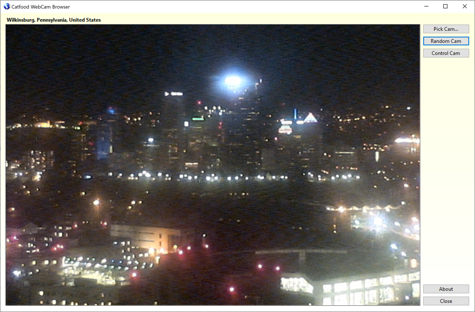
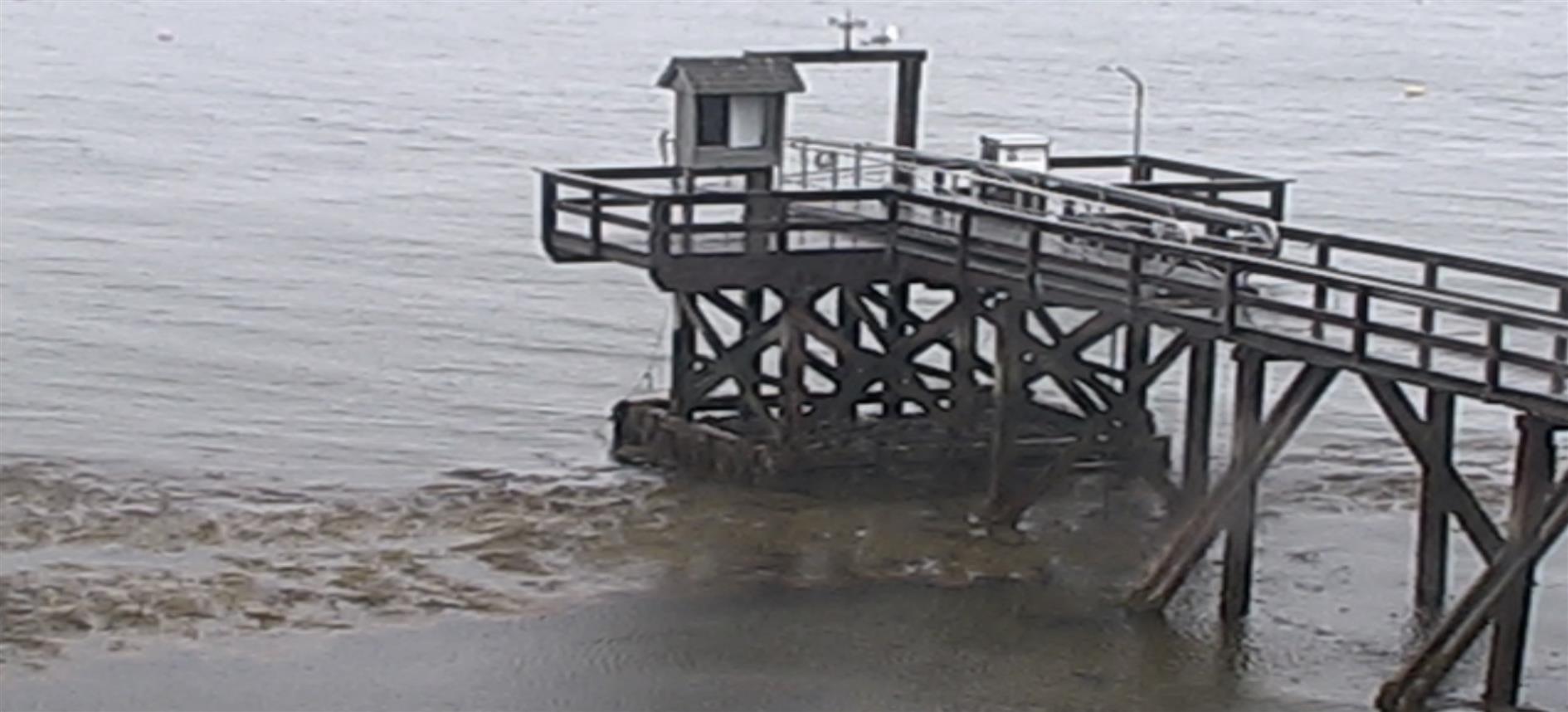
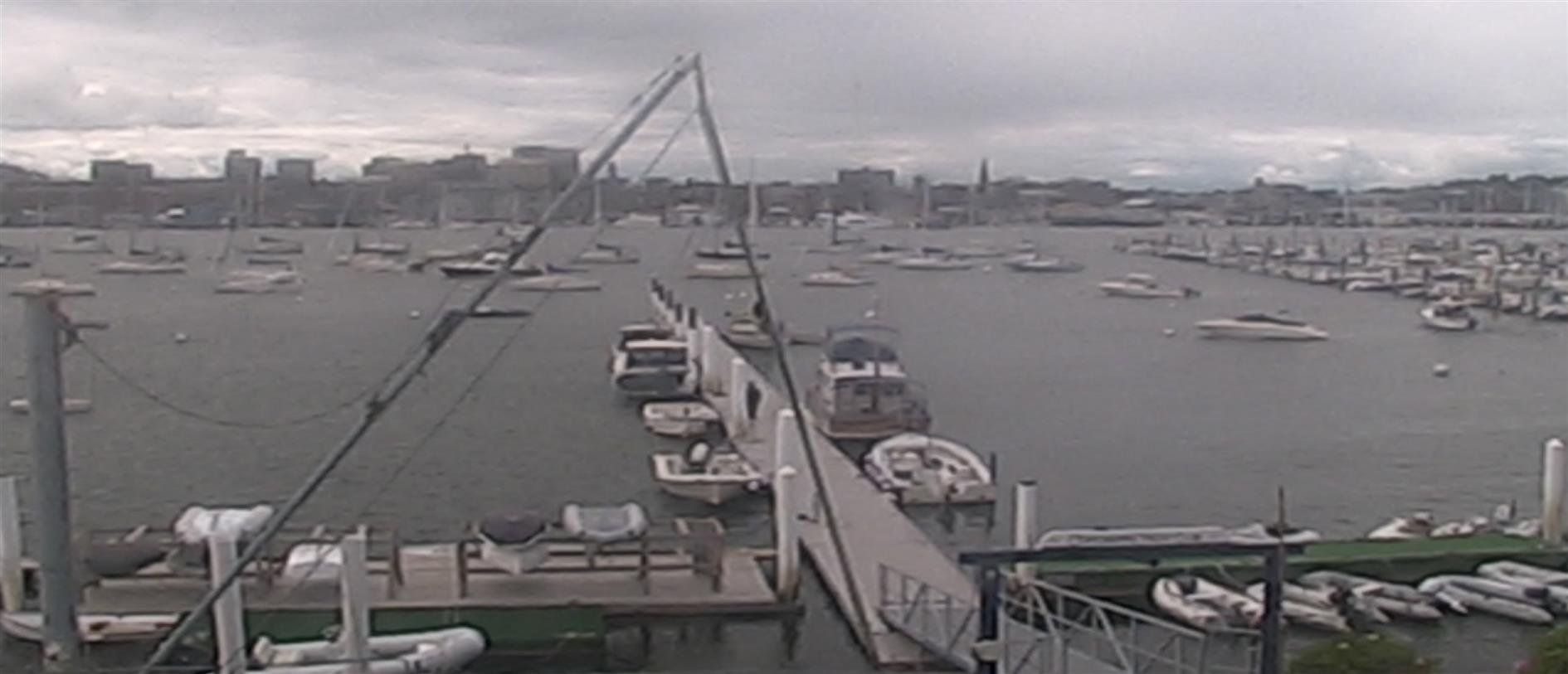
Catfood WebCamSaver is a Windows screen saver that streams live views from random webcams around the world. Download for Windows. You can choose to display 1, 4 or 16 webcams at the same time, and WebCamSaver fully supports multiple monitors. Catfood WebCamSaver was first released in 2004.
When you install Catfood WebCamSaver a shortcut is created to Screen Saver Settings. You can search for Catfood WebCamSaver Settings and run the shortcut, or open Screen Saver Settings directly (on Windows 10, Start -> Settings -> Personalization -> Lock screen -> Screen saver settings). From Screen Saver Settings make sure that Catfood WebCamSaver is selected and then click Settings. On the Windows settings dialog you can also choose how many minutes to wait before starting the selected screen saver and if the login screen should be displayed when the screen saver exits.
Catfood WebCamSaver Settings has three tabs:
Under Description choose if the description of the webcam and the local time if available should be displayed. Click Font to pick the font, color, and optional outline color to use for the description and time.
Under Display choose the number of webcams to show at the same time (1, 4 or 16), how often to switch to a new webcam and how often to refresh the webcam image.
Under Offline Display you can choose a fallback screensaver to start if the Internet is not available.
Please note that recent releases of WebCamSaver will delete and recreate the webcam list on install. This means you will lose any customization of the list on upgrade. See the import and export instructions below to back up any changes you have made.
The Webcams list shows the current library of webcams. Click the column headers to sort (and click again to sort in the opposite direction). You can enable to disable a specific cam using the checkbox in the list.
Click Add to enter details for a new webcam.
When a webcam in the list is selected click Open to launch the web page associated with the webcam, Edit to update details or Delete to remove it from the list entirely.
Click Delete All to remove all webcams from the list.
Click Enable All or Disable All to toggle the checkboxes for all webcams in the list.
You can save your customized list by clicking Export and restore it by clicking Import.
If you prefer day (or night) scenes you can set a local time range here. If this option is enabled webcams where the time zone is unknown will never be displayed.
Click Proxy Settings to configure a proxy server.
Catfood WebCam Browser is a companion application installed with WebCamSaver. When you open WebCam Browser it will start showing a random webcam from the library.
Pick Cam opens a window where you can select a webcam to view from the full list. You can sort the list (click any column header, click again to sort the opposite direction). There is also a filter that only shows webcams matching text that you enter.
Random Cam will select a new webcam at random from the list and start streaming images.
Control Cam launches a URL where you can control the currently selected webcam (if available).
About shows the version and copyright information for the application.
Catfood WebCamSaver requires version 4.8 of the .NET Framework. You almost certainly have this already and the installer will download it if necessary. The installer for Catfood WebCamSaver is digitally signed. You may get a warning about it being infrequently used which you will need to ignore to install.
For support please visit this post, check to see if your issue has already been addressed and if not leave a new comment.
“We LOVE your screen saver. I've seen others try this idea, but never quite seemed to get it right.” Buddy King
“The other day I watched as a middle aged couple in Japan took photos of the changing orange leaves along a calm street. I saw another couple, some tourists, digging for their sunscreen on the beach in Kona, HI.” MIT Center for Future Civic Media Blog
“I've been fascinated by your ‘saver’! It strikes me that so many different places & cultures seem to share some common traits, so that each saver appears to be both familiar and exotic.” Tom
“Very nice screensaver. One of the best I've seen.” Andy Cant
“As a live webcam afficionado, I believe your product is the best, offering high quality resolution, reliable transmissions, a nice blend of everyday street scenes with landscape views, and multiple cam shots filling the entire widescreen page.” Oliver Garrison
“The new version is wonderful. I love being able to sort by age (so I'll never miss a new addition), and I love how easy it is to select my favourites. Basically, I love everything about it. It's so much fun, and brings so much variety to the screen. I have my favourite cams - The streets of Narbonne, that crazy Japanese wind-speed screen, the flag-filled car-park of a Dutch retail park - But it's always fun to leave this screensaver on random and let it transport me to a completely new place.” James
“I have to say that I am enjoying the sights that I am able to see on the web cam. The views are very clear and they are never the same shots. I like being able to show off my new screensaver. Thank you.” Isaac Adel
“Hi, I just love your web cam, I enjoy looking around the world at places I have never been to. Whoever thought up this idea, gets a 10/10 from me.” Lynne
Catfood WebCamSaver 3.20 is available for download.
WebCamSaver is a Windows screensaver that shows you a feed from open web cameras around the world. It also includes WebCamBrowser which allows you to explore the directory and launch a URL where you can control each cam.
Version 3.20 includes an updated list of working webcams - if you are an existing user this will replace any current list the first time you run the updated version.
Catfood WebCamSaver 3.21 is available for download.
This update fixes a screensaver install issue on recent versions of Windows 10 and has the latest webcam list.
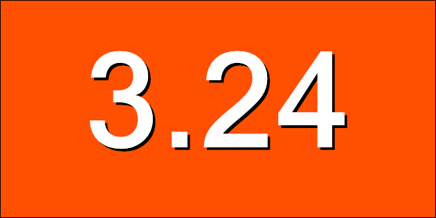
Catfood WebCamSaver 3.24 is available for download. This release includes an update to the default list of webcams.
(Previously: Catfood WebCamSaver 3.21)
Catfood WebCamSaver 3.25 is available for download. This release includes the latest webcam list.
Catfood WebCamSaver 3.26 is available to download.
This update includes the latest list of webcams. It has also been updated to use .NET 4.8 which means it will install with no additional downloads needed on Windows 10 and 11. The installer is now signed. You might get a warning from Defender about the program being infrequently used, you will need to ignore this to install. Lastly WebCamSaver will now automatically check for updates so you'll get a desktop notification when a new version is available.
Catfood WebCamSaver 3.27 is available to download.
This release contains the latest webcam list and will upgrade any current set of webcams. I'm currently releasing updates for WebCamSaver every three months with the latest cams.
Catfood WebCamSaver 3.28 is available to download.
This release updates the webcam list.
Catfood WebCamSaver 3.29 is now available to download.
This release updates the webcam list and includes a selection of new webcams provided by a long-time user.
Catfood WebCamSaver 3.30 is now available to download. This release contains the latest webcam updates.
Catfood WebCamSaver 3.31 is available to download. This includes the latest update to the webcam list.
Catfood WebCamSaver 3.22 is available to download. This release updates the webcam list.
(Published to the Fediverse as: Catfood WebCamSaver #code #webcamsaver #catfood #webcam #screensaver #webcam #software #webcams #screensaver A Windows screen saver that displays live webcams from around the world. Supports 1, 4 or 16 webcams per monitor (multi-display setups fully supported). Free download. )
Snap Out of It, America: Give Kids the Right to Vote
So I disagree with this but it's interesting and well argued. A better idea is my life expectancy weighted voting plan.
--
The ease of mail-in voting may increase turnout in California’s recall election.
NYT finally twigs.
--
A woman is suing S.F. for $50 million over a parking ticket, saying tire chalk is unconstitutional
In one of the cases, filed Sept. 4, plaintiff Maria Infante seeks $50 million and class-action status after a San Francisco parking enforcement officer wielding chalk on a residential street gave her a $95 ticket.
The second case, filed the same day against San Leandro, demands $5 million for class members whose tires were chalked to financially benefit the city.
Civilization continues to collapse. I had my tongue in my cheek for this proposed constitutional amendment but I'm not so sure any more...
--
How to Call Customer Service and Actually Get What You Want
Wired has this generic article on getting support with some insights that might have been cutting age a decade ago. I'm still waiting for CAPTGUAs.

4/5

3/5

3/5

4/5

3/5
ITHCWY voter guide to the 2021 gubernatorial recall. Keep Gavin!
Improving my storage habits with folder insights.
Time lapse of stars over Redding, California.
Adventures growing crystals from a National Geographic kit.
A small WebCamSaver update.
Hikes - around the perimeter road of Angel Island, Teague Hill Preserve, and Echo Lake in Lassen.
ITHCWY interviews every coronavirus expert.
Previously:

