The screen shot above is from Google Fit. Which icon is active? I can't tell any more. Is it the blue one or the underlined one which is a much stronger cue?
Of course none of the icons are underlined. This is a bottom navigation bar on top of the Android navigation bar on Android 10 with gesture navigation enabled. My brain knows this but my finger still tries to click on Home. Journal just looks so much more active I can't help it. This friction is also in Google Photos and Google Maps and presumably Google everything before too long.
Maybe the Google app developers don't have access to recent Pixels, or maybe the Material Design team all have iPhones?
(Published to the Fediverse as:
Did anyone tell Material Design about Gesture Navigation? #etc#google#design I can no longer tell which tab of most Google Android apps is active due to confusion between gesture navigation and the bottom navigation bars.)
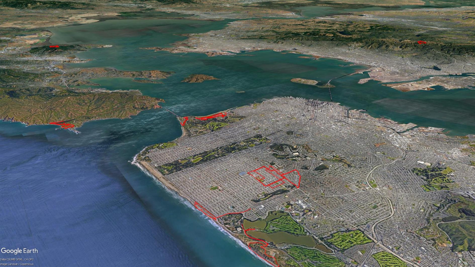
(Published to the Fediverse as:
Humpback Whale at Fort Funston #photo#whales#humpback#fortfunston Humpback Whale photos at Fort Funston (Golden Gate National Recreation Area) in San Francisco, California.)
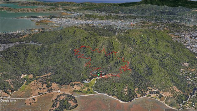
(Published to the Fediverse as:
Northern Pacific Rattlesnake #photo#snake Photo of a Northern Pacific rattlesnake at Fort Baker, Marin County, California.)
By Robert Ellison. Updated on Saturday, September 23, 2023.
Cases and Deaths by Country
Week on Week Incremental
Cumulative
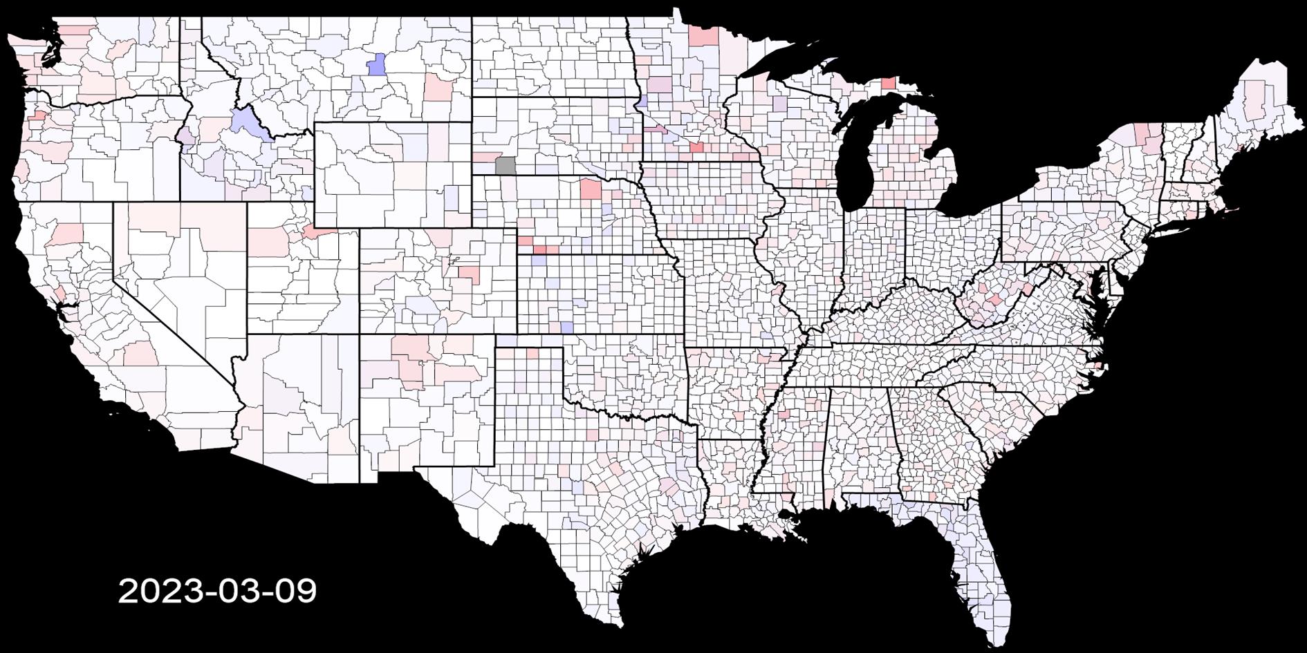
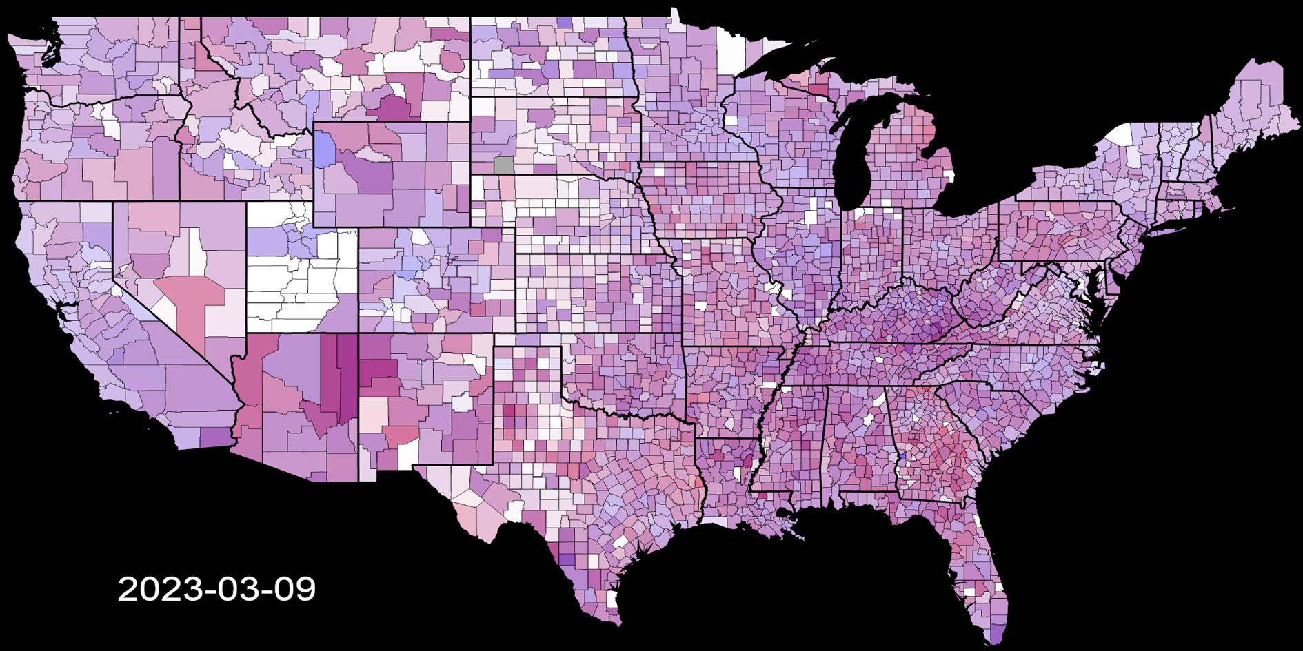
Cases and Deaths by US County
Week on Week Incremental
Cumulative
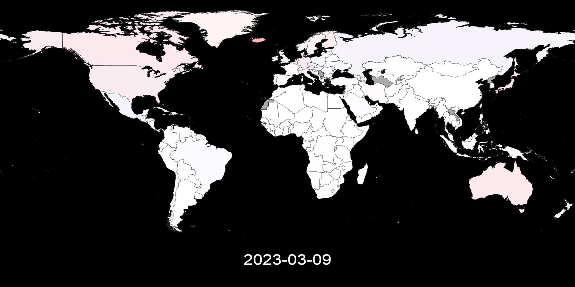
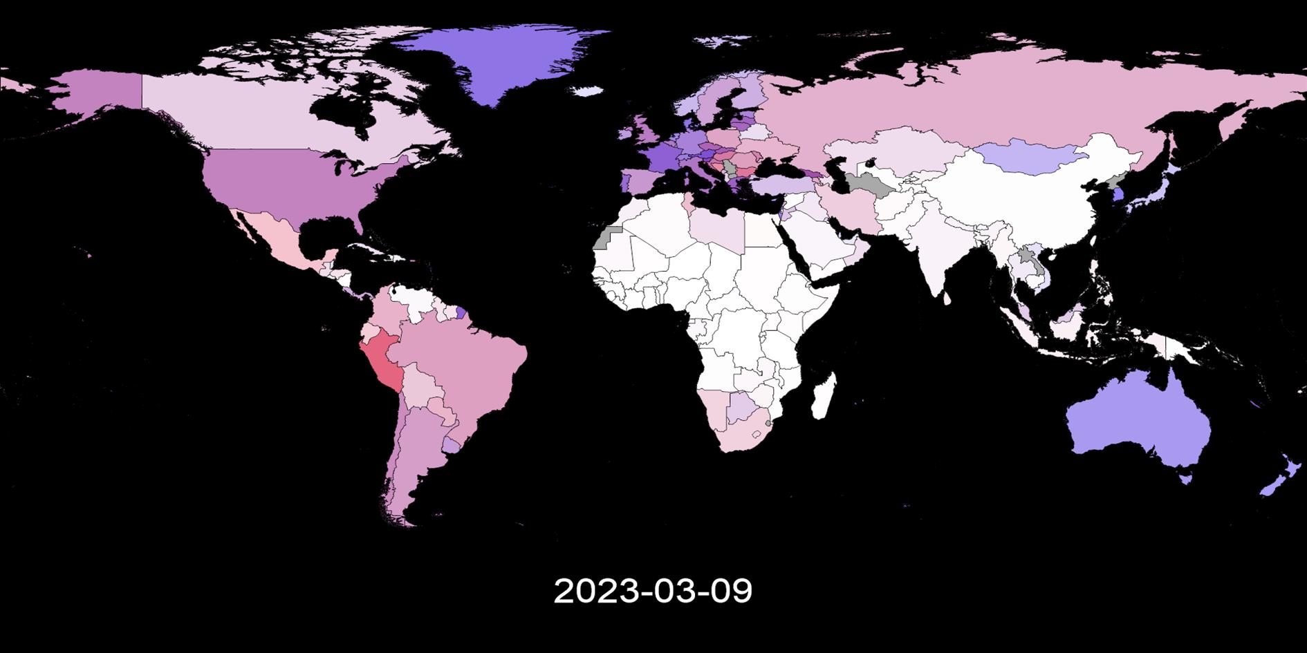
This post visualizes global and US county level coronavirus data from
Johns Hopkins University. Four videos show both cumulative and week on week
progression (comparing seven day moving averages) of the disease together with four images that show the most recent snapshot. It used to be updated weekly, this stopped August 5, 2023.
Cases and deaths are shown simultaneously using blue for cases and red for deaths.
Where both are high a region will be a shade of purple. Regions with no data are dark gray.
The week on week incremental visualization is useful to see the history and current state of the spread of coronavirus.
Each region is shaded based on the highest number of daily cases and deaths for that region and is relative to population. For example if the highest
number of deaths reported on any day in San Francisco county is seven, then any day that has seven deaths will be the
brightest shade of red. This shows where COVID-19 is relatively bad over time.
The cumulative visualization is shaded relative to the highest total death and case count for any region, relative to population.
As the location and date of the peak in week on week and cumulative cases and deaths change over time the videos will be
different each time you watch. Bookmark this post and check back for weekly updates.
(This is the fifth version of this post as I have changed the data source and methodology several times.
I usually preserve the previous version of any post but the changes are large enough that in this case I have removed them).
(Published to the Fediverse as:
Visualizing Coronavirus Cases and Deaths by Country and US County #etc#coronavirus#shapefile#h5v Videos showing the spread of confirmed COVID-19 cases and death by country and US county/state per capita from 2020 to 2023.)
If you're going to ask for something be direct, don't beat around the bush.
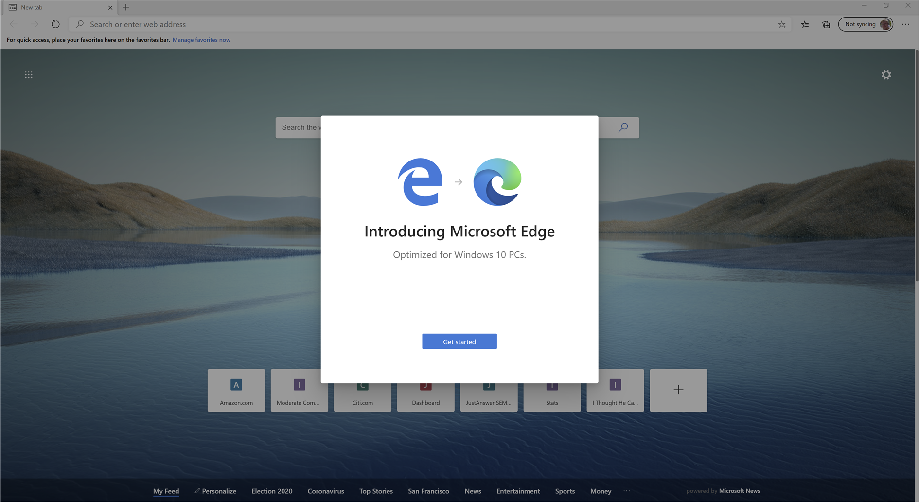
So I'm confused, Microsoft. Do you want me to use Edge? After installing updates Edge wants to 'Get started', on a nice modal with no cancel button or even any little x to close it. Must be some mistake right, not quite ready for prime time if they forgot the 'Don't get started' button. Maybe I'll try it when the kinks are worked out.
Ah, right clicking the icon and choosing close would work, right? Nope. Feels more and more like malware.
You can kill it from task manager so at least someone was paying some attention to usability.
Don't I remember some settlement with the DOJ after an antitrust judgement for forcing browsers on someone? That was a while back, must be remembering a different company.
(Published to the Fediverse as:
Do you want me to use Edge, Microsoft? #etc#microsoft#edge Please help me, I'm having a really hard time understanding if Microsoft wants me to switch to their Edge browser or not.)