As a public service we interviewed every coronavirus expert from every hospital and public health department to get definitive advice on how to think about COVID-19 and navigating the current state of the pandemic.
ITHCWY: With the rise of the more infectious Delta variant, how should the vaccinated approach returning to bars, restaurants and even the office?
ECE: Great question. I think people should be asking themselves two questions. First, how vulnerable are you to infection? Do you have comorbidities brought on by having been alive for more than a few years? Do your cells accept or reject spike proteins? Second, what is your personal tolerance for badly quantified risks?
ITHCWY: What about families where the parents are vaccinated but there might be younger kids who aren't eligible?
ECE: Families are in a tough spot. As well as considering your own unknown vulnerability and appetite for risk, parents should also consider how likely their children are to get infected and the various articles they have read about unprecedented increases in vanishingly rare side effects that are overwhelming health providers at unconcerning levels.
ITHCWY: Your education and career have prepared you to quantify absolute and relative risks for infectious diseases, correct?
ECE: That's right. Not sure why you'd be interviewing me otherwise.
ITHCWY: Let's move on to outdoor risk. Last year there was a lot of talk of maintaining six feet of separation. Is this still the best advice?
ECE: It was the best advice we had available at the time. It turns out that six feet came from a Japanese marketing campaign in the '60s and has been passed on from public health expert to public health expert until the origins were entirely forgotten. The Japanese character for 6 looks a lot like a man standing to one side while a virus particle lands harmlessly next to him and so it kind of stuck. Cute, but it turns out there is little data to suggest it should be 6 feet rather than 4 or 20.
ITHCWY: So in 2021 what sort of distance should we leave when passing others?
ECE: It's a heavily populated planet. If you're moving further away from one person you're getting close to another. Instead of absolute distance I'd consider if that total stranger is vaccinated, what their hygiene habits are like, do they look like they'd cough into their elbow or directly at your face. That kind of thing. And as always you should consider your likelihood of infection from that specific person as well as the risks you've already taken and may yet take that day.
ITHCWY: More and more businesses are installing carbon dioxide sensors. Do you think this is a helpful trend?
ECE: As we all know ventilation is incredibly important in an indoor environment. It's also important that we use common sense. If you think 400 parts per million is a good level of CO2, good for you. If your spider sense thinks it should be more like 20%, knock yourself out.
ITHCWY: Is there a level of CO2 that would make you, for instance, stand up and leave a restaurant and go somewhere else?
ECE: Yes.
ITHCWY: Thanks for your time today. I'm sure our readers feel that all of their questions have been cleared up.
(Published to the Fediverse as:
Every Coronavirus Article #etc#coronavirus ITHCWY interviewed every coronavirus expert to provide the definitive advice on the state of the pandemic in 2021 so you can stop reading other articles.)
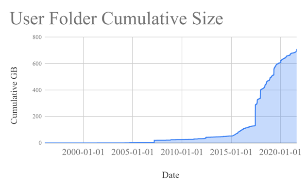
A while back 2TB of storage seemed like plenty. Ooops.
It doesn't help that I'm a digital hoarder. I have everything from email mailboxes from the early 90s to obsolete Android virtual machines that will never run again. I've been forced to do something about it by filling up my backup drive.
My current backup strategy is to send everything to Google Drive. And then send all my pictures to Amazon Photos (free with Prime!). And then backup everything to an external drive (using my VSS tool) every month and stick it in a fire safe because Google and Amazon do not care about my files like I do.
I wrote a little utility to dump some stats to help me accept the problem and then do some tidying. Here's storage over time (imperfect, based on earliest of creation and last write time):
Some of that is driven by ever better cameras and increased willingness to shoot 4K video. Some of it is crazy projects that I forgot to tidy up after, like making a daily timelapse movie from a nest cam.
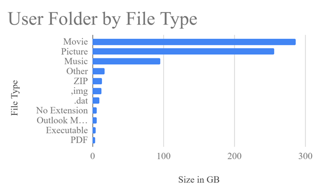
Here's a breakdown by file type:
Mostly media. New resolution, when I take 500 photos of my thumb I should delete all but the very best right after uploading instead of saving them in case I want to make some kind of thumb-animation later.
The most useful thing the utility does is dump out each folder with more than 1GB of files. That found a lot of cruft hiding in unexpected places (bye bye every frame of the 2017 eclipse that I accidentally left in Google Drive instead of my dedicated time lapse disk). I might improve this over time, but all of the above is available now as folder-insights on GitHub.
(Published to the Fediverse as:
Folder Insights #code#backup A tool that shows storage over time, and by file extension, and finds folders with more than 1GB of files. Windows, source on GitHub.)
By Robert Ellison. Updated on Saturday, October 4, 2025.
I just voted no to recalling Gavin Newsom. He probably shouldn't have had that mid-Pandemic party at The French Laundry, but I don't think that rises to the level of getting kicked out of office. I think we can wait for 2022 to pass judgement on his tenure.
The polling seems fairly tight right now, which is a little surprising given the Democratic lean of the state. I was tempted to leave the tedious second question unanswered, or write something stupid in, but it's possible that Newsom loses and we have to pick a new Governor. I backed Kevin Paffrath because he's going to fix homelessness in 60 days and he's the leading Democrat in the polls (and I don't believe he's going to fix homelessness). I don't want Newsom to lose but if he does I'd rather avoid the bear renter or talk radio climate skeptic.
"The vote is expected to come down to whether Democrats can mobilize enough of the state’s enormous base to counteract Republican enthusiasm for Gavin Newsom’s ouster."
But everyone is getting a postal vote. You don't even need a stamp. "Mobilize" is a bit of a stretch. If Newsom ends up sacked it's because he partied while the rest of us were bleaching our broccoli.
(Published to the Fediverse as:
2021 California Gubernatorial Recall #politics#election#california Voter guide for the 2021 California gubernatorial recall election. Vote No for recalling Gavin Newsom and vote for Kevin Paffrath to replace him.)
By Robert Ellison. Updated on Saturday, February 19, 2022.
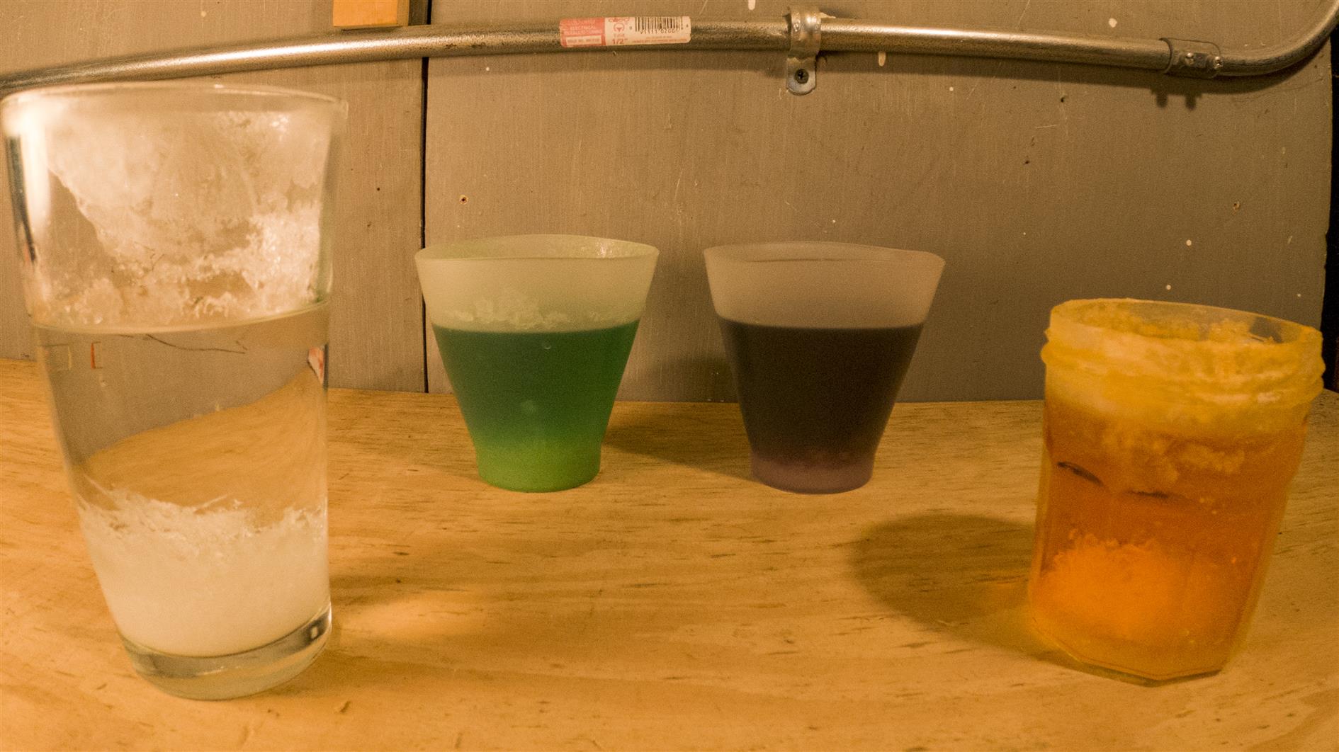
A timelapse of four containers growing crystals from the National Geographic Mega Crystal Growing Lab. The sequence was shot over two weeks (one frame every four minutes, running at 60 frames per second).
It should have taken less time. They recommend a growing area that is at least 68 degrees. This shouldn't be a problem with most of the country suffering record temperatures under heat domes if not actively burning in record breaking wildfires, but San Francisco is experiencing its coldest summer in more than five decades so two weeks seems like the minimum.
Other than not attempting to grow crystals in San Francisco, the other lesson learned is that you really want to use the two silicone cups included in the kit. We tried a pint glass that just grew fuzz (possibly due to the age and pitted nature of the glass) and a jam jar that grew cute small crystals that then made a decent attempt at escaping down the outside. I think three weeks and it would be a full J. G. Ballard situation.
Updated 2021-09-04 18:54:
Second batch. This time shot from above. It's still cold, so this is three weeks, 5 min interval and 60 frames per second for the timelapse:
Updated 2021-09-12 12:57:
Third batch. We're well into September but San Francisco is still bathed in fog. This is still at 5min per frame, but only took two weeks as I moved the lights closer in. For this timelapse I experimented with Adobe Super Resolution so the video has the same sequence three different ways (I wrote a separate post on the Super Resolution experiment).
(Published to the Fediverse as:
Crystal World #timelapse#crystals#video Timelapse of growing crystals from the National Geographic Mega Crystal Growing Lab shot over two weeks (photo every 4 mins, video at 60fps).)
By Robert Ellison. Updated on Saturday, February 19, 2022.
Time lapse of stars and the milky way over Redding, California. Nice to have got the milky way as there is still a fair bit of light pollution in this area. Shot over three nights in July 2021. Shot on a Sony A7C with 20mm f1.8 G lens. Post processed in Lightroom, LRTimelapse, Resolve and Filmstro Pro.
(Published to the Fediverse as:
Milky Way and stars over Redding #timelapse#stars#milkyway#video 4K time lapse of stars and the milky way over Redding, California.)
By Robert Ellison. Updated on Monday, September 29, 2025.
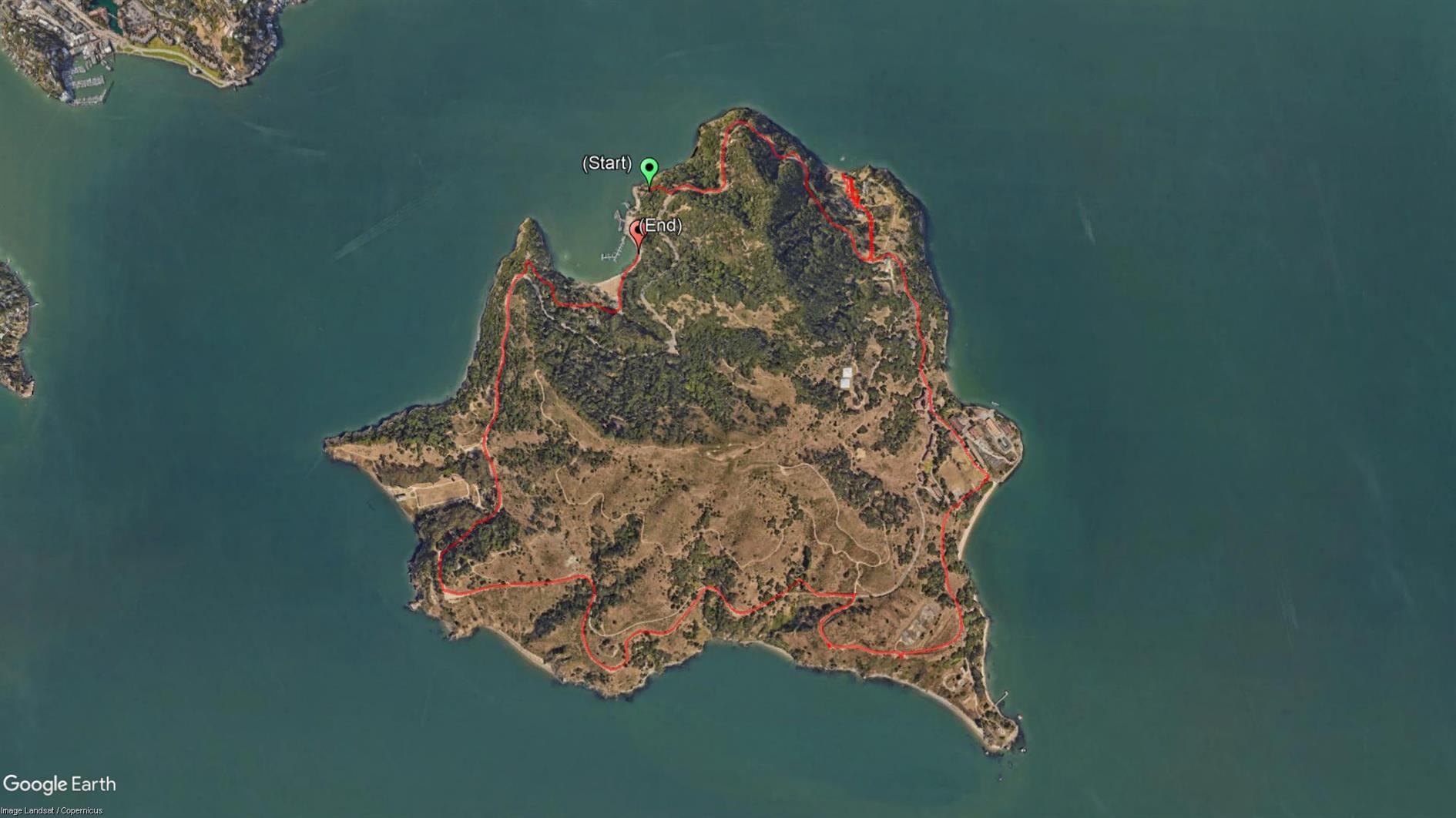
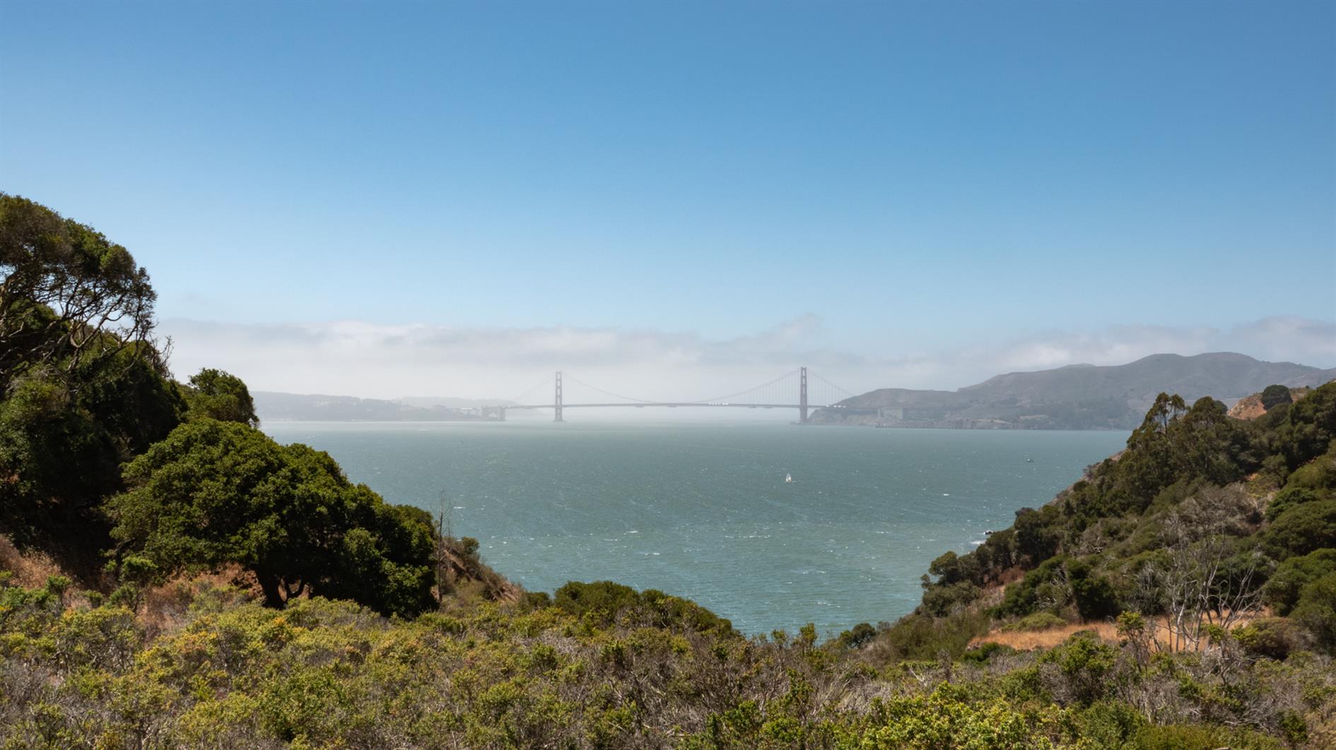
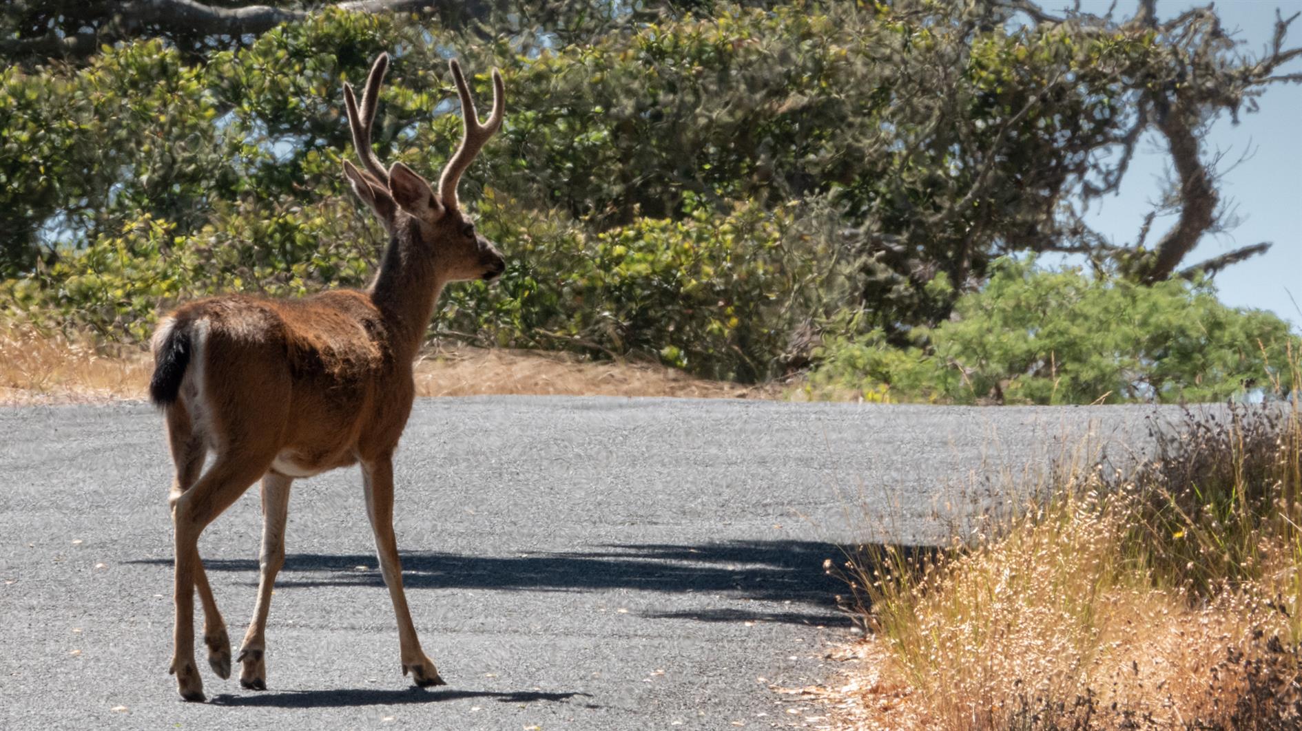
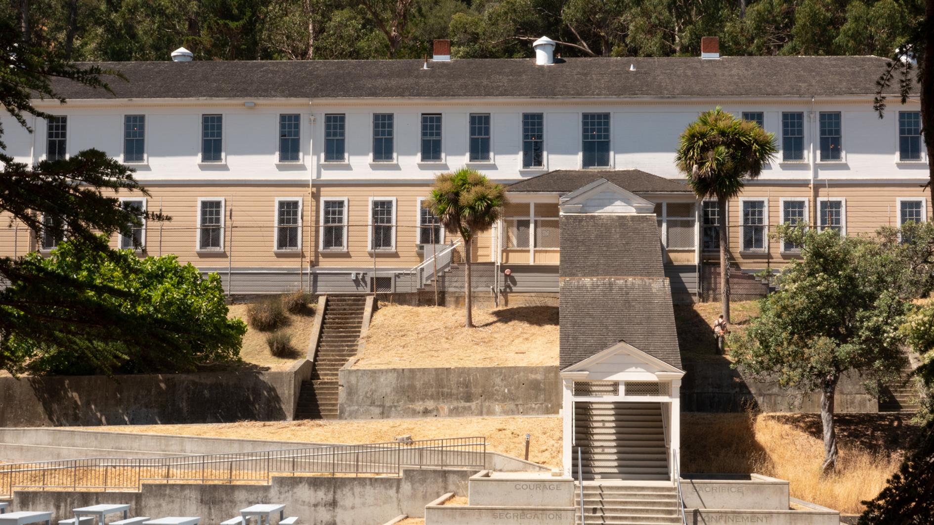
Easy and spectacular hike around the perimeter road of Angel Island. Around five and half miles, although gets a bit longer if you add a detour or two, and there is something interesting around every corner. Just make sure you don't miss the last ferry back.
(Published to the Fediverse as:
Angel Island Perimeter Road #hike#angelisland#map 5.5 mile hike around the perimeter road of Angel Island State Park in California.)
By Robert Ellison. Updated on Monday, September 29, 2025.
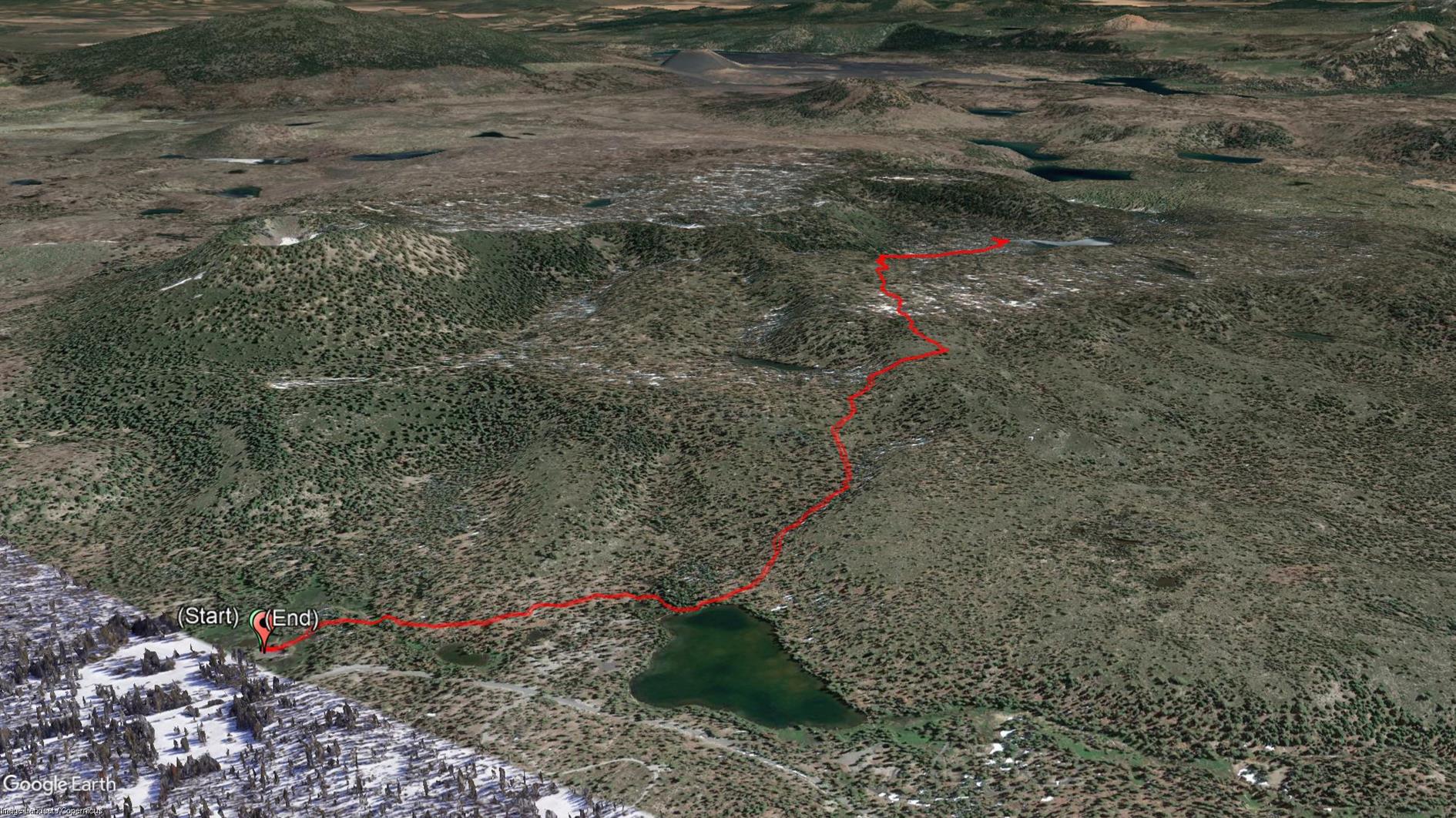
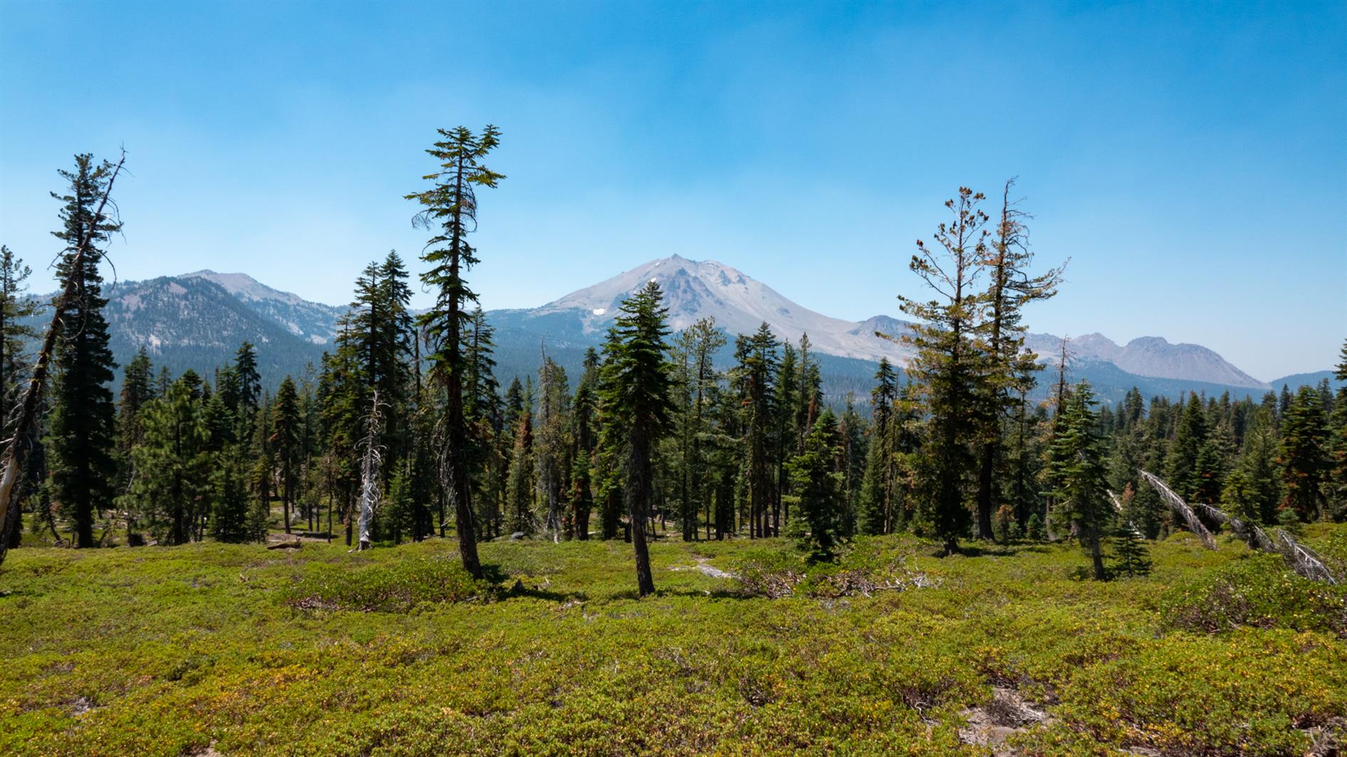
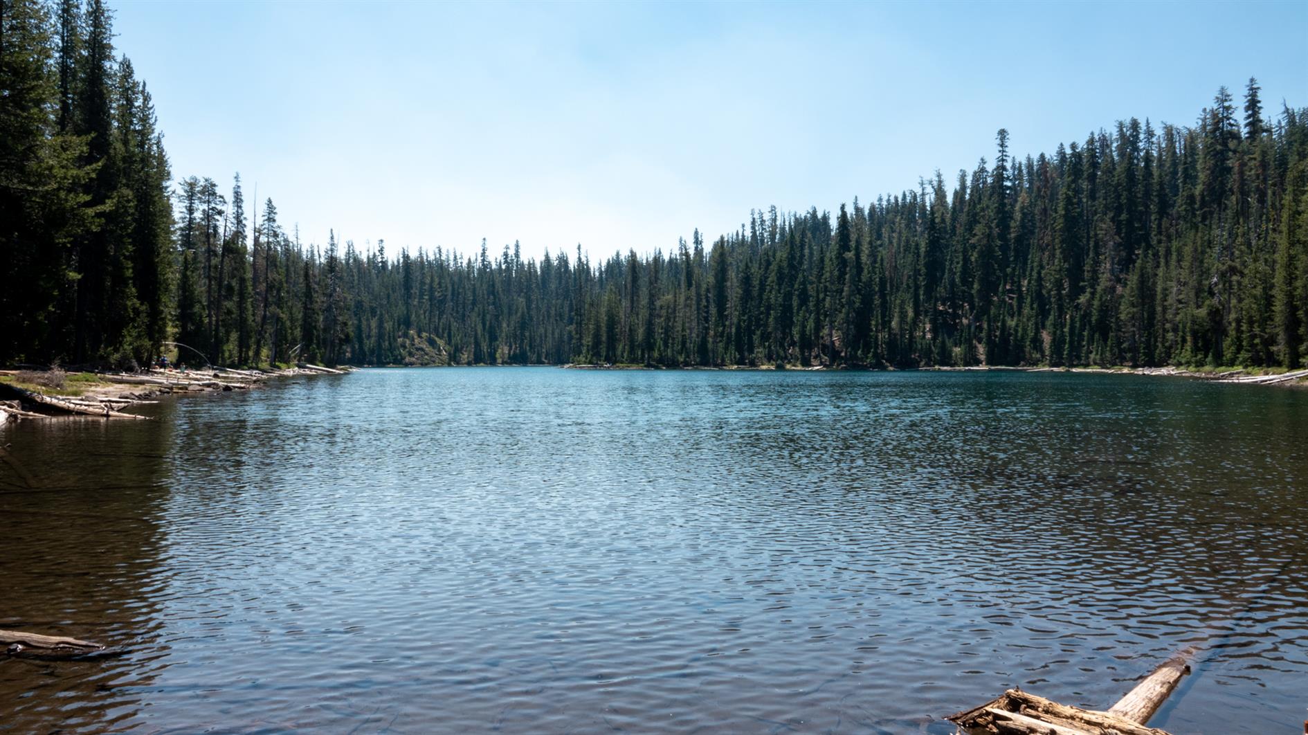
A 4.5 mile out and back hike to Echo Lake in Lassen Volcanic National Park. Start at the Summit Lake Ranger Station, take the short trail to Summit Lake and then follow signs to Echo Lake.
(Published to the Fediverse as:
Summit Lake to Echo Lake in Lassen #hike#lake#lassen#map Hike from Summit Lake to Echo Lake in Lassen Volcanic National Park. 4.5 miles out and back.)