Black Kite
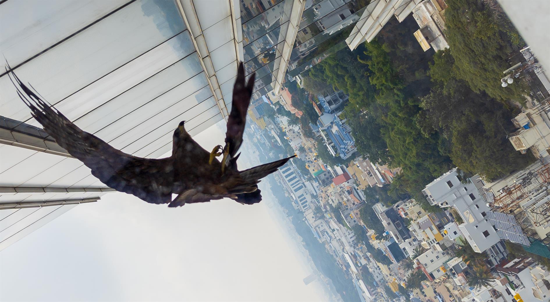
Google Pixel 6 Pro 7mm f1.9 1/900s ISO44
Photo of a Black Kite in Bangalore, startled off a window ledge by me trying to take a quick photo. Fantastic bird but sadly a dirty window.
Related Posts
(Published to the Fediverse as: Black Kite #photo #map #kite #bangalore Black Kite in Bangalore (Bengaluru), Karnataka, India )
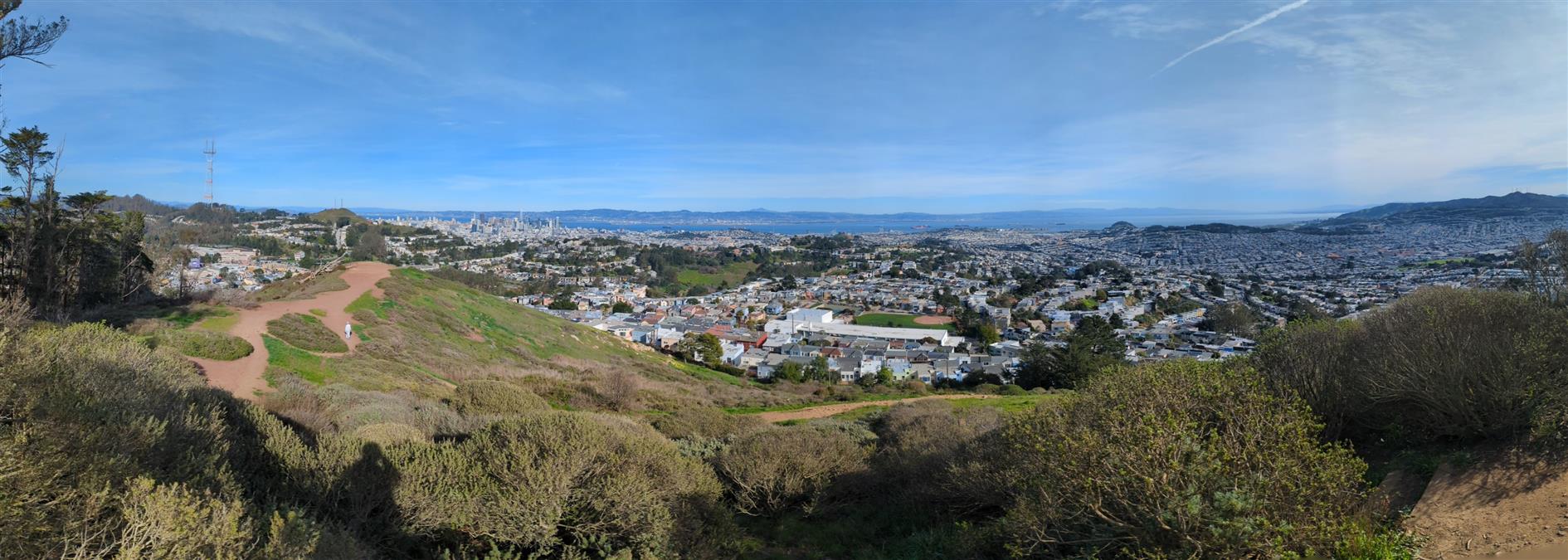
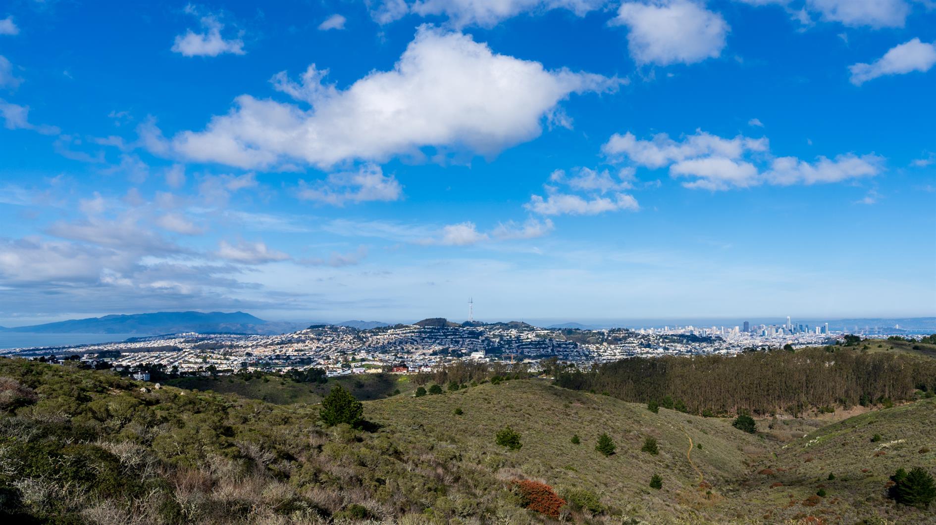
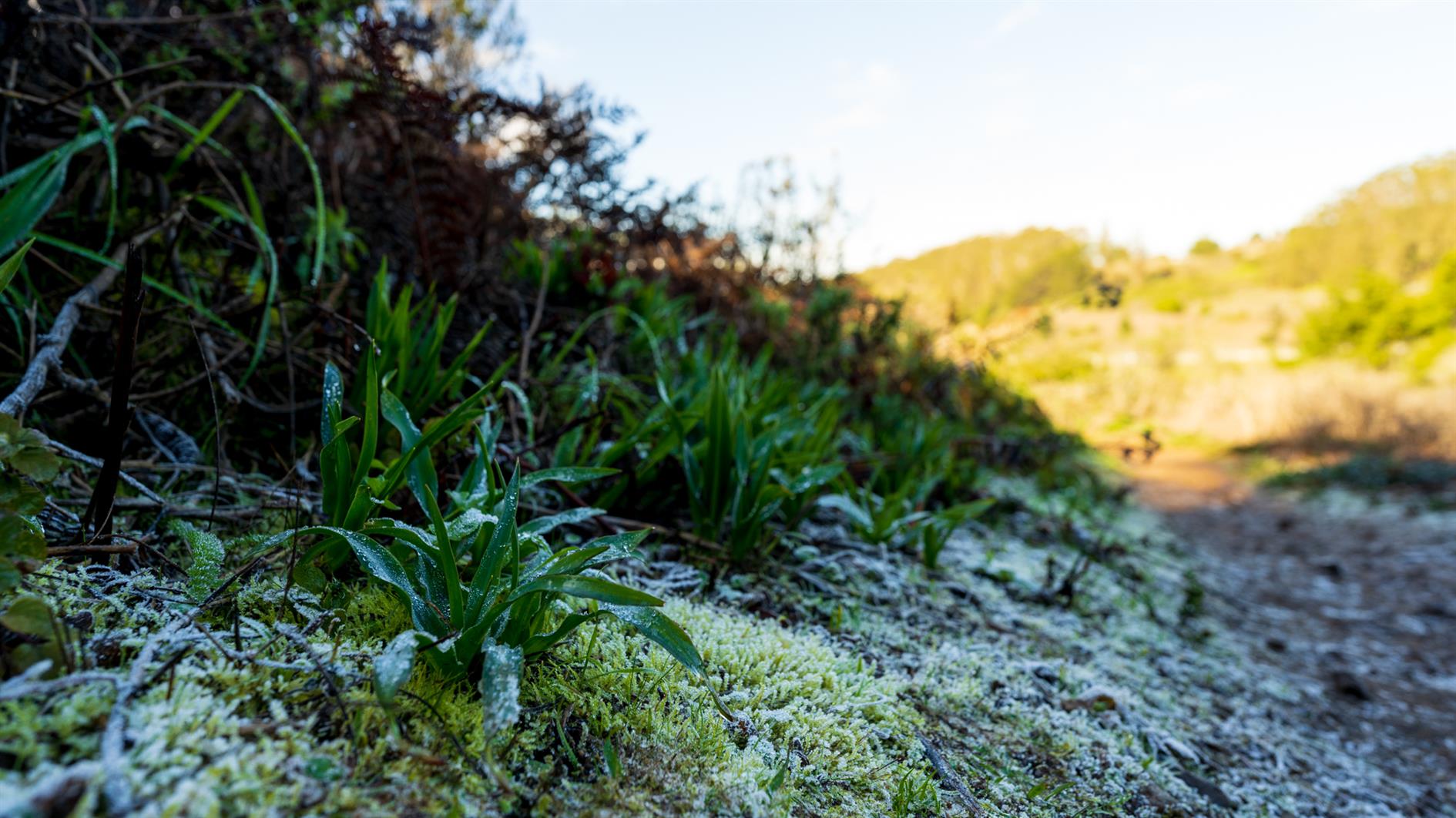
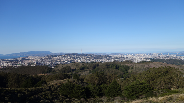
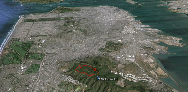
Philosopher's Way in McLaren Park
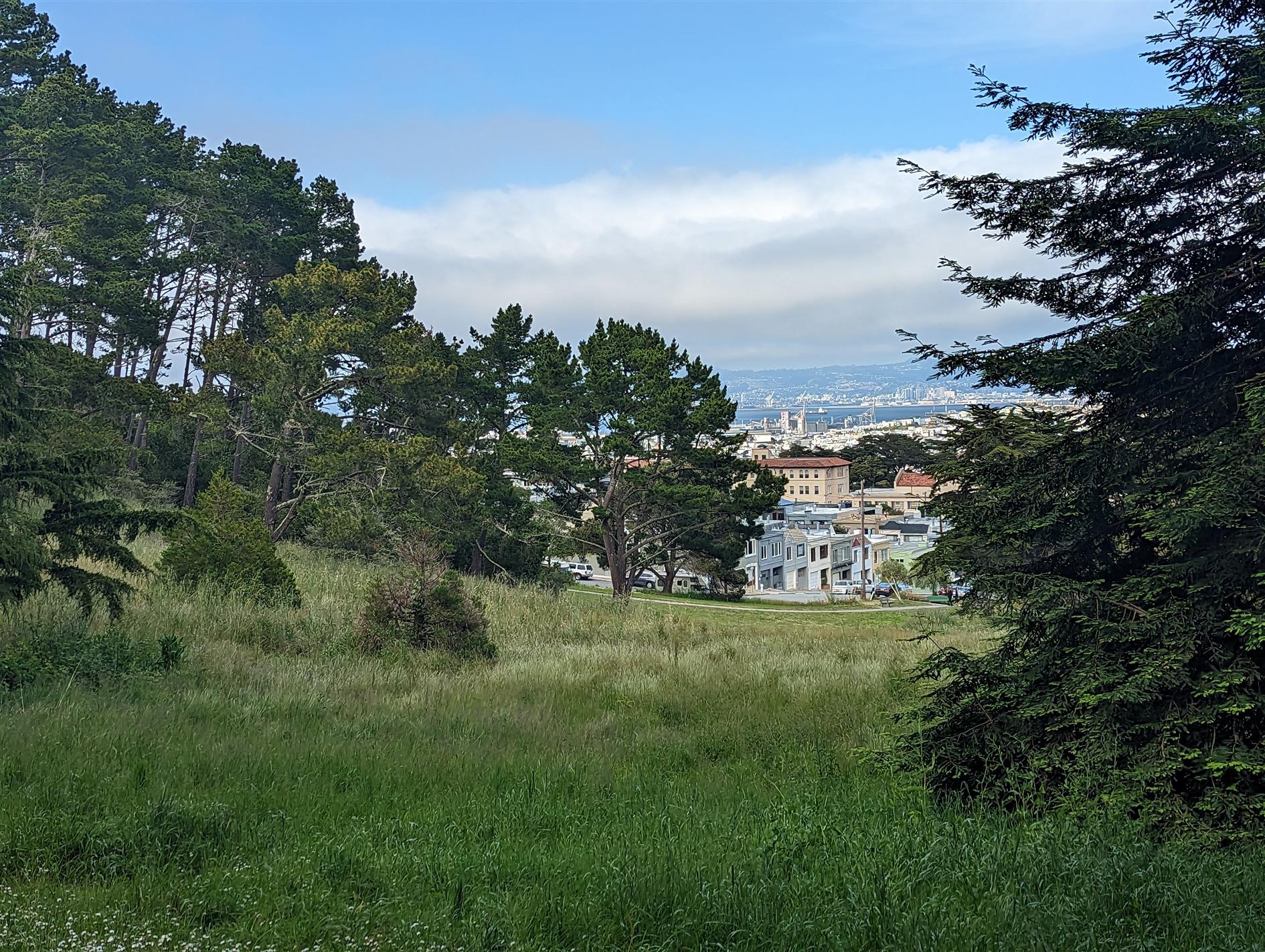
Philosopher's Way is a 2.7 mile loop around McLaren Park in San Francisco. The trail was designed by Peter Richards and Susan Schwatzenberg and opened in 2013. The stone markers are fun to look for and there are various interesting plaques on the route as well. McLaren is the second largest city park in San Francisco. John McLaren is more famous for developing and then becoming the superintendent of Golden Gate Park. He is responsible for the windmills - to pump water to irrigate the park and apparently insisted that there could be no 'Keep off the Grass' signs.
Hike starts at: 37.718265, -122.412104. View in Google Earth.
Related Posts
- Golden Gate Park - Stow Lake, Strawberry Hill and Museum Concourse
- Buena Vista Park
- Richards Fire Road
- Golden Gate Park Loop
- Milagra Ridge
(Hike Map)
(Published to the Fediverse as: Philosopher's Way in McLaren Park #hike #video #sanfrancisco #sfdogwalk #map 2.7 mile loop walk around Philosopher's Way in McLaren Park, San Francisco, California. )
Presidio Loop Hike
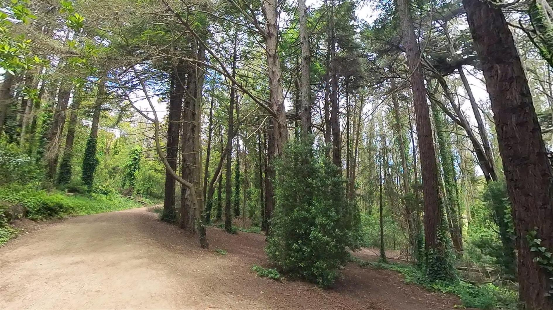
A pleasant loop hike in the Presidio of San Francisco. This is a dog friendly version, many trails are closed to dogs in the spring due to coyote pupping season. It starts at Mountain Lake, winds down the Ecology Trail to the main post and runs past both the new tunnel tops parks before returning to Mountain Lake.
Hike starts at: 37.786106, -122.472095. View in Google Earth.
Related Posts
- Golden Gate Park Loop
- Coyote
- Lands End
- Golden Gate Park - Stow Lake, Strawberry Hill and Museum Concourse
- Short Shell Ridge Open Space Loop
(Hike Map)
(Published to the Fediverse as: Presidio Loop Hike #hike #video #presidio #sanfrancisco #hikevid #map 4 mile loop hike in the Presidio of San Francisco, California including Main Post and Tunnel Tops (dog friendly). )
Phantom Falls
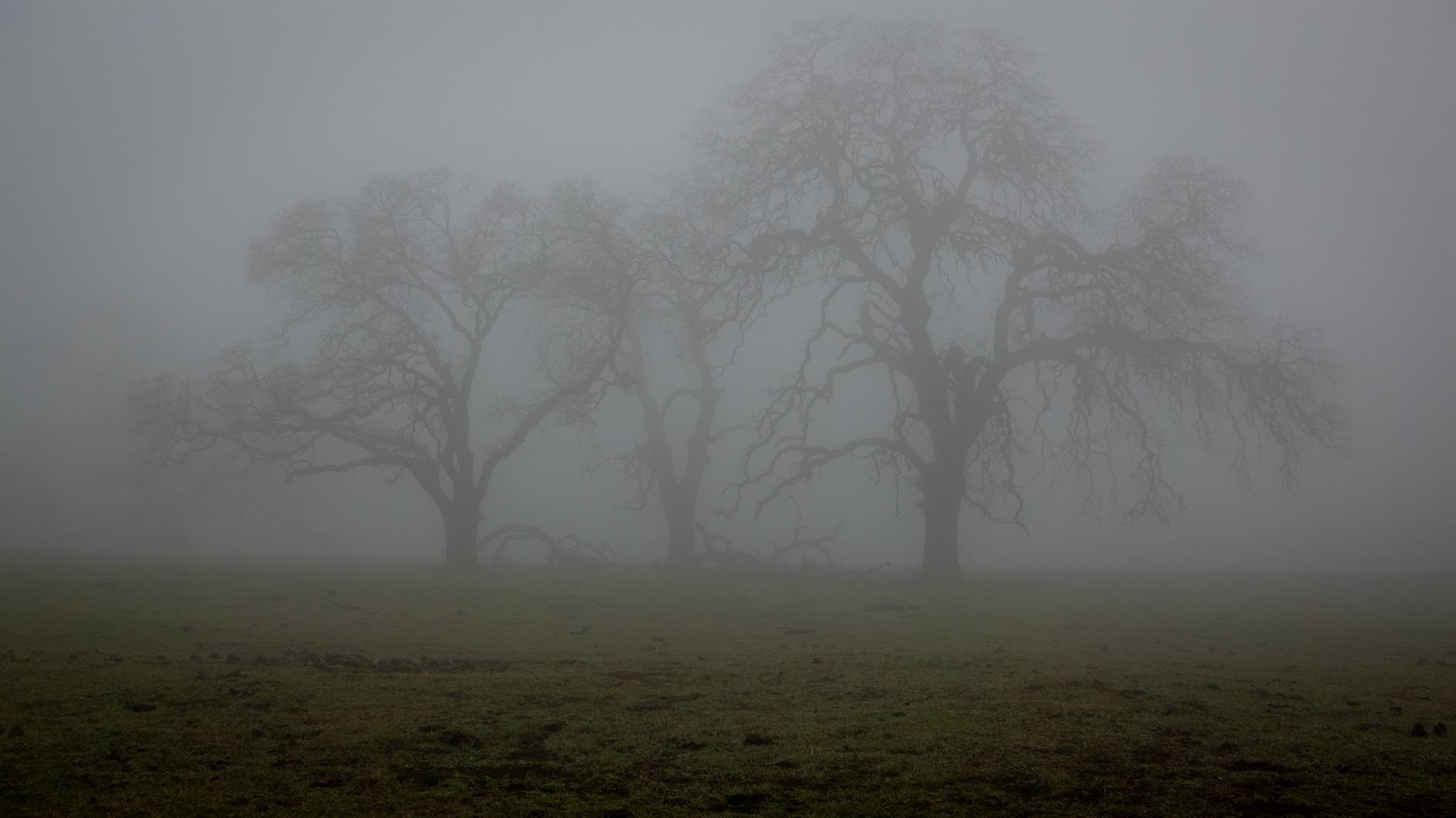
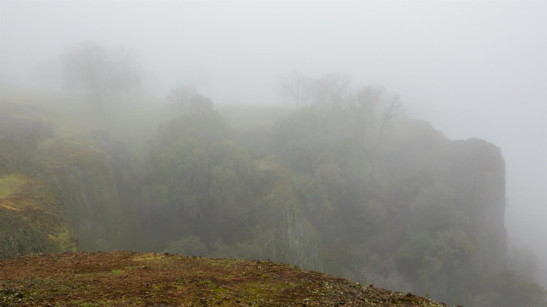
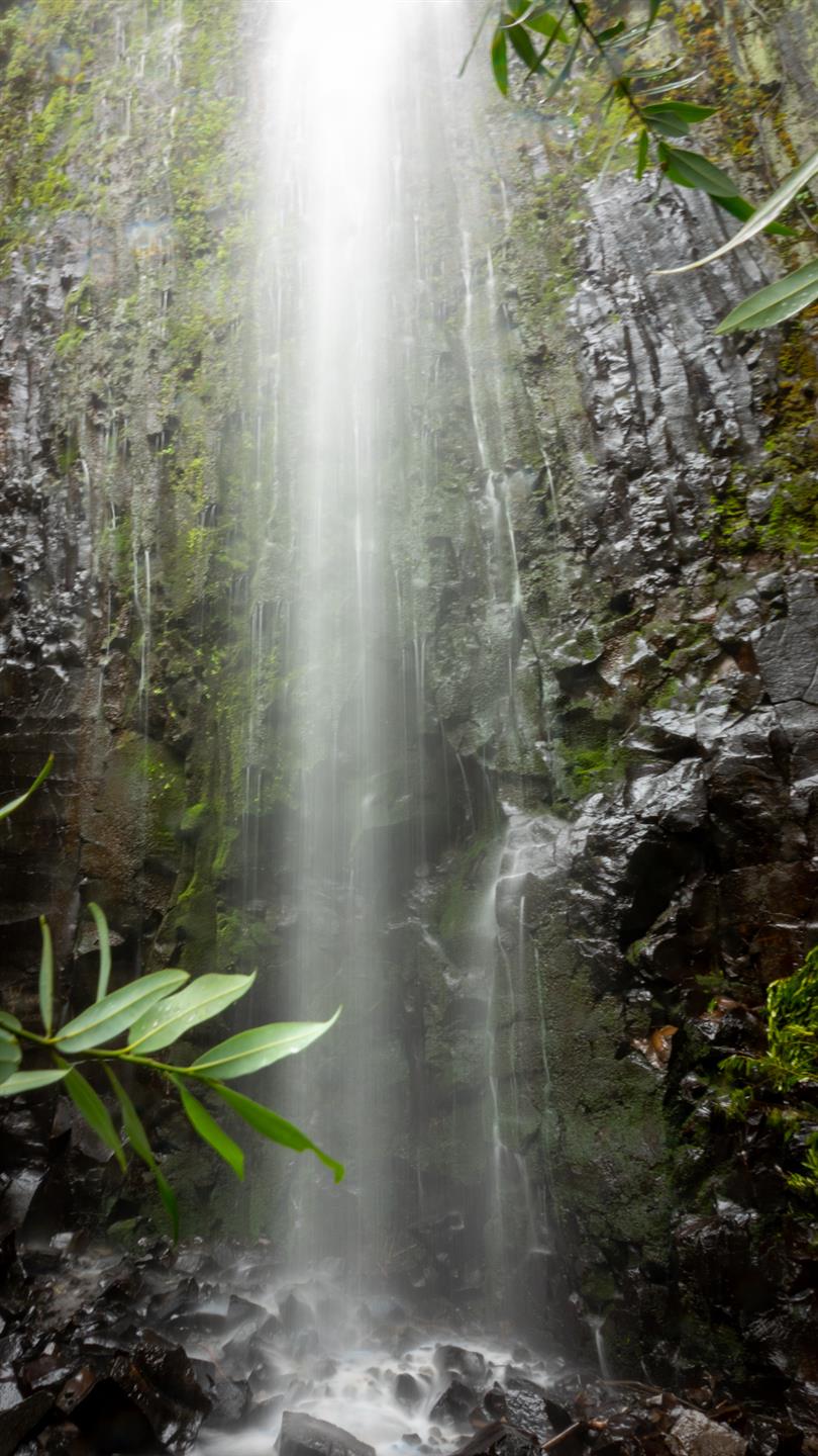
We did this four mile out and back hike during a small gap between record breaking winter storms. There was snow, fog, mud, many ordinary cows and one very furious one. The first waterfall, Ravine Falls, was very pretty and the eponymous Phantom Falls lived up to its name. Will try again sometime. This is close to Oroville, California in the North Table Mountain Ecological Reserve.
Hike starts at: 39.595612, -121.541953. View in Google Earth.
Related Posts
- McCloud River Trail (Three Waterfalls)
- McArthur-Burney Falls
- San Pedro Valley Park Waterfall Loop
- Fallen Leaf Lake
- Point Reyes - Tomales Point
(Hike Map)
(Published to the Fediverse as: Phantom Falls #hike #waterfall #map Four mile out and back hike to Ravine Falls and Phantom Falls in the North Table Mountain Ecological Reserve near Oroville, California. )
Short Shell Ridge Open Space Loop
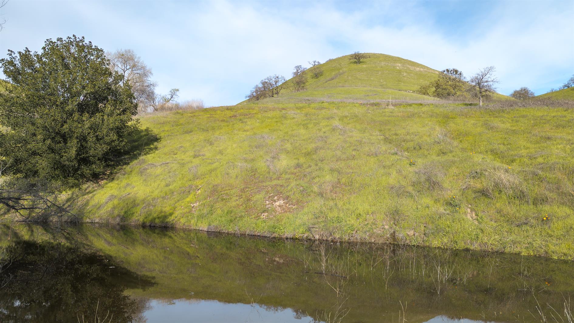
A two mile Shell Ridge Open Space loop in Walnut Creek. This follows Fossil Hill Trail to Indian Creek Trail, then loops back via the Briones to Mount Diablo Regional Trail and finally Jeep Trail. The Jeep Trail portion was to avoid getting the dog wet and it failed miserably thanks to a hidden muddy wallow.
Hike starts at: 37.894476, -122.030699. View in Google Earth.
Related Posts
- Presidio Loop Hike
- Coastal and Julian loop plus Black Sands Beach
- Milagra Ridge
- Waters Gulch Loop Trail
- Creekside Trail to Big Leaf Trail Loop
(Hike Map)
(Published to the Fediverse as: Short Shell Ridge Open Space Loop #hike #dogwalk #walnutcreek #shellridge #map An easy two mile loop in Shell Ridge Open Space, Walnut Creek. Suitable for dogs. )
Treasure Island Perimeter
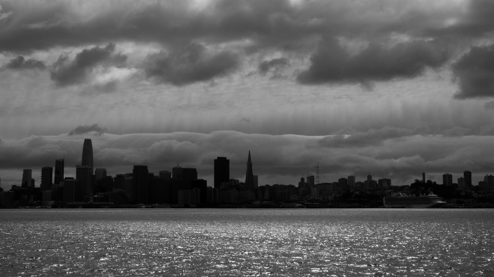
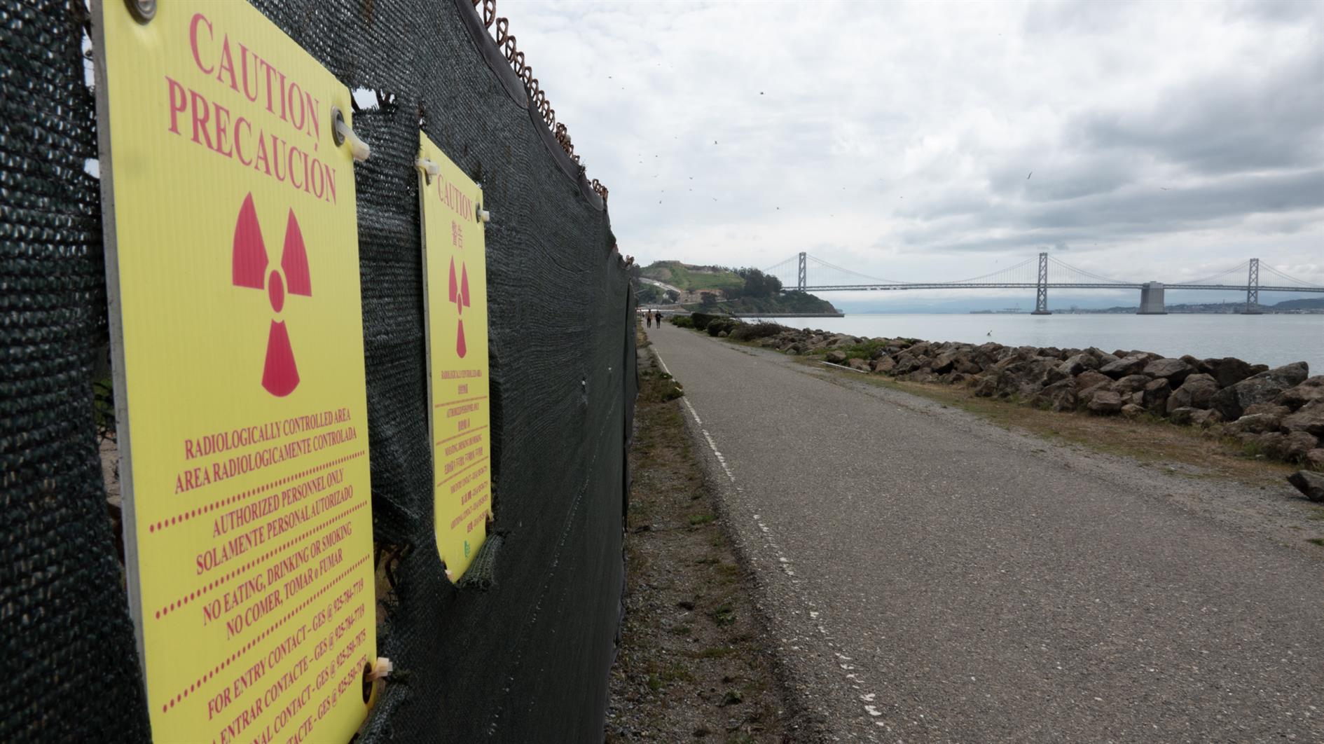
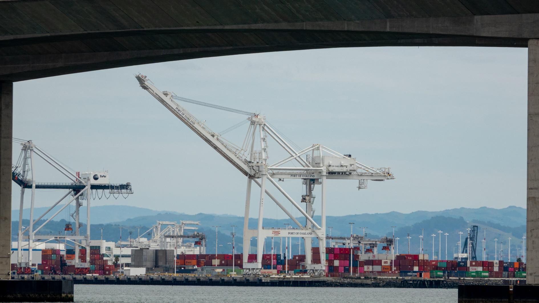
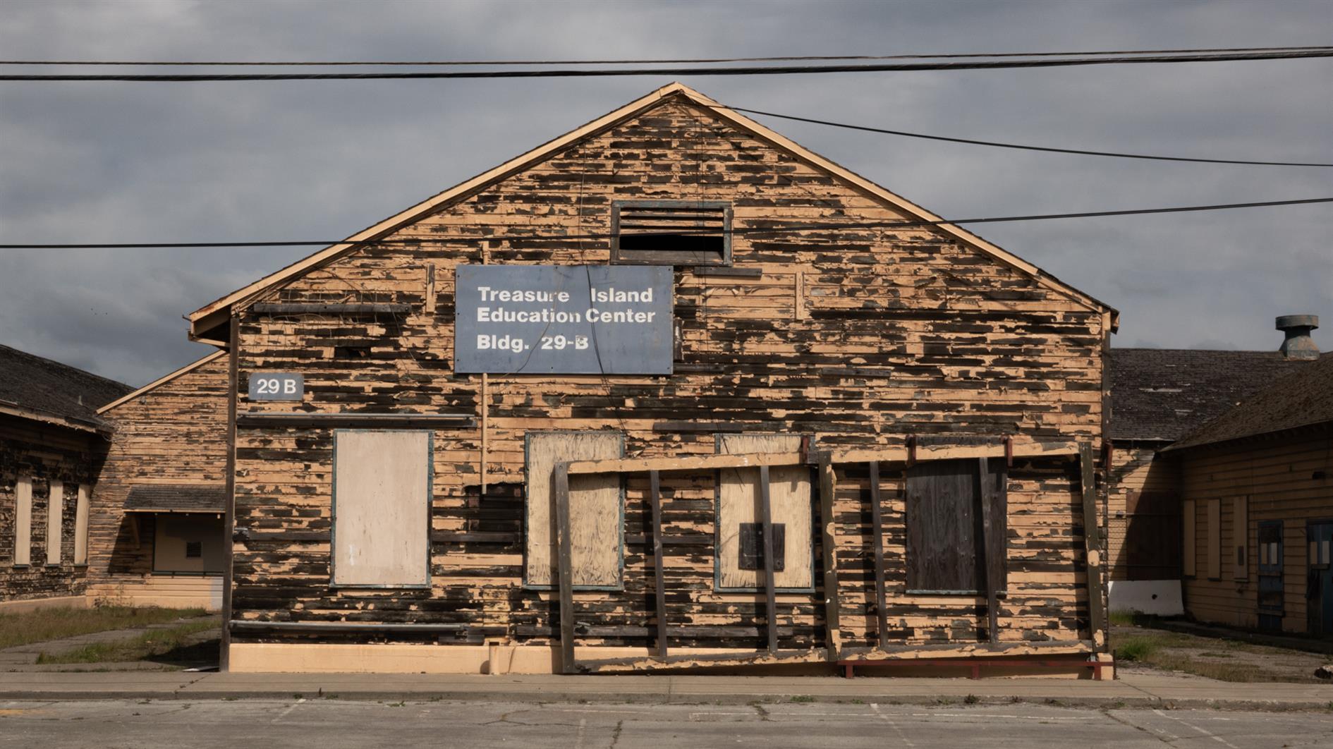
Today, for no great reason, I decided to see if it's possible to walk the full perimeter of Treasure Island. I parked at the Treasure Island Museum and headed north up the Avenue of the Palms. I've been here many times and it offers stunning views of San Francisco and both the Bay Bridge and the Golden Gate Bridge. The path continues around the north of the island and then you need to work around a blocked off area to get back to the coast. The east side is less appealing with a lot of garbage along the path and a view of many barges and the Port of Oakland peeking out under the new section of the Bay Bridge. Finally I was fully thwarted as the entire south west corner of the island is a mess of construction (and a rather unpleasant portable toilet staging area). I had to head inland all the way to 9th Street before cutting back over to the Avenue of the Palms. Overall I'm glad I tried but I can't recommend it.
Hike starts at: 37.817257, -122.371726. View in Google Earth.
Related Posts
- Treasure Island
- Golden Gate Park - Stow Lake, Strawberry Hill and Museum Concourse
- Angel Island Perimeter Road
- Lands End
- Fort Funston in the rain
(Hike Map)
(Published to the Fediverse as: Treasure Island Perimeter #hike #sanfrancisco #treasureisland #map 4 mile hike around the perimeter of Treasure Island in the San Francisco Bay. It's not possible to fully circumnavigate the island. )
Mount Davidson
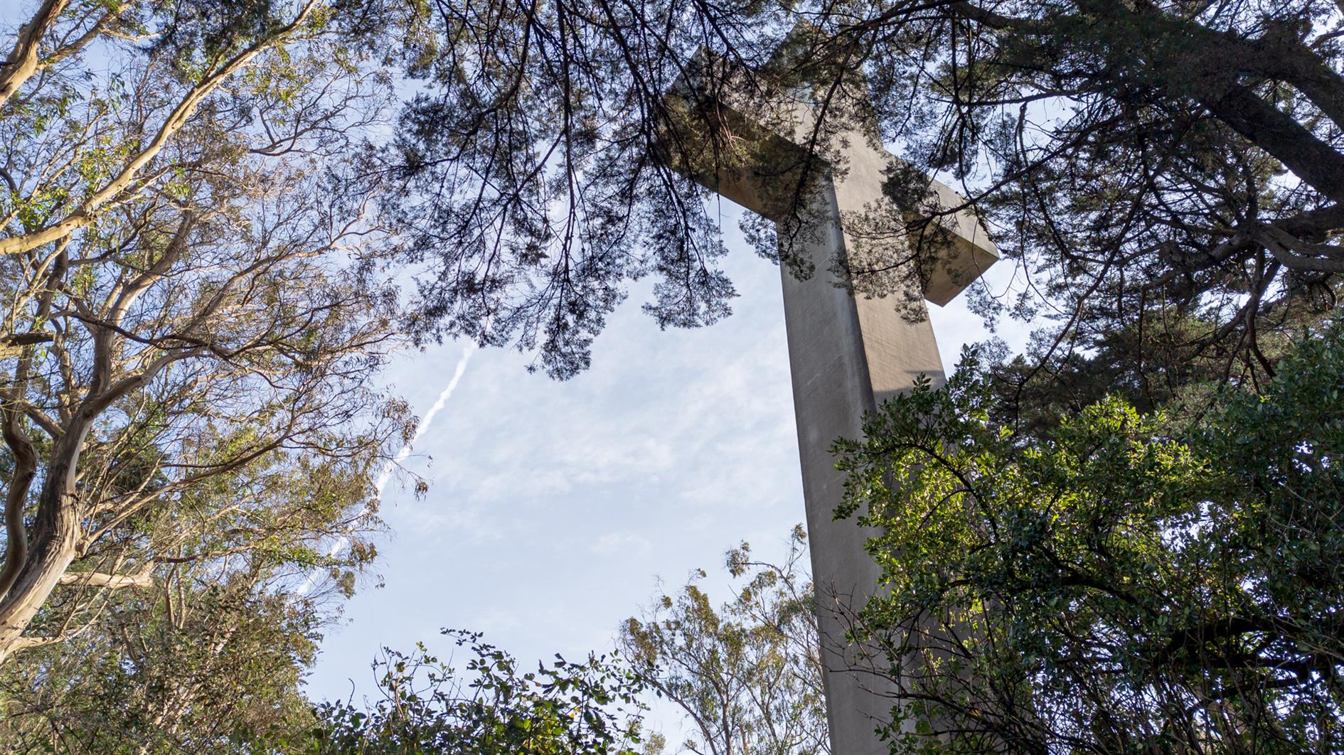

Continuing my series of local coronavirus hikes, Mount Davidson is the highest peak in San Francisco and this three mile hike takes you there from West Portal. Take Ulloa to Kensington and then cross Portola on the footbridge. Juanita takes you to one of the Mount Davidson trails and up to the top. You can come back the same way, or follow Kensington all the way over to Taraval.
The cross at the top is a memorial to the Armenian Genocide and while most of Mount Davidson is a San Francisco park the area at the top is owned by the Council of Armenian-American Organizations of Northern California (due to a church/state separation lawsuit). It's a great spot to look (slightly) down on the Twin Peaks set who just think they've reached the top of San Francisco.
(Previously: Mount Davidson 360 4K)
Hike starts at: 37.741614, -122.471306. View in Google Earth.
Related Posts
(Hike Map)
(Published to the Fediverse as: Mount Davidson #hike #sanfrancisco #davidson #coronavirus #map #video Three mile hike from West Portal to the summit of Mount Davidson, the highest peak in San Francisco. )
Summit Loop, San Bruno Mountain
Summit Loop is a three mile hike around San Bruno Mountain, a 1,319 peak just south of San Francisco. For some reason, possibly a lack of desire to wrestle with bridges, it has become a family favorite for the first hike of the new year. Fantastic views and scenery at any time of the year, although it is especially good in the spring with all the wildflowers. I'm adding a fresh post on this hike as I noticed the GPS track is broken on the last one (I'll redirect that here) and I have a video of the hike to add as well (a little cloud focused, but it was that kind of day):
Hike starts at: 37.695247, -122.43443. View in Google Earth.
Updates
San Bruno Mountain
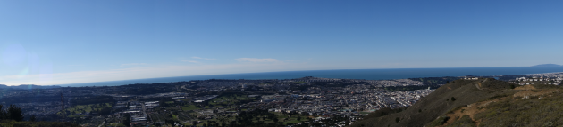
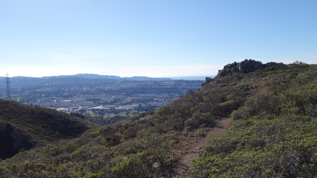
San Bruno Mountain State Park has outstanding views of San Francisco, the Pacific out to the Farallon Islands and much of the bay. We did the three mile summit loop (the wrong way round, San Bruno pros do it counter-clockwise).
Hike starts at 37.6888964,-122.437008 (Google Earth).
Related Posts
- Twin Peaks Loop
- Mariposa Loop
- San Bruno Mountain 360 4K
- Presidio Loop Hike
- Golden Gate Park - Stow Lake, Strawberry Hill and Museum Concourse
(Hike Map)
(Published to the Fediverse as: Summit Loop, San Bruno Mountain #hike #sanbruno #hikevid #map #video Three mile loop hike up to the 1,319 summit of San Bruno Mountain in San Mateo County, California. )
Creekside Trail to Big Leaf Trail Loop

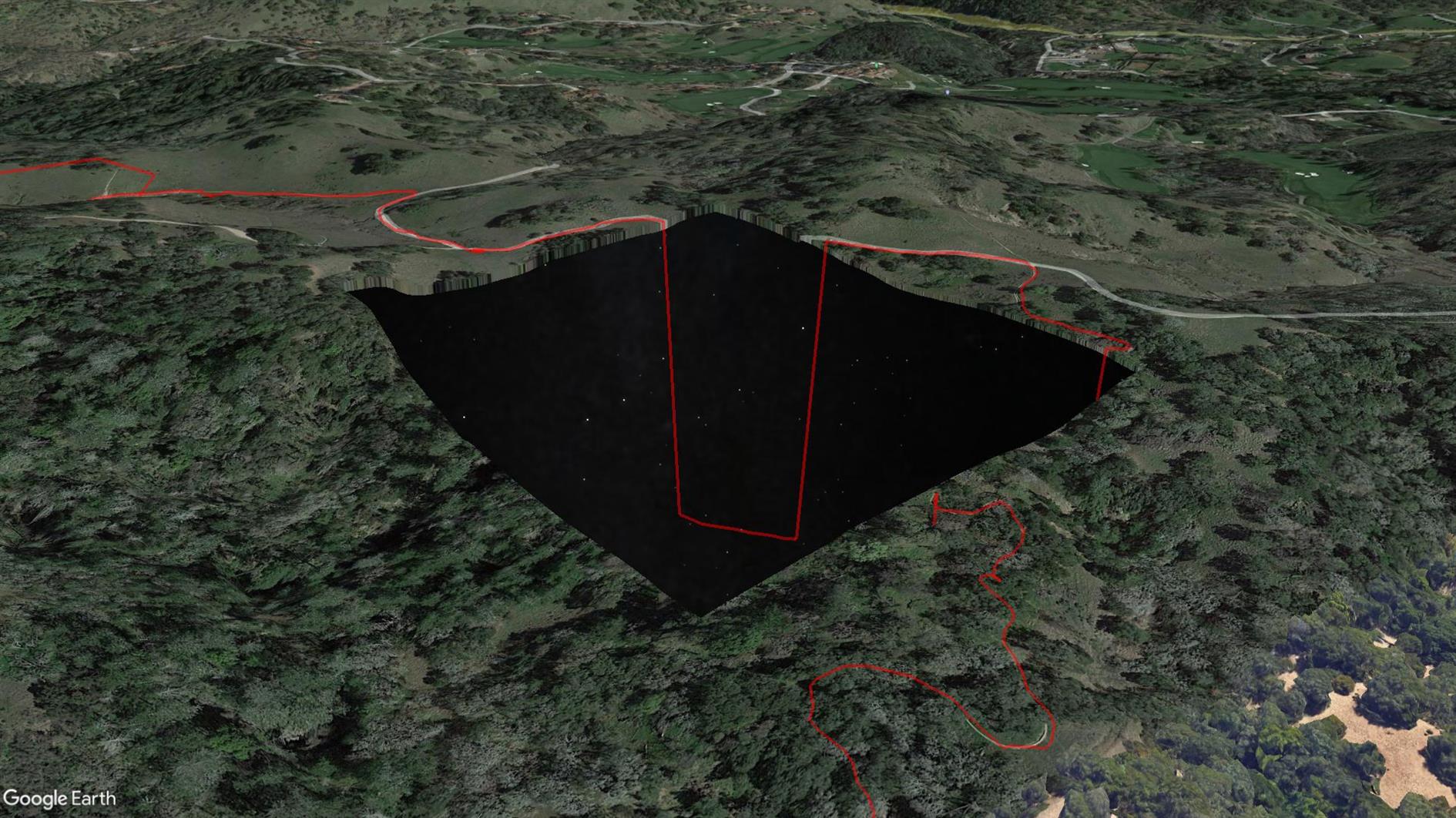
3.8 mile loop with 600 foot elevation gain in Shiloh Ranch Regional Park near Santa Rosa in Sonoma County.
This is the first time my Pixel 4 XL GPS has failed me. Sometimes it wanders a little off trail, but this time it took a completely unauthorized trip to a Home Depot before eventually snapping back to reality. I've included it here but unlike any other track I've uploaded you might not want to use this one (see the route on AllTrails instead, distance incorrect below). The really strange thing is that when I look at the trail in Google Earth there is a missing tile around where the GPS freaks out and Google Earth sends the route plunging down into outer space (because it's clamping to its elevation model but the stars under Sonoma are not as far away as they look?) See the screenshot above. Something is odd at Shiloh Ranch...
Hike starts at: 38.525412, -122.762561. View in Google Earth.
Related Posts
- Sawmill Flats
- Short Shell Ridge Open Space Loop
- Point Reyes - Drakes Estero
- Waters Gulch Loop Trail
- Milagra Ridge
(Hike Map)
(Published to the Fediverse as: Creekside Trail to Big Leaf Trail Loop #hike #hikevid #map #video 3.8 mile loop in Shiloh Ranch Regional Park, Sonoma, California. This hike includes a GPS failure and a suspicious missing tile in Google Maps that shows the stars below Sonoma. )
Barker Dam and Wall Street Mill
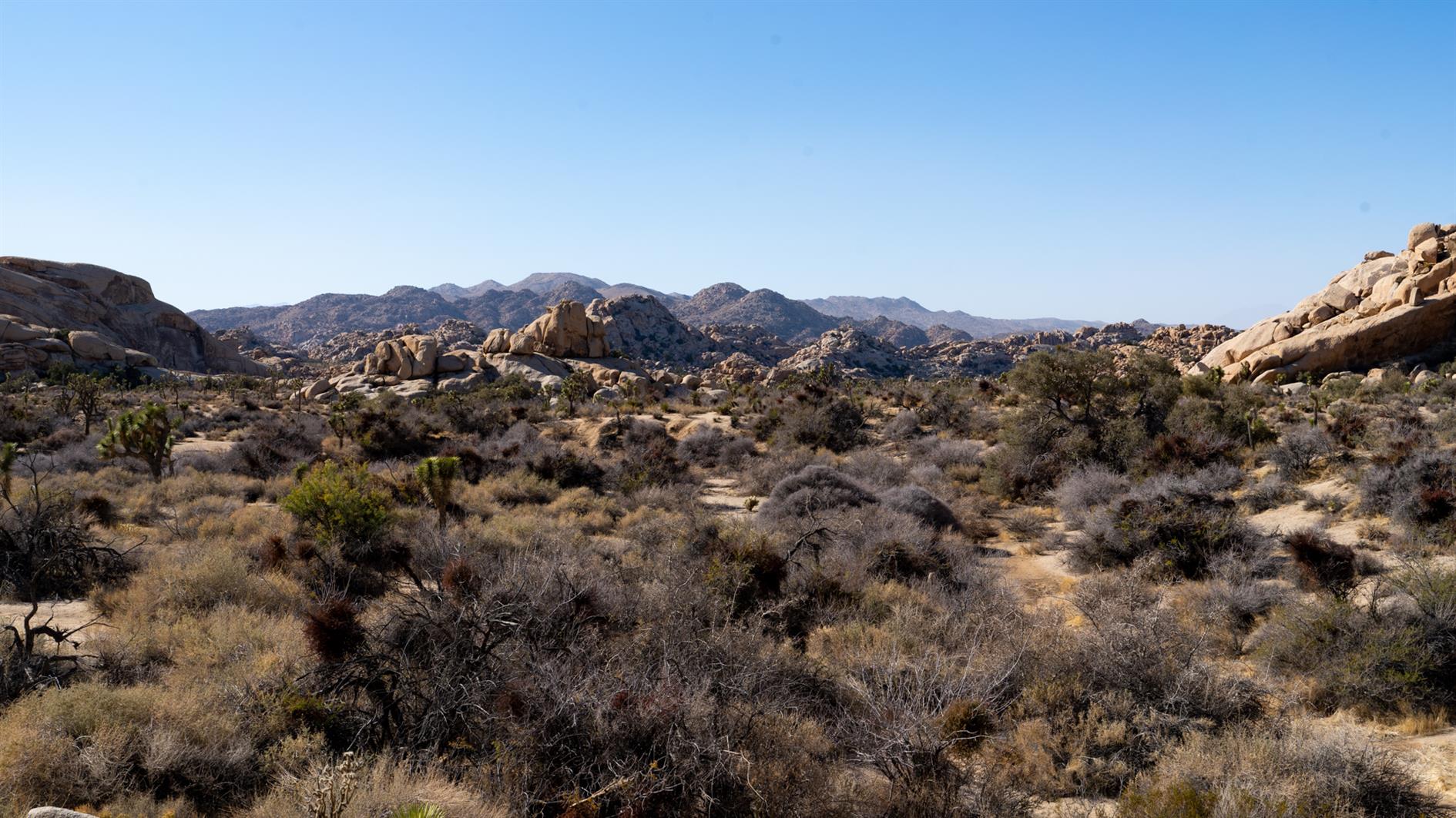
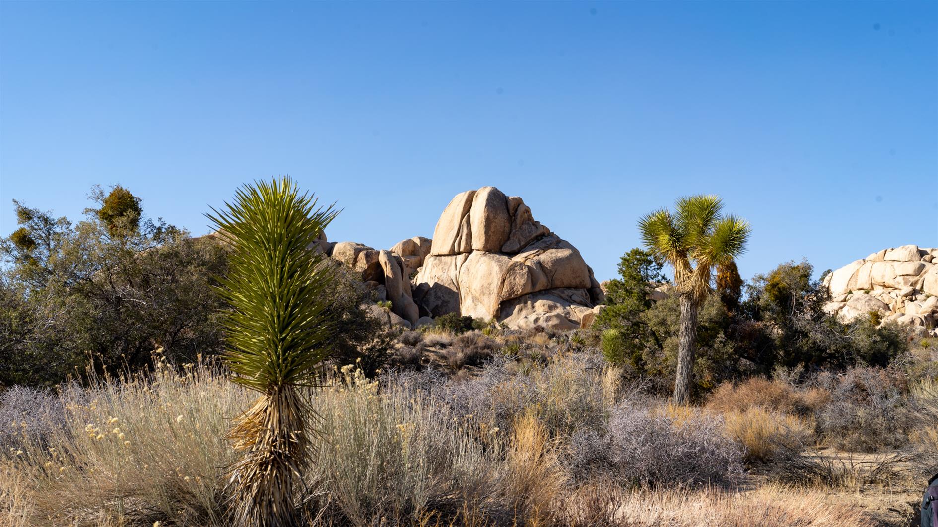
Double feature in Joshua Tree National Park. Barker Dam is just over a mile, a short loop that takes in rock art, the dam, and a nice mix of boulders and desert. Wall Street Mill is two miles out and back and the mill extracted gold to send to the US Mint in San Francisco.
Hike starts at: 34.025005, -116.142098. View in Google Earth.
Related Posts
- San Pedro Valley Park Waterfall Loop
- Grabtown Gulch and Borden Hatch Mill in Purisima Creek
- Sawmill Flats
- Short Shell Ridge Open Space Loop
- McArthur-Burney Falls
(Hike Map)
(Published to the Fediverse as: Barker Dam and Wall Street Mill #hike #map #joshua wo hikes from the same parking lot in Joshua Tree National Park, a one mile loop (Barker Dam) and a two mile out and back (Wall Street Mill). )