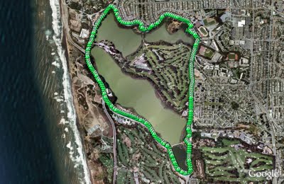
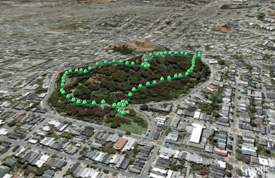
Milagra Ridge
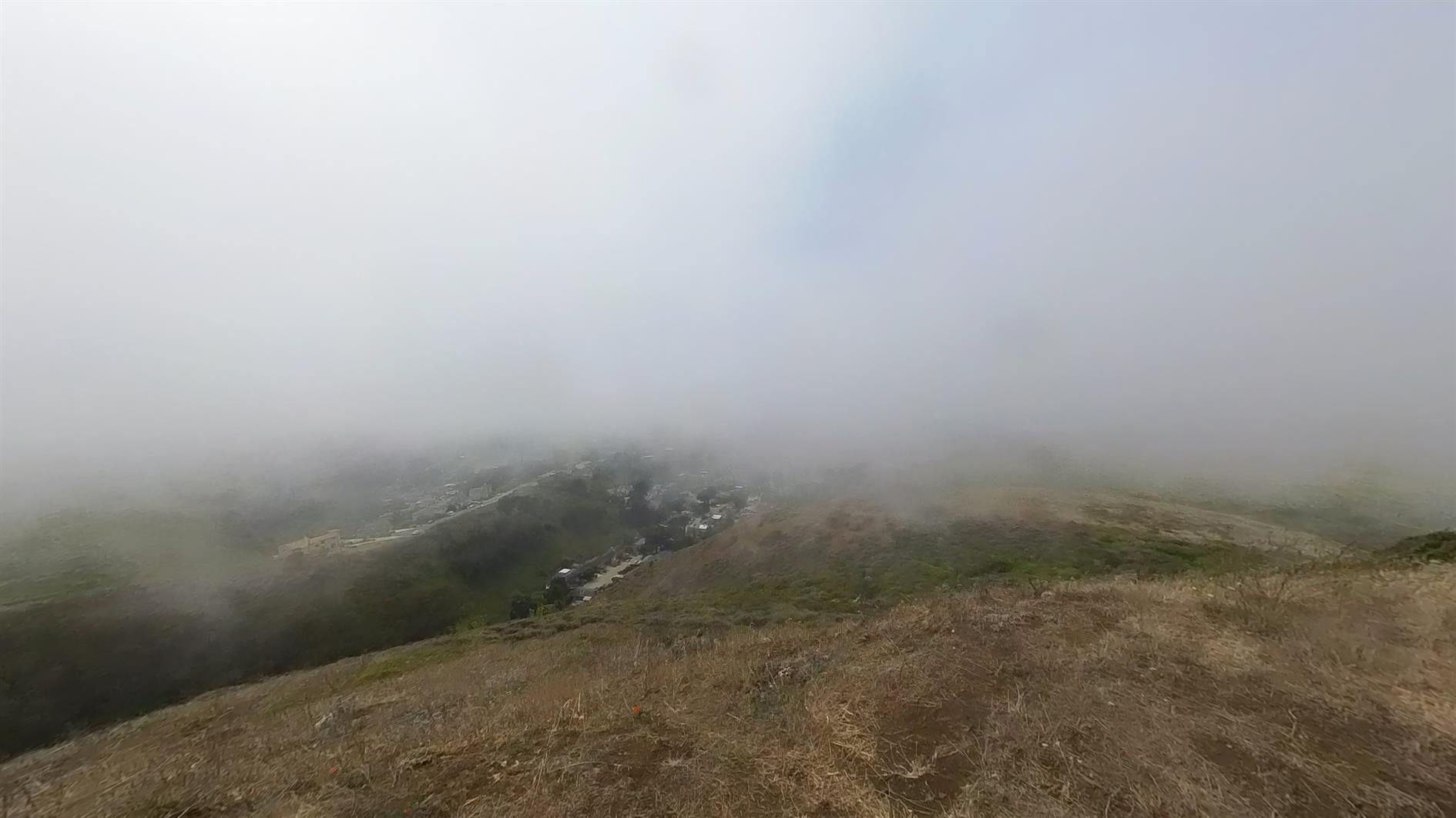
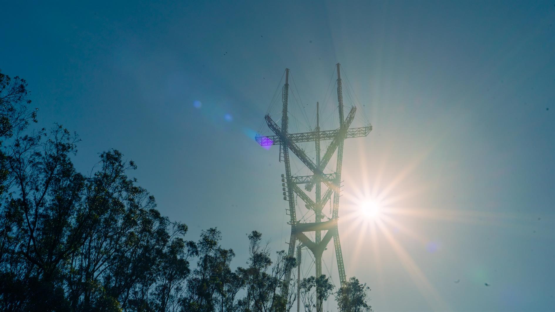
Starting from this parking area makes for a brisk walk up to Milagra Ridge and then a nice loop at the top before returning by the same trail. Milagra Ridge used to be a Nike missile site (SF-51), still has some WWII remains (Battery #244) and a reservoir. I thought it looked like a nice enough day to brave Pacifica but by the time I'd loaded the dog and driven down the fog had swept in. Still a pleasant 3 mile hike.
Hike starts at: 37.643146, -122.488815. View in Google Earth.
Related Posts
- Richards Fire Road
- Hill 88
- Lands End
- Golden Gate Park - Stow Lake, Strawberry Hill and Museum Concourse
- Point Reyes - Divide Meadow Loop
(Hike Map)
(Published to the Fediverse as: Milagra Ridge #hike #video #pacifica #sfdogwalk #hikevid #map A 3 mile loop hike at Milagra Ridge (GGNRA) in Pacifica, California )
Philosopher's Way in McLaren Park
Philosopher's Way is a 2.7 mile loop around McLaren Park in San Francisco. The trail was designed by Peter Richards and Susan Schwatzenberg and opened in 2013. The stone markers are fun to look for and there are various interesting plaques on the route as well. McLaren is the second largest city park in San Francisco. John McLaren is more famous for developing and then becoming the superintendent of Golden Gate Park. He is responsible for the windmills - to pump water to irrigate the park and apparently insisted that there could be no 'Keep off the Grass' signs.
Hike starts at: 37.718265, -122.412104. View in Google Earth.
Related Posts
- Golden Gate Park - Stow Lake, Strawberry Hill and Museum Concourse
- Buena Vista Park
- Richards Fire Road
- Golden Gate Park Loop
- Milagra Ridge
(Hike Map)
(Published to the Fediverse as: Philosopher's Way in McLaren Park #hike #video #sanfrancisco #sfdogwalk #map 2.7 mile loop walk around Philosopher's Way in McLaren Park, San Francisco, California. )
Twin Peaks Loop
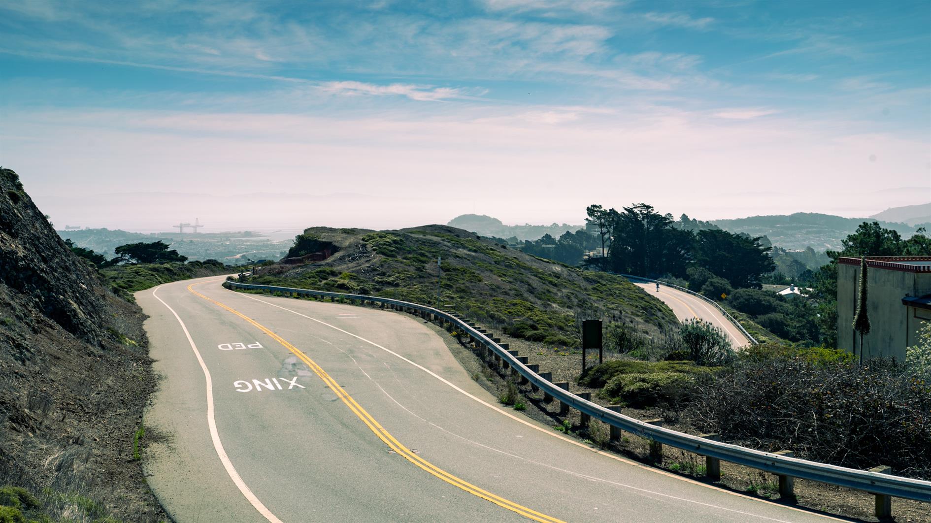
I have previously described Twin Peaks as not much of a hike, which is absolutely true if you drive there. When I first moved to San Francisco I lived in Noe Valley and used to cycle up to Twin Peaks and then try to get home without pedalling. For many years after that I'd take visitors up to the top and developed a somewhat weird tradition of taking each new child there soon after they were released from the hospital.
Post lockdown I'm up there most weeks. This is my five mile loop which starts heading up Ulloa from West Portal to Portola. Portola breaks the climb briefly as you pass the striking herchurch and controversial Twin Peaks gas station before heading up Twin Peaks Boulevard to the 922 foot summits. For a while Twin Peaks Boulevard was entirely closed to traffic (although you really had to keep an eye out for high speed skateboarders). Unfortunately it's now open all the way to Christmas Tree Point. Head down the north side to Clarendon and follow this all the way down to Forest Hill and then back to West Portal.
(Previously: Twin Peaks 360 4K, Twin Peaks, San Francisco from Twin Peaks)
Hike starts at: 37.741879, -122.471354. View in Google Earth.
Updated 2023-08-10 03:02:
Hyperlapse of this hike from August 9, 2023.
Related Posts
- Twin Peaks
- Summit Loop, San Bruno Mountain
- Twin Peaks 360 4K
- Mount Davidson
- Timelapse, Week of Jan 17 2022
(Hike Map)
(Published to the Fediverse as: Twin Peaks Loop #hike #sanfrancisco #twinpeaks #coronavirus #map #video #hikevid #sfdogwalk Five mile loop hike from West Portal up Ulloa and Portola to the 922 foot summits of Twin Peaks and then back down Clarendon and Forest Hill. )
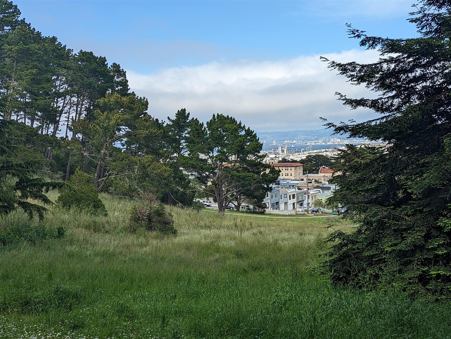
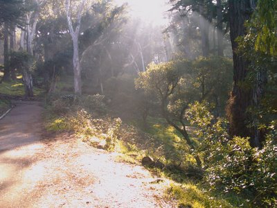
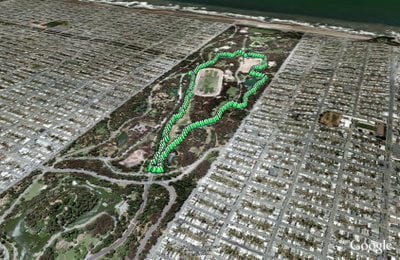
Golden Gate Park - Stow Lake, Strawberry Hill and Museum Concourse
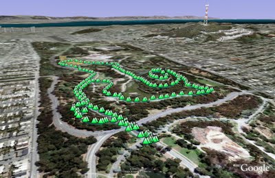
An alternative to our normal loop is another three mile walk starting from JFK and Transverse. Instead of heading towards the beach walk up under the bridge and take the first right to Stow Lake.
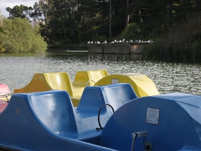
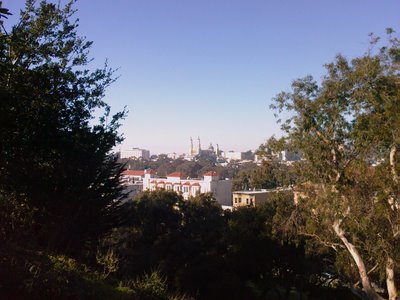
Stow Lake surrounds Strawberry Hill. There's a path around the lake with two bridges leading to the hill. I normally walk to one bridge, cross and then up to the top of the hill. It's generally pretty quiet with great city and ocean views in between the trees.
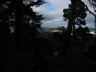
View from the top of Strawberry Hill. Rudy is in there somewhere, click for a larger version.
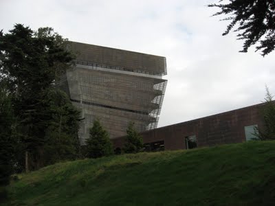
After the hill I walk over to the Museum Concourse. The de Young rises through the trees like an implausibly stranded copper aircraft carrier. It hosts a range of paintings, decorative art, sculpture and modern art. You're bound to find something you like here.
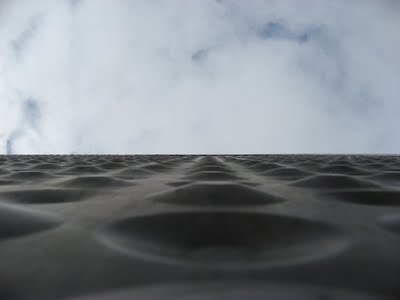
The copper cladding will turn green eventually, probably before the new Bay Bridge span is finished.
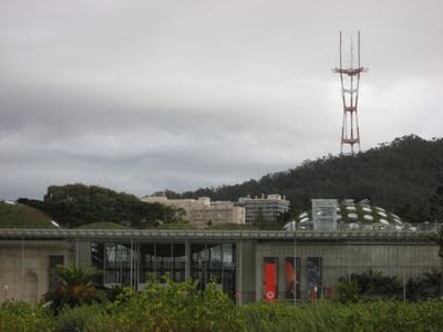
Opposite the de Young is the California Academy of Sciences. The Academy features an outstanding digital planetarium, a three story rainforest and an aquarium. It reopened last year after a major rebuild and it's insanely popular - get there first thing to snag the first come first served planetarium tickets.
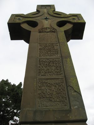
On the way back I detoured up to Prayerbook Cross, donated in 1894 to commemorate the first English sermon on the pacific coast after Sir Francis Drake discovered Drake's Bay (a name which didn't stick).
(2.97 miles, total elevation gain 103 feet, 1 hours, 17 minutes, average 2.29 mph, view in Google Earth, view in Google Maps.)
Hike starts at: 37.770433, -122.479941.
Related Posts
(Hike Map)
(Published to the Fediverse as: Golden Gate Park - Stow Lake, Strawberry Hill and Museum Concourse #hike #sfdogwalk Three mile hike in Golden Gate Park taking in Stow Lake, Strawberry Hill and the Museum Concourse (San Francisco, California). )
Lake Merced
Lake Merced is a natural lake near Fort Funston. It used to be San Francisco's main fresh water supply but is now the emergency reserve (somewhat worrying as a previous earthquake caused much of Lake Merced to drain into the Pacific).
The lake is also the site of the Terry/Broderick duel where in 1859 the Chief Justice of the California Supreme Court (Terry) killed a US Senator (Broderick) in an argument over slavery.
The loop around the lake is a flat five mile path, unfortunately marred by heavy traffic and constant gunfire from clay pigeon shooting and/or the SFPD firing range.
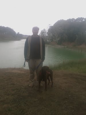
Rob and Rudy at Lake Merced.
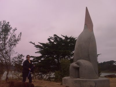
Gill and Rudy next to a sculpture called "Penguin's Prayer". Given the latitude I expect the penguin is praying for the next ice age.
(4.85 miles, total elevation gain 0 feet, 1 hour, 39 minutes, average 2.93 mph, view in Google Earth, view in Google Maps.)
Hike starts at: 37.712302, -122.489232.
Updated 2023-06-20 01:27:
Video from a trip round Lake Merced on June 19, 2023.
Related Posts
- Merced
- Lake Merritt
- Lake Merced Timelapse
- Golden Gate Park - Stow Lake, Strawberry Hill and Museum Concourse
- Lands End
(Hike Map)
(Published to the Fediverse as: Lake Merced #hike #sfdogwalk #video #hikevid Five mile hike around Lake Merced in San Francisco, California. )
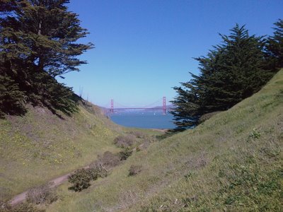
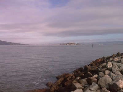
Lands End
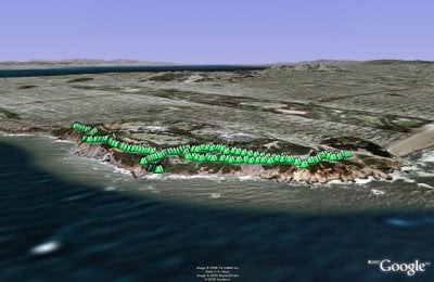
Lands End to Eagle's Point is a stunning section of the Coastal Trail. Park in or near the new lot at Point Lobos Ave and El Camino del Mar. Before or after the walk check out the ruins of Sutro Baths. I'd put some of that American Recovery and Reinvestment Act cash into rebuilding the baths, it looks like they were incredible.
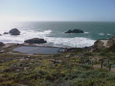
If you follow the trial down the the baths then there's a short but very cool cave to explore which ends in another unique view of the pacific and the mouth of the Golden Gate.
From Sutro Baths follow signs to Eagle's point. There are some very steep cliffs along the trail, so a leash is a really good idea for dogs.
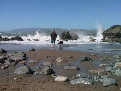
One worthwhile detour is to wonder down to Mile Rock Beach. It's a stony and impressively violent beach with a couple of lookouts on the way down with impressive views.
(3.16 miles, total elevation gain 457 feet, 1 hours, 24 minutes, average 2.24 mph, view in Google Earth, view in Google Maps)
Hike starts at: 37.783491, -122.510793.
Updated 2023-06-19 02:22:
Here's a video of the hike from June 18, 2023:
Related Posts
- Golden Gate Park - Stow Lake, Strawberry Hill and Museum Concourse
- Crissy Field
- Hill 88
- Fort Funston
- Remnants in the Sunset
(Hike Map)
(Published to the Fediverse as: Lands End #hike #sfdogwalk #video #hikevid 3 mile hike from Lands End to Eagle's Point in San Francisco taking in Sutro Baths. )
Buena Vista Park
Buena Vista Park is a small but dramatic park above Haight-Ashbury.
I usually start at Buena Vista Ave and Upper Terrace. Walk up the large path which meanders to a small lawn at the top of the park.
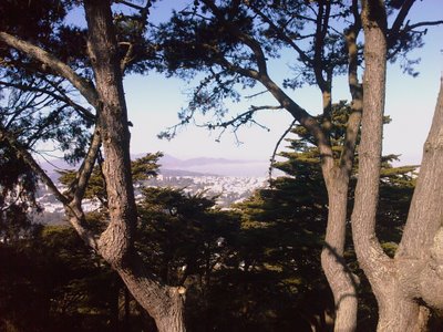
From the lawn walk down through the maze of paths. It's a densely wooded park but every time you walk round a corner you're treated to a different city view peeking through the trees.
(0.96 miles, total elevation gain 576 feet, 24 minutes, average 2.40 mph, view in Google Earth, view in Google Maps)
Hike starts at: 37.766248, -122.442906.
Related Posts
- Golden Gate Park - Stow Lake, Strawberry Hill and Museum Concourse
- Lands End
- Glen Park Canyon
- Golden Gate Park Loop
- Bernal Hill
(Hike Map)
(Published to the Fediverse as: Buena Vista Park #hike #sfdogwalk Short walk around Buena Vista Park in San Francisco, California. )
Golden Gate Park Loop
This gentle three mile loop is our favorite walk in the Golden Gate Park. Start at JFK and Transverse and walk down JFK to 30th Avenue. Turn right at 30th and then left onto a metaled path before you exit the path. The path takes you to Spreckels Lake.
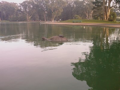
At Spreckels Lake it's turtles all the way down…
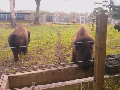
Walk halfway round the Lake and then head off behind the bison paddock (over 36th Avenue and then to the right of the restrooms). You'll pass one of two enclosed off-leash dog areas in the park.
Follow the path right round the paddock and then cross JFK at Chain of Lakes Drive. Immediately turn left on a small path that runs behind Middle Lake. This is a quiet area of the path where we've seen skunks and a lone coyote (although fortunately not at the same time). When you hit a T junction turn left and follow the path behind the angling pond and up to the Polo Fields. Keep going and you'll reach Speedway Meadow.
Follow the path beside Speedway Meadow back up to JFK and then on to the starting point at Transverse.
(2.80 miles, 1 hour, 6 minutes, average 2.53 mph, view in Google Earth, view in Google Maps)
Hike starts at: 37.770814, -122.48021.
Related Posts
- Golden Gate Park - Stow Lake, Strawberry Hill and Museum Concourse
- Crissy Field
- Presidio Loop Hike
- Lands End
- Golden Gate Park
(Hike Map)
(Published to the Fediverse as: Golden Gate Park Loop #hike #sfdogwalk A three mile hike in San Francisco's Golden Gate Park that includes lakes, meadows and some Bison. )
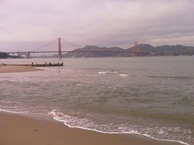
Crissy Field
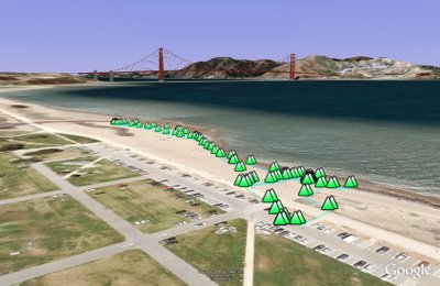
Crissy Field, part of the Golden Gate National Parks, is a recently restored stretch of beach and parkland next to the bay. It's a very popular place to take dogs for a good swim. Currently there is a big debate about dogs in the national parks - see Dog Management at the GGNRA site and SF Dog.
If the weather is vaguely nice then the beaches at Chrissy Field get pretty packed. We go to Fort Funston most weekends, and save Chrissy Field for when the sea is too rough or (like today) when we just can't face climbing back up the sand ladder.
(0.55 miles, total elevation gain 3 feet, 45 minutes, average 0.72 mph, view in Google Earth)
Hike starts at: 37.806083, -122.450172.
Related Posts
- Fort Funston
- Golden Gate Park - Stow Lake, Strawberry Hill and Museum Concourse
- Lands End
- Golden Gate Park Loop
- Fort Funston in the rain
(Hike Map)
(Published to the Fediverse as: Crissy Field #hike #sfdogwalk A short walk at Crissy Field, part of the Golden Gate National Recreation Area (GGNRA) in San Francisco, California. )
Glen Park Canyon
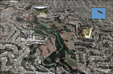
Glen Park Canyon is a short city hike — the trail gets increasingly dense as you walk into the canyon until you need to limbo your way under branches.
(1.51 miles, total elevation gain 909 feet, 47 minutes (average 1.92 mph), view in Google Earth)
Hike starts at: 37.737133, -122.442133.
Updated 2023-05-06 17:32:
Updating to add a hyperlapse video of the hike.
Related Posts
(Hike Map)
(Published to the Fediverse as: Glen Park Canyon #hike #sfdogwalk #video #hikevid 1.5 mile hike around Glen Canyon Park, a startling wilderness area in San Francisco, California. )