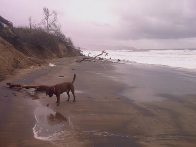
Fort Funston in the rain
By Robert Ellison. Updated on
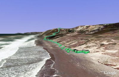
(view in Google Earth).
This is the short version of our Fort Funston walk (the long version is here). Depending on the tide and the height of the sand it's sometimes not easy to get past a couple of sewage outlet pipes. Today's walk was wet with a high tide so we turned left at the bottom of the sand ladder and just walked along the beach and back. The longer version is to turn right and complete a three mile loop.

Hike starts at: 37.714211, -122.502257383333.
Add Comment
All comments are moderated. Your email address is used to display a Gravatar and optionally for notification of new comments and to sign up for the newsletter.