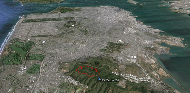
Summit Loop, San Bruno Mountain #hike#sanbruno#hikevid#map#video Three mile loop hike up to the 1,319 summit of San Bruno Mountain in San Mateo County, California.
Updated on Saturday, February 19, 2022
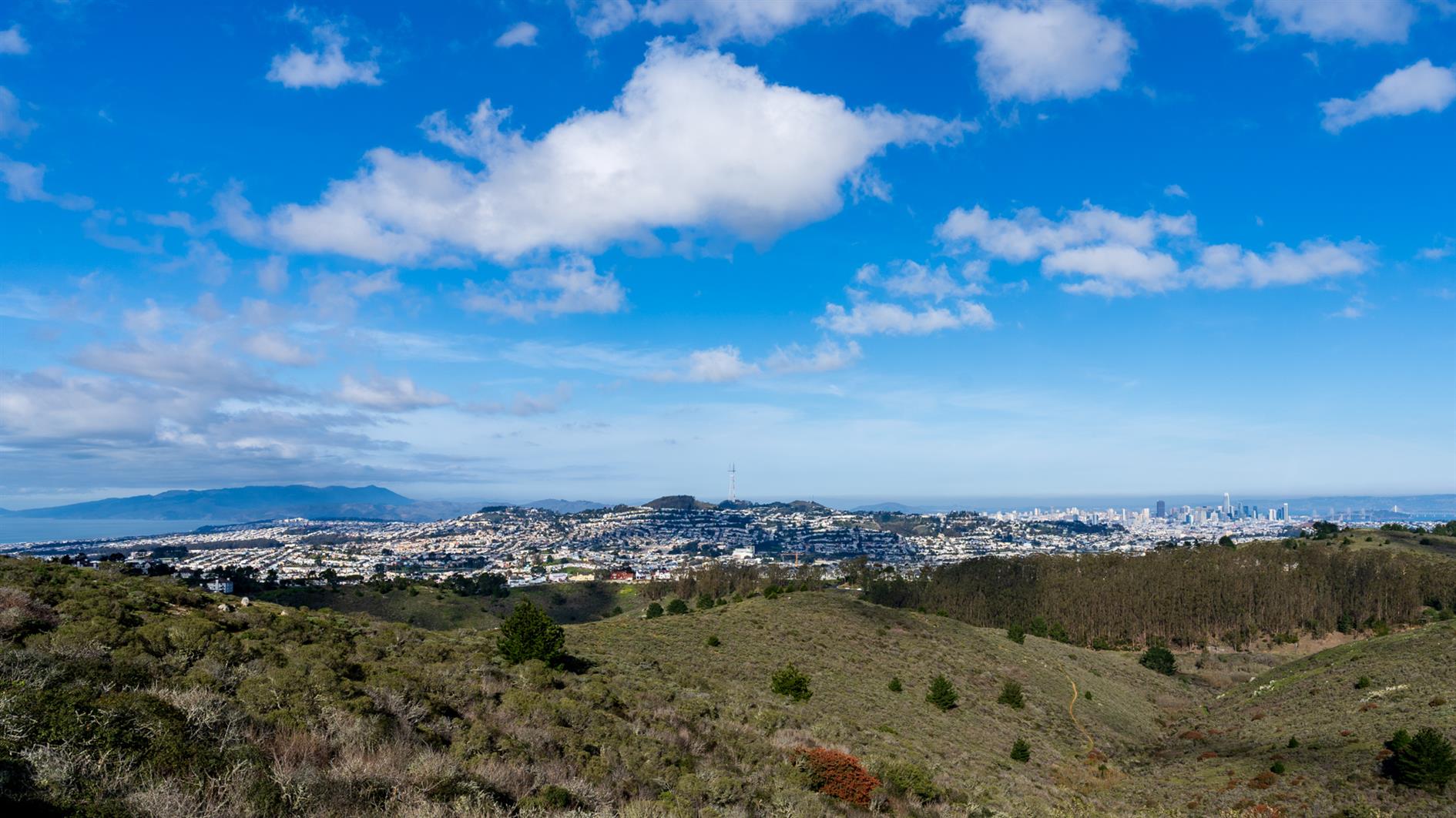
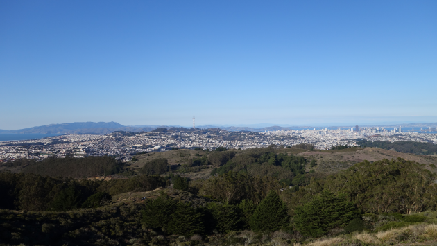
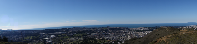
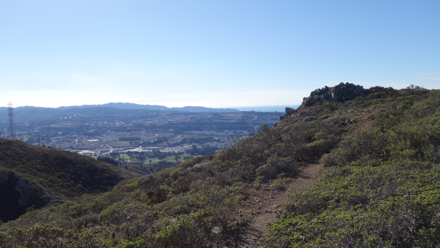
Summit Loop is a three mile hike around San Bruno Mountain, a 1,319 peak just south of San Francisco. For some reason, possibly a lack of desire to wrestle with bridges, it has become a family favorite for the first hike of the new year. Fantastic views and scenery at any time of the year, although it is especially good in the spring with all the wildflowers. I'm adding a fresh post on this hike as I noticed the GPS track is broken on the last one (I'll redirect that here) and I have a video of the hike to add as well (a little cloud focused, but it was that kind of day):
San Bruno Mountain State Park has outstanding views of San Francisco, the Pacific out to the Farallon Islands and much of the bay. We did the three mile summit loop (the wrong way round, San Bruno pros do it counter-clockwise).
(Published to the Fediverse as:
Summit Loop, San Bruno Mountain #hike#sanbruno#hikevid#map#video Three mile loop hike up to the 1,319 summit of San Bruno Mountain in San Mateo County, California.)
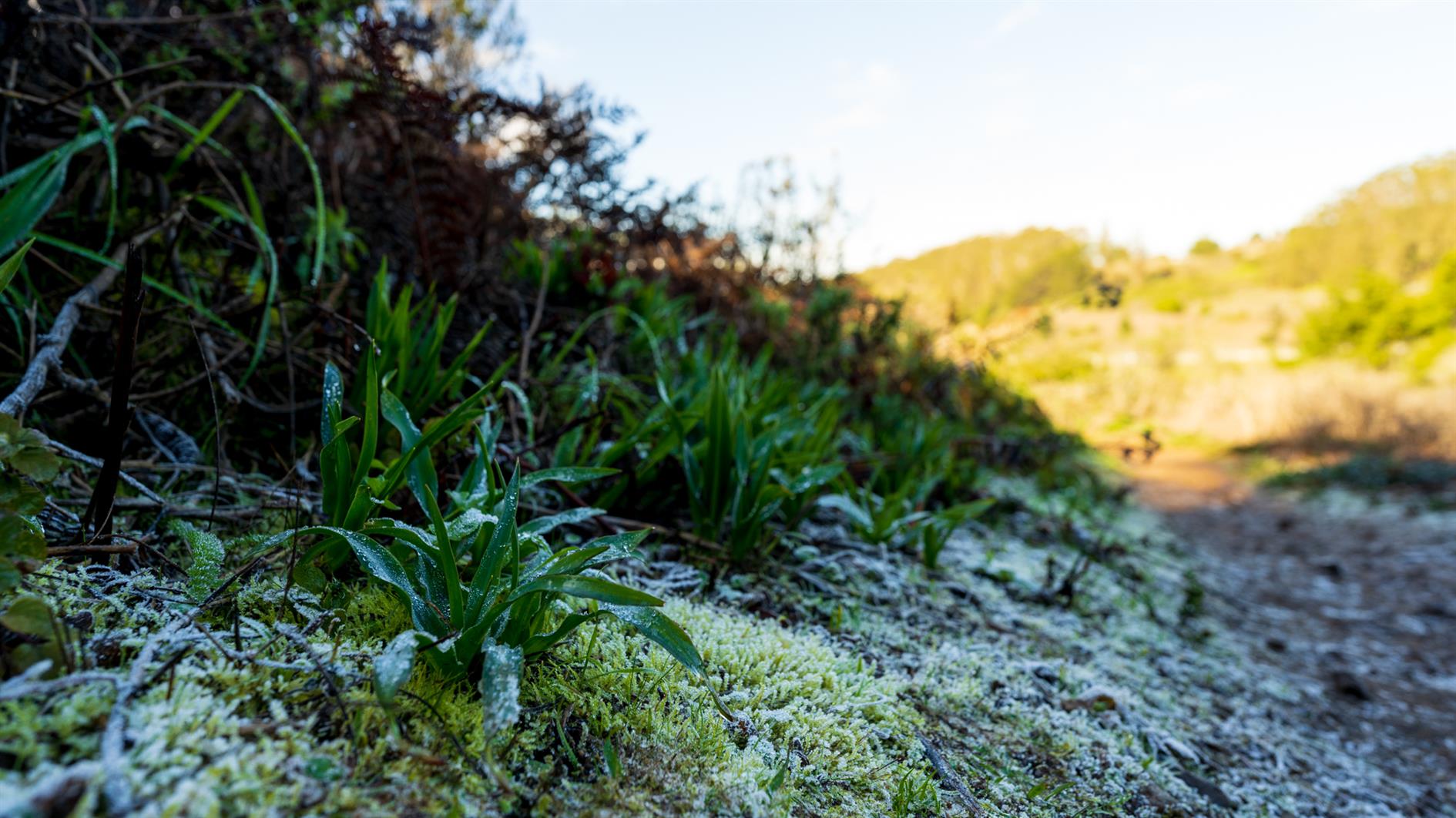
San Francisco from San Bruno Mountain #photo#sanfrancisco#sanbruno A mossy tree frames San Francisco, shot from San Bruno Mountain in San Mateo, California.
Updated on Wednesday, May 12, 2021
Photo of San Francisco framed by a mossy tree on San Bruno Mountain.
(Published to the Fediverse as:
San Francisco from San Bruno Mountain #photo#sanfrancisco#sanbruno A mossy tree frames San Francisco, shot from San Bruno Mountain in San Mateo, California.)
San Bruno Mountain State Park has outstanding views of San Francisco, the Pacific out to the Farallon Islands and much of the bay. We did the three mile summit loop (the wrong way round, San Bruno pros do it counter-clockwise).