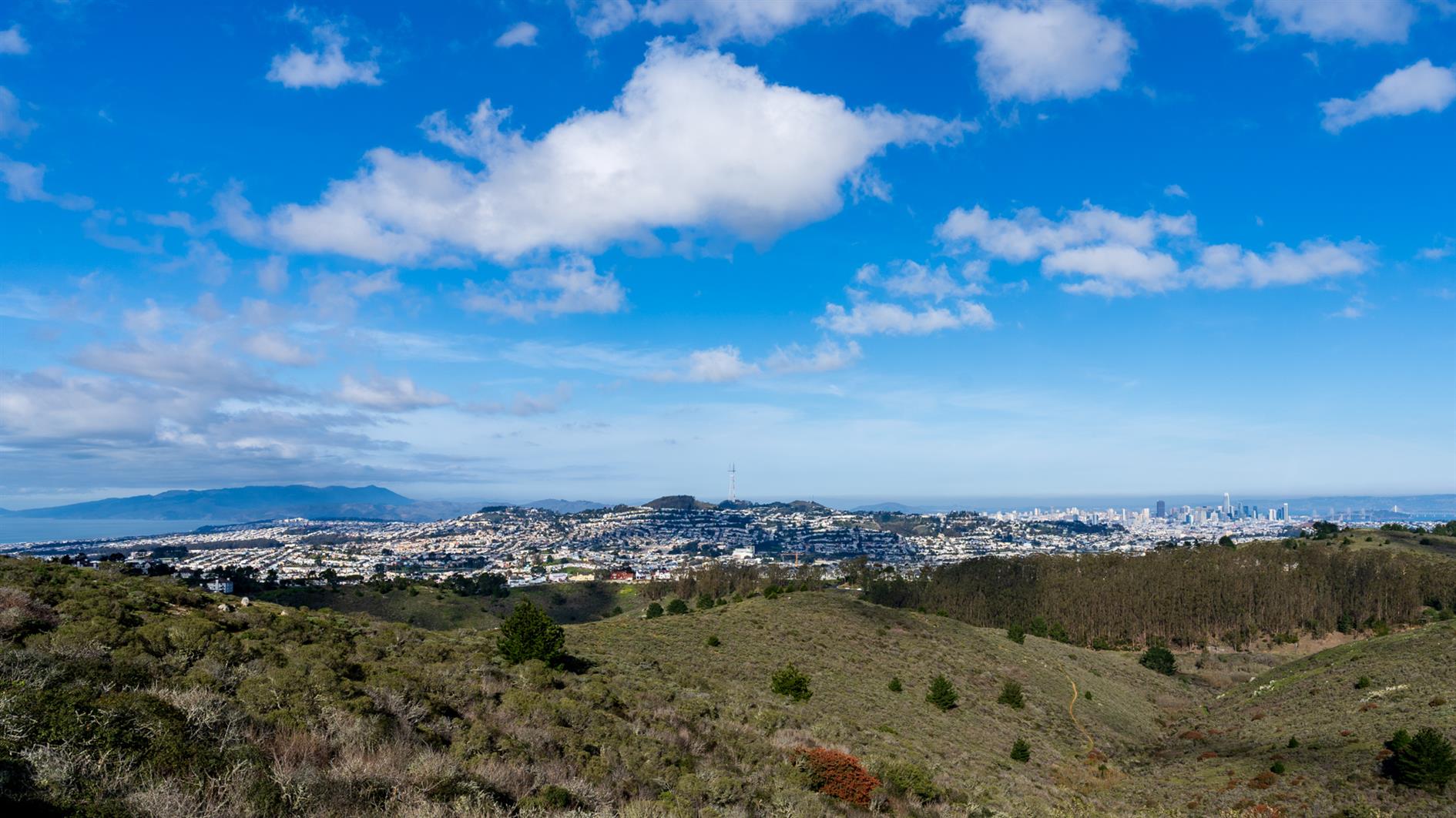
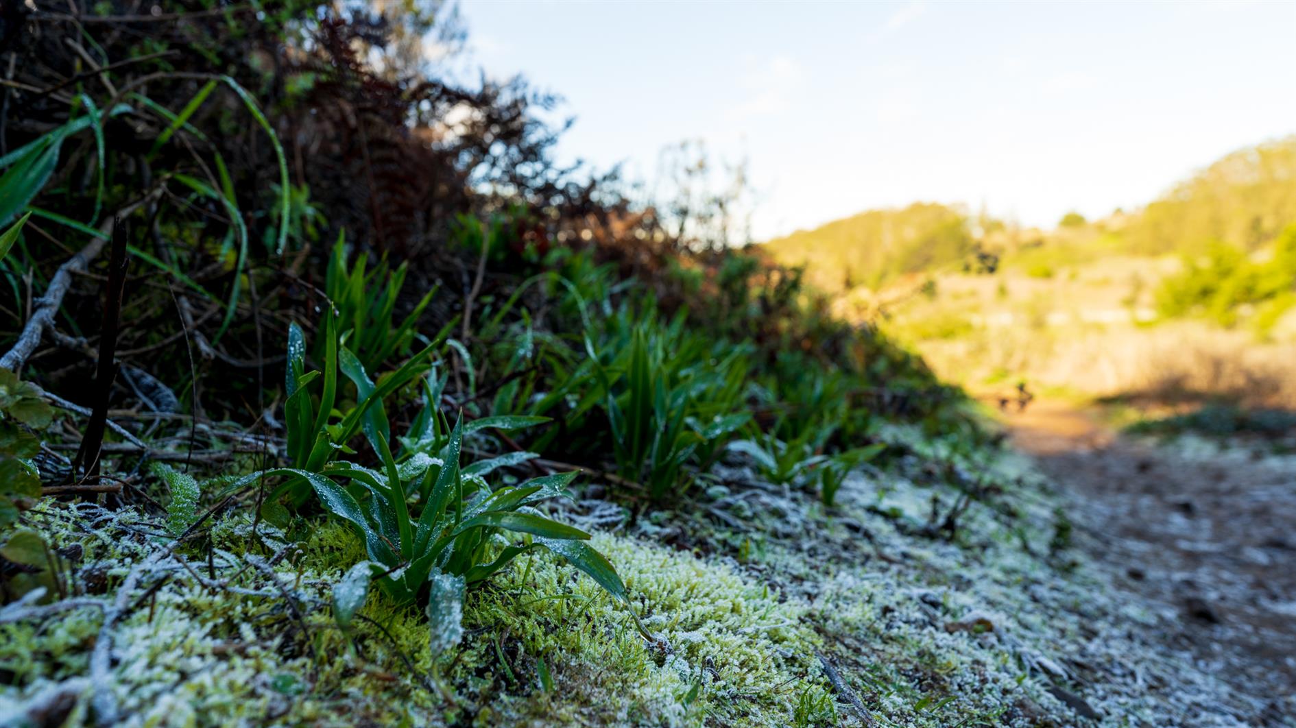
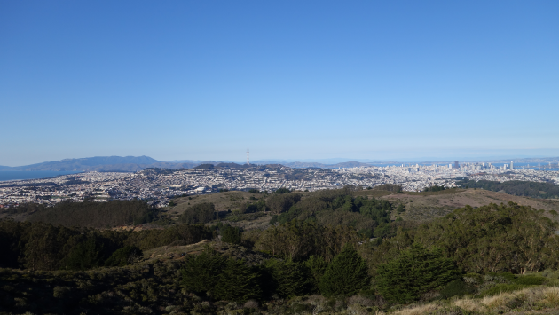
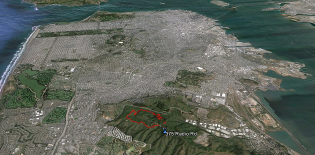
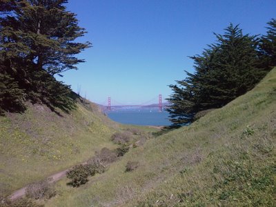
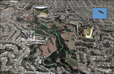
Presidio Loop Hike
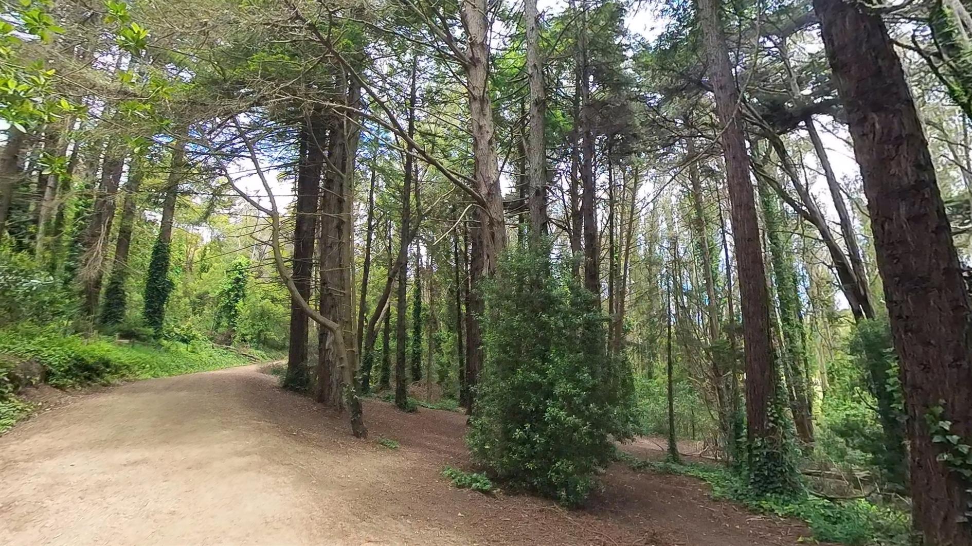
A pleasant loop hike in the Presidio of San Francisco. This is a dog friendly version, many trails are closed to dogs in the spring due to coyote pupping season. It starts at Mountain Lake, winds down the Ecology Trail to the main post and runs past both the new tunnel tops parks before returning to Mountain Lake.
Hike starts at: 37.786106, -122.472095. View in Google Earth.
Related Posts
- Summit Loop, San Bruno Mountain
- Golden Gate Park Loop
- Hill 88
- Lands End
- Short Shell Ridge Open Space Loop
(Hike Map)
(Published to the Fediverse as: Presidio Loop Hike #hike #video #presidio #sanfrancisco #hikevid #map 4 mile loop hike in the Presidio of San Francisco, California including Main Post and Tunnel Tops (dog friendly). )
Summit Loop, San Bruno Mountain
Summit Loop is a three mile hike around San Bruno Mountain, a 1,319 peak just south of San Francisco. For some reason, possibly a lack of desire to wrestle with bridges, it has become a family favorite for the first hike of the new year. Fantastic views and scenery at any time of the year, although it is especially good in the spring with all the wildflowers. I'm adding a fresh post on this hike as I noticed the GPS track is broken on the last one (I'll redirect that here) and I have a video of the hike to add as well (a little cloud focused, but it was that kind of day):
Hike starts at: 37.695247, -122.43443. View in Google Earth.
Updates
San Bruno Mountain
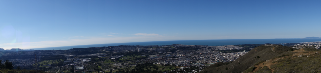
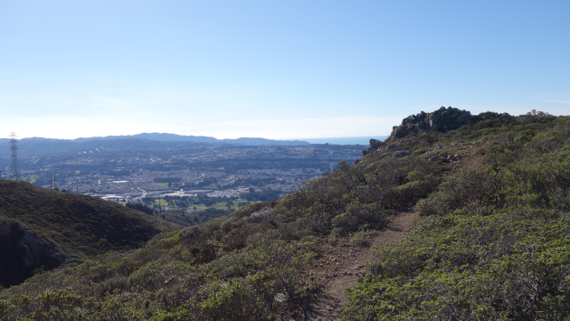
San Bruno Mountain State Park has outstanding views of San Francisco, the Pacific out to the Farallon Islands and much of the bay. We did the three mile summit loop (the wrong way round, San Bruno pros do it counter-clockwise).
Hike starts at 37.6888964,-122.437008 (Google Earth).
Related Posts
(Hike Map)
(Published to the Fediverse as: Summit Loop, San Bruno Mountain #hike #sanbruno #hikevid #map #video Three mile loop hike up to the 1,319 summit of San Bruno Mountain in San Mateo County, California. )
Creekside Trail to Big Leaf Trail Loop

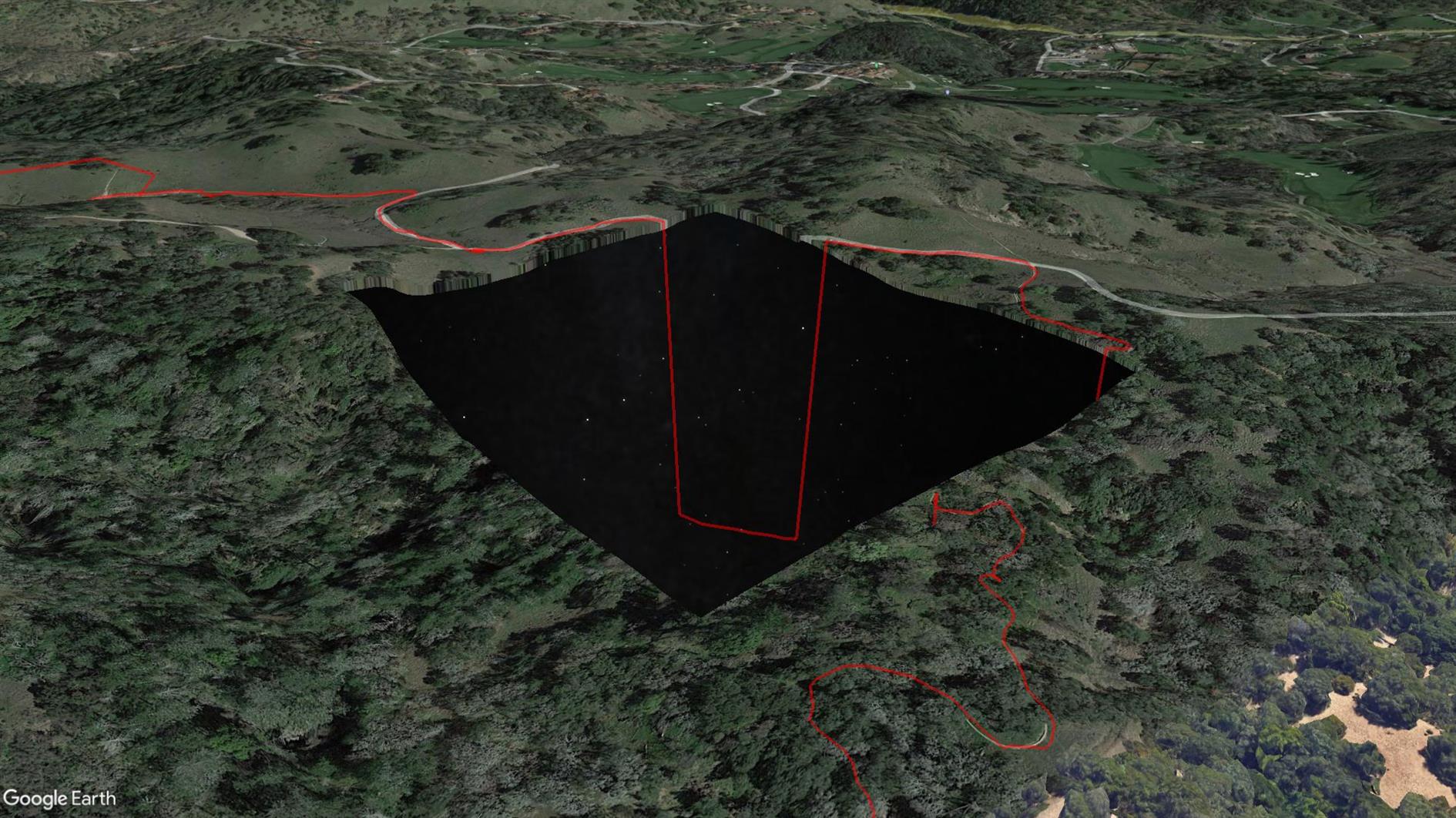
3.8 mile loop with 600 foot elevation gain in Shiloh Ranch Regional Park near Santa Rosa in Sonoma County.
This is the first time my Pixel 4 XL GPS has failed me. Sometimes it wanders a little off trail, but this time it took a completely unauthorized trip to a Home Depot before eventually snapping back to reality. I've included it here but unlike any other track I've uploaded you might not want to use this one (see the route on AllTrails instead, distance incorrect below). The really strange thing is that when I look at the trail in Google Earth there is a missing tile around where the GPS freaks out and Google Earth sends the route plunging down into outer space (because it's clamping to its elevation model but the stars under Sonoma are not as far away as they look?) See the screenshot above. Something is odd at Shiloh Ranch...
Hike starts at: 38.525412, -122.762561. View in Google Earth.
Related Posts
- Short Shell Ridge Open Space Loop
- Richards Fire Road
- Teague Hill Preserve
- Sawmill Flats
- Bald Mountain, Vista and Meadow Trails Loop (Sugarloaf Ridge State Park)
(Hike Map)
(Published to the Fediverse as: Creekside Trail to Big Leaf Trail Loop #hike #hikevid #map #video 3.8 mile loop in Shiloh Ranch Regional Park, Sonoma, California. This hike includes a GPS failure and a suspicious missing tile in Google Maps that shows the stars below Sonoma. )
Twin Peaks Loop
I have previously described Twin Peaks as not much of a hike, which is absolutely true if you drive there. When I first moved to San Francisco I lived in Noe Valley and used to cycle up to Twin Peaks and then try to get home without pedalling. For many years after that I'd take visitors up to the top and developed a somewhat weird tradition of taking each new child there soon after they were released from the hospital.
Post lockdown I'm up there most weeks. This is my five mile loop which starts heading up Ulloa from West Portal to Portola. Portola breaks the climb briefly as you pass the striking herchurch and controversial Twin Peaks gas station before heading up Twin Peaks Boulevard to the 922 foot summits. For a while Twin Peaks Boulevard was entirely closed to traffic (although you really had to keep an eye out for high speed skateboarders). Unfortunately it's now open all the way to Christmas Tree Point. Head down the north side to Clarendon and follow this all the way down to Forest Hill and then back to West Portal.
(Previously: Twin Peaks 360 4K, Twin Peaks, San Francisco from Twin Peaks)
Hike starts at: 37.741879, -122.471354. View in Google Earth.
Updated 2023-08-10 03:02:
Hyperlapse of this hike from August 9, 2023.
Related Posts
(Hike Map)
(Published to the Fediverse as: Twin Peaks Loop #hike #sanfrancisco #twinpeaks #coronavirus #map #video #hikevid #sfdogwalk Five mile loop hike from West Portal up Ulloa and Portola to the 922 foot summits of Twin Peaks and then back down Clarendon and Forest Hill. )
Mariposa Loop

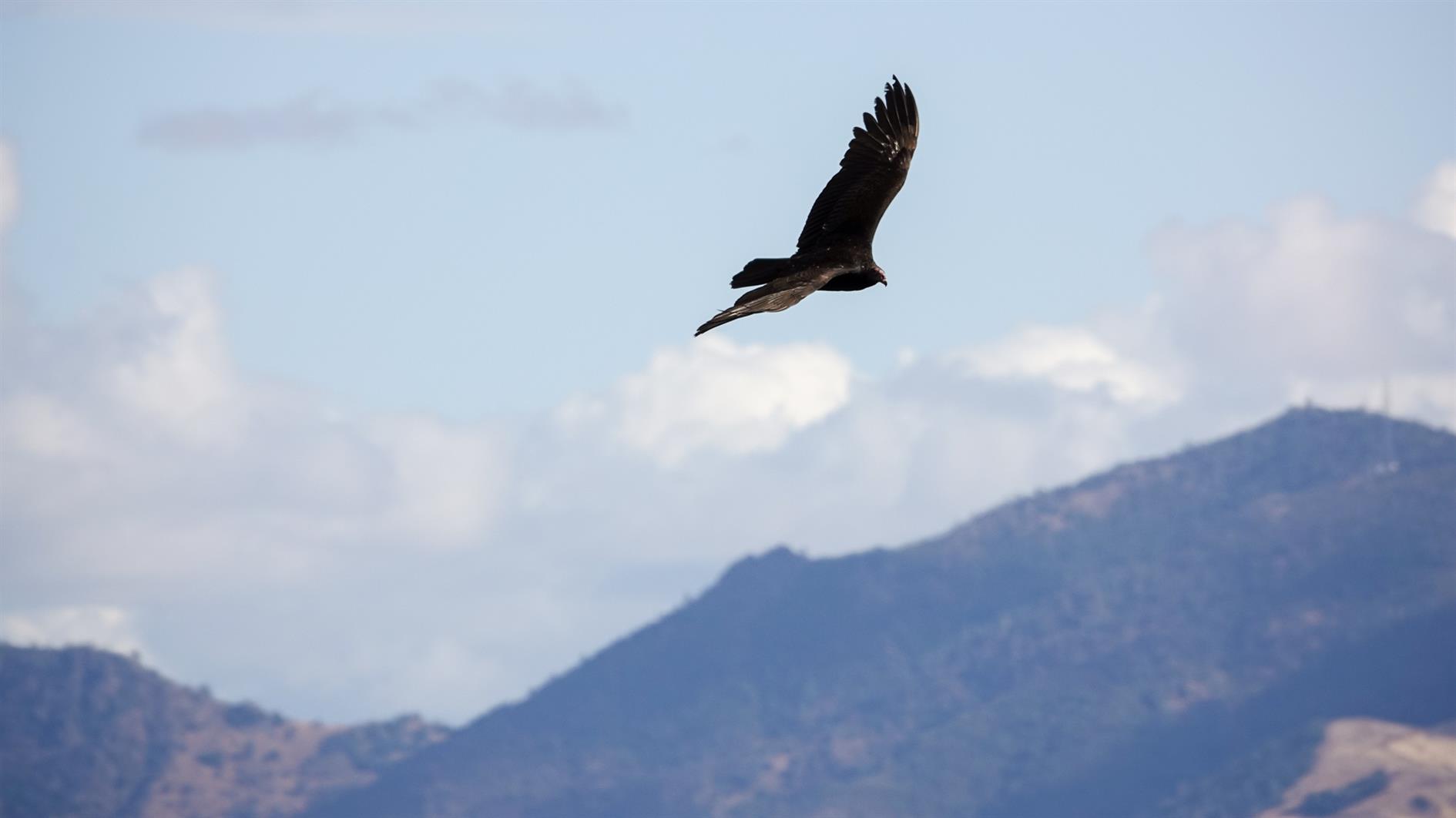
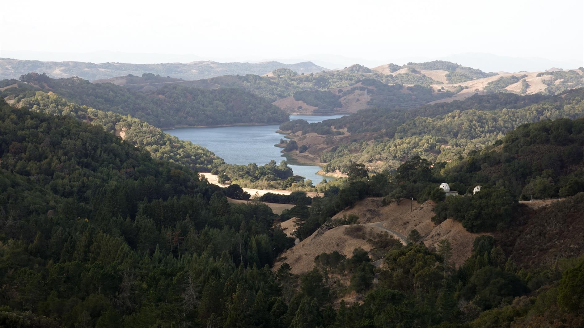
Mariposa Loop in Briones Regional Park near Lafayette. Park near Happy Valley Elementary School and then head up Panorama Drive to the top to get the trailhead. It's just over three miles. The first mile goes up 600 feet without stopping and the views are fantastic in every direction. This is the first time we've visited Briones, will be back soon as it looks like it has a lot of decent loops.
Hike starts at: 37.905312, -122.142265. View in Google Earth.
Related Posts
- Abrigo Valley
- Summit Loop, San Bruno Mountain
- San Pedro Valley Park Waterfall Loop
- Presidio Loop Hike
- Point Reyes - Divide Meadow Loop
(Hike Map)
(Published to the Fediverse as: Mariposa Loop #hike #lafayette #vulture #map #hikevid #video Three mile hike in Briones Regional Park near Lafayette. Steep first mile goes up 600 feet, then a pleasant loop back to the start. )
Richards Fire Road
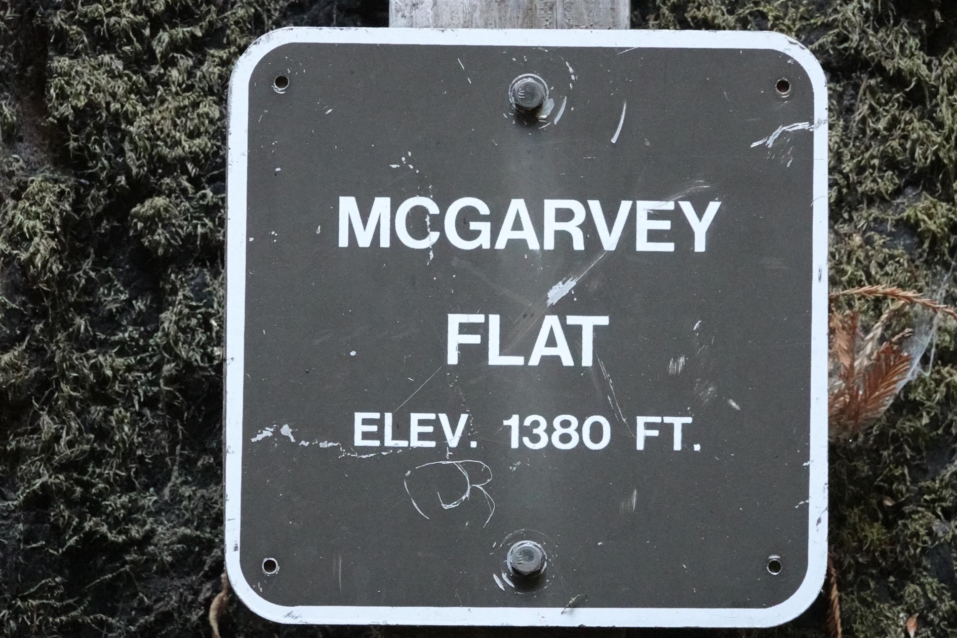
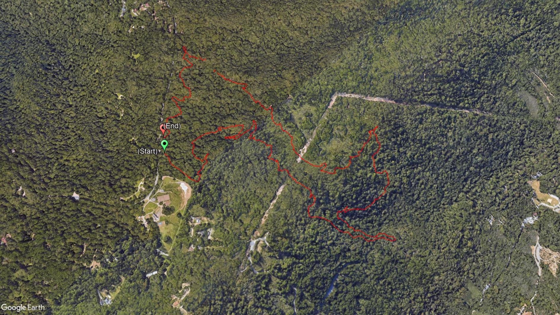
A 4 mile loop starting at Skyline Boulevard and descending through dense forest from 2,000 feet to McGarvey Flat at 1,380 before ascending in slightly brighter but still shaded conditions. Perfect on a warm day. This is in Huddart Park in San Mateo county, just the other side of 35 from Purisima Creek. The hyperlapse video shows the second half of the hike.
Hike starts at: 37.429281, -122.312027. View in Google Earth.
Related Posts
- Teague Hill Preserve
- Point Reyes - Divide Meadow Loop
- Adobe Creek
- Grabtown Gulch and Borden Hatch Mill in Purisima Creek
- Mariposa Loop
(Hike Map)
(Published to the Fediverse as: Richards Fire Road #hike #sanmateo #huddartpark #redwoods #map #hikevid #video Richards Fire Road, a pleasant four mile hike in Huddart Park (San Mateo, California). )
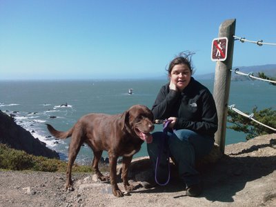
Lake Merced
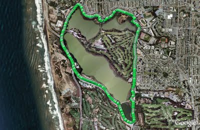
Lake Merced is a natural lake near Fort Funston. It used to be San Francisco's main fresh water supply but is now the emergency reserve (somewhat worrying as a previous earthquake caused much of Lake Merced to drain into the Pacific).
The lake is also the site of the Terry/Broderick duel where in 1859 the Chief Justice of the California Supreme Court (Terry) killed a US Senator (Broderick) in an argument over slavery.
The loop around the lake is a flat five mile path, unfortunately marred by heavy traffic and constant gunfire from clay pigeon shooting and/or the SFPD firing range.
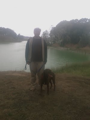
Rob and Rudy at Lake Merced.
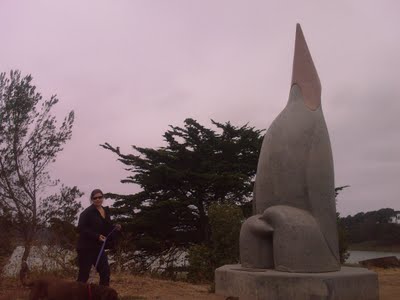
Gill and Rudy next to a sculpture called "Penguin's Prayer". Given the latitude I expect the penguin is praying for the next ice age.
(4.85 miles, total elevation gain 0 feet, 1 hour, 39 minutes, average 2.93 mph, view in Google Earth, view in Google Maps.)
Hike starts at: 37.712302, -122.489232.
Updated 2023-06-20 01:27:
Video from a trip round Lake Merced on June 19, 2023.
Related Posts
(Hike Map)
(Published to the Fediverse as: Lake Merced #hike #sfdogwalk #video #hikevid Five mile hike around Lake Merced in San Francisco, California. )
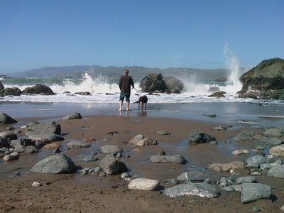
Lands End
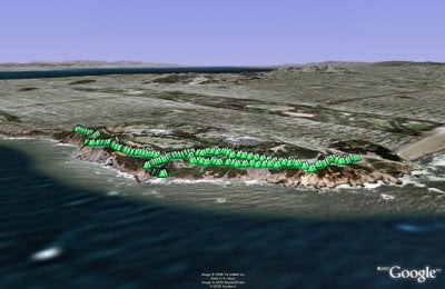
Lands End to Eagle's Point is a stunning section of the Coastal Trail. Park in or near the new lot at Point Lobos Ave and El Camino del Mar. Before or after the walk check out the ruins of Sutro Baths. I'd put some of that American Recovery and Reinvestment Act cash into rebuilding the baths, it looks like they were incredible.
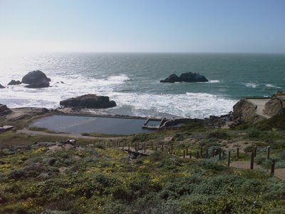
If you follow the trial down the the baths then there's a short but very cool cave to explore which ends in another unique view of the pacific and the mouth of the Golden Gate.
From Sutro Baths follow signs to Eagle's point. There are some very steep cliffs along the trail, so a leash is a really good idea for dogs.
One worthwhile detour is to wonder down to Mile Rock Beach. It's a stony and impressively violent beach with a couple of lookouts on the way down with impressive views.
(3.16 miles, total elevation gain 457 feet, 1 hours, 24 minutes, average 2.24 mph, view in Google Earth, view in Google Maps)
Hike starts at: 37.783491, -122.510793.
Updated 2023-06-19 02:22:
Here's a video of the hike from June 18, 2023:
Related Posts
- Hill 88
- Coastal and Julian loop plus Black Sands Beach
- Point Reyes - Tomales Point
- Presidio Loop Hike
- Point Reyes - Drakes Estero
(Hike Map)
(Published to the Fediverse as: Lands End #hike #sfdogwalk #video #hikevid 3 mile hike from Lands End to Eagle's Point in San Francisco taking in Sutro Baths. )
Glen Park Canyon
Glen Park Canyon is a short city hike — the trail gets increasingly dense as you walk into the canyon until you need to limbo your way under branches.
(1.51 miles, total elevation gain 909 feet, 47 minutes (average 1.92 mph), view in Google Earth)
Hike starts at: 37.737133, -122.442133.
Updated 2023-05-06 17:32:
Updating to add a hyperlapse video of the hike.
Related Posts
(Hike Map)
(Published to the Fediverse as: Glen Park Canyon #hike #sfdogwalk #video #hikevid 1.5 mile hike around Glen Canyon Park, a startling wilderness area in San Francisco, California. )