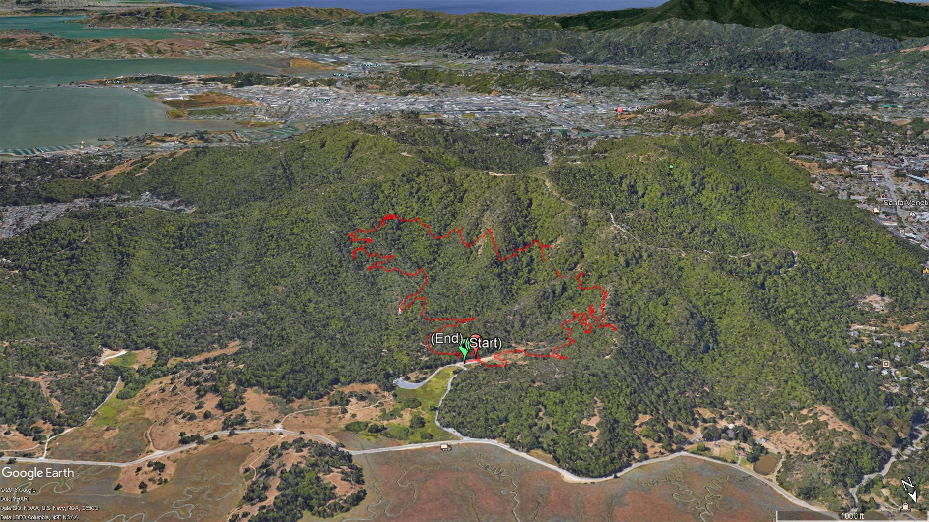
Bumpass Hell
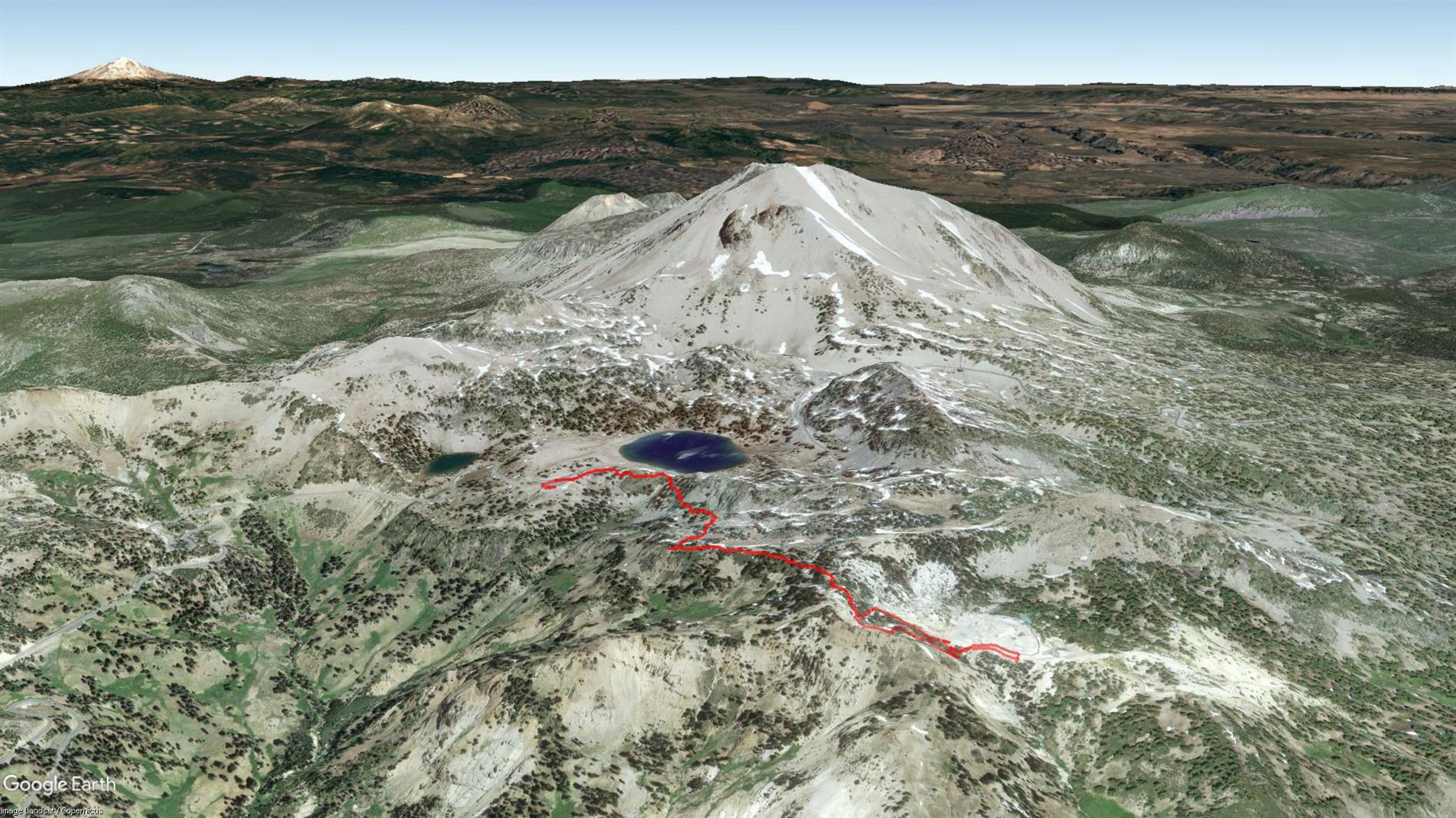
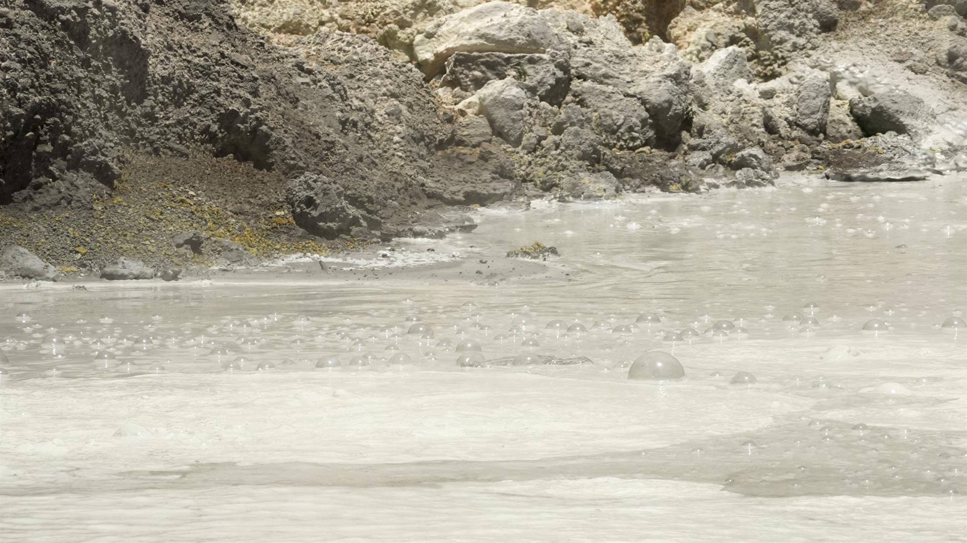
Third time lucky - Bumpass Hell was open for my third trip to Lassen Volcanic National Park. It's a three mile out and back with great views and of course a whole bunch of geothermal features at the end. The trail winds gently up to Bumpass Hell where there is a steep and surprisingly slippery descent (and an alternate route back up for a very small loop at the end of the trail). Very glad to have finally hiked it.
(Previously: Lassen Star Trails)
Hike starts at: 40.465403, -121.514653. View in Google Earth.
Related Posts
- Lassen Star Trails
- Summit Lake to Echo Lake in Lassen
- Devils Kitchen
- Las Trampas Wilderness
- McCloud River Trail (Three Waterfalls)
(Hike Map)
(Published to the Fediverse as: Bumpass Hell #hike #lassen #map Bumpas Hell )
Coronavirus Hikes: June 2020
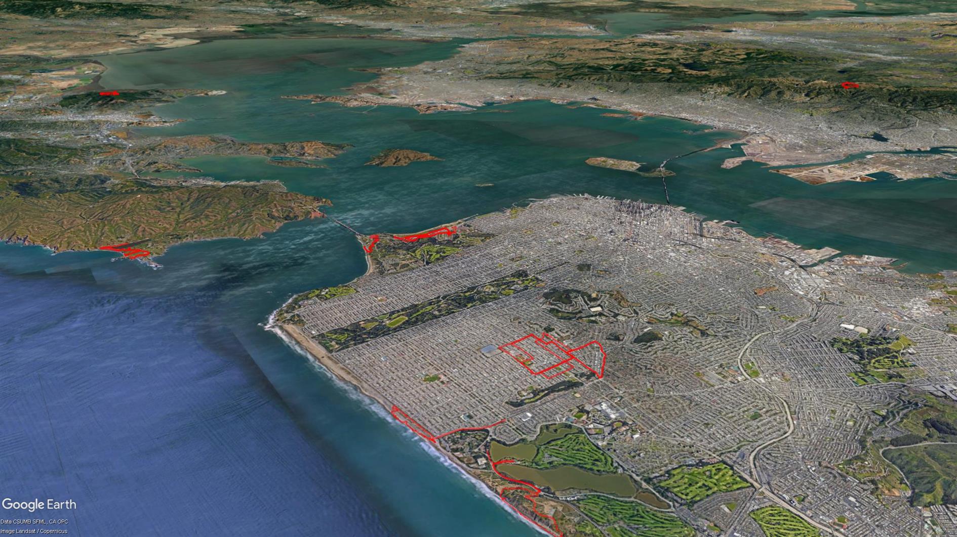
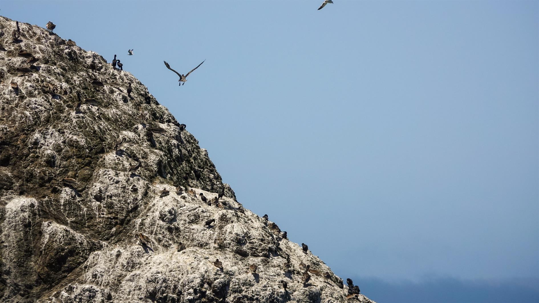
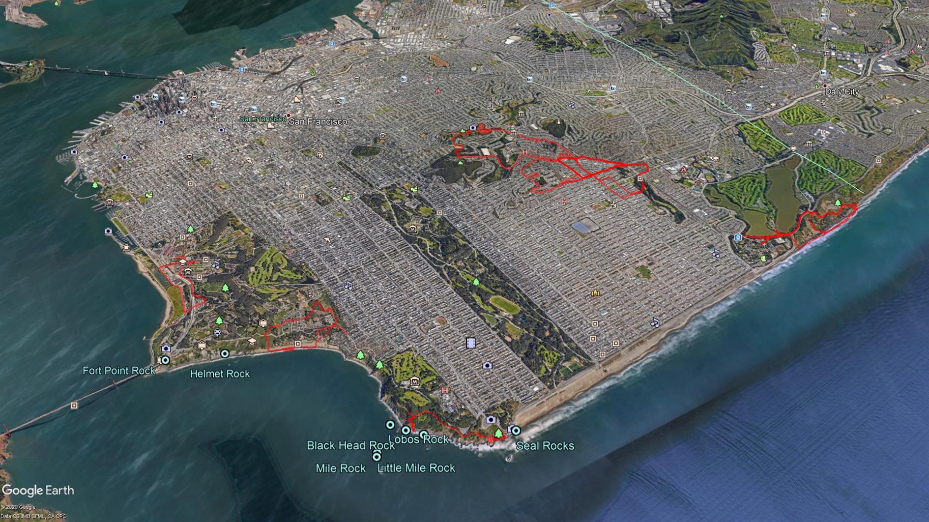
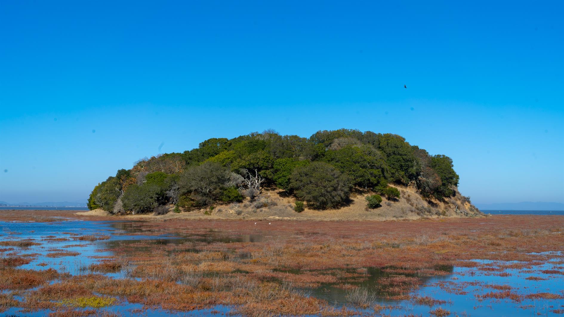
Starting to leave San Francisco. Photo is of Bird Island in the Marin Headlands. 39.1 unique miles.
Hike starts at: 37.741862, -122.471579. View in Google Earth.
Related Posts
- Coronavirus Hikes: May 2020
- Coronavirus Hikes: April 2020
- Coronavirus Hikes: July 2020
- Coronavirus Hikes: March 2020
- Coronavirus Hikes: Done
(Hike Map)
(Published to the Fediverse as: Coronavirus Hikes: June 2020 #hike #coronavirus #map Lockdown hikes around San Francisco for June 2020. )
Coronavirus Hikes: May 2020
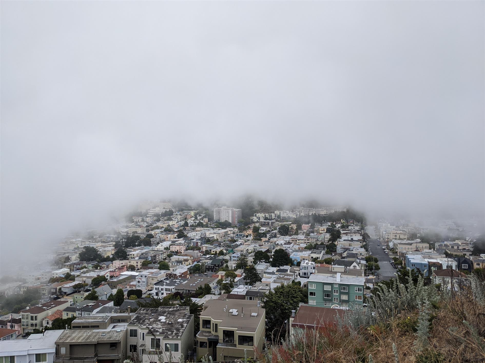
37.2 unique miles in May. Photo is the fog shadow behind Grand View Park.
Hike starts at: 37.741726, -122.471298. View in Google Earth.
Related Posts
- Coronavirus Hikes: June 2020
- Coronavirus Hikes: April 2020
- Coronavirus Hikes: July 2020
- Coronavirus Hikes: March 2020
- Coronavirus Hikes: Done
(Hike Map)
(Published to the Fediverse as: Coronavirus Hikes: May 2020 #hike #sanfrancisco #coronavirus #map Pandemic lockdown hikes around San Francisco for May 2020. )
Coronavirus Hikes: March 2020
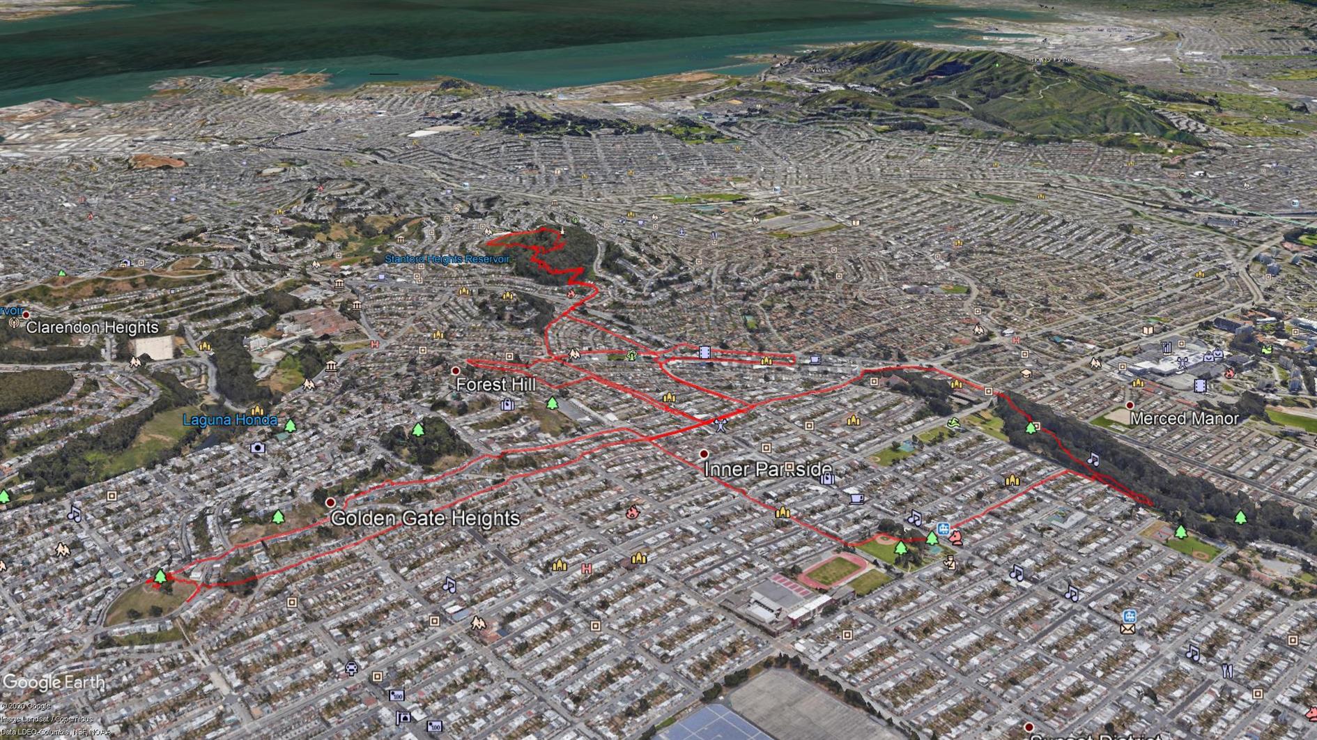
Not getting far from home any time soon so all hikes for now will be local. I found a great web app, Routeshuffle, that will generate a random hike from the starting location of your choice. It's a great way of seeing streets you'd never venture down normally. The map is generated with some software I wrote to combine multiple KML files for easy rendering in Google Earth (oh, and Google Earth, I guess that does the heavy lifting). I'll post these every month while we're locked down. March is 15.6 miles total.
Hike starts at: 37.800778, -122.455943. View in Google Earth.
Related Posts
- Coronavirus Hikes: Done
- Coronavirus Hikes: April 2020
- Coronavirus Hikes: May 2020
- Coronavirus Hikes: June 2020
- Coronavirus Hikes: July 2020
(Hike Map)
(Published to the Fediverse as: Coronavirus Hikes: March 2020 #hike #coronavirus #sanfrancisco #map Pandemic lockdown hikes around San Francisco from March 2020 )
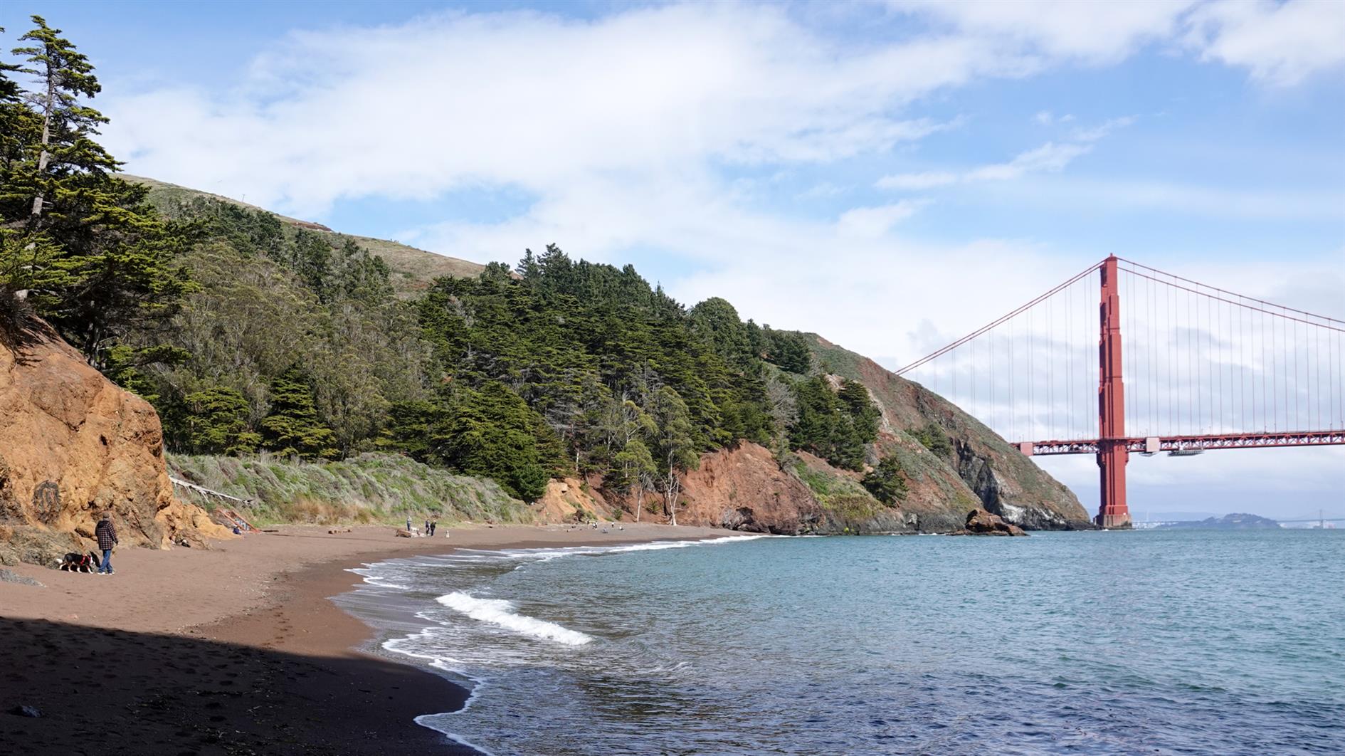
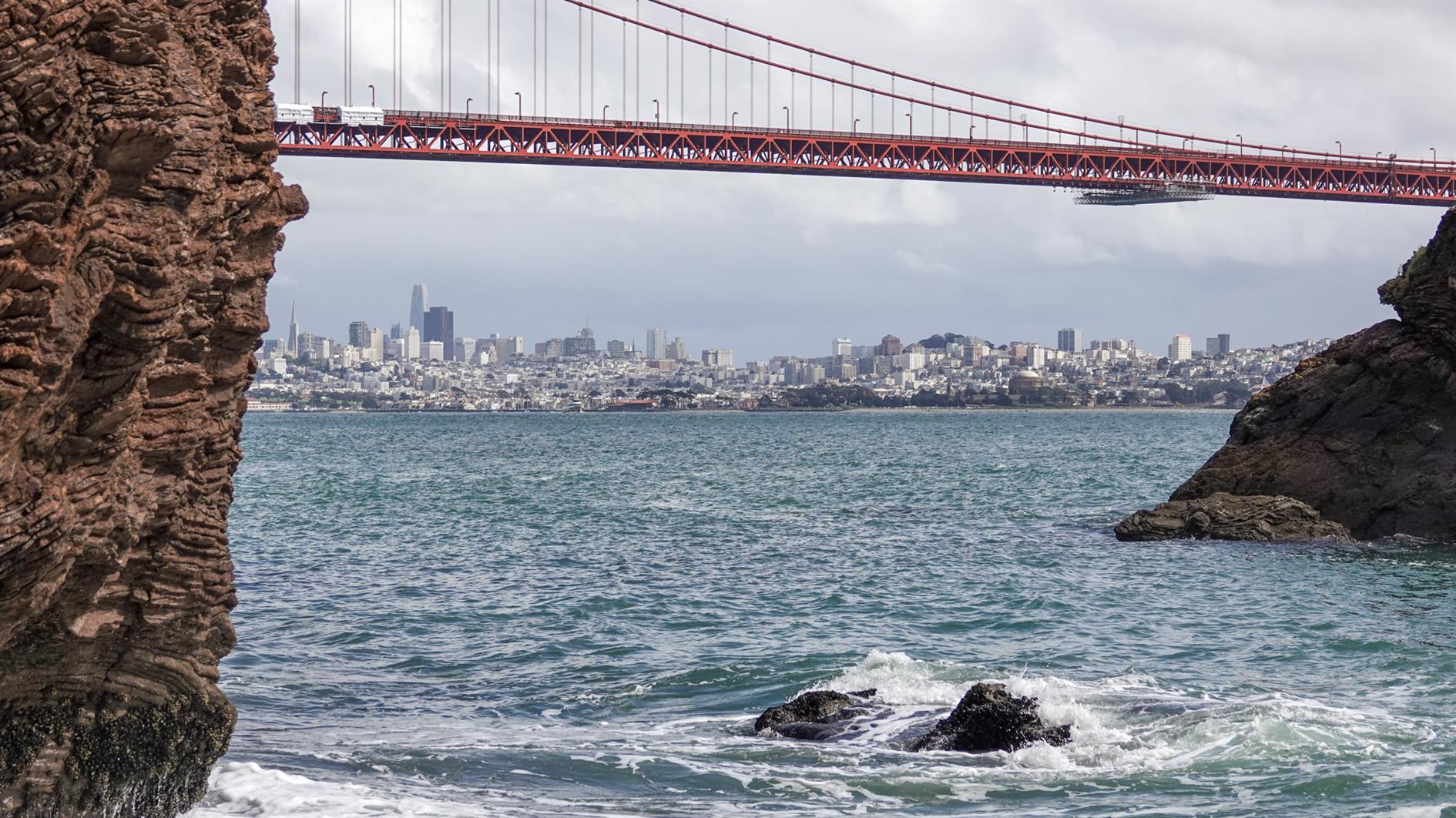
Kirby Cove
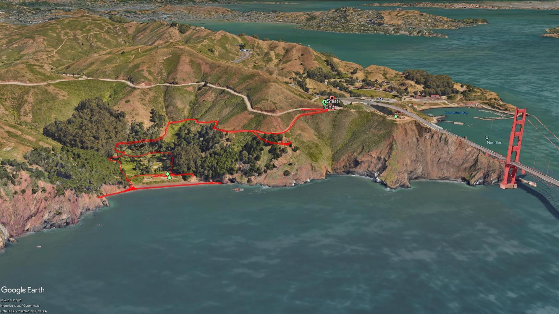

A short two mile out and back from the Battery Spencer parking area on Conzelman Road to Kirby Cove.
The Marin Headlands have had a bit of a traffic management change recently so you need to go through the tunnel to get in and Conzelman Road is now one way back to highway 101. The advantage is that there is way more parking then there used to be. I think I've only ever managed to park near Battery Spencer once in 20 years.
The walk is my least favorite profile, downhill to start and uphill on the way back and also not a loop. It's worth it though because it's short and Kirby Cove beach is quiet and has wonderful views of San Francisco through the Golden Gate Bridge. You can also visit Battery Wagner and Battery Kirby on the way back up.
Hike starts at: 37.829459, -122.48401. View in Google Earth.
Related Posts
- Batteries to Bluffs
- Treasure Island Perimeter
- Coastal and Julian loop plus Black Sands Beach
- Hill 88
- Golden Gate Park - Stow Lake, Strawberry Hill and Museum Concourse
(Hike Map)
(Published to the Fediverse as: Kirby Cove #hike #sanfrancisco #ggb #map Two mile hike to Kirby Cove Beach in the Marin Headlands with outstanding views of San Francisco through the Golden Gate Bridge. )
Mt. Livermore on Angel Island
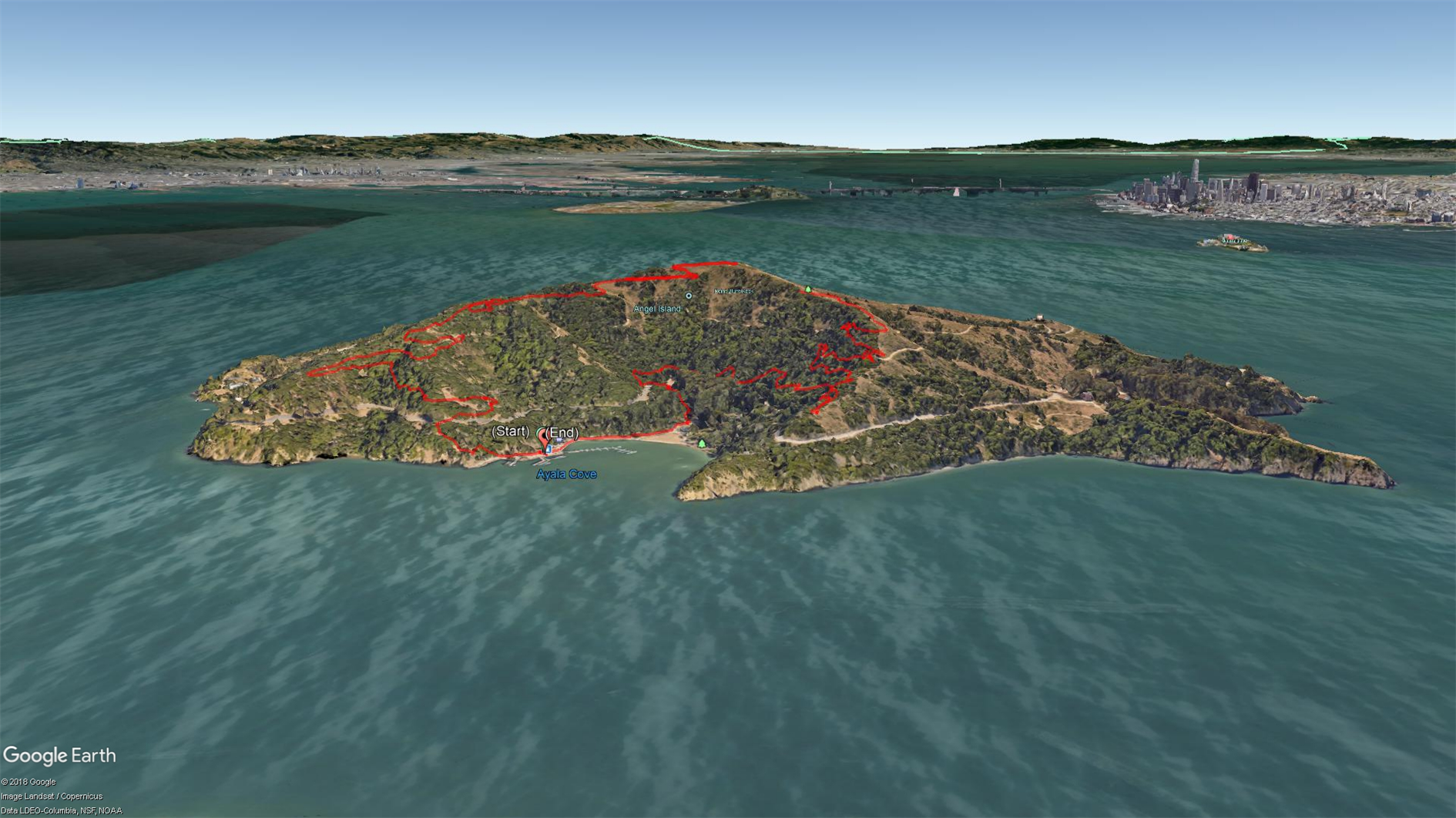

The Immigration Station at Angel Island is a fascinating piece of history. It's amazing how unwelcoming we were to Chinese immigrants while the station was in operation, and how ineffective all of the unpleasantness was. It's a racist mirror universe of Ellis Island. Get a guided tour if you can. I've visited the Immigration Station a couple of times and also hiked around the perimeter (which is spectacular), but this trip was the first time going up to the top. The Angel Island Company site suggests that this is a 6.5 mile hike but my GPS thinks it was 5 miles and so did the fact that we made it back in time for our planned ferry back to San Francisco.
Get off the boat, head right and up the hill to pick up the sign for Sunset Trail. This takes you up to a spur about half a mile from the top that is well signed for Mt. Livermore. There are a few picnic tables and an annoying mast that makes it hard to take the panorama that this peak is so obviously calling for. On the way back down head right at the first opportunity to follow North Ridge trail back to Ayala Cove.
Hike starts at: 37.868337, -122.434656. View in Google Earth.
Related Posts
- Angel Island Perimeter Road
- Treasure Island Perimeter
- Golden Gate Park - Stow Lake, Strawberry Hill and Museum Concourse
- Hill 88
- Lands End
(Hike Map)
(Published to the Fediverse as: Mt. Livermore on Angel Island #hike #sanfrancisco #angelisland #map Five mile hike to Mt. Livermore at the summit of Angel Island State Park in the San Francisco bay. )
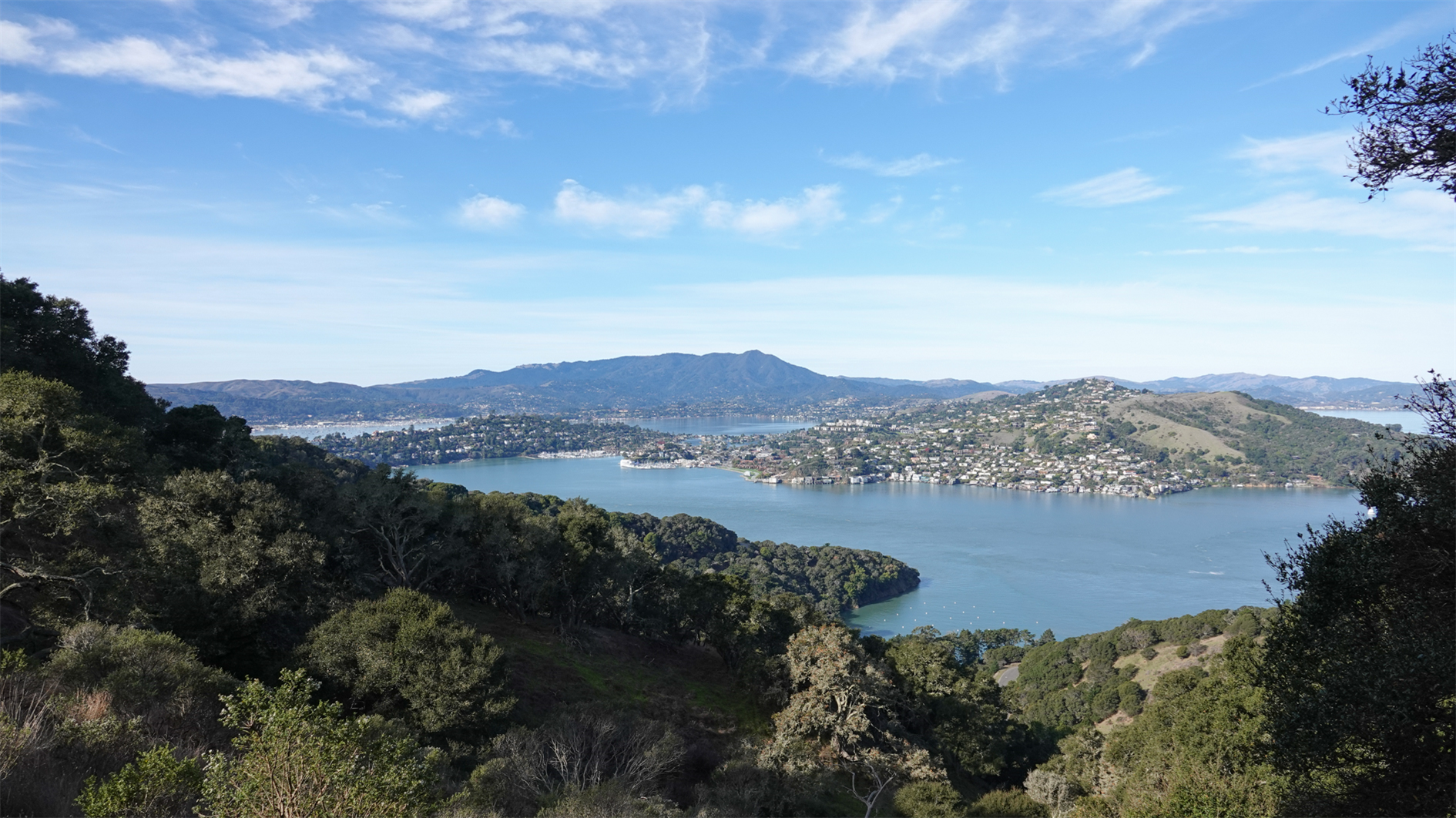
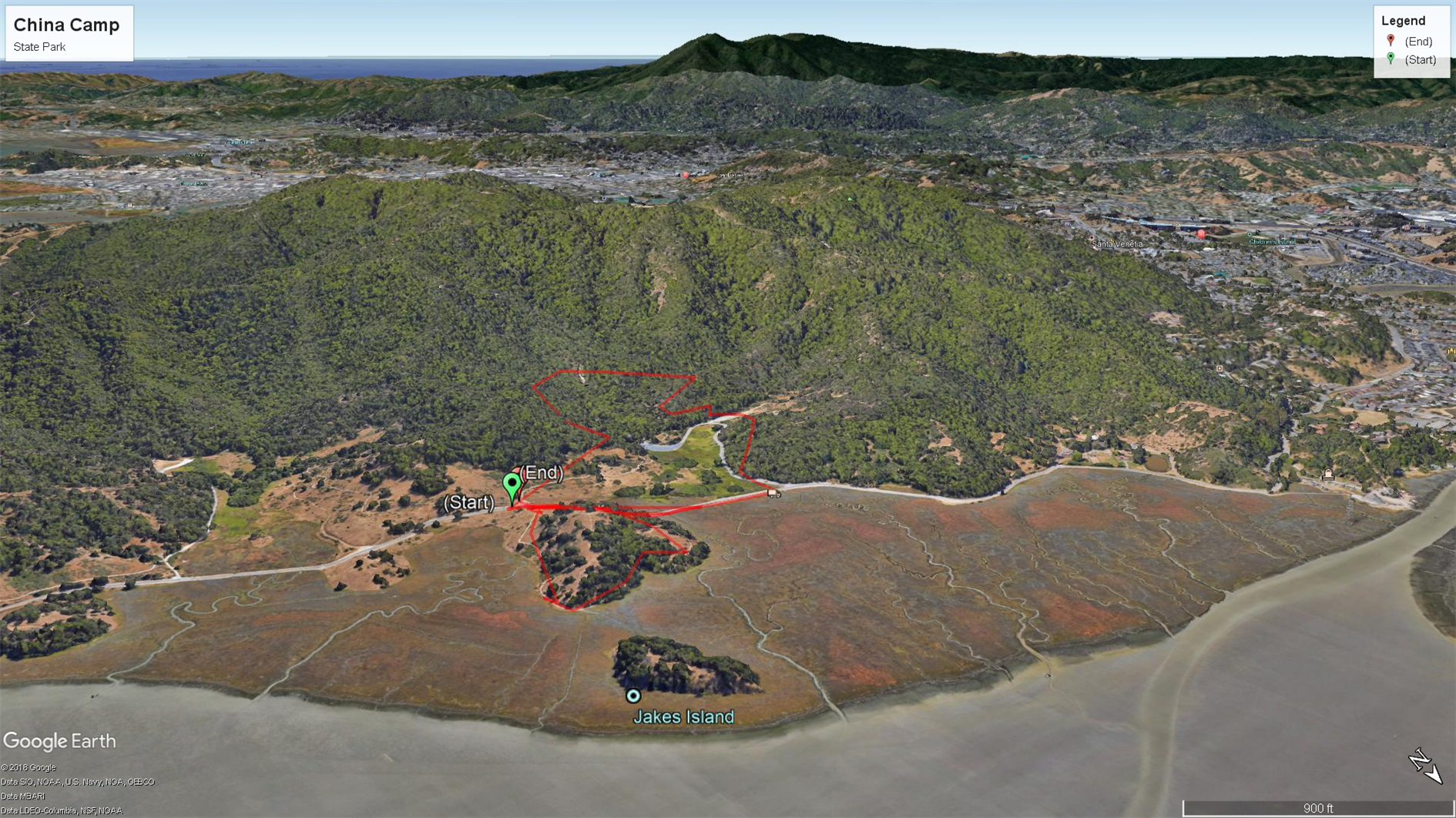
Bay View and Shoreline Trails at China Camp State Park
A nice 4 mile hike at China Camp State Park - starting at the day use parking in the campsite follow Powerline Fire Trail up to a left on Bay View Trail then left on Back Ranch Fire Trail and finally left again on Shoreline Trial back to the parking lot. Gentle ascent for three miles then a fairly steep stretch down Back Ranch Fire Trail (I slipped three times, watch where you're going) and then gentle again for the final half mile.
(Previously: shorter 3 mile hike of Back Ranch Meadows and Turtleback Point loop)
Hike starts at: 38.006014, -122.496775. View in Google Earth.
Related Posts
(Hike Map)
(Published to the Fediverse as: Bay View and Shoreline Trails at China Camp State Park #hike #chinacamp #map Bay View Trail to Shoreline Trail 4 mile hike at China Camp State Park )
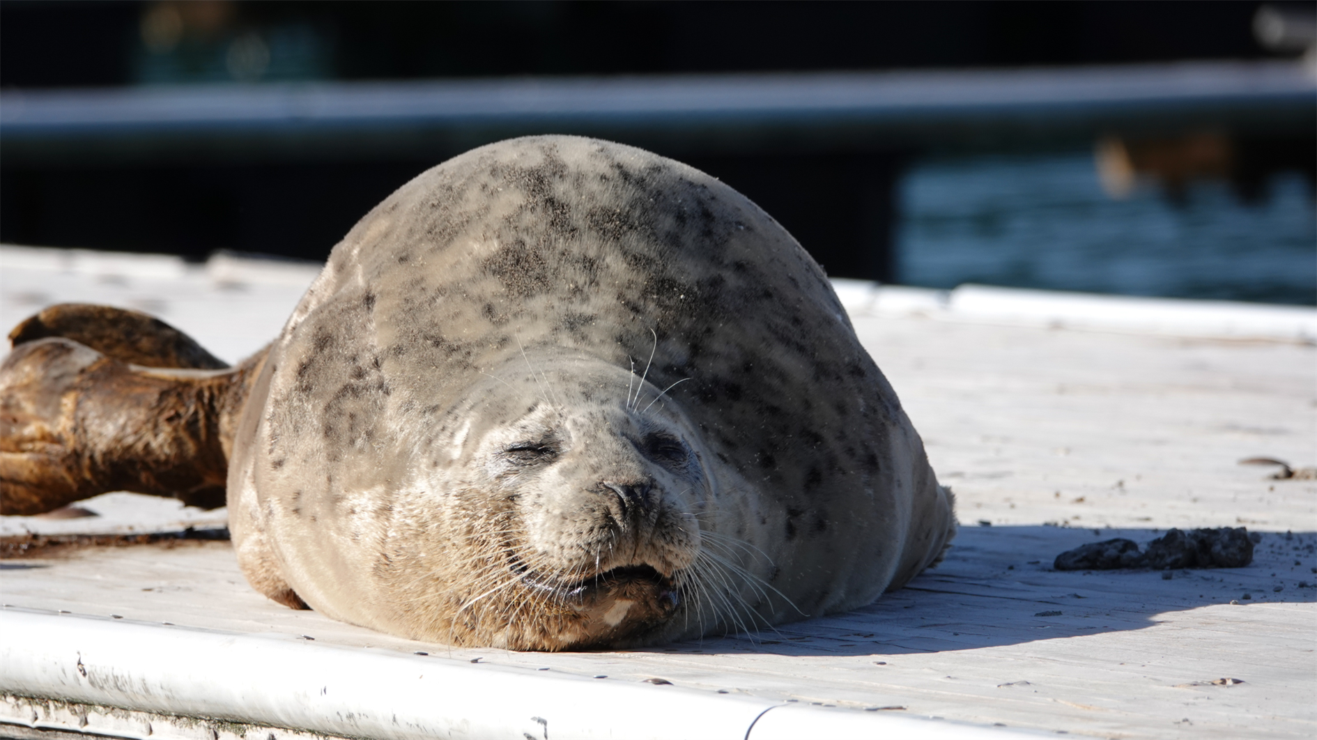
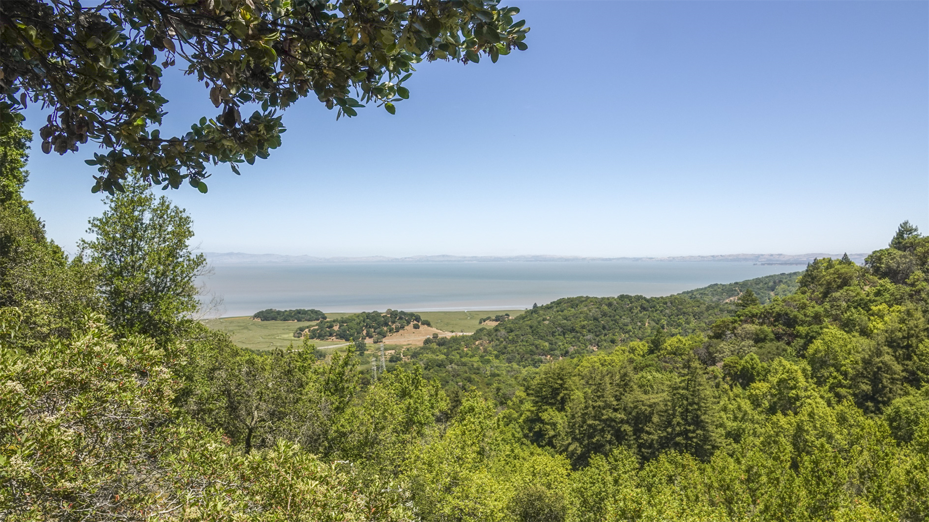
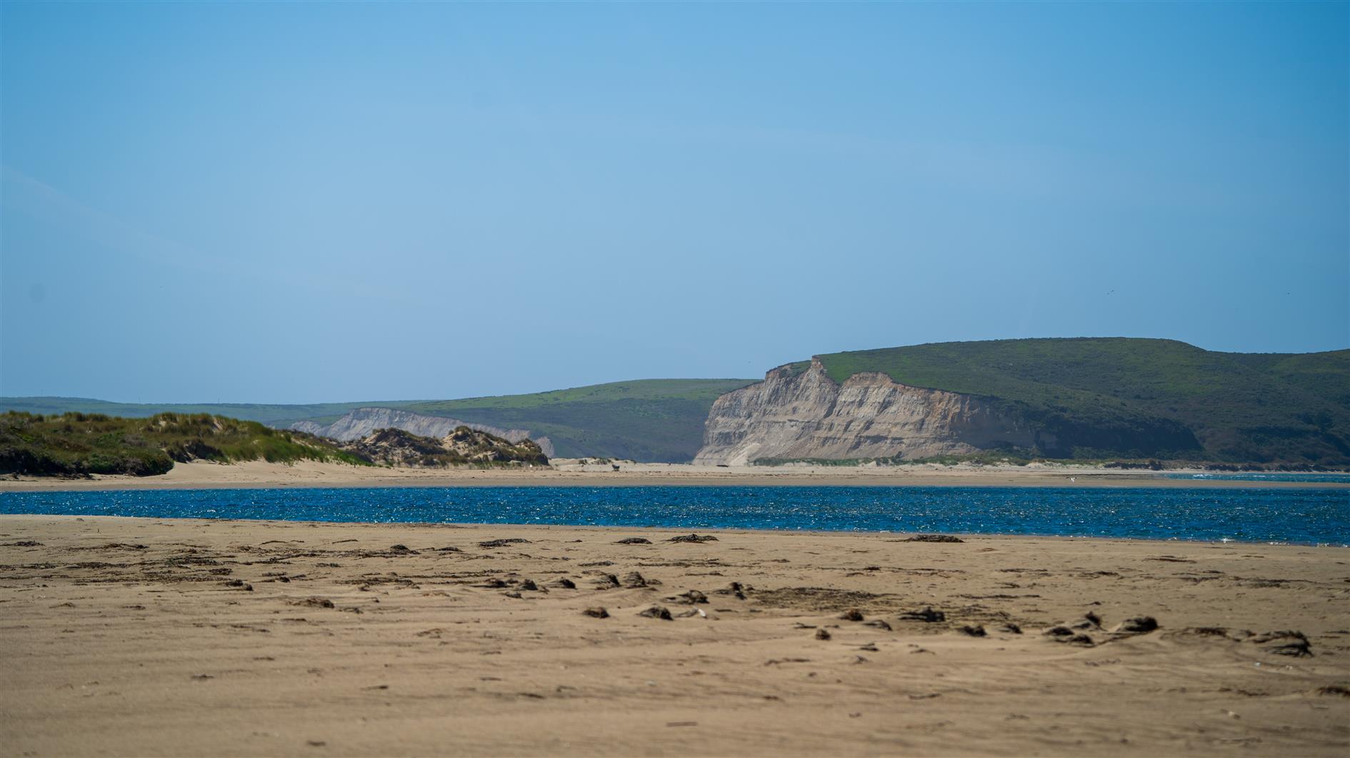
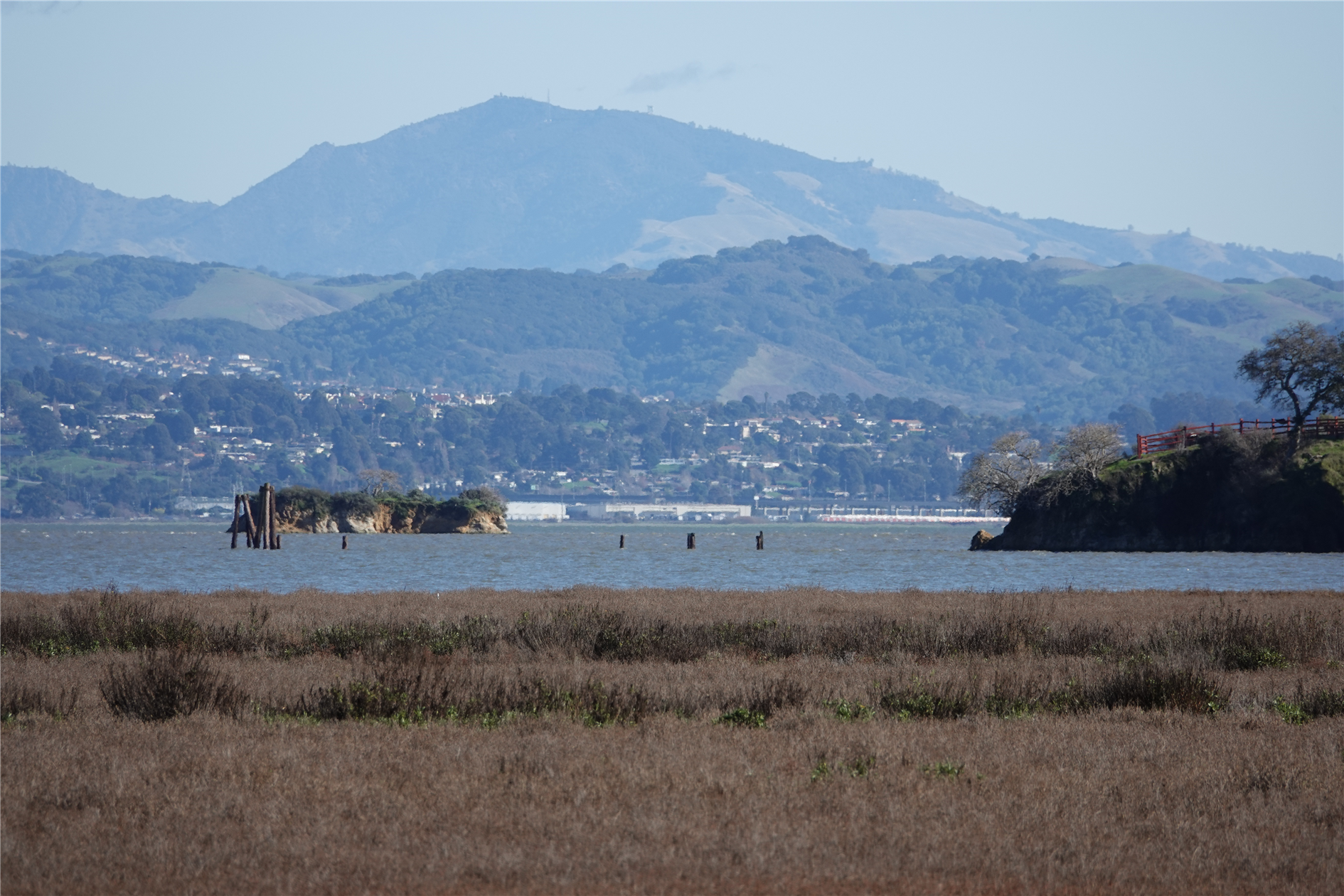
Limantour Spit
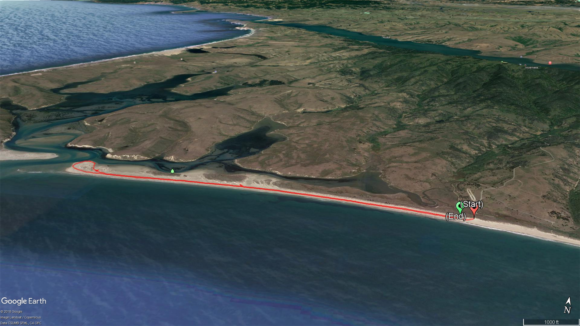
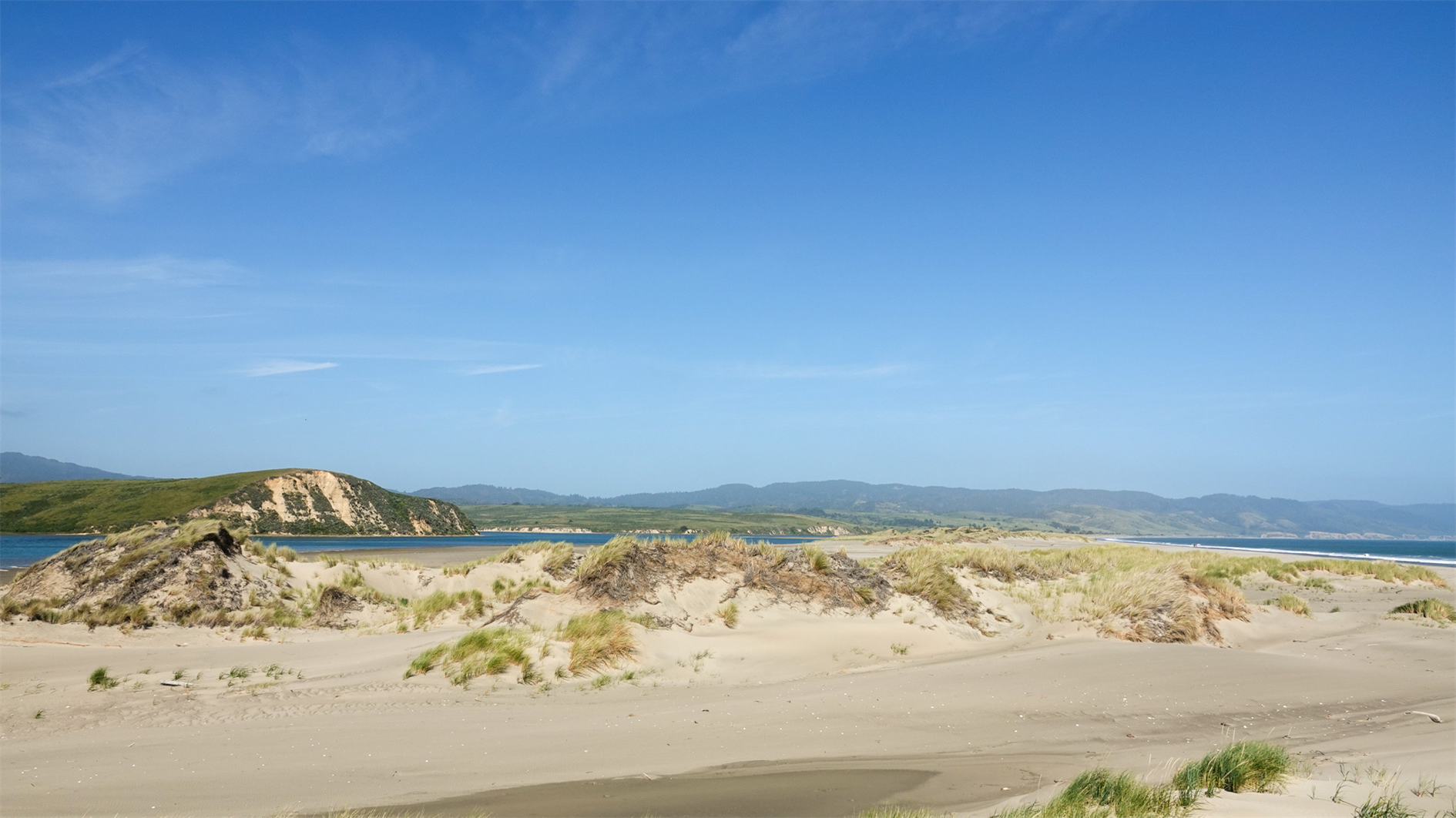
There is a shorter trail through the dunes before you get to the beach which we attempted a couple of years ago. The vegetation is spiky and unforgiving for small people. Better option is to hit the beach, turn right and walk as close to the end as you can. Five mile flat round trip. We saw harbor seals and one very decomposed whale.
Hike starts at: 38.025765, -122.884455. View in Google Earth.
Updated 2024-04-13 21:52:
Another visit, on another beautiful day. Spotted a seal and I think a grey whale.
Related Posts
- Lands End
- Point Reyes - Tomales Point
- Salt Point State Park
- Coastal and Julian loop plus Black Sands Beach
- Average Beach
(Hike Map)
(Published to the Fediverse as: Limantour Spit #hike #limantour #pointreyes #map Five mile beach hike along Limantour Spit in Point Reyes )
San Pedro Valley Park Waterfall Loop


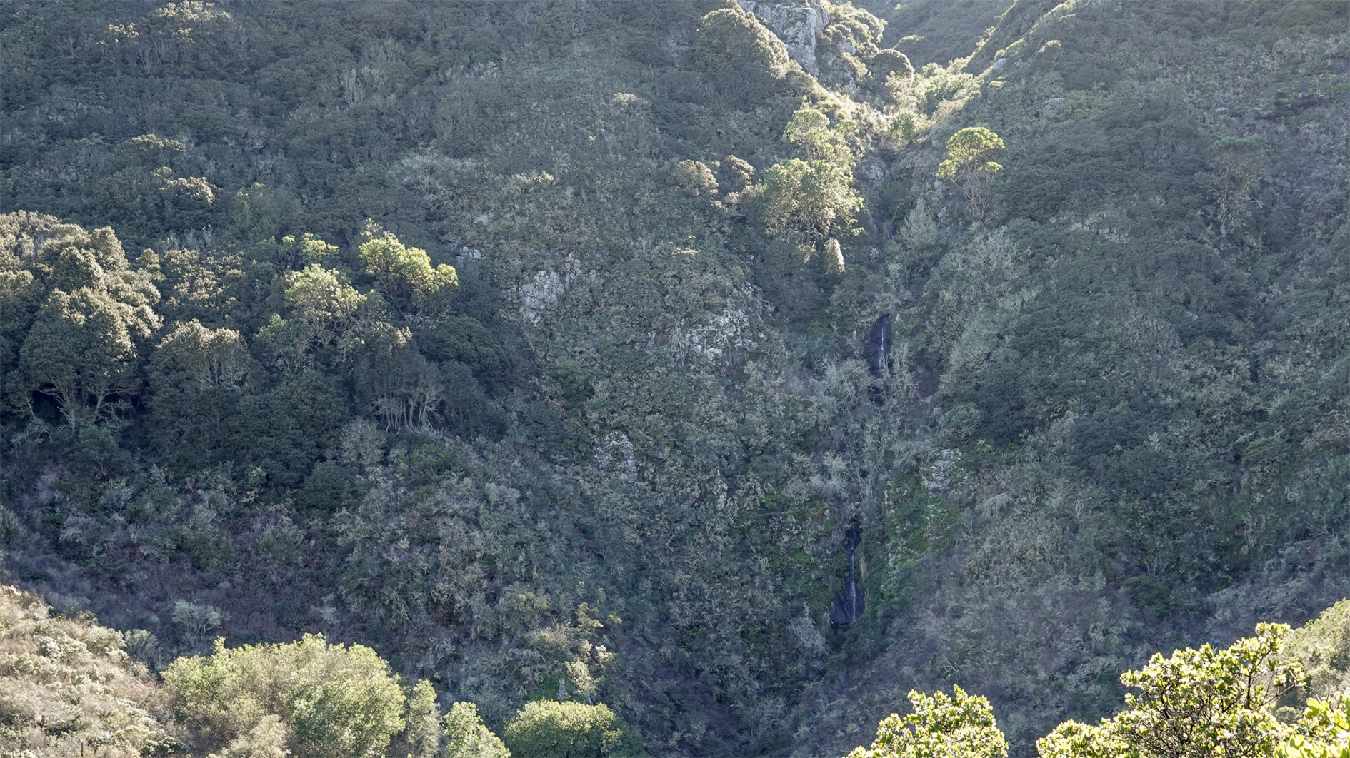
A short but steep 2.2 mile loop in San Pedro Valley Park. From the parking lot go behind the toilet block and turn right to find the start of Montara Mountain Trail. After 1.2 miles winding slowly up you reach the junction with Brooks Creek Trail at a bench with views to the Pacific. Take Brooks Creek Trail down 1 mile to the parking lot, passing another bench with a view of the waterfall on the way down.
Hike starts at: 37.578046, -122.475395. View in Google Earth.
Related Posts
- Hazelnut Trail
- Bull Valley Trail to Port Costa
- Mariposa Loop
- Grabtown Gulch and Borden Hatch Mill in Purisima Creek
- Teague Hill Preserve
(Hike Map)
(Published to the Fediverse as: San Pedro Valley Park Waterfall Loop #hike #sanpedrovalleypark #pacifica #map Montara Mountain Trail to Brooks Creek Trail in San Pedro Valley Park (2.2 miles, waterfall view). )
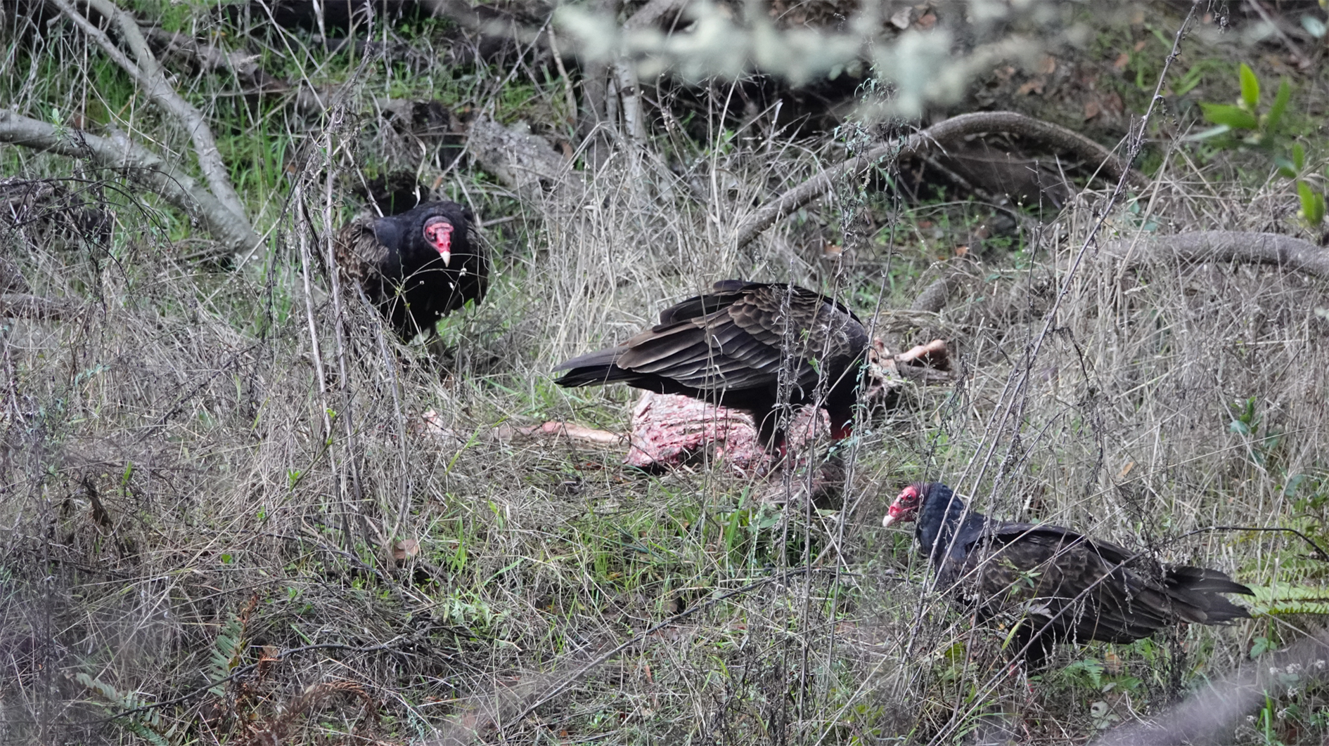
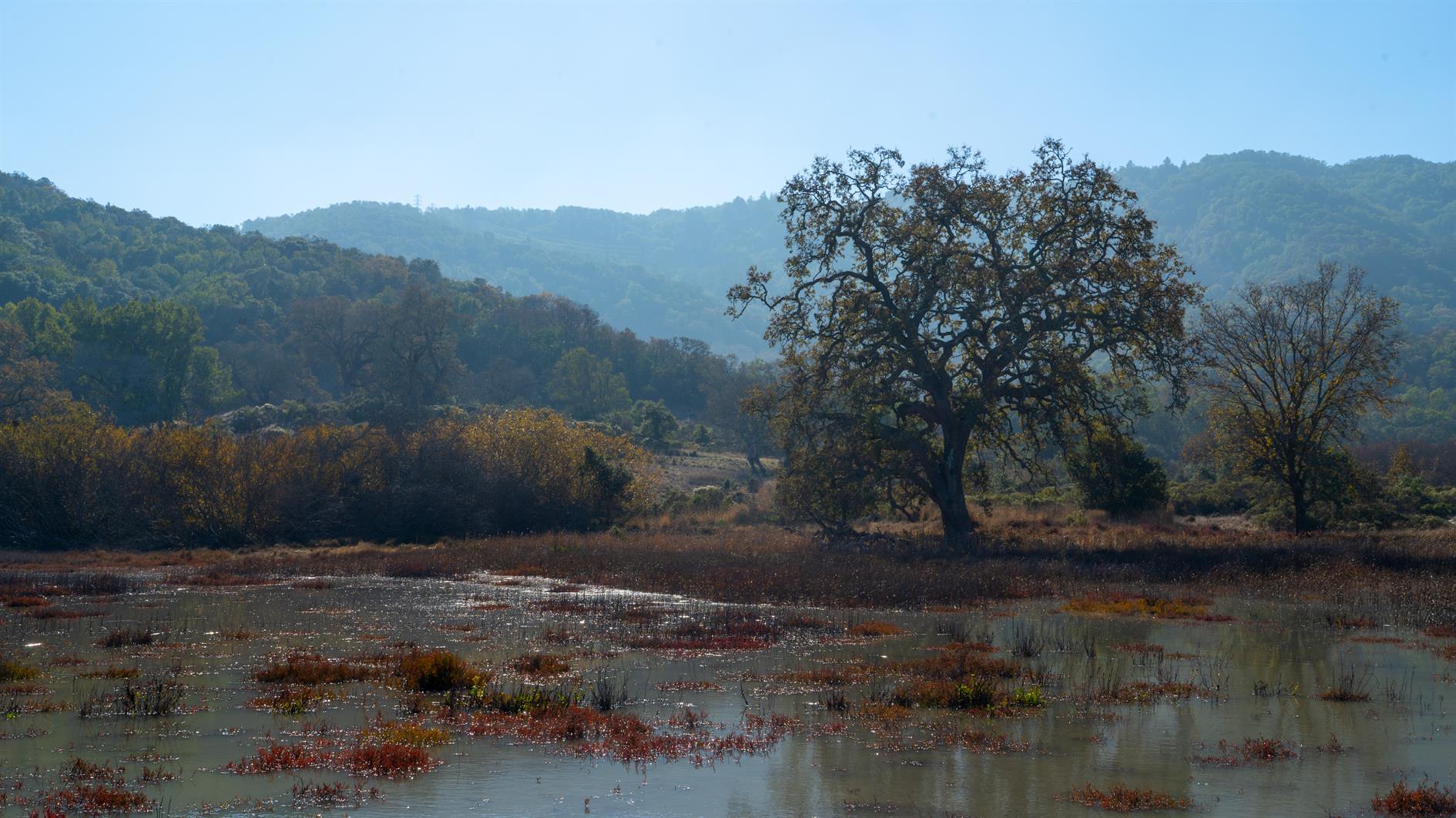
China Camp State Park
New Year's resolution: hike more again.
This is a combined hike of Back Ranch Meadows and Turtleback Point loop at China Camp State Park (around 2.7 miles total). Have never been to China Camp before, it's a beautiful park forty minutes north of San Francisco with plenty of interesting looking trails so will be back again soon.
(Hikes was my first blog, now folded into ITHCWY. Here's an old post about the blog. Since the last update I've ditched My Tracks because it got terrible and switched to Gaia GPS. I also moved from BlogEngine.net to my own custom blogging platform which is mostly better but hasn't worked well for my hike posts. I had to manually upload any KML files and also manually scrape out the coordinates for the start of the hike. Today I've automated this for my post by email system - I just need to attach a KML file to the email and it gets automatically uploaded to the blog and the start point is used to link to Google Maps, geocode the post and include an embedded map. Pretty cool. Hopefully this will inspire me to hike more and post more hikes as well.)
Hike starts at: 38.00733, -122.490322. View in Google Earth.
Updated 2022-11-24 14:14:
Related Posts
- Bay View and Shoreline Trails at China Camp State Park
- About Hikes
- Summit Loop, San Bruno Mountain
- Route map and elevation profile for Hike Posts
- Sawmill Flats
(Hike Map)
(Published to the Fediverse as: China Camp State Park #hike #chinacamp #map Back Ranch Meadows and Turtleback Point loop hikes at China Camp State Park. )