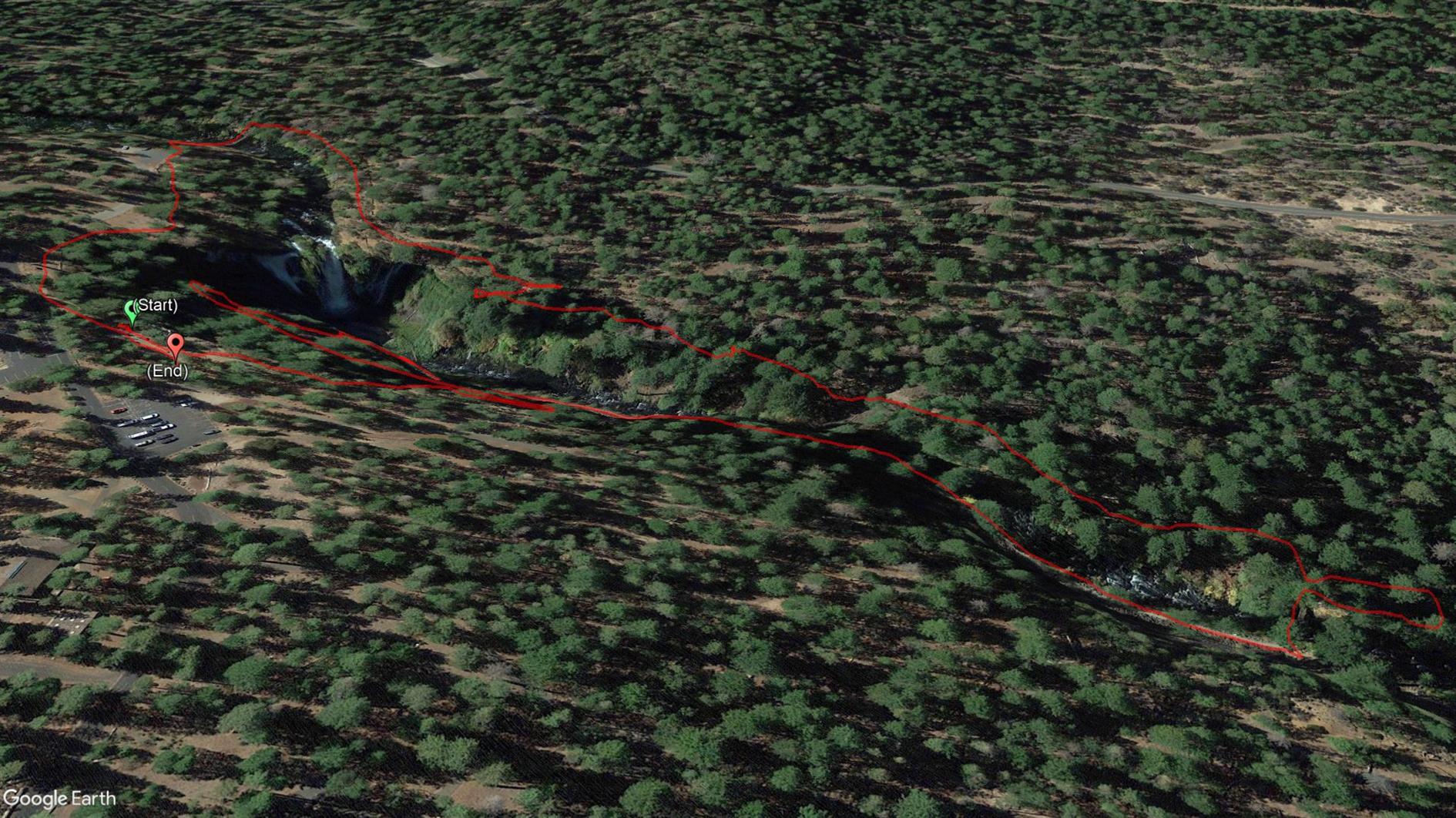
Phantom Falls
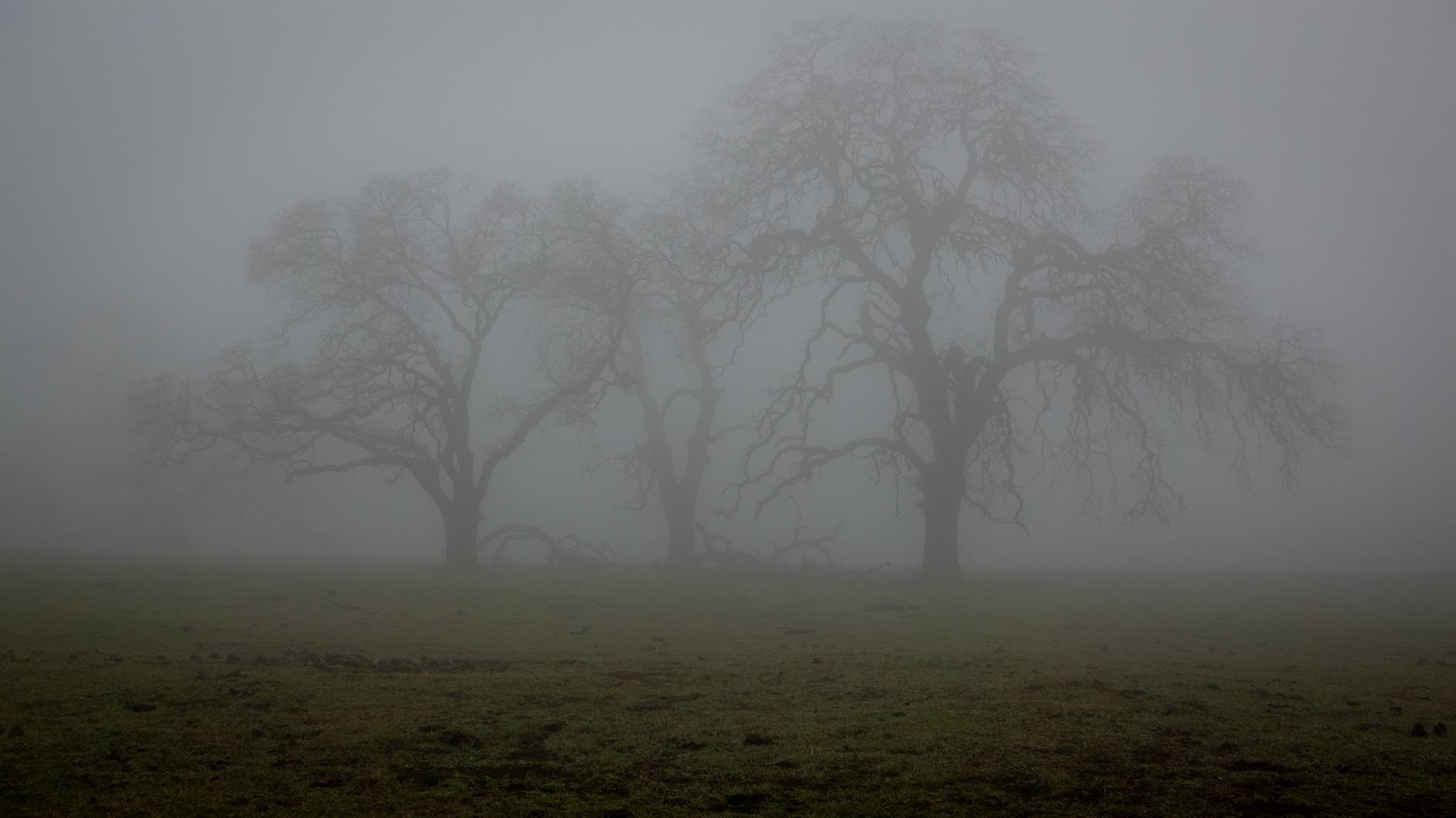
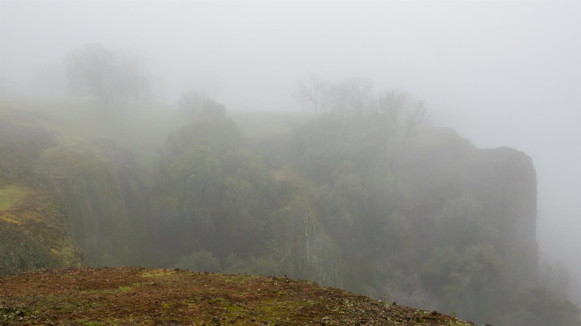
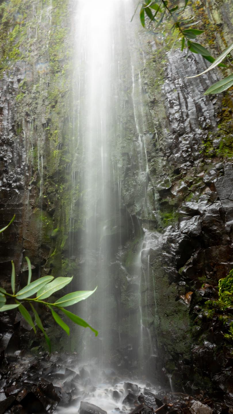
We did this four mile out and back hike during a small gap between record breaking winter storms. There was snow, fog, mud, many ordinary cows and one very furious one. The first waterfall, Ravine Falls, was very pretty and the eponymous Phantom Falls lived up to its name. Will try again sometime. This is close to Oroville, California in the North Table Mountain Ecological Reserve.
Hike starts at: 39.595612, -121.541953. View in Google Earth.
Related Posts
- McCloud River Trail (Three Waterfalls)
- Adobe Creek
- San Pedro Valley Park Waterfall Loop
- Lake Merritt
- McArthur-Burney Falls
(Hike Map)
(Published to the Fediverse as: Phantom Falls #hike #waterfall #map Four mile out and back hike to Ravine Falls and Phantom Falls in the North Table Mountain Ecological Reserve near Oroville, California. )
McArthur-Burney Falls
Short hike taking in the spectacular McArthur-Burney Falls.
Hike starts at: 41.01255, -121.650831. View in Google Earth.
Related Posts
- McCloud River Trail (Three Waterfalls)
- San Pedro Valley Park Waterfall Loop
- Coronavirus Hikes: July 2020
- Richards Fire Road
- Devil's Slide Trail
(Hike Map)
(Published to the Fediverse as: McArthur-Burney Falls #hike #waterfall #map A short walk to take in McArthur-Burney Falls near Burney, California. )
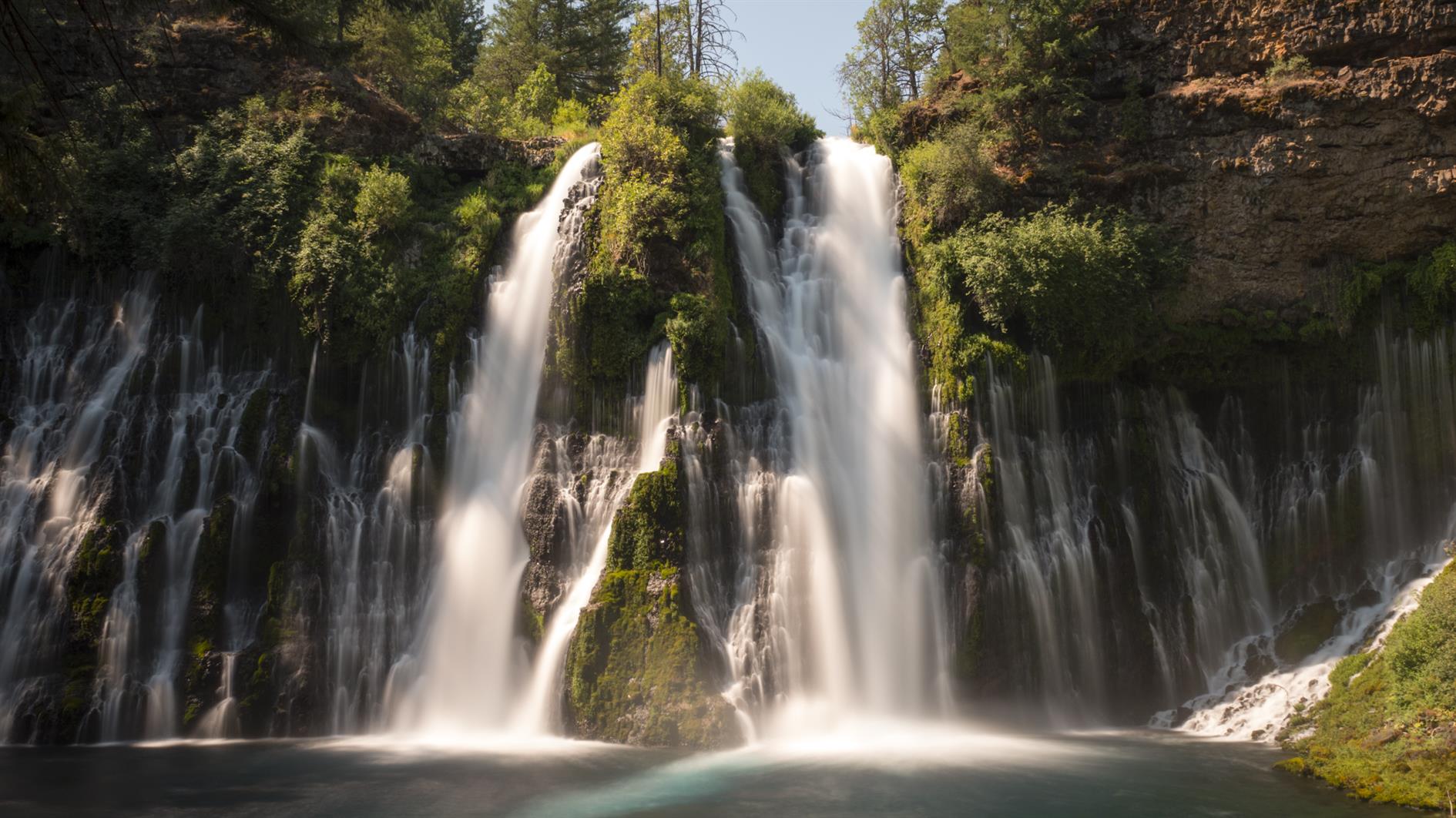
McCloud River Trail (Three Waterfalls)
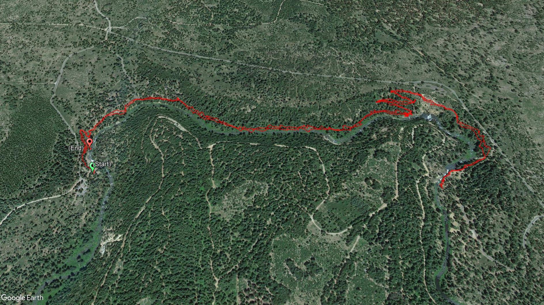
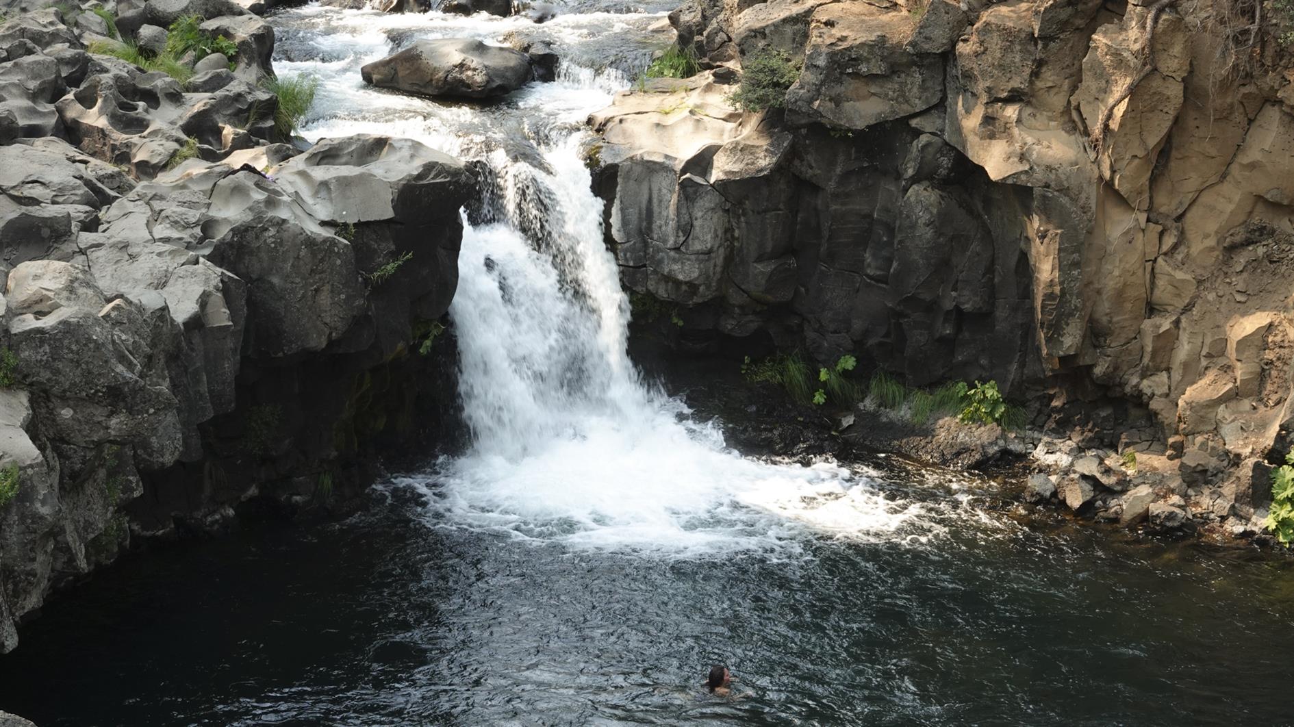
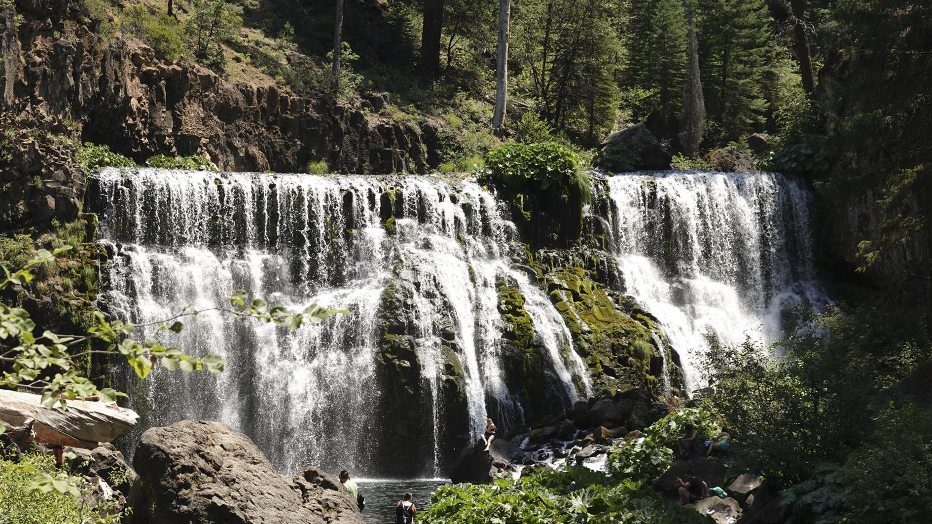
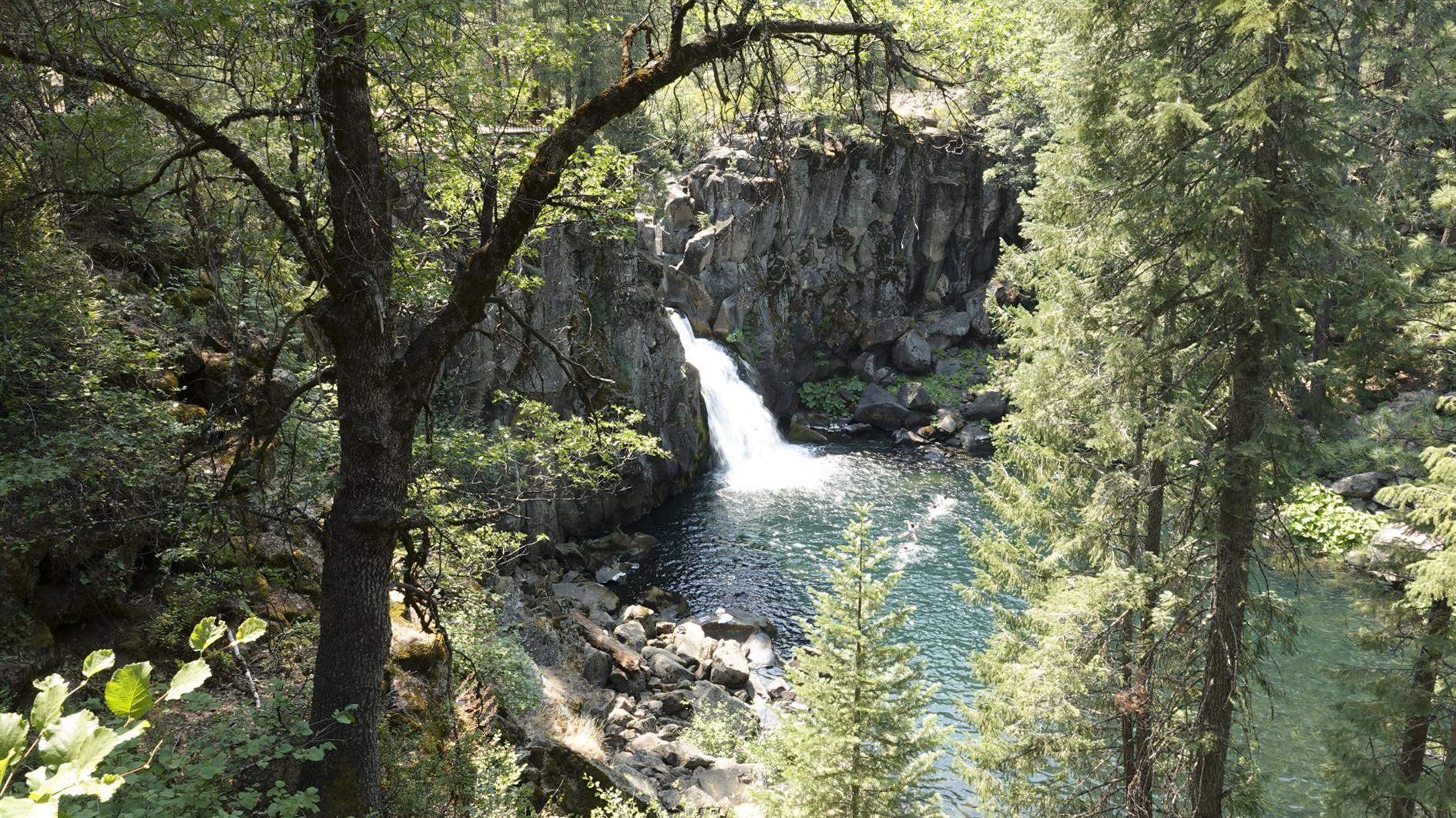
A four mile out and back hike taking in three waterfalls along the McCloud River near Mt Shasta.
Hike starts at: 41.240749, -122.024747. View in Google Earth.
Updated 2021-07-22 12:45:
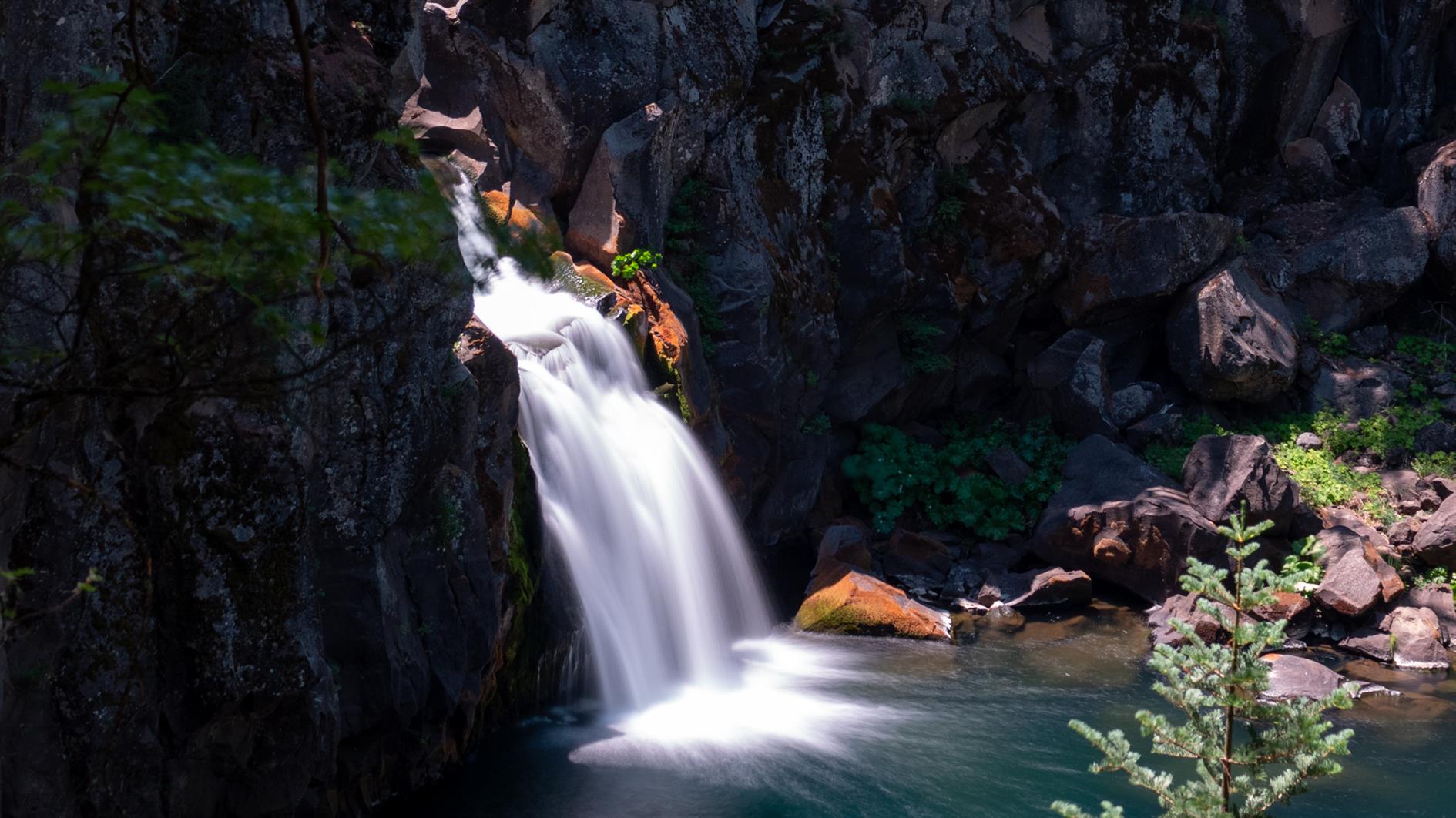
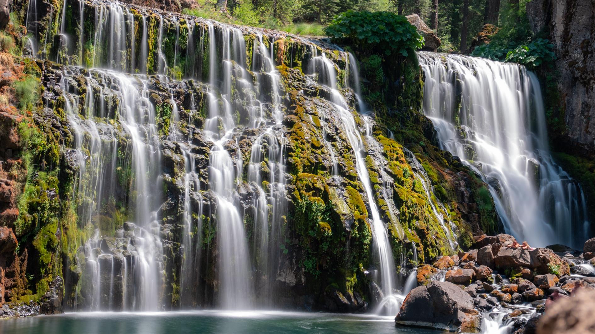
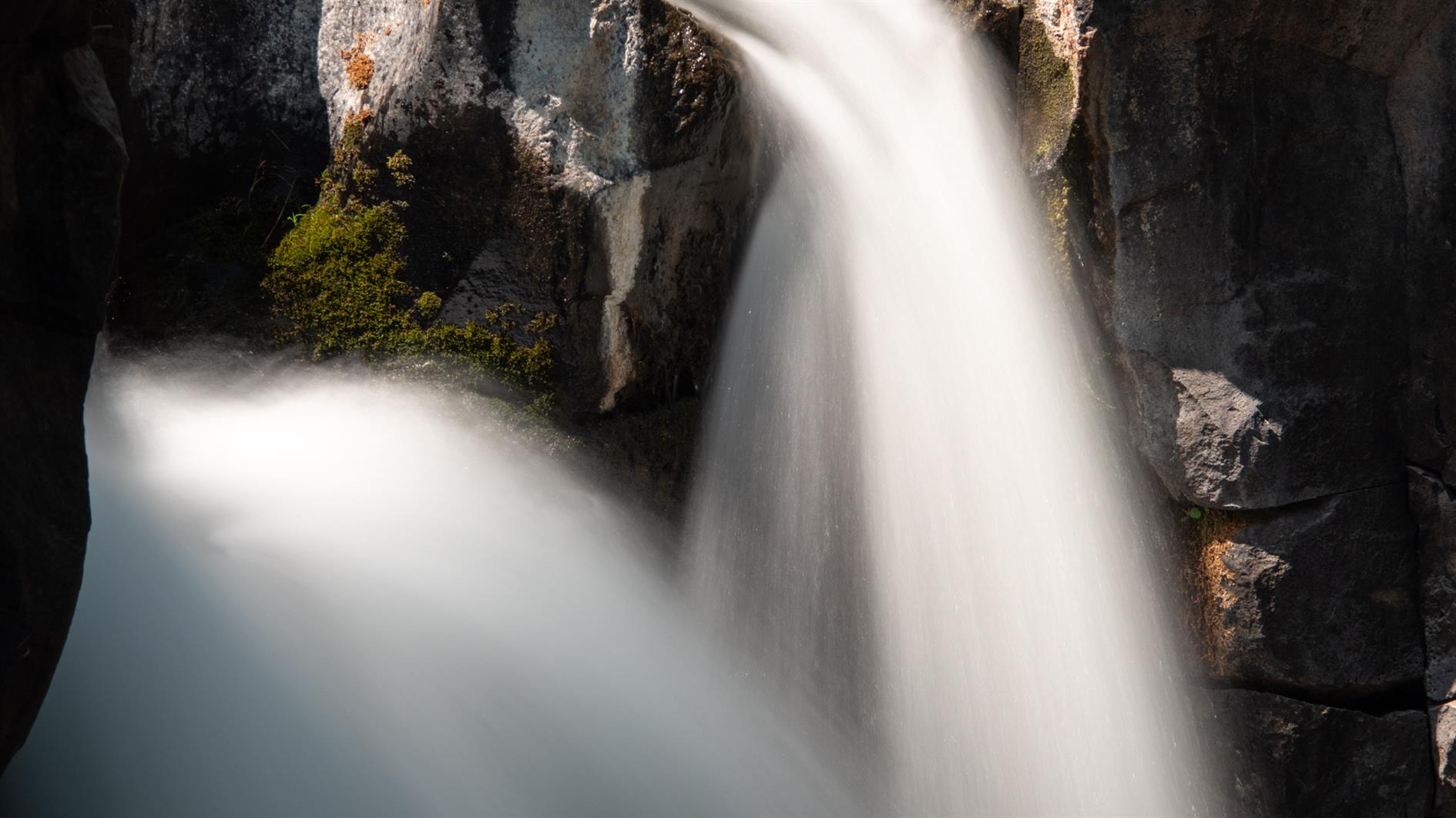
Did the same hike again this year - it's worth repeating. Here are some long exposure shots of the three waterfalls.
Related Posts
(Hike Map)
(Published to the Fediverse as: McCloud River Trail (Three Waterfalls) #hike #map #waterfall #shasta 4 mile out and back hike taking in three waterfalls on the McCloud River Trail near Mount Shasta in California. )