McArthur-Burney Falls
By Robert Ellison.
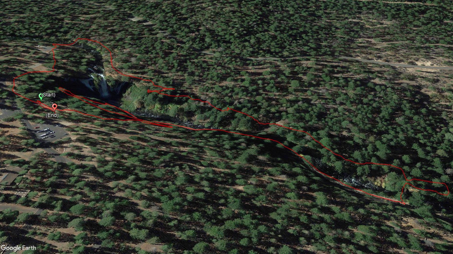
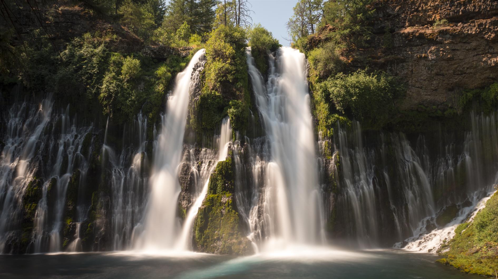
Short hike taking in the spectacular McArthur-Burney Falls.
Hike starts at: 41.01255, -121.650831. View in Google Earth.
Short hike taking in the spectacular McArthur-Burney Falls.
Hike starts at: 41.01255, -121.650831. View in Google Earth.
Add Comment
All comments are moderated. Your email address is used to display a Gravatar and optionally for notification of new comments and to sign up for the newsletter.