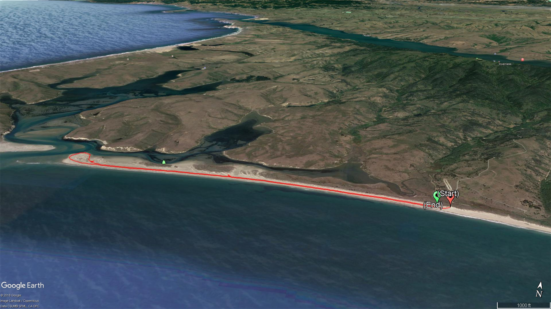
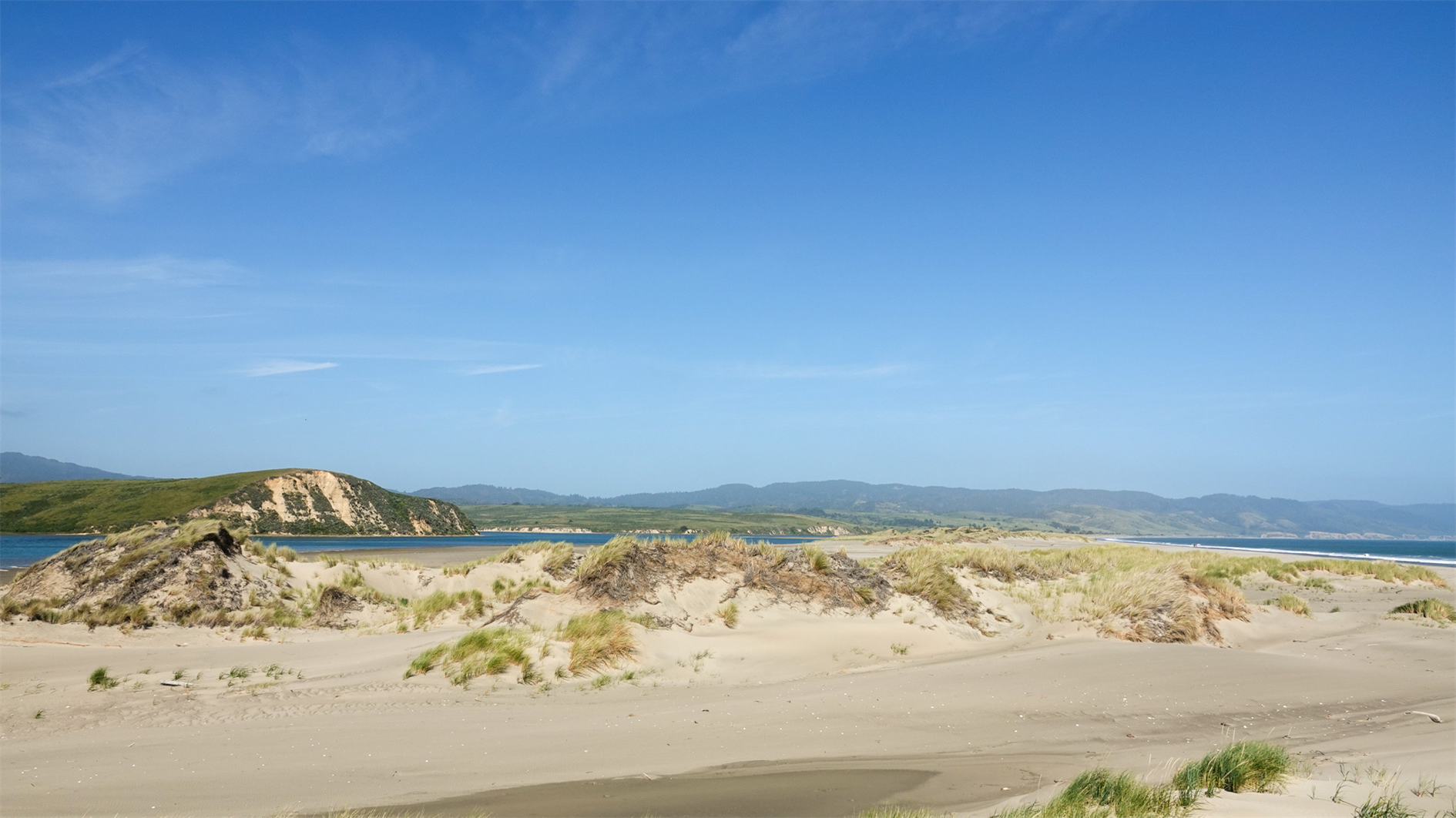
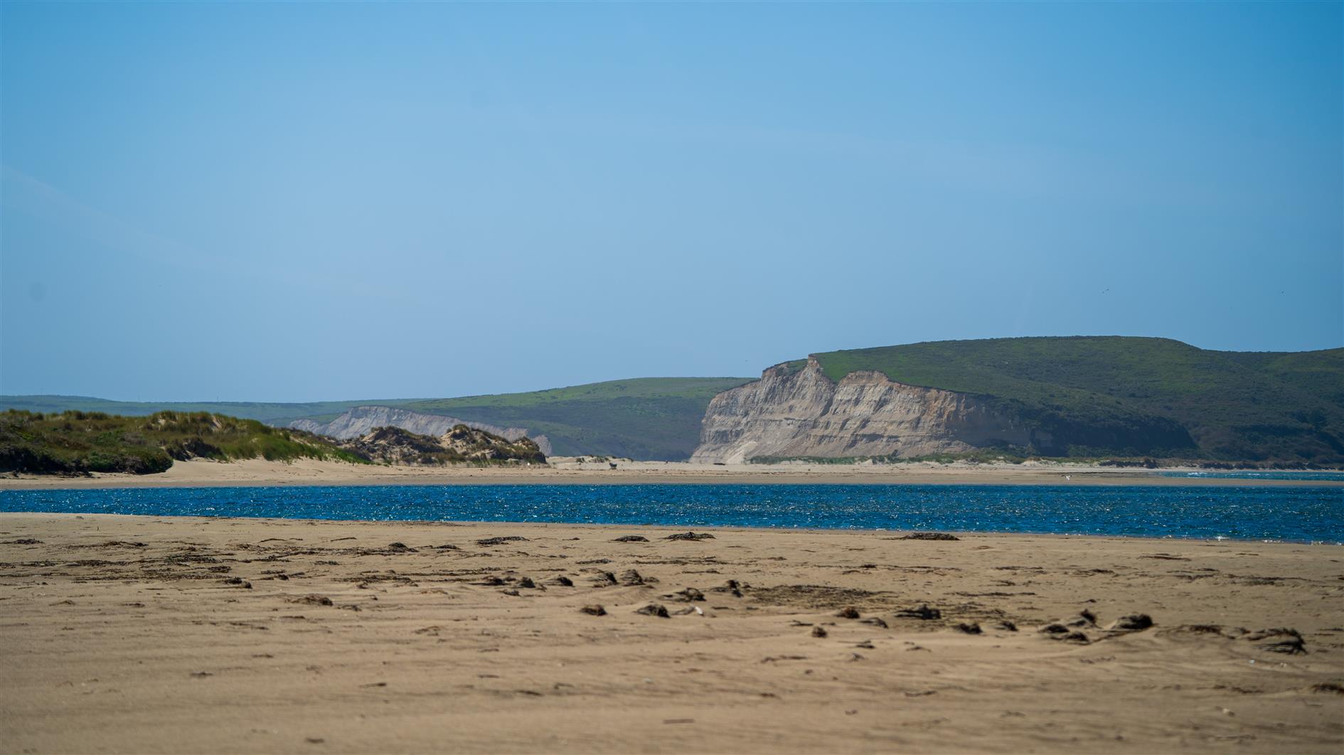
There is a shorter trail through the dunes before you get to the beach which we attempted a couple of years ago. The vegetation is spiky and unforgiving for small people. Better option is to hit the beach, turn right and walk as close to the end as you can. Five mile flat round trip. We saw harbor seals and one very decomposed whale.
By Robert Ellison. Updated on Monday, September 29, 2025.
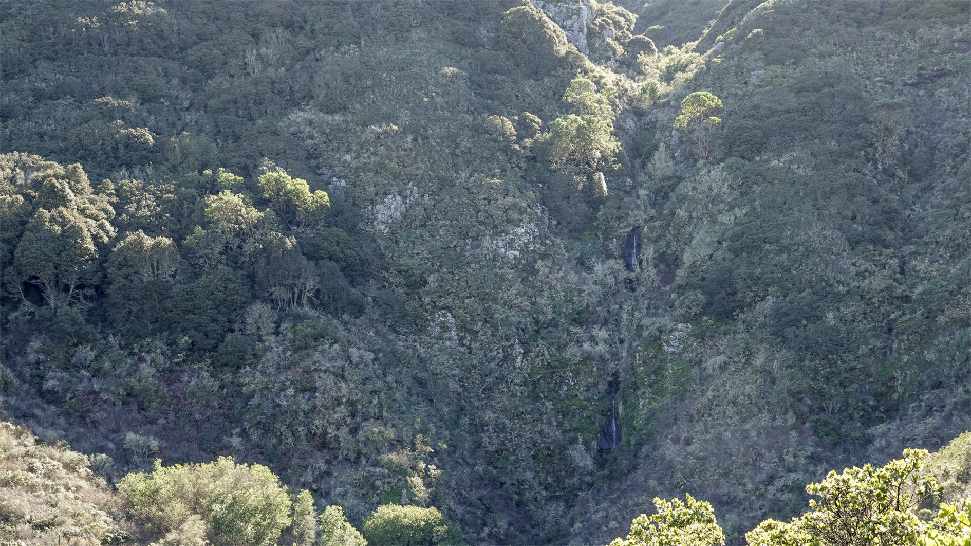
A short but steep 2.2 mile loop in San Pedro Valley Park. From the parking lot go behind the toilet block and turn right to find the start of Montara Mountain Trail. After 1.2 miles winding slowly up you reach the junction with Brooks Creek Trail at a bench with views to the Pacific. Take Brooks Creek Trail down 1 mile to the parking lot, passing another bench with a view of the waterfall on the way down.
(Published to the Fediverse as:
San Pedro Valley Park Waterfall Loop #hike#sanpedrovalleypark#pacifica#map Montara Mountain Trail to Brooks Creek Trail in San Pedro Valley Park (2.2 miles, waterfall view).)
By Robert Ellison. Updated on Thursday, November 24, 2022.
New Year's resolution: hike more again.
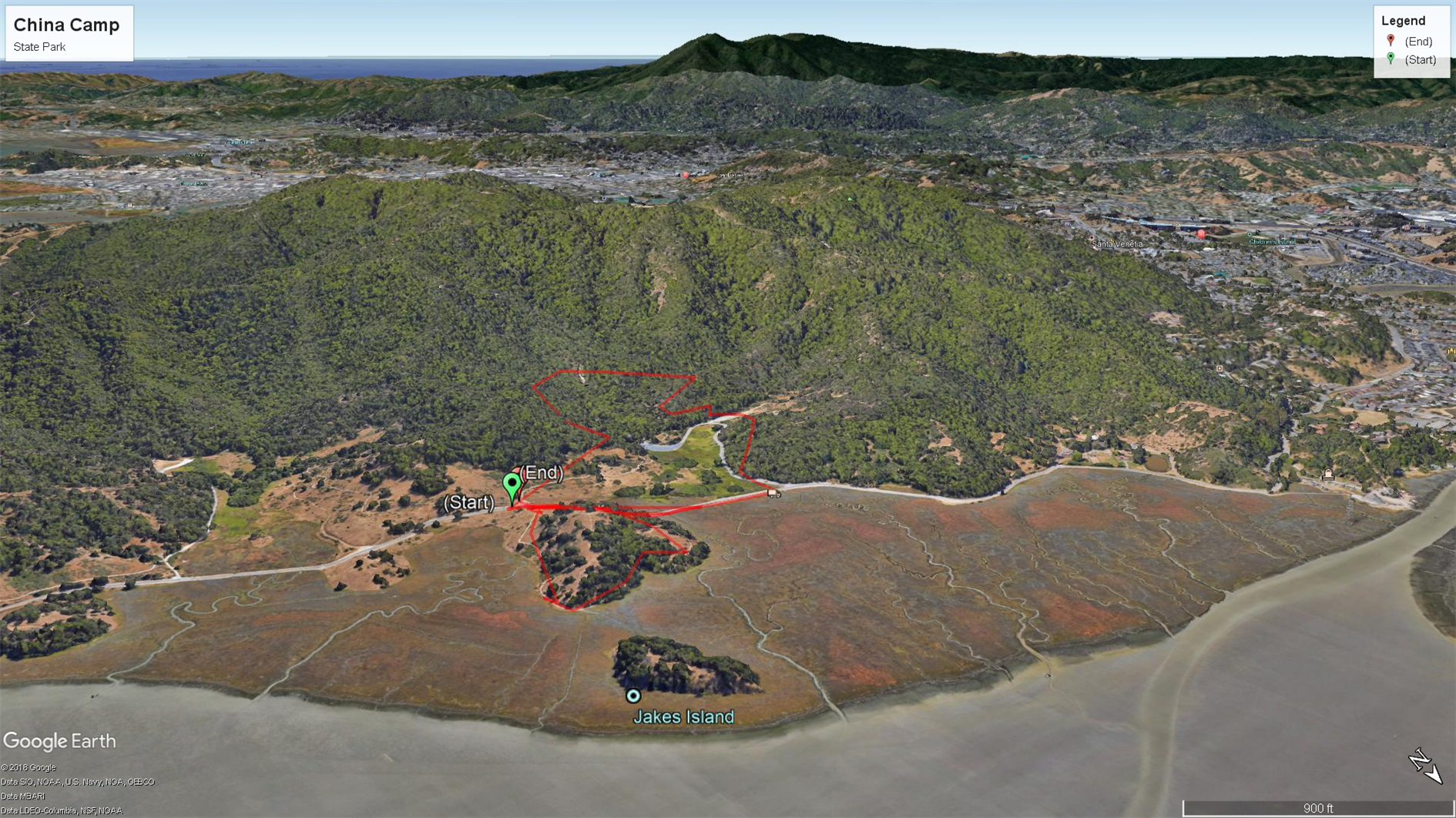
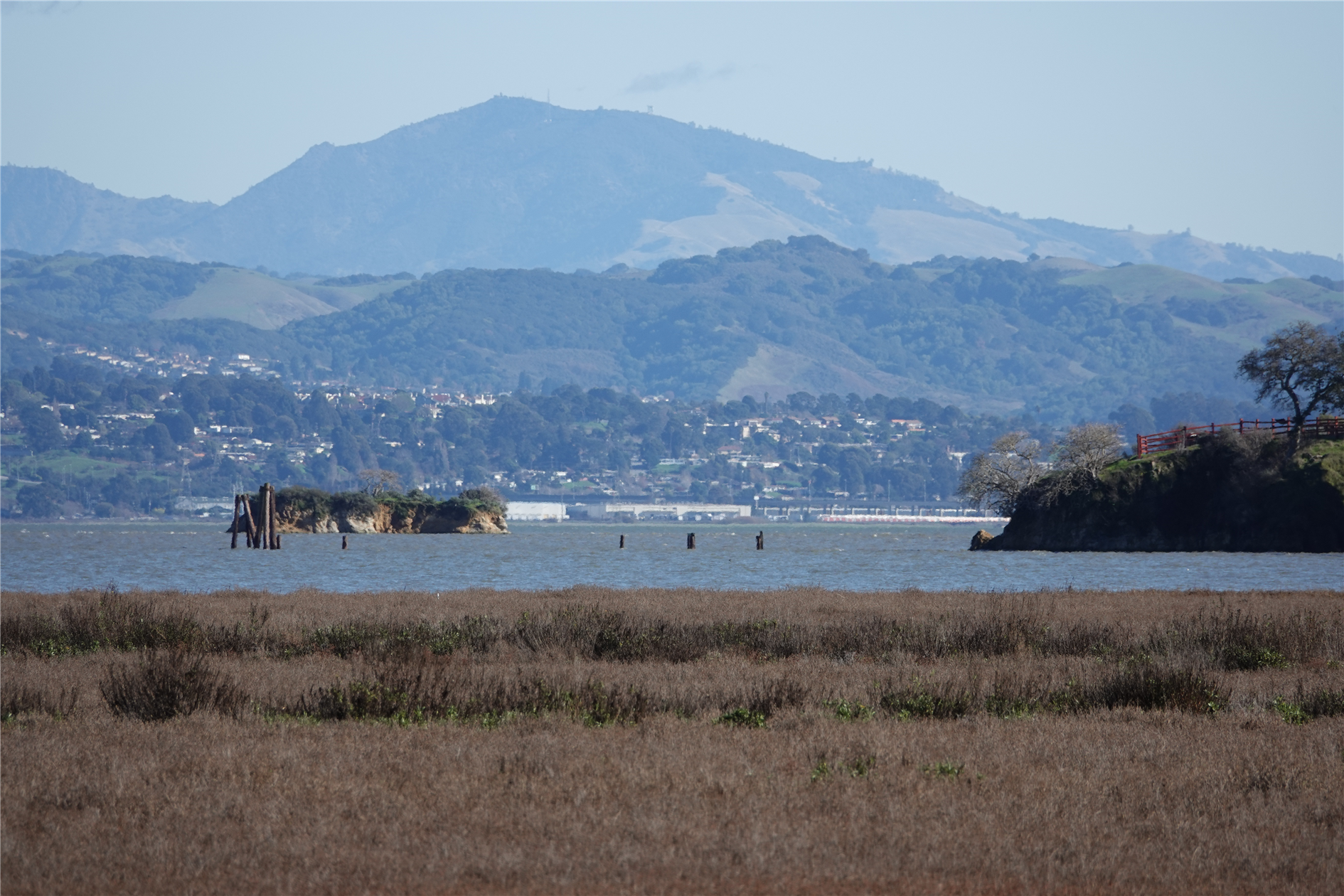
This is a combined hike of Back Ranch Meadows and Turtleback Point loop at China Camp State Park (around 2.7 miles total). Have never been to China Camp before, it's a beautiful park forty minutes north of San Francisco with plenty of interesting looking trails so will be back again soon.
(Hikes was my first blog, now folded into ITHCWY. Here's an old post about the blog. Since the last update I've ditched My Tracks because it got terrible and switched to Gaia GPS. I also moved from BlogEngine.net to my own custom blogging platform which is mostly better but hasn't worked well for my hike posts. I had to manually upload any KML files and also manually scrape out the coordinates for the start of the hike. Today I've automated this for my post by email system - I just need to attach a KML file to the email and it gets automatically uploaded to the blog and the start point is used to link to Google Maps, geocode the post and include an embedded map. Pretty cool. Hopefully this will inspire me to hike more and post more hikes as well.)
(Published to the Fediverse as:
China Camp State Park #hike#chinacamp#map Back Ranch Meadows and Turtleback Point loop hikes at China Camp State Park.)
By Robert Ellison. Updated on Saturday, October 4, 2025.
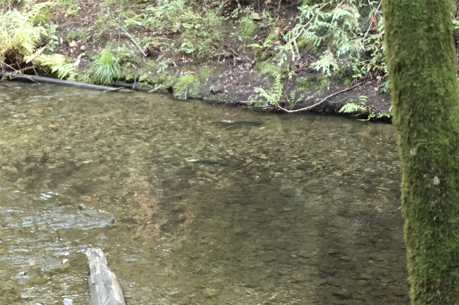
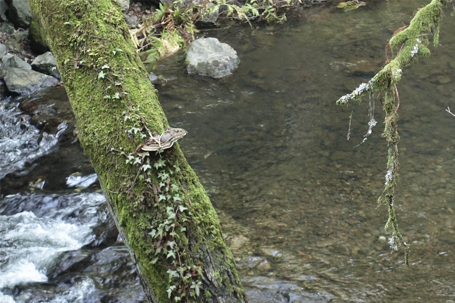
A five mile guided hike from Samuel P. Taylor State Park to the Leo T Cronin Fish Viewing Area along Lagunitas Creek and back again to spot spawning Coho Salmon. The hike was a program offered by Turtle Island and the specific route will vary based on where the salmon are currently active. Having done this once I think I could spot them again without assistance but it's well worth donating to get the full naturalist led experience.
(Published to the Fediverse as:
Coho Salmon in Lagunitas Creek #hike#lagunitascreek Finding spawning Coho Salmon in Lagunitas Creek with Turtle Island naturalists, a hike from Samuel P. Taylor State Park to the Leo T Cronin fish viewing area.)
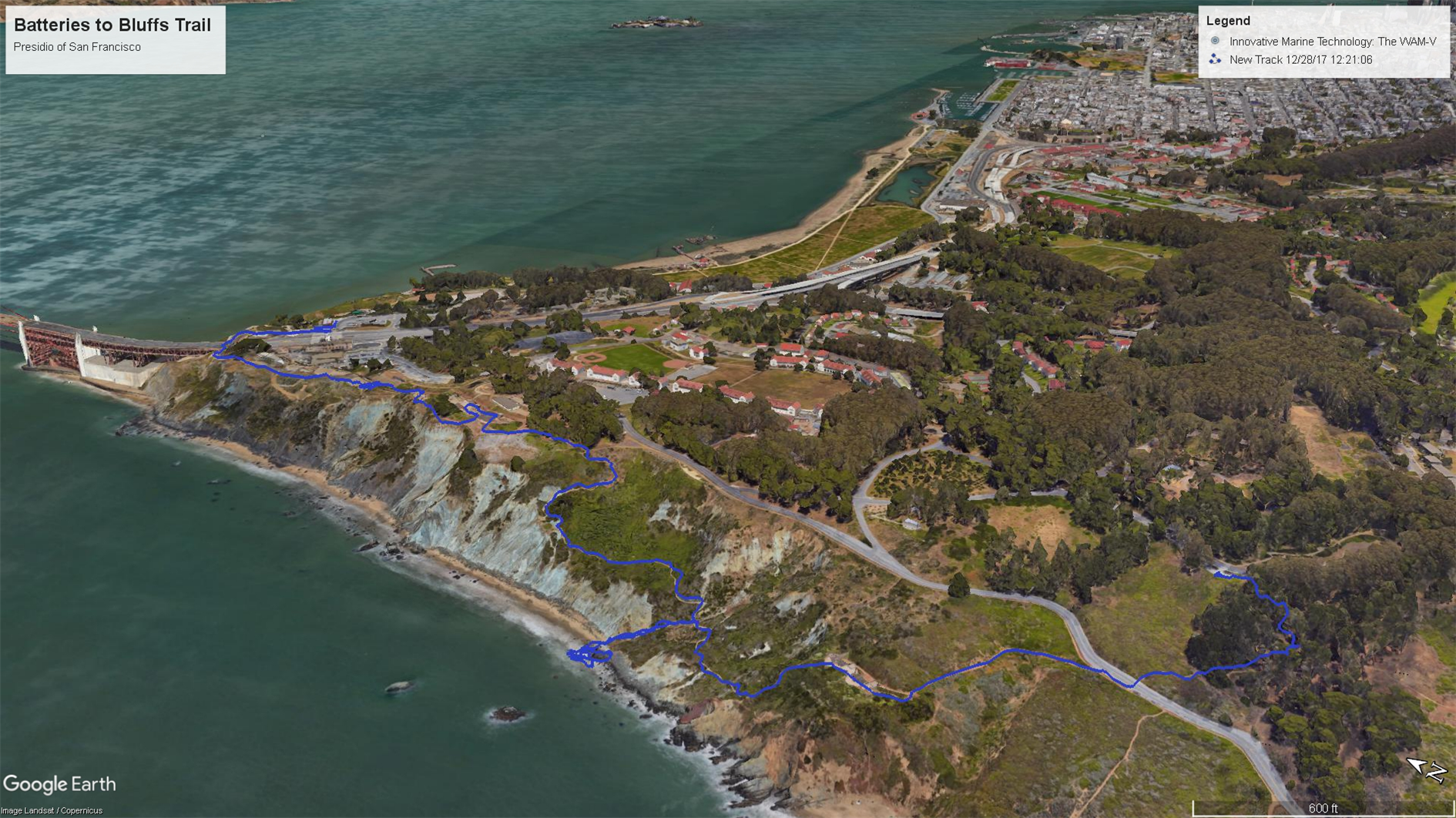
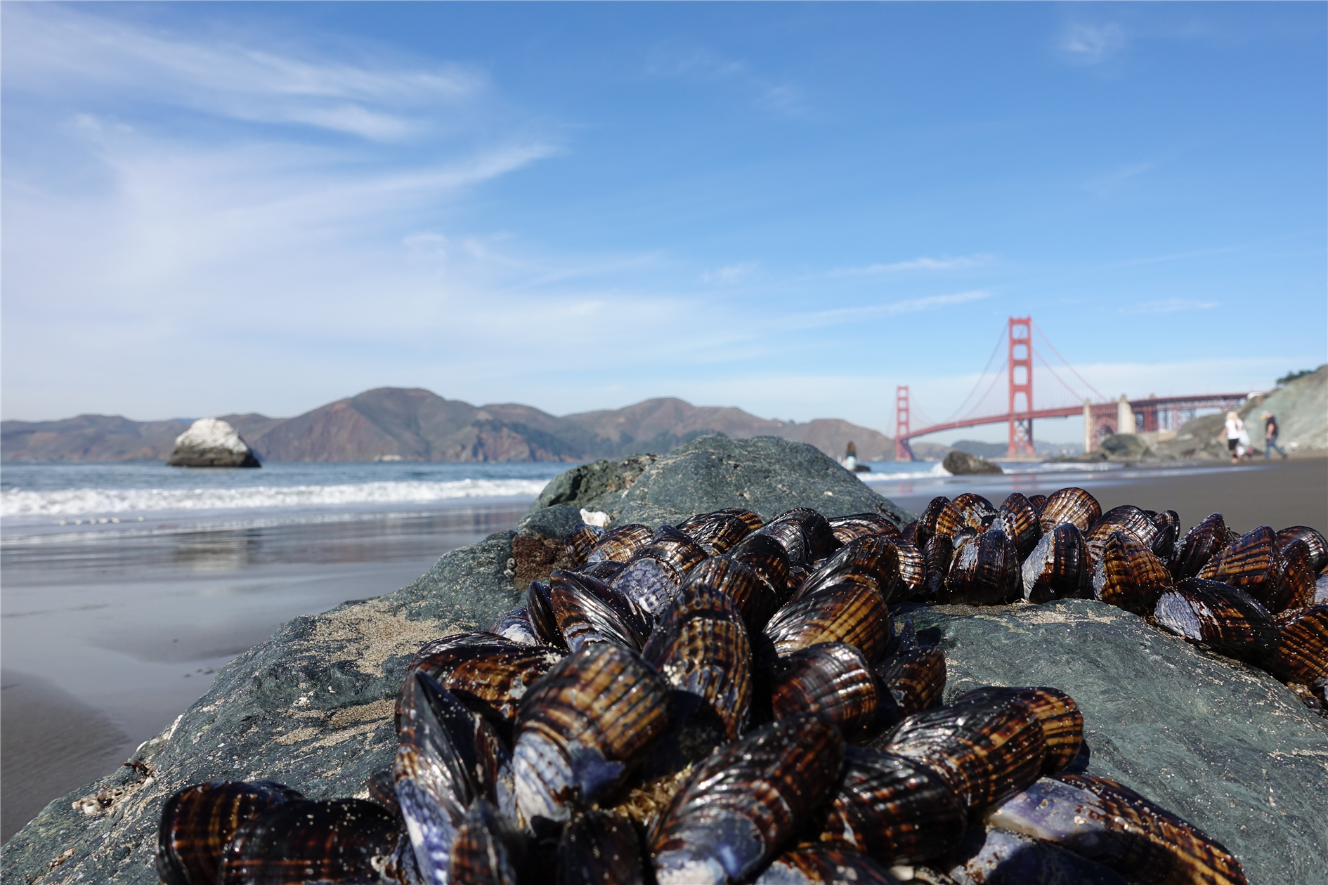
(Published to the Fediverse as:
Batteries to Bluffs #hike#presidio#ggb Hike from Immigrant Point to the Golden Gate Bridge via the Batteries to Bluffs trail and Marshall Beach in The Presidio of San Francisco)
By Robert Ellison. Updated on Monday, September 29, 2025.
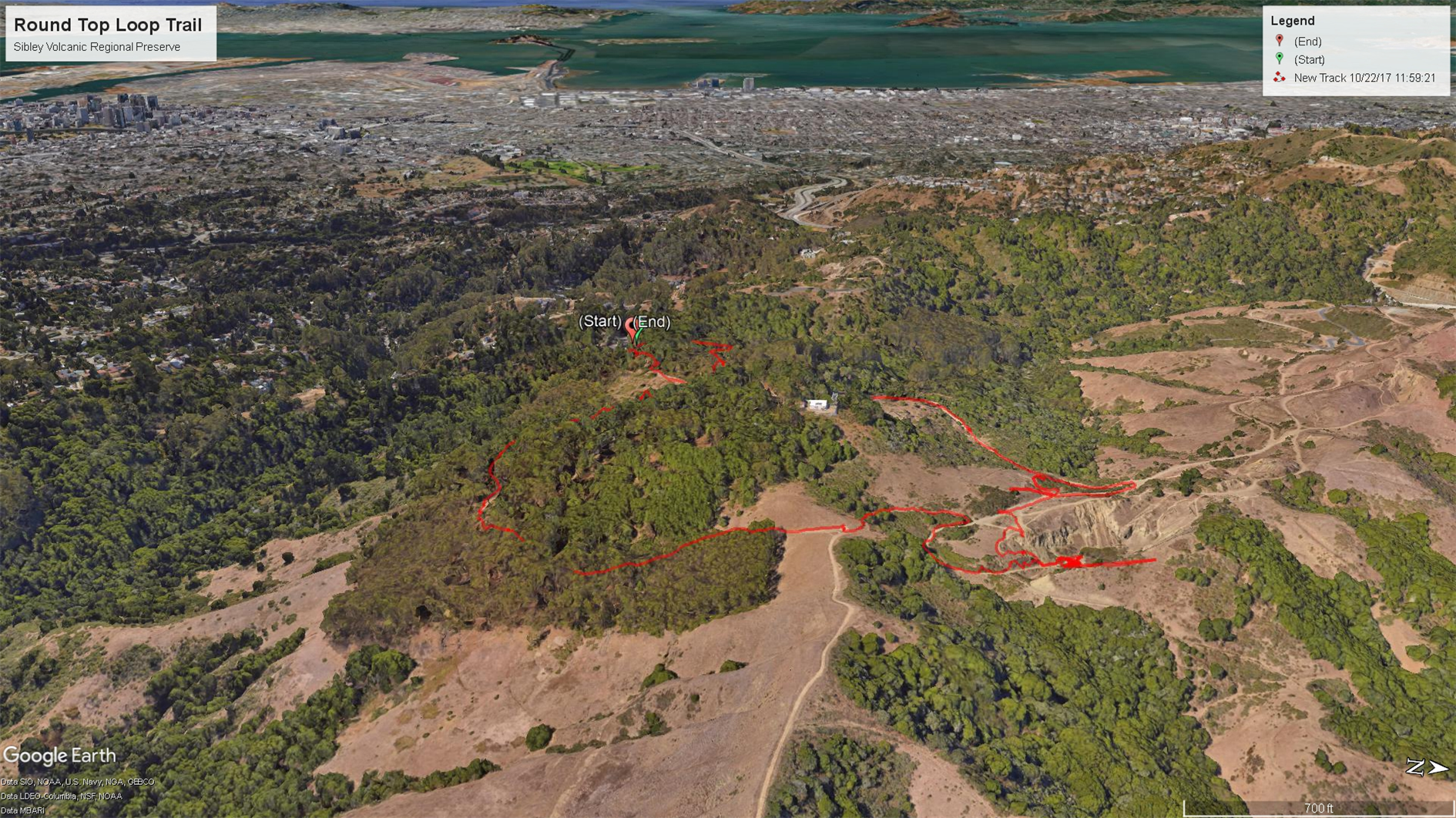
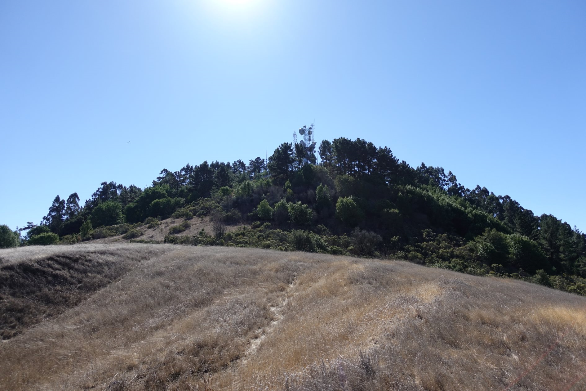
Round Top is a remnant of a 10 million year old volcano, tipped over by tectonic activity. It's pretty high at 1,763 feet. Unfortunately the peak is privately owned so you can't go right to the top but there is a 2.5 mile loop around the peak. You get views out to Mount Tam, Mount Diablo and even the Sierras and an occasional glimpse of the bay. The drive up is also spectacular.
(Published to the Fediverse as:
Round Top loop at Sibley Volcanic Regional Preserve #hike#sibley#roundtop#map#volcano#snake Hike around Round Top Loop (a 10 million year old volcano) at Sibley Volcanic Regional Preserve with views out to Mount Tam, Mount Diablo and even the Sierras)
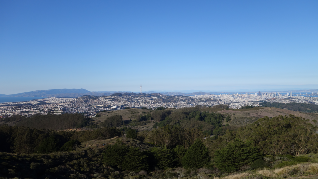
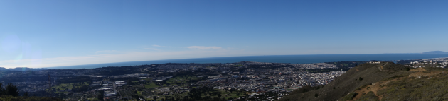
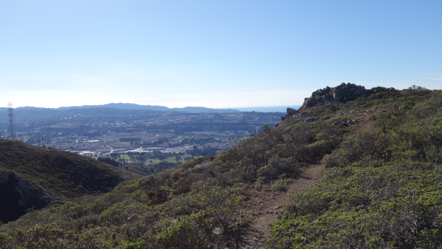
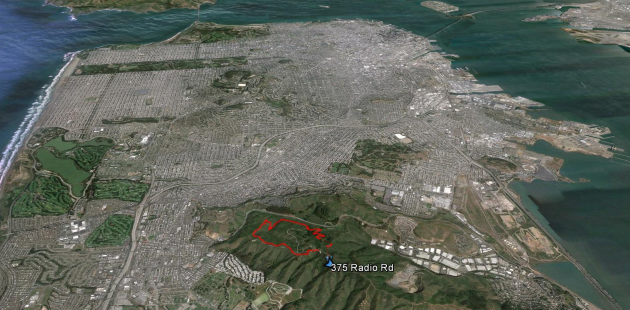
San Bruno Mountain State Park has outstanding views of San Francisco, the Pacific out to the Farallon Islands and much of the bay. We did the three mile summit loop (the wrong way round, San Bruno pros do it counter-clockwise).
By Robert Ellison. Updated on Monday, September 29, 2025.
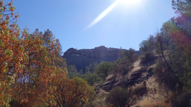
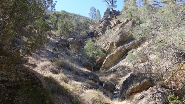
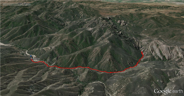
Pinnacles is the newest National Park which features various hikes to Talus Caves (formed by rockfalls into a valley) which are fun to scramble through as long as you don't think about the formation process while you do it.
By Robert Ellison. Updated on Monday, September 29, 2025.
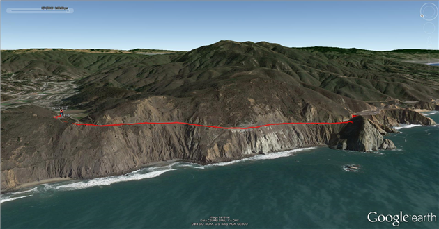
Devil's Slide Trail used to be one of the most scenic stretches of Highway 1. It was hard to enjoy though while you were trying not to crash and die. Now it's a leisurely stroll with magnificent views and well worth a visit.
(Published to the Fediverse as:
Devil's Slide Trail #hike#devilsslide Hike on Devil's Slide Trail, it used to be one of the most scenic stretches of Highway 1.)
(Published to the Fediverse as:
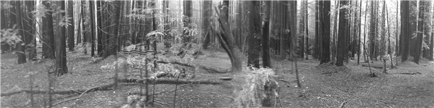
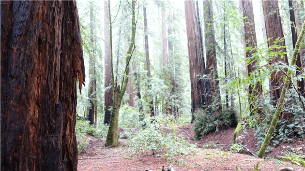
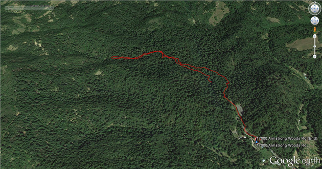
Armstrong Redwoods #hike#armstrong#redwoods Hike through coastal redwoods at the Armstrong Redwoods State Natural Reserve.)