Fort Funston
By Robert Ellison. Updated on
Fort Funston was part of San Francisco's WWII era coastal defenses and is now a dog friendly part of the Golden Gate National Recreation Area.
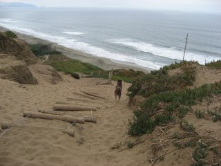
Rudy pegs it down Sand Ladder Trail - the easiest way down to the beach but no so much fun on the way back up.
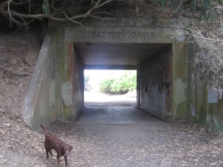
Battery Davis.
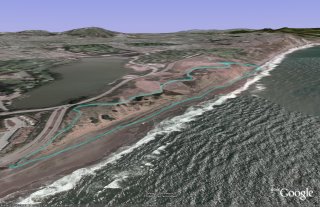
(2.62 miles, total elevation gain 417 feet, 1 hour 25 minutes (average 1.84 mph), view in Google Earth)
Hike starts at: 37.714383, -122.502167.
Add Comment
All comments are moderated. Your email address is used to display a Gravatar and optionally for notification of new comments and to sign up for the newsletter.