Twin Peaks

Not much of a hike, but Twin Peaks is about as high as you can get in San Francisco and offers wonderful views on a clear day or night. Park here and then escape the throngs by walking up one or both of the peaks.

We often take guests from out of town up Twin Peaks. The occasion today was a first visit for a new native San Franciscan – Katherine Harper Ellison – seven days old on her first trip up to the top of Noe Peak.

A Red-tailed Hawk hunting over Twin Peaks.
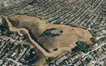
(.49 miles, total elevation gain 201 feet, 25 minutes, average 1.17 mph, view in Google Earth.)
Hike starts at: 37.754849, -122.446607.
Related Posts
(Hike Map)
(Published to the Fediverse as: Twin Peaks #hike #twinpeaks #sanfrancisco Short hike up Twin Peaks in San Francisco, California. )
Fort Funston in the rain
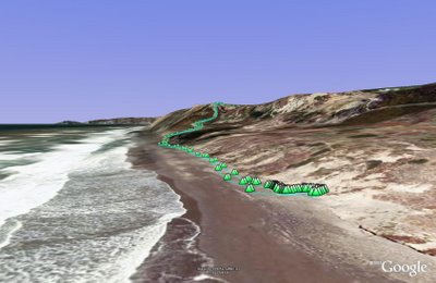
(view in Google Earth).
This is the short version of our Fort Funston walk (the long version is here). Depending on the tide and the height of the sand it's sometimes not easy to get past a couple of sewage outlet pipes. Today's walk was wet with a high tide so we turned left at the bottom of the sand ladder and just walked along the beach and back. The longer version is to turn right and complete a three mile loop.
Hike starts at: 37.714211, -122.502257383333.
Related Posts
(Hike Map)
(Published to the Fediverse as: Fort Funston in the rain #hike #ggnra #fortfunston #sanfrancisco Shorter hike at Fort Funston (GGNRA) in San Francisco, California. )
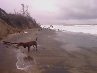
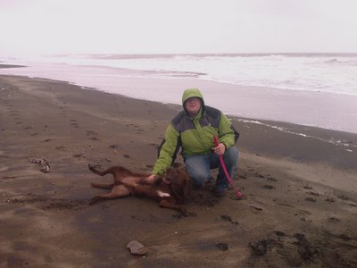
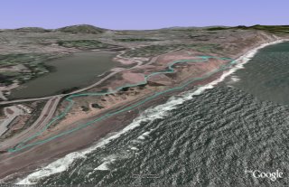
Fort Funston
Fort Funston was part of San Francisco's WWII era coastal defenses and is now a dog friendly part of the Golden Gate National Recreation Area.
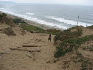
Rudy pegs it down Sand Ladder Trail - the easiest way down to the beach but no so much fun on the way back up.
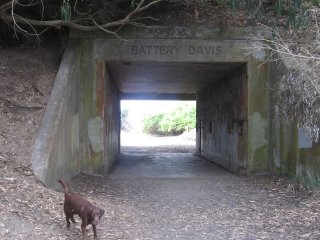
Battery Davis.
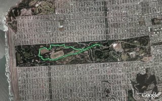
(2.62 miles, total elevation gain 417 feet, 1 hour 25 minutes (average 1.84 mph), view in Google Earth)
Hike starts at: 37.714383, -122.502167.
Related Posts
- Fort Funston in the rain
- Sand Ladder at Fort Funston
- Crissy Field
- Lands End
- Golden Gate Park - Stow Lake, Strawberry Hill and Museum Concourse
(Hike Map)
(Published to the Fediverse as: Fort Funston #hike #fortfunston #sanfrancisco #ggnra Great Fort Funston loop hike, just under three miles in the Golden Gate National Recreation Area (San Francisco, California). )
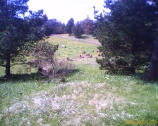
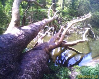
Golden Gate Park
A quick walk around the Golden Gate park, past the Buffalo paddock and stadium.
I only had the camera phone, so this is a very blury picture.
And there are some turtles on this tree, really!
(3.32 miles, total elevation gain 915 feet, 1 hour 14 minutes (average 2.68 mph), view in Google Earth)
Hike starts at: 37.771517, -122.474917.
Related Posts
- Golden Gate Park Loop
- Golden Gate Park - Stow Lake, Strawberry Hill and Museum Concourse
- Glen Park Canyon
- Crissy Field
- Buena Vista Park
(Hike Map)
(Published to the Fediverse as: Golden Gate Park #hike #goldengatepark #sanfrancisco #bison A 3 mile loop in the Golden Gate Park - great short hike or dog walk. )
Hill 88
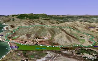
Hill 88 is a favorite walk when the Marin headlands are free from fog. Starting from Fort Cronkhite the Coastal Trail winds up to Hill 88 at 960ft, past various WWII era coastal defenses. Cross the ridge and descend down Wolf Ridge Trail and Miwok Trail to complete a 4.5 mile loop.
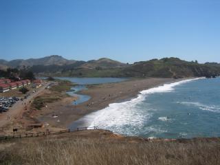
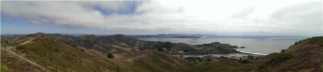
Rodeo Beach viewed from the Coastal Trail. As you ascend there are views of the Golden Gate Bridge and San Francisco.
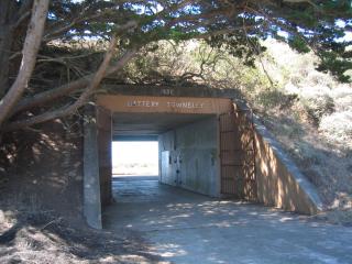
Battery Townsley, one of several coastal defenses passed on the walk.
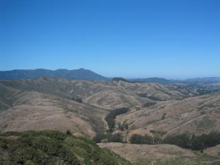
View of Mount Tamalpais as you begin to descend Wolf Ridge Trail.
(4.56 miles, total elevation gain 1,142 feet, 1 hour 38 minutes (average 2.79 mph), view in Google Earth)
Hike starts at: 37.832683, -122.526217.
Updated 2021-09-07 17:55:
Having done this walk many times I would now recommend doing it counterclockwise. You get a nice flat stretch to warm up, a fairly steady climb to the top and then can enjoy the ocean views on the way down if the fog is cooperating.
Updates
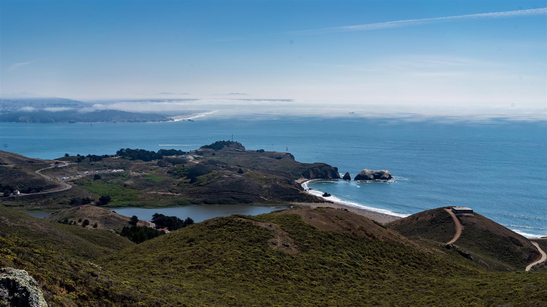
San Francisco from Hill 88
Related Posts
- Golden Gate Park - Stow Lake, Strawberry Hill and Museum Concourse
- Lands End
- Coastal and Julian loop plus Black Sands Beach
- Milagra Ridge
- Fort Funston
(Hike Map)
(Published to the Fediverse as: Hill 88 #hike #hill88 #marinheadlands #sanfrancisco Marin Headlands hike up Hill 88, a loop of just under 5 miles and a little over 1,000 feet of elevation gain. )
Bernal Hill
Closest walk from home is a quick trip round Bernal Hill for views of downtown San Francisco and three bridges.
(0.83 miles, total elevation gain 292 feet, 23 minutes (average 2.12 mph), view in Google Earth)
Hike starts at: 37.74355, -122.417583.
Related Posts
- Golden Gate Park - Stow Lake, Strawberry Hill and Museum Concourse
- Buena Vista Park
- Hill 88
- Golden Gate Park
- Oakland Hills
(Hike Map)
(Published to the Fediverse as: Bernal Hill #hike #bernal #sanfrancisco Hike around Bernal Hill in San Francisco, California (a little under a mile). )