ISS over San Francisco
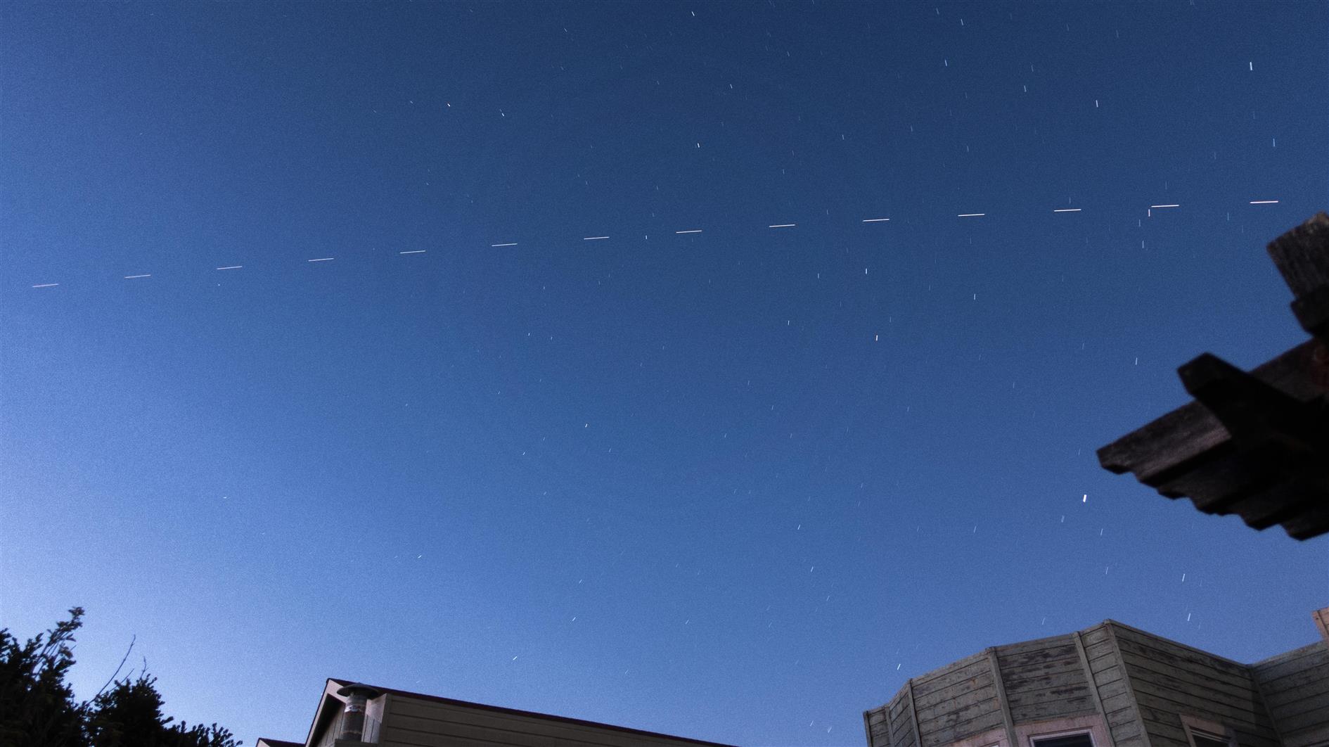
The International Space Station passes over San Francisco (first crew bearing Dragon capsule attached). 14 stacked two second exposures.
Related Posts
- ISS
- ISS over Wales
- Photos of Space Shuttle Endeavor visiting San Francisco
- Clouds Over The Farallones
- San Francisco Stars
(Published to the Fediverse as: ISS over San Francisco #photo #iss #sanfrancisco 14 stacked two second exposures of the International Space Station (ISS) passing over San Francisco, California. )
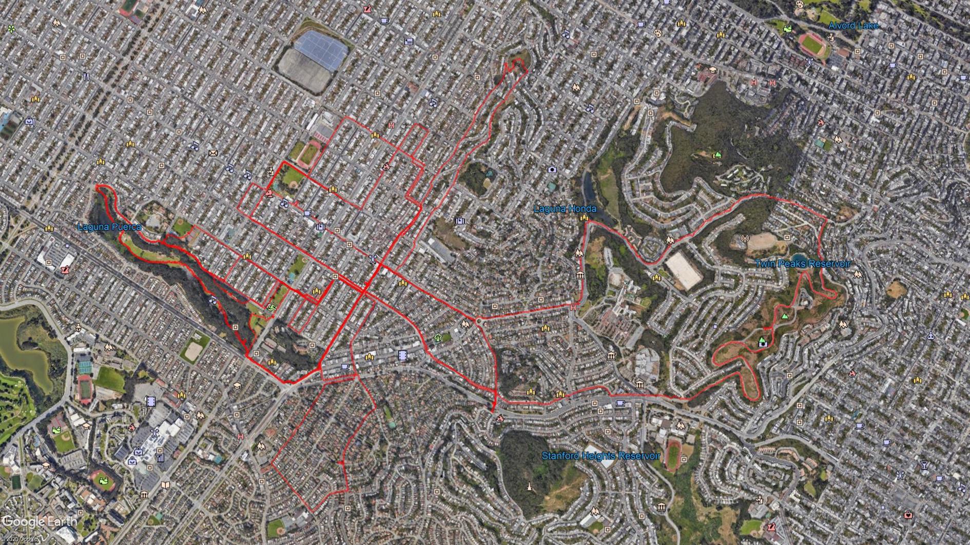
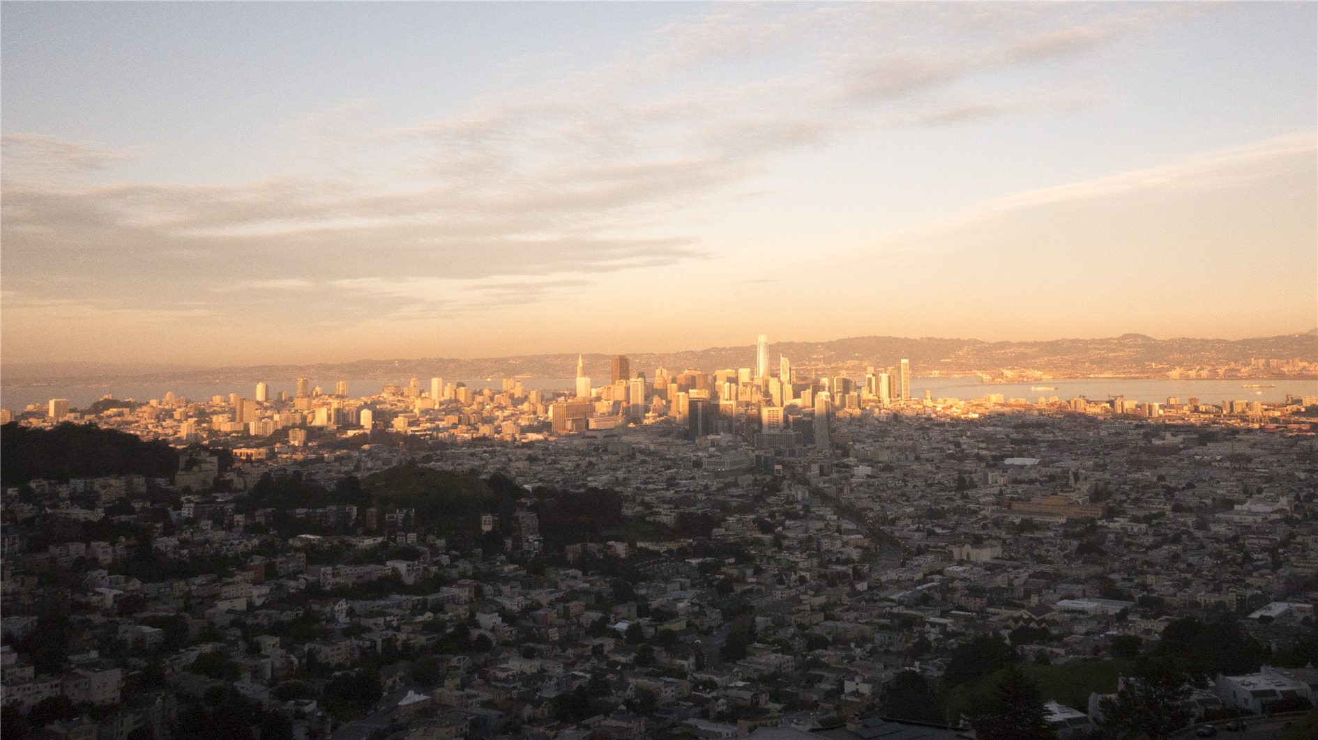
Coronavirus Hikes: May 2020
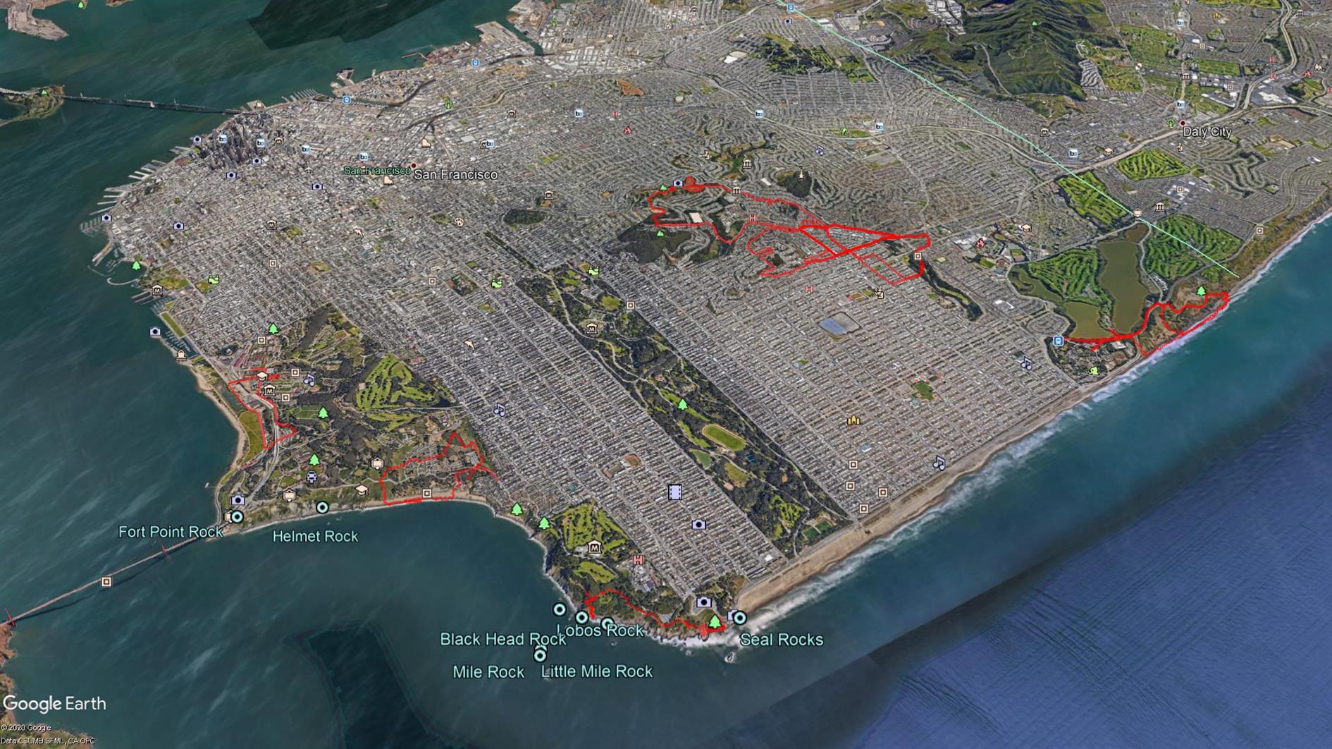
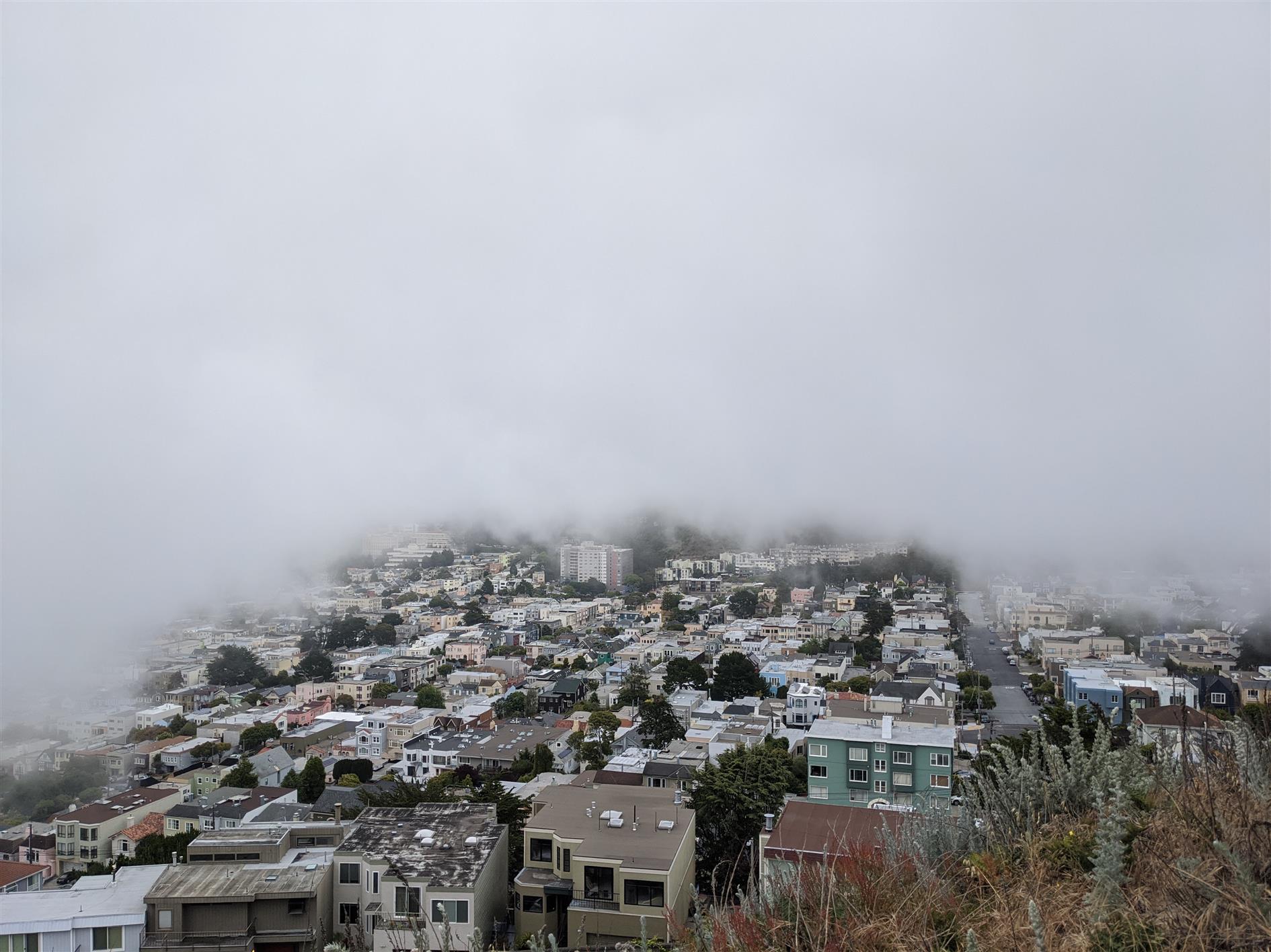
37.2 unique miles in May. Photo is the fog shadow behind Grand View Park.
Hike starts at: 37.741726, -122.471298. View in Google Earth.
Related Posts
- Coronavirus Hikes: June 2020
- Coronavirus Hikes: April 2020
- Coronavirus Hikes: July 2020
- Coronavirus Hikes: March 2020
- Coronavirus Hikes: Done
(Hike Map)
(Published to the Fediverse as: Coronavirus Hikes: May 2020 #hike #sanfrancisco #coronavirus #map Pandemic lockdown hikes around San Francisco for May 2020. )
San Francisco Stars
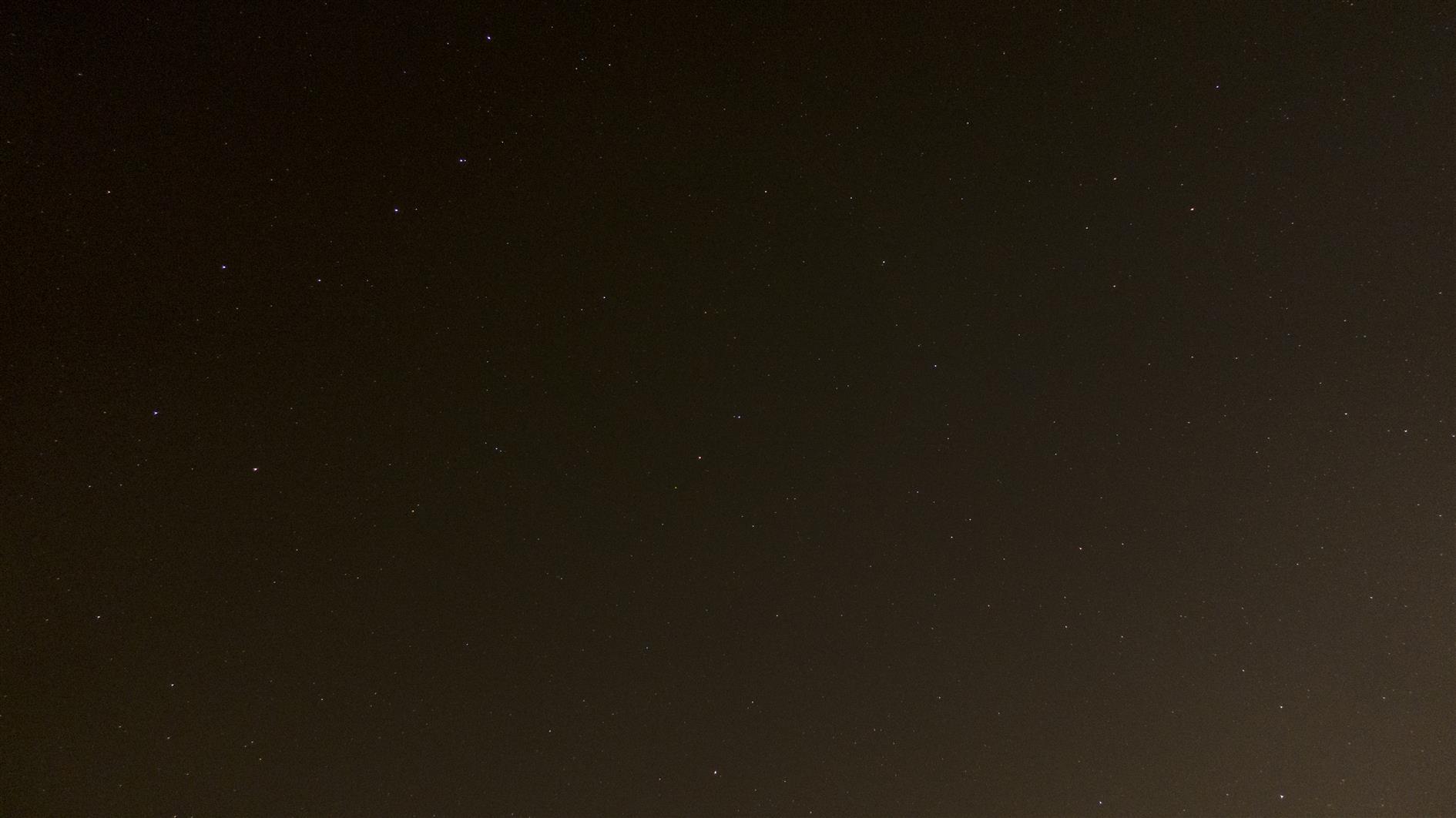
Unusually good night sky conditions in San Francisco recently. Here's a video of several timelapses shot over the last couple of months. The sequences are: (super) moonrise, no Lyrids over Sutro Tower, Ursa Major rotating around Polaris, Orion setting, moonset.
Related Posts
- Stars over Columbia State Historic Park
- Timelapse, Week of Jan 31 2022
- Timelapse of San Francisco Clouds After Various Atmospheric Rivers
- Sunset sunset
- Sugarloaf Stars
(Published to the Fediverse as: San Francisco Stars #timelapse #stars #sanfrancisco #sutrotower #video Time lapse of stars over San Francisco (including moonrise, Orion setting and Ursa Major rotating around Polaris). )
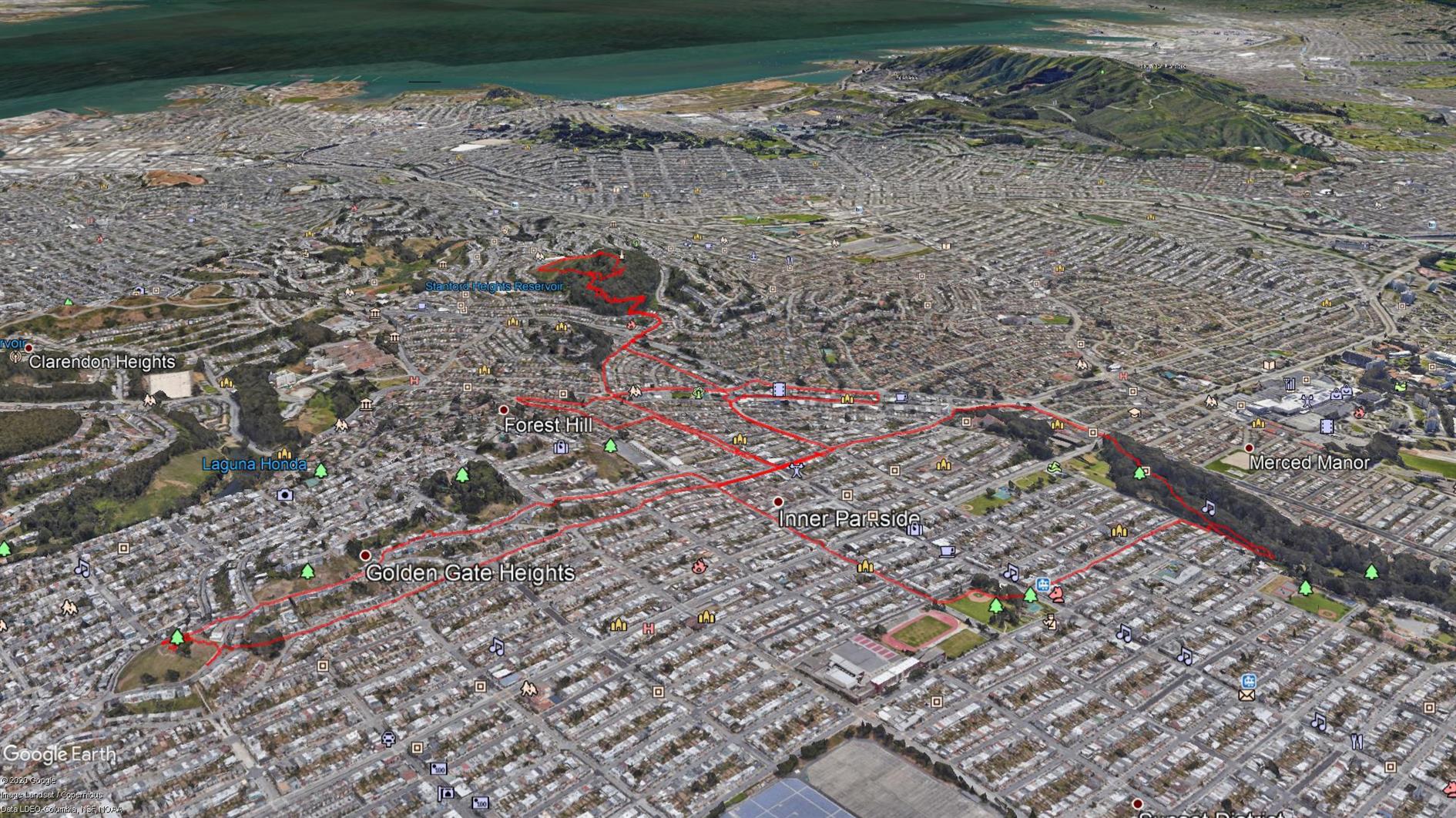
Coronavirus Hikes: April 2020
36.4 unique miles in April (I'm not using the GPS for repeat hikes). Bagged Twin Peaks, wider paths than Mount Davidson.
Related Posts
- Coronavirus Hikes: May 2020
- Coronavirus Hikes: June 2020
- Coronavirus Hikes: March 2020
- Coronavirus Hikes: Done
- Coronavirus Hikes: July 2020
(Hike Map)
(Published to the Fediverse as: Coronavirus Hikes: April 2020 #hike #sanfrancisco #coronavirus Map of hikes around San Francisco during the Coronavirus lockdown: April 2020 )
Coronavirus Hikes: March 2020
Not getting far from home any time soon so all hikes for now will be local. I found a great web app, Routeshuffle, that will generate a random hike from the starting location of your choice. It's a great way of seeing streets you'd never venture down normally. The map is generated with some software I wrote to combine multiple KML files for easy rendering in Google Earth (oh, and Google Earth, I guess that does the heavy lifting). I'll post these every month while we're locked down. March is 15.6 miles total.
Hike starts at: 37.800778, -122.455943. View in Google Earth.
Related Posts
- Coronavirus Hikes: Done
- Coronavirus Hikes: April 2020
- Coronavirus Hikes: May 2020
- Coronavirus Hikes: June 2020
- Coronavirus Hikes: July 2020
(Hike Map)
(Published to the Fediverse as: Coronavirus Hikes: March 2020 #hike #coronavirus #sanfrancisco #map Pandemic lockdown hikes around San Francisco from March 2020 )
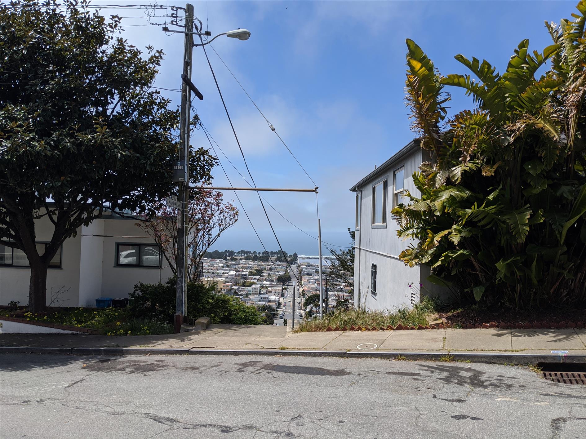
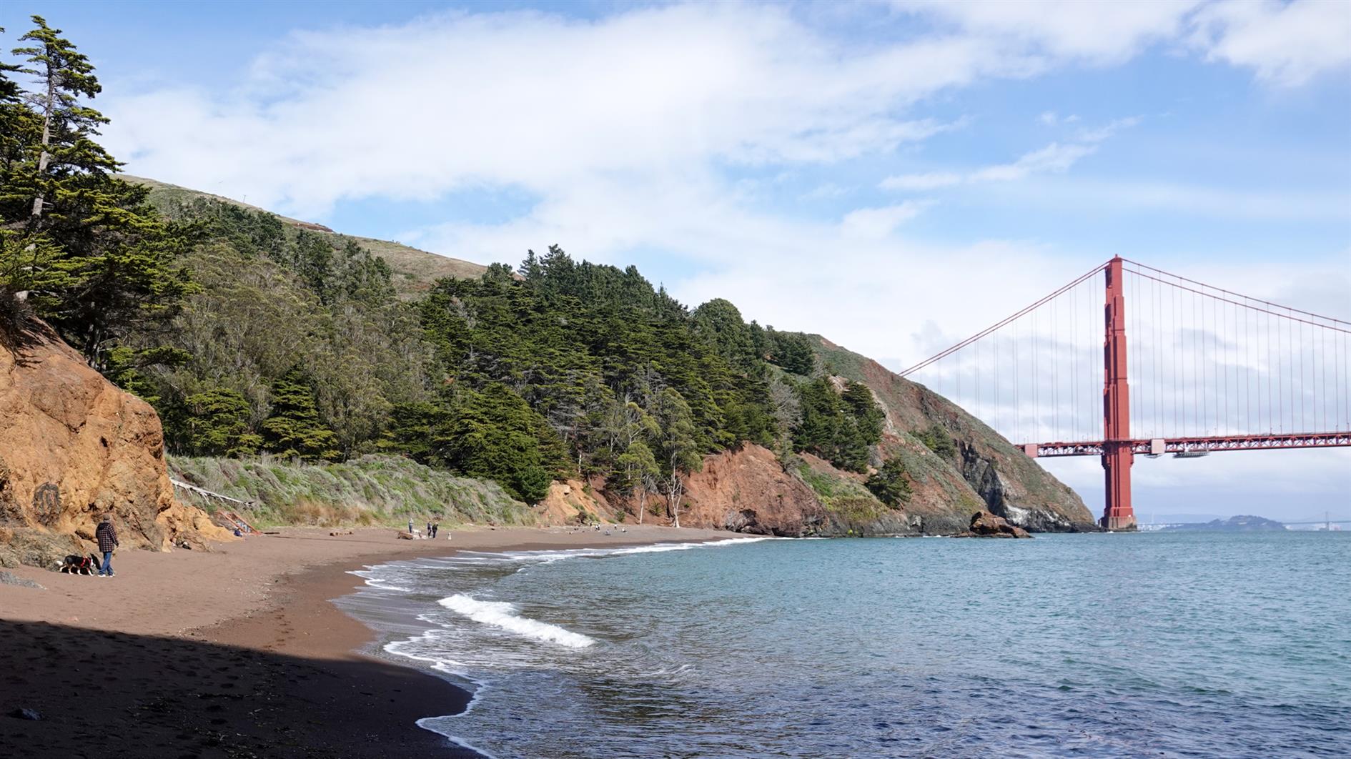
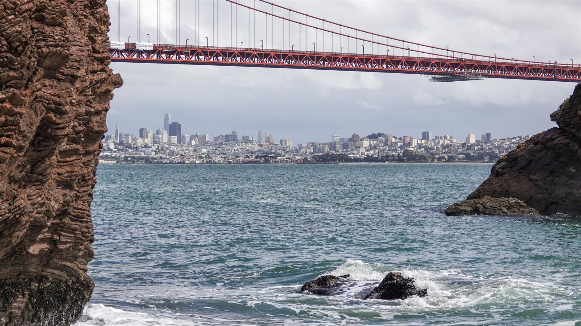
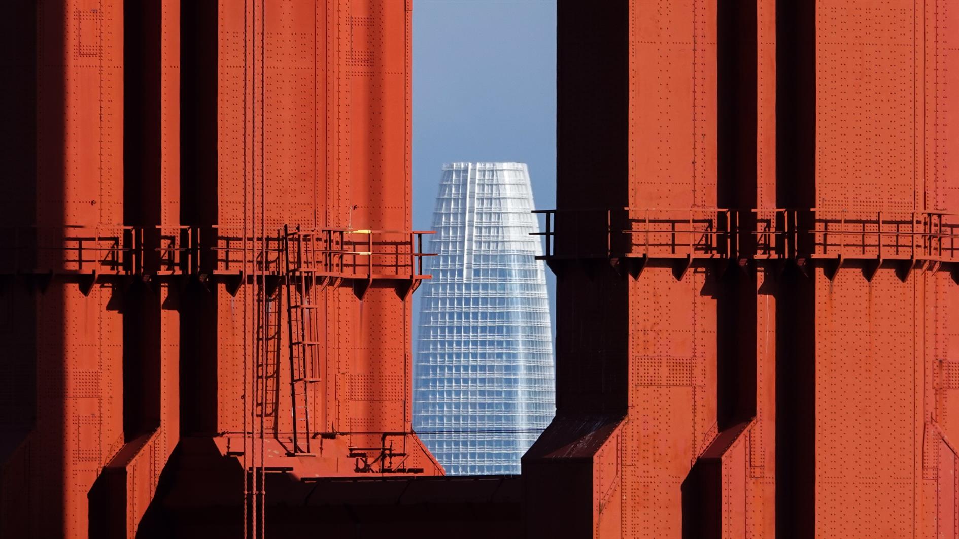
Kirby Cove
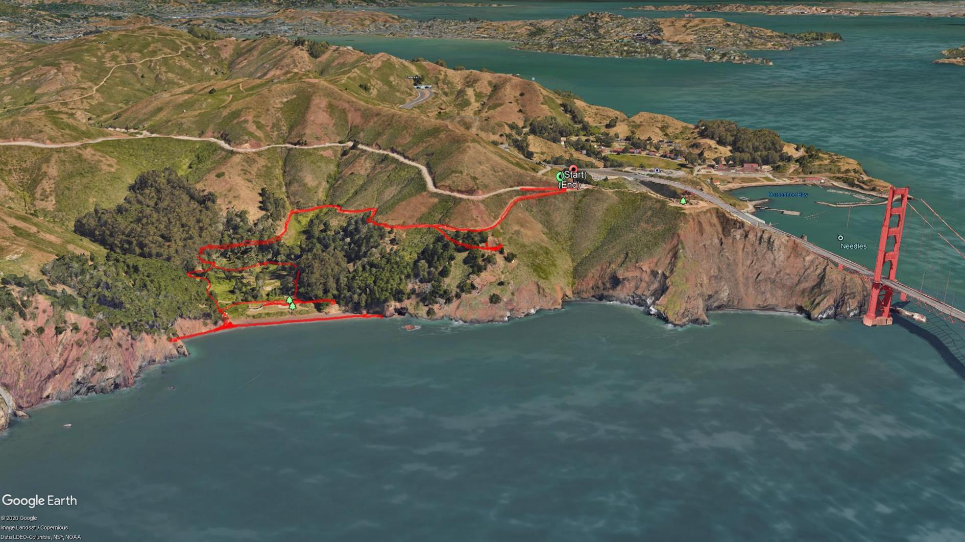
A short two mile out and back from the Battery Spencer parking area on Conzelman Road to Kirby Cove.
The Marin Headlands have had a bit of a traffic management change recently so you need to go through the tunnel to get in and Conzelman Road is now one way back to highway 101. The advantage is that there is way more parking then there used to be. I think I've only ever managed to park near Battery Spencer once in 20 years.
The walk is my least favorite profile, downhill to start and uphill on the way back and also not a loop. It's worth it though because it's short and Kirby Cove beach is quiet and has wonderful views of San Francisco through the Golden Gate Bridge. You can also visit Battery Wagner and Battery Kirby on the way back up.
Hike starts at: 37.829459, -122.48401. View in Google Earth.
Related Posts
- Batteries to Bluffs
- Treasure Island Perimeter
- Coastal and Julian loop plus Black Sands Beach
- Hill 88
- Golden Gate Park - Stow Lake, Strawberry Hill and Museum Concourse
(Hike Map)
(Published to the Fediverse as: Kirby Cove #hike #sanfrancisco #ggb #map Two mile hike to Kirby Cove Beach in the Marin Headlands with outstanding views of San Francisco through the Golden Gate Bridge. )
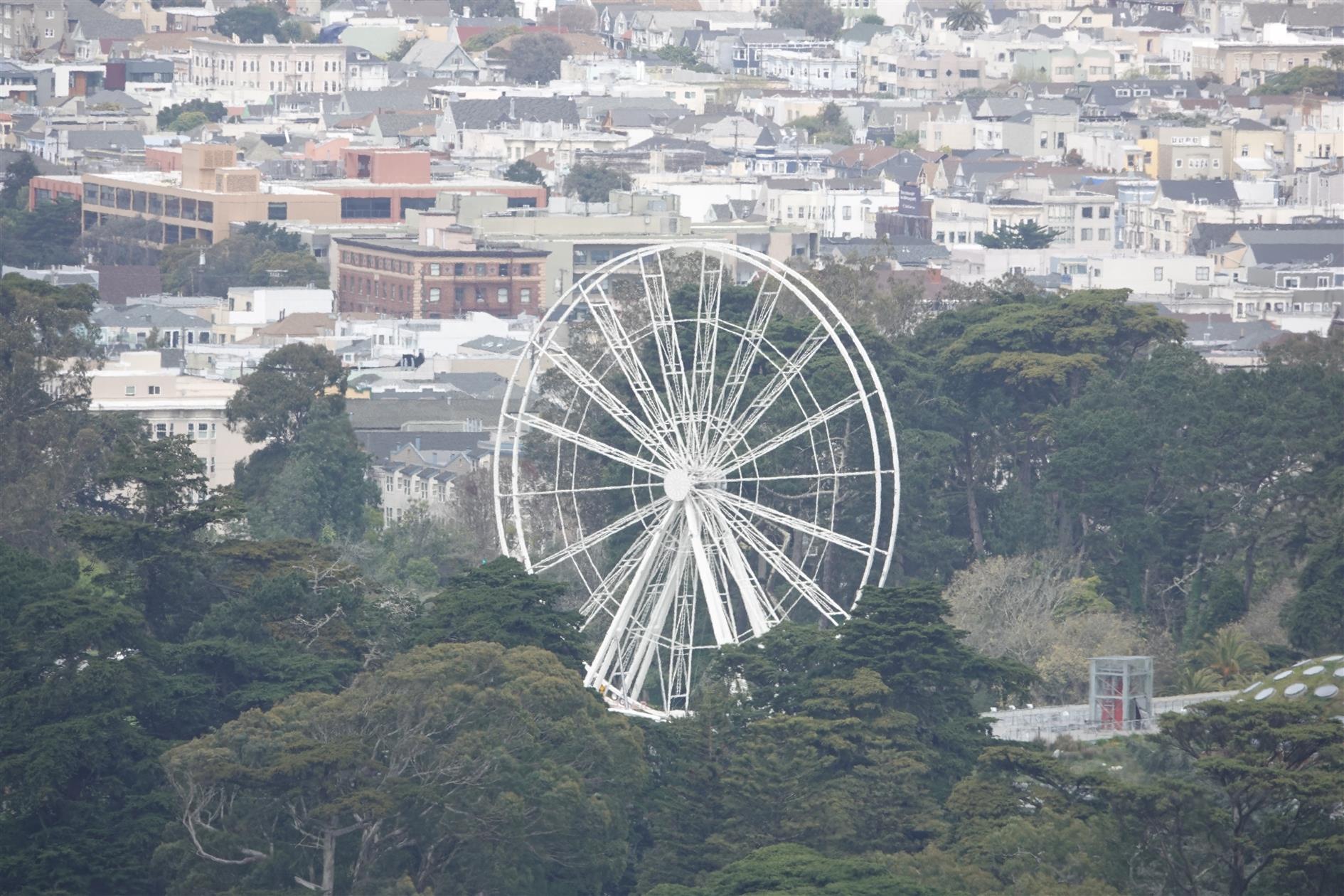
San Francisco New Year's Eve Timelapse
A timelapse portrait of San Francisco on New Year's Eve 2019:
The video features the view from Inspiration Point, The Palace of Fine Arts, Union Square, Crissy Field, The Ferry Building, Music Concourse in Golden Gate Park, Market Street and the sun setting over downtown shot from Twin Pearks.
Related Posts
- San Francisco New Year's Eve Timelapse 2020
- Embarcadero
- Timelapse, Week of Jan 17 2022
- San Francisco Shoreline Timelapse
- Yerba Buena Island Timelapse
(Published to the Fediverse as: San Francisco New Year's Eve Timelapse #timelapse #video #sanfrancisco A timelapse of San Francisco, California on New Year's Eve 2019 featuring Inspiration Point, The Palace of Fine Arts, Union Square, Crissy Field, The Ferry Building, Music Concourse and Market Street. )
Mt. Livermore on Angel Island
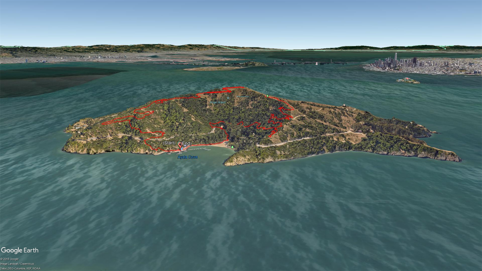

The Immigration Station at Angel Island is a fascinating piece of history. It's amazing how unwelcoming we were to Chinese immigrants while the station was in operation, and how ineffective all of the unpleasantness was. It's a racist mirror universe of Ellis Island. Get a guided tour if you can. I've visited the Immigration Station a couple of times and also hiked around the perimeter (which is spectacular), but this trip was the first time going up to the top. The Angel Island Company site suggests that this is a 6.5 mile hike but my GPS thinks it was 5 miles and so did the fact that we made it back in time for our planned ferry back to San Francisco.
Get off the boat, head right and up the hill to pick up the sign for Sunset Trail. This takes you up to a spur about half a mile from the top that is well signed for Mt. Livermore. There are a few picnic tables and an annoying mast that makes it hard to take the panorama that this peak is so obviously calling for. On the way back down head right at the first opportunity to follow North Ridge trail back to Ayala Cove.
Hike starts at: 37.868337, -122.434656. View in Google Earth.
Related Posts
- Angel Island Perimeter Road
- Treasure Island Perimeter
- Golden Gate Park - Stow Lake, Strawberry Hill and Museum Concourse
- Hill 88
- Lands End
(Hike Map)
(Published to the Fediverse as: Mt. Livermore on Angel Island #hike #sanfrancisco #angelisland #map Five mile hike to Mt. Livermore at the summit of Angel Island State Park in the San Francisco bay. )
Transit of Mercury
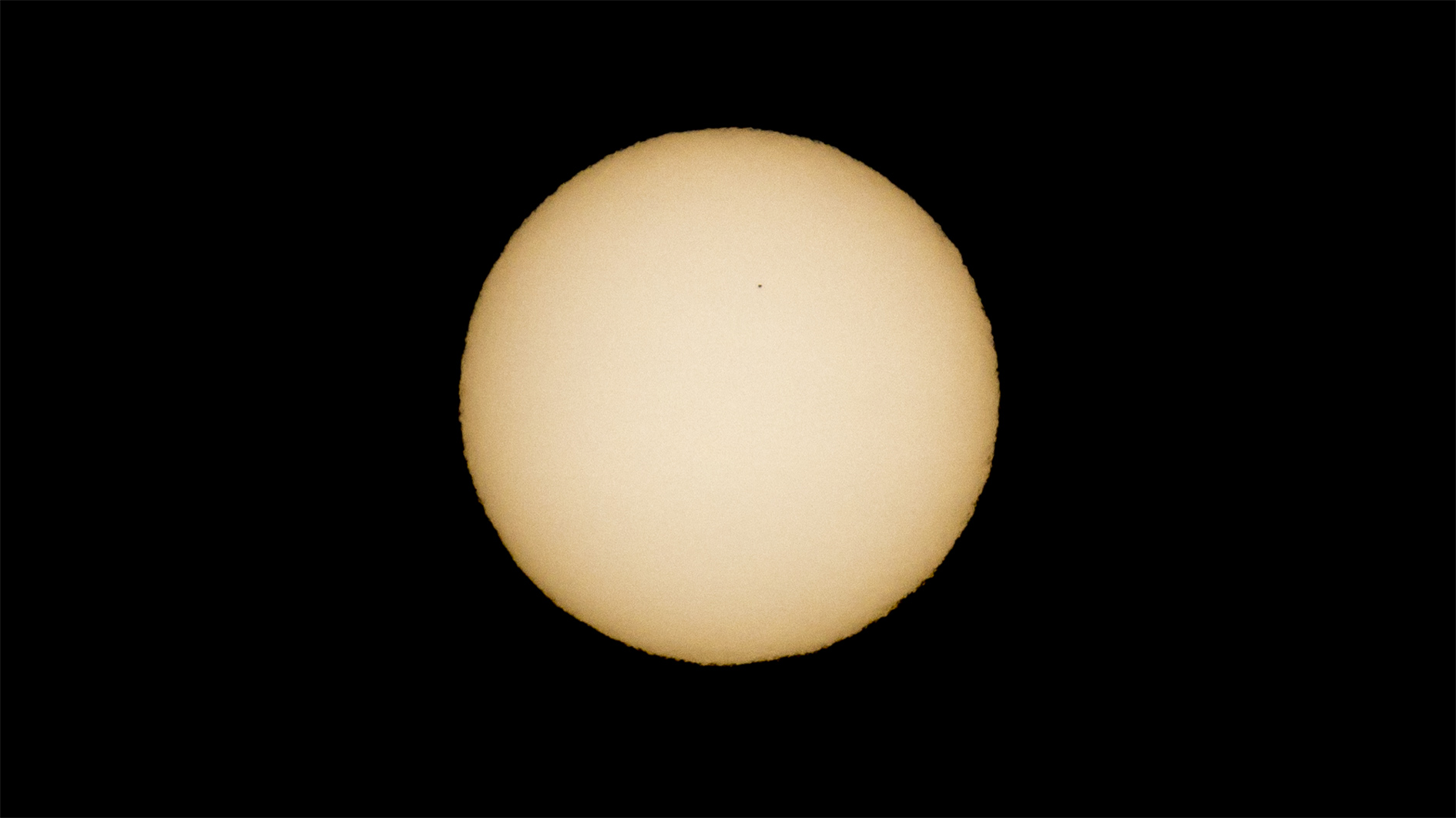

The transit of Mercury on November 11, 2019 shot from San Francisco, CA with a Sony RX10 IV with an ND5.0 filter (and a better filter adapter than this one).
Related Posts
(Published to the Fediverse as: Transit of Mercury #photo #sun #mercury #transit #solar #sanfrancisco Photo and zoomed in detail of the transit of Mercury shot from San Francisco, CA with a Sony RX10 IV. )
Fleet Week 2019 Air Show
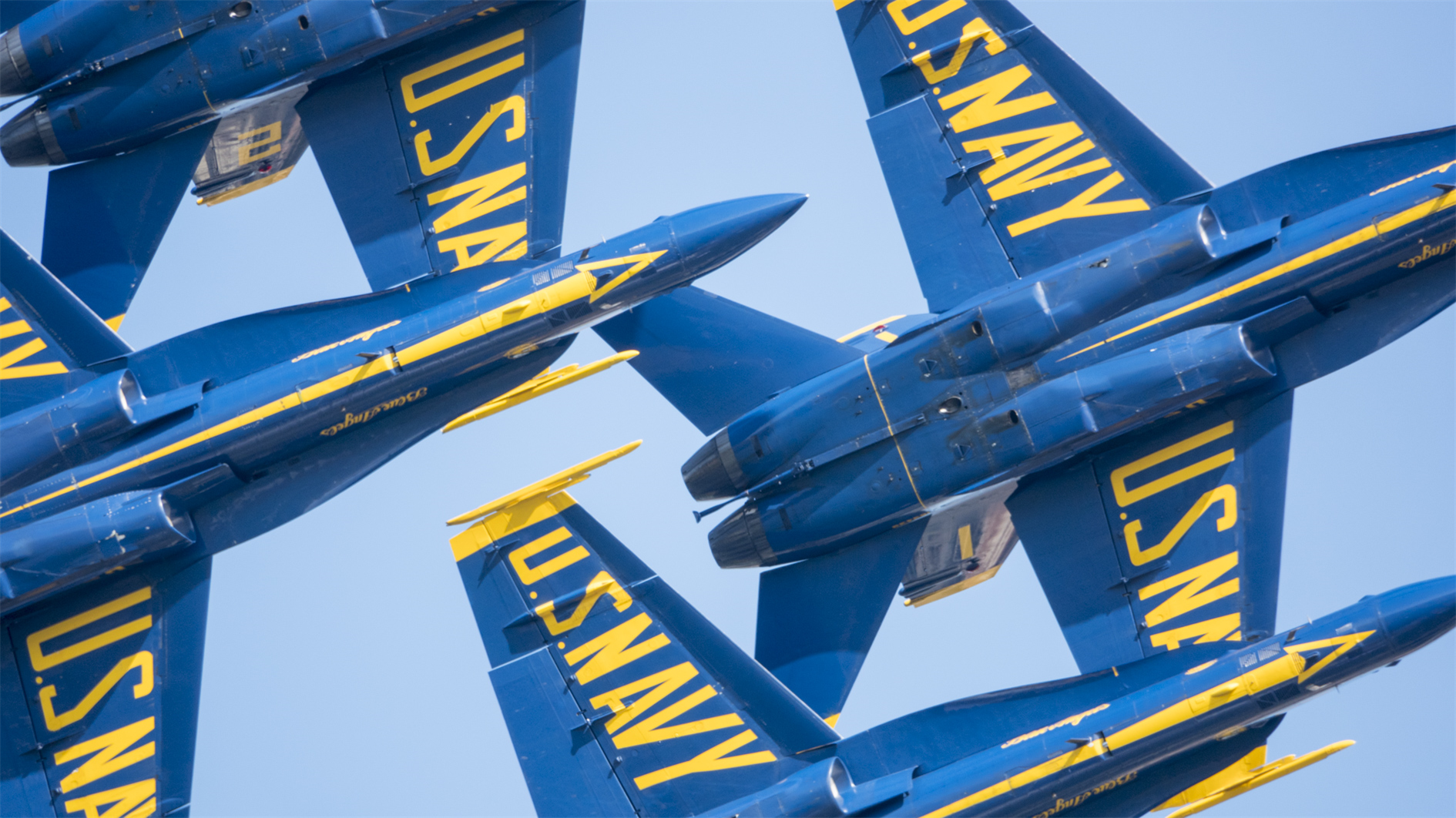

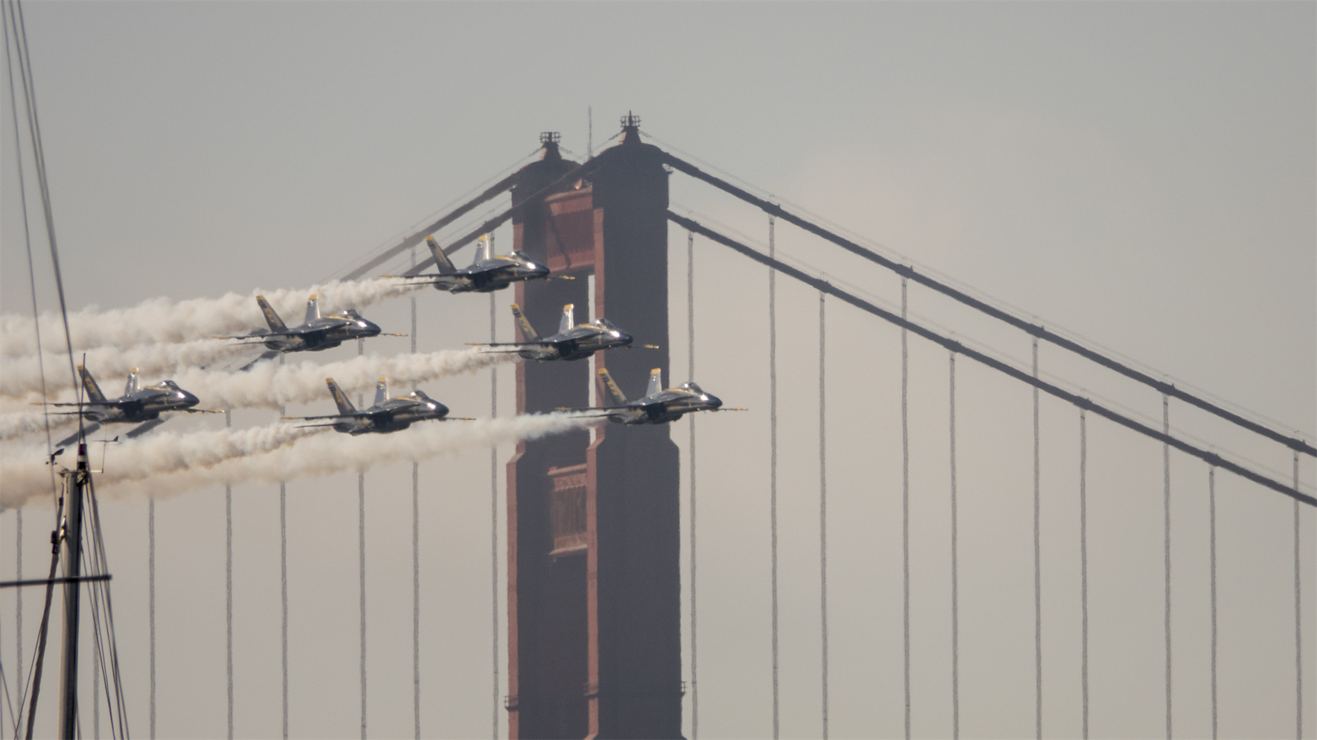
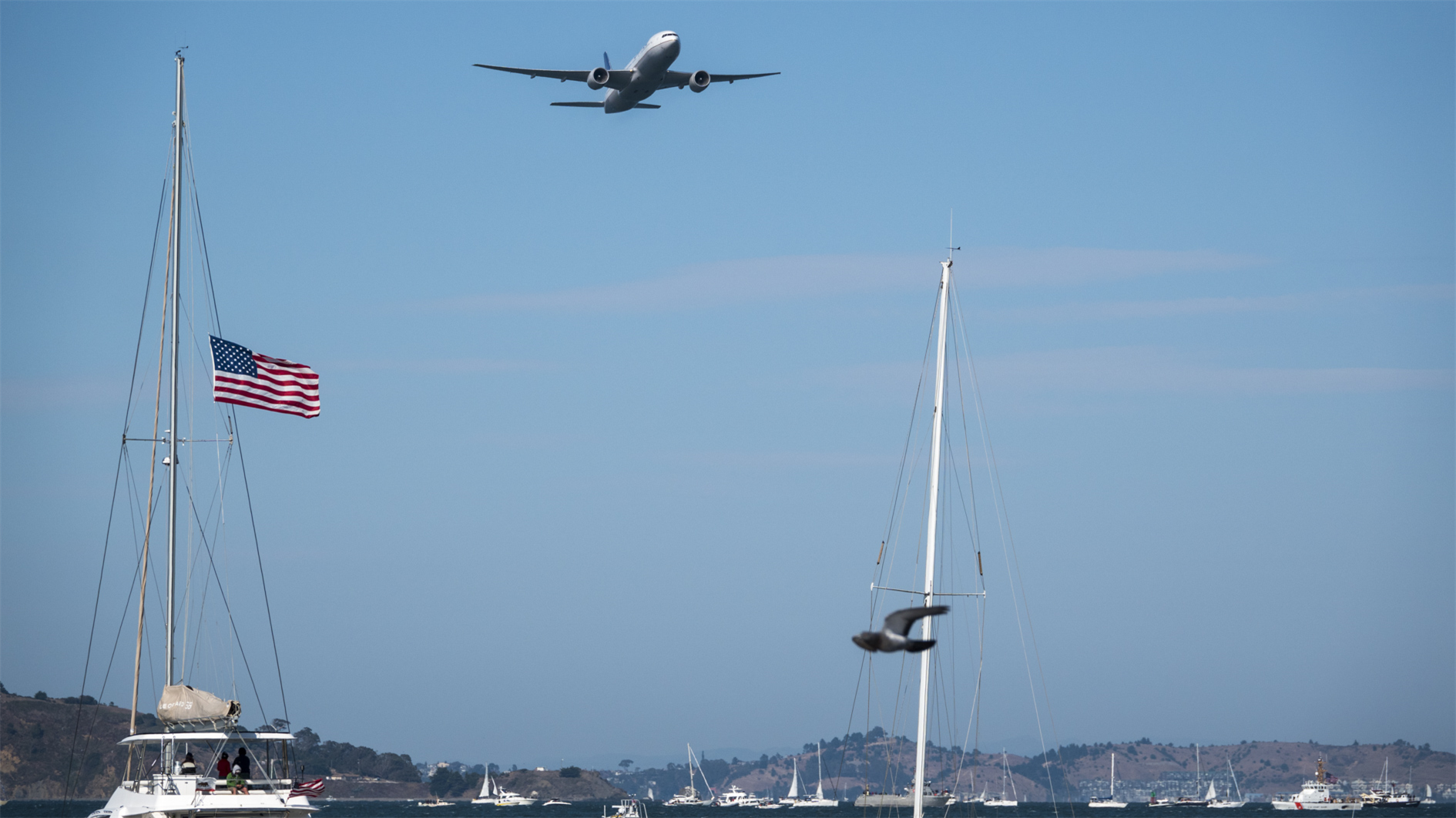
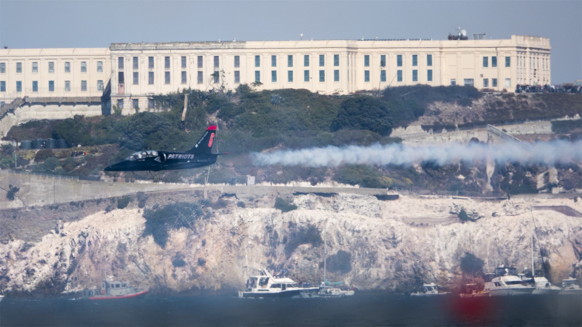

Blue Angels, United 777, a Patriot passing Treasure Island and an F-35 wtih a P-51.
Related Posts
- Fleet Week 2021 Air Show (Photos and Timelapse)
- Fleet Week 2019 Parade of Ships
- Timelapse, Week of Jan 31 2022
- GGB
- Pelicans
(Published to the Fediverse as: Fleet Week 2019 Air Show #photo #fleetweek #sanfrancisco #ggb Photos from the San Francisco Fleet Week 2019 Air Show. )