Great Billboard Hack
By Robert Ellison. Updated on Saturday, June 7, 2025.
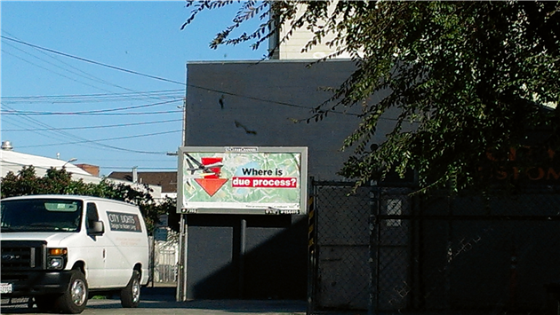
Updated 2013-06-30 19:51:
Updated 2013-06-30 20:37:
Updated 2013-07-01 00:31:
Updated 2013-07-01 08:37:
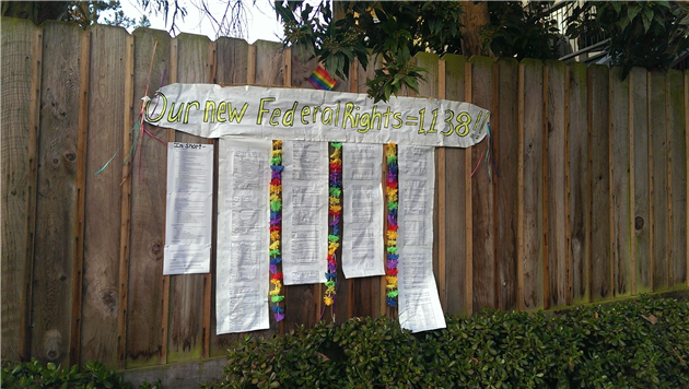
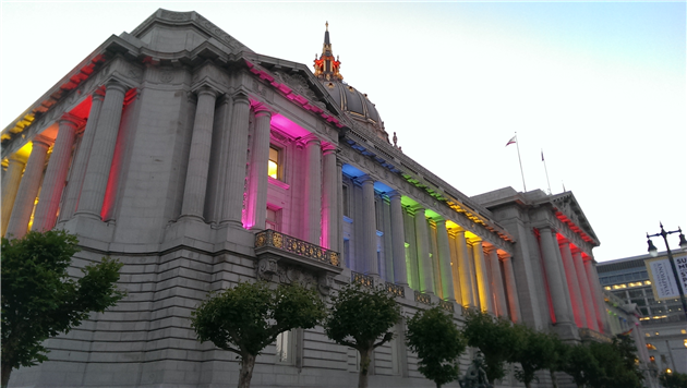
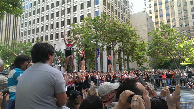
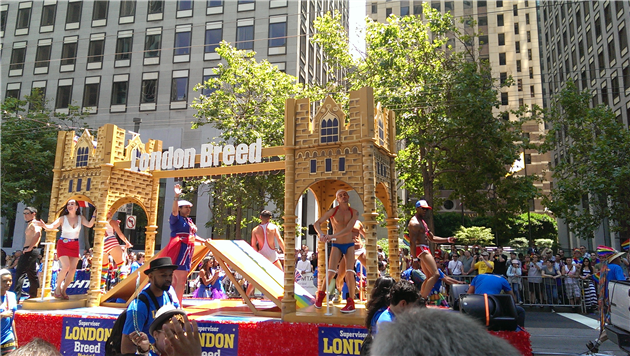
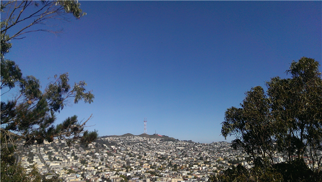
(Published to the Fediverse as: Pride #photo #sanfrancisco Various photos from 2013 Pride in San Francisco, California. )
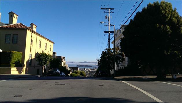
View to Alcatraz from Steiner and Pacific - about to cycle down very fast.
Updated 2016-04-26 21:42:
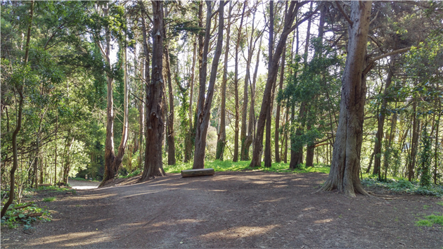
View from the Ecology Trail in The Presidio of San Francisco.
(Previously: Commute failing to suck this morning...)
(Published to the Fediverse as: Commute #photo #commute #sanfrancisco Photos from my commute in San Francisco. )
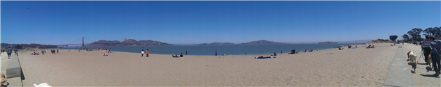
Panoramic photo of West Beach at Crissy Field in San Francisco (taken while enjoying some lunch).
(Published to the Fediverse as: Crissy Field Lunch #photo #ggnra #crissyfield #sanfrancisco Photo of Crissy Field West Beach in San Francisco, California. )
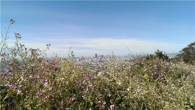
Wildflowers bloom in Bernal Heights Park with downtown San Francisco in the distance.
(Published to the Fediverse as: Bernal in Bloom #photo #bernal #sanfrancisco Photo of wildflowers blooming in Bernal Heights Park with downtown San Francisco in the distance. )
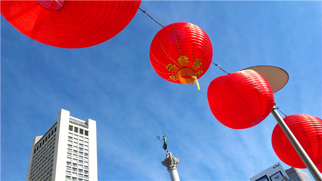
Photo of red lanterns decorating Union Square in San Francisco to celebrate Chinese New Year.
(Published to the Fediverse as: Chinese New Year #photo #sanfrancisco Photo of red lanterns in Union Square, San Francisco for Chinese New Year. )
Last light of 2012 (up Bernal Hill). Happy New Year!
(Published to the Fediverse as: Last Light #photo #bernal #sanfrancisco The last day of 2012 ends from Bernal Hill in San Francisco, California. )

Like the Internet, The Wave Organ is a series of tubes. Unlike the Internet it groans at you in different ways as the tide comes in and out. It’s also a nice walk on a blustery day with great views around the bay and back over to the Marina.

(Google Earth KML, Google Maps)
Hike starts at: 37.806707, -122.446921.
(Hike Map)
(Published to the Fediverse as: Wave Organ #hike #sanfrancisco #waveorgan Hike to visit The Wave Organ in San Francisco, California. It makes an exciting variety of sounds depending on what the tide is up to. )

Following yesterday’s post on the California 2012 Propositions here’s a shorter post on how I’m planning to vote on the San Francisco (PDF) ballot initiatives:
A: City College Parcel Tax
Yes, happy to pay another $79 a year to support City College.
B: Clean and Safe Neighborhood Parks Bond
Yes, park improvements for a littler over $50 a year.
C: Housing Trust Fund
Yes, a modest amount of money to include affordable housing in a city that desperately needs it.
D: Consolidating Odd-Year Municipal Elections
Yes, because there are too many elections already.
E: Gross Receipts Tax
Yes, makes more sense than taxing payroll and doesn’t tax businesses until you’re over $1M in revenue (whereas the payroll tax hits pre-revenue startups).
F: Water and Environment Plan
No, this is a study on draining the Hetch Hetchy reservoir. Which is just crazy. I might not support building it today but it makes no sense to look at getting rid of it now. Plus that water is really nice.
G: Policy Opposing Corporate Personhood
Yes, because a San Francisco policy will totally reverse hundreds of years of legal precedent. More seriously, corporations are not people and while a policy won’t reverse the malign influence of unlimited corporate spending on elections it doesn’t hurt to whine about it a little.
(Published to the Fediverse as: San Francisco 2012 Propositions #politics #election #sanfrancisco #propositions Official ITHCWY voter guide to the San Francisco 2012 Propositions )
No books this month.
RT @drclue: "drclue: #pearlhunt making progress... http://t.co/FAgLQ2UH" --http://www.twitter.com/drclue/status/185829093244280832
We won #pearlhunt and all we won was this... http://t.co/vUBgLWeK
Bald eagle, fox, and cat are porch friends - Boing Boing http://t.co/5WGciNLD via @BoingBoing
ITHCWY: Agua: Little known fact, geologists would tell you that Bernal Hill is made of chert, actually it's mostly… http://t.co/xMRm2J9n
ITHCWY: Mangler: I don't know what the machine attached to our office does but it's giving me nightmares. http://t.co/BSbvoshq
ITHCWY: It was where he left it: Not to bang on about the BBC and their horrible headlines but 'lost' is a bit… http://t.co/bDKjUbl4
ITHCWY: Executive Clubbing: I used to really love British Airways. I even got over their silly new livery and… http://t.co/NC2Bt9bM
ITHCWY: Sand Ladder at Fort Funston http://t.co/5aeQjoti
ITHCWY: SFO http://t.co/sB1QdXCt
BBC News - The Spanish link in cracking the Enigma code http://t.co/Qv6qYqqQ #fb
ITHCWY: Robot Ahead http://t.co/tn7mHTI8
ITHCWY: Goldilocks: Israel just banned models with a BMI under 18.5. That's not severely underweight, it's the… http://t.co/G5HCE5Ey
External impact report for @IDEX at http://t.co/BsMp8ADa
RT @CatfoodSoftware: Blog: Vernal (Spring) #Equinox 2012 in Catfood #Earth: Spring starts right now in the… http://t.co/xxnASTMp
Good weekend to skip Fort Funston: http://t.co/UE8blE4c
ITHCWY: Catfood: PdfScan 1.40: Catfood PdfScan 1.40 is a small bug fix release. PdfScan converts documents to PDFs… http://t.co/YXdMn6ux
RT @CatfoodSoftware: Blog: Catfood #PdfScan 1.40: I’ve just released Catfood PdfScan 1.40. This is a minor update… http://t.co/6bzjCdfi
Shamed... http://t.co/AlSwTzzY
ITHCWY: Three reasons the dream of a robot companion isn't over: David Lee reports from the Innorobo 2012… http://t.co/JndJZahn
ITHCWY: Fixing dropped wireless connection for Linksys E4200: I've been going quietly mad trying to fix a constant… http://t.co/VVZ2dl2m
Why is this firefighting robot familiar: http://t.co/rqXLfCdC vs. http://t.co/wCL3Hu2d US Navy, call Cybernetics #fb
RT @CatfoodSoftware: Blog: To Follow or Not To Follow: The Third Way: Mashable published an article by Christine… http://t.co/MEzWlryS
ITHCWY: Sweeney Ridge: Sweeney Ridge, starting from Skyline College and walking up to the Portola Expedition… http://t.co/g1HIms1F
ITHCWY: Upgrading to http://t.co/0gDd7HHJ 2.5: Today I upgraded this blog to the latest and greatest version of… http://t.co/HHDj7VdM
"not a threat to the penguins, we don't suspect" - http://t.co/oIrzQOEj - it wasn't a dream!
http://t.co/qRCS8Qhb (new #SF data portal) #todo @myEN
Export Google Fit Daily Steps, Weight and Distance to a Google Sheet
Download a Sharepoint File with GraphServiceClient (Microsoft Graph API)
Which PG&E rate plan works best for EV charging?
International Date Line Longitude, Latitude Coordinates
Monitor page index status with Google Sheets, Apps Script and the Google Search Console API
Google Photos killed my Aura Frame
Is it safe to open securedoc.html (Cisco Registered Envelope)?