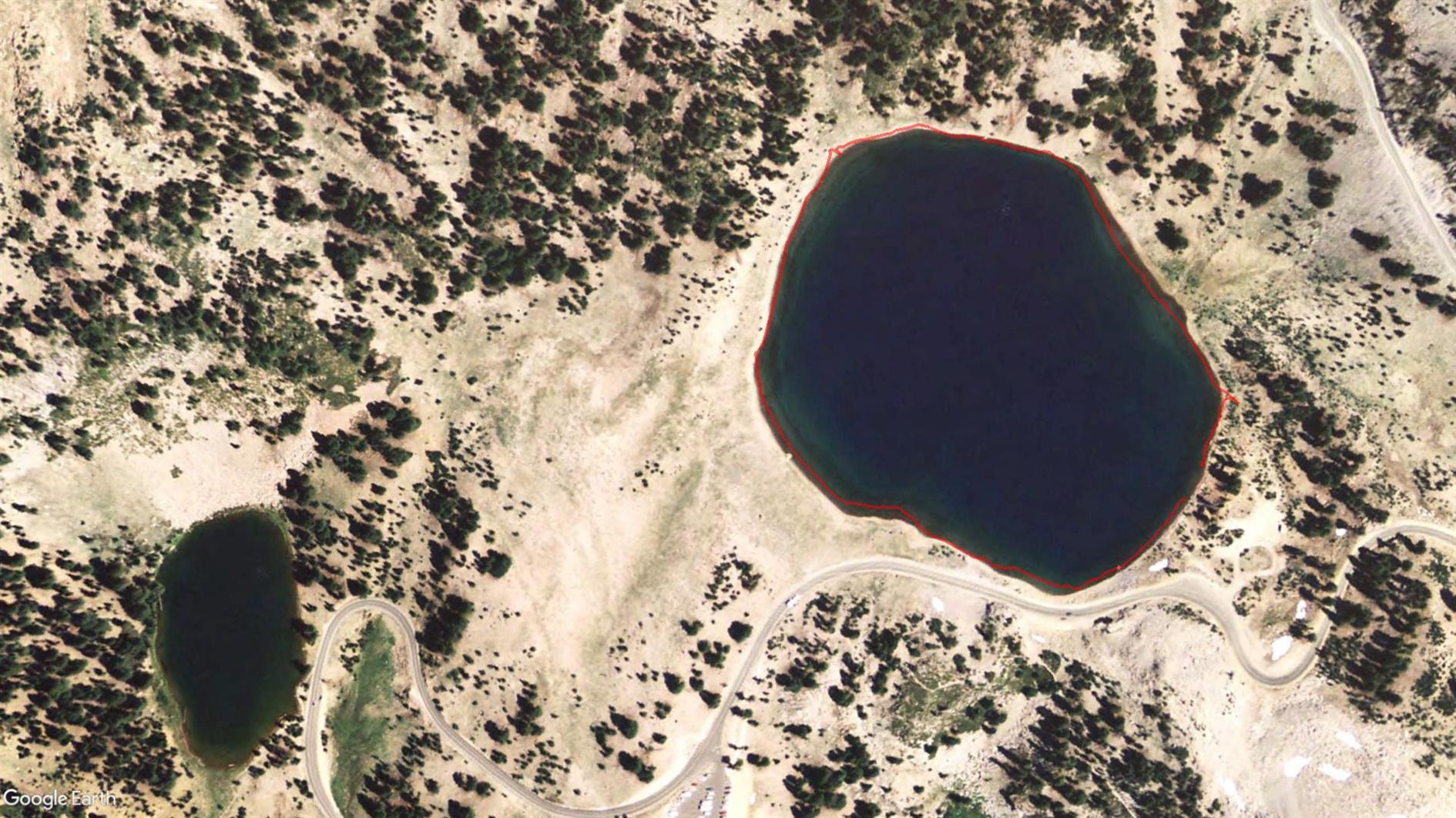
Summit Lake to Echo Lake in Lassen
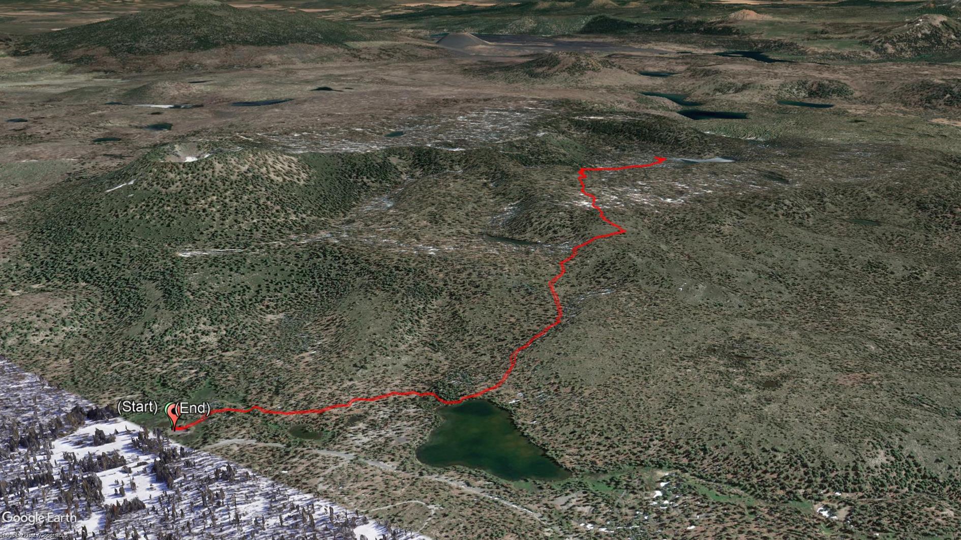
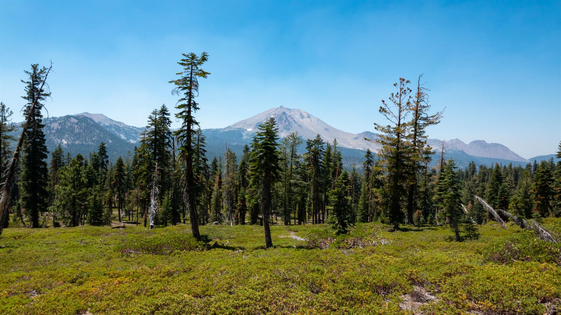
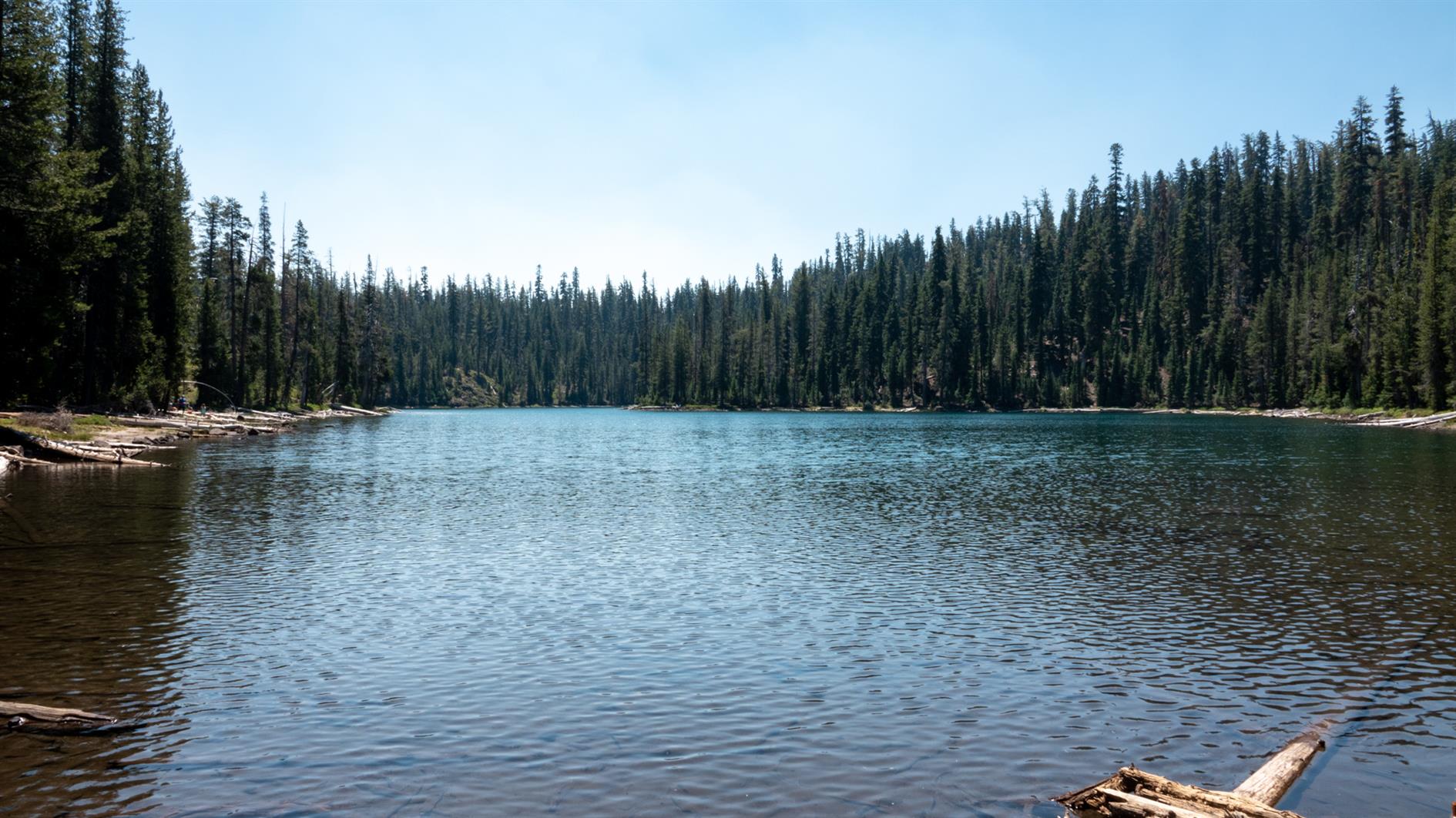
A 4.5 mile out and back hike to Echo Lake in Lassen Volcanic National Park. Start at the Summit Lake Ranger Station, take the short trail to Summit Lake and then follow signs to Echo Lake.
Hike starts at: 40.498228, -121.42711. View in Google Earth.
Related Posts
(Hike Map)
(Published to the Fediverse as: Summit Lake to Echo Lake in Lassen #hike #lake #lassen #map Hike from Summit Lake to Echo Lake in Lassen Volcanic National Park. 4.5 miles out and back. )
Devils Kitchen
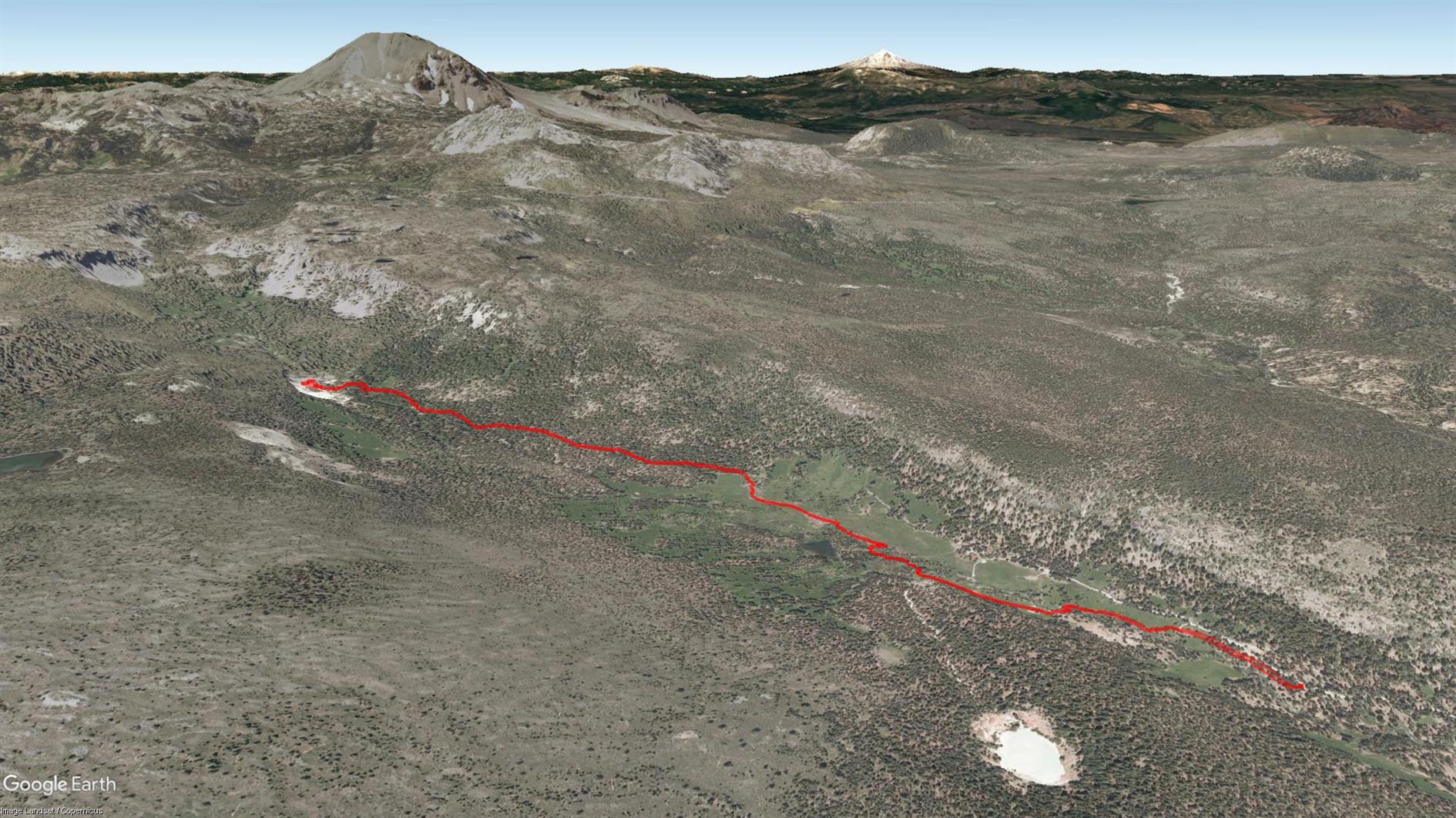
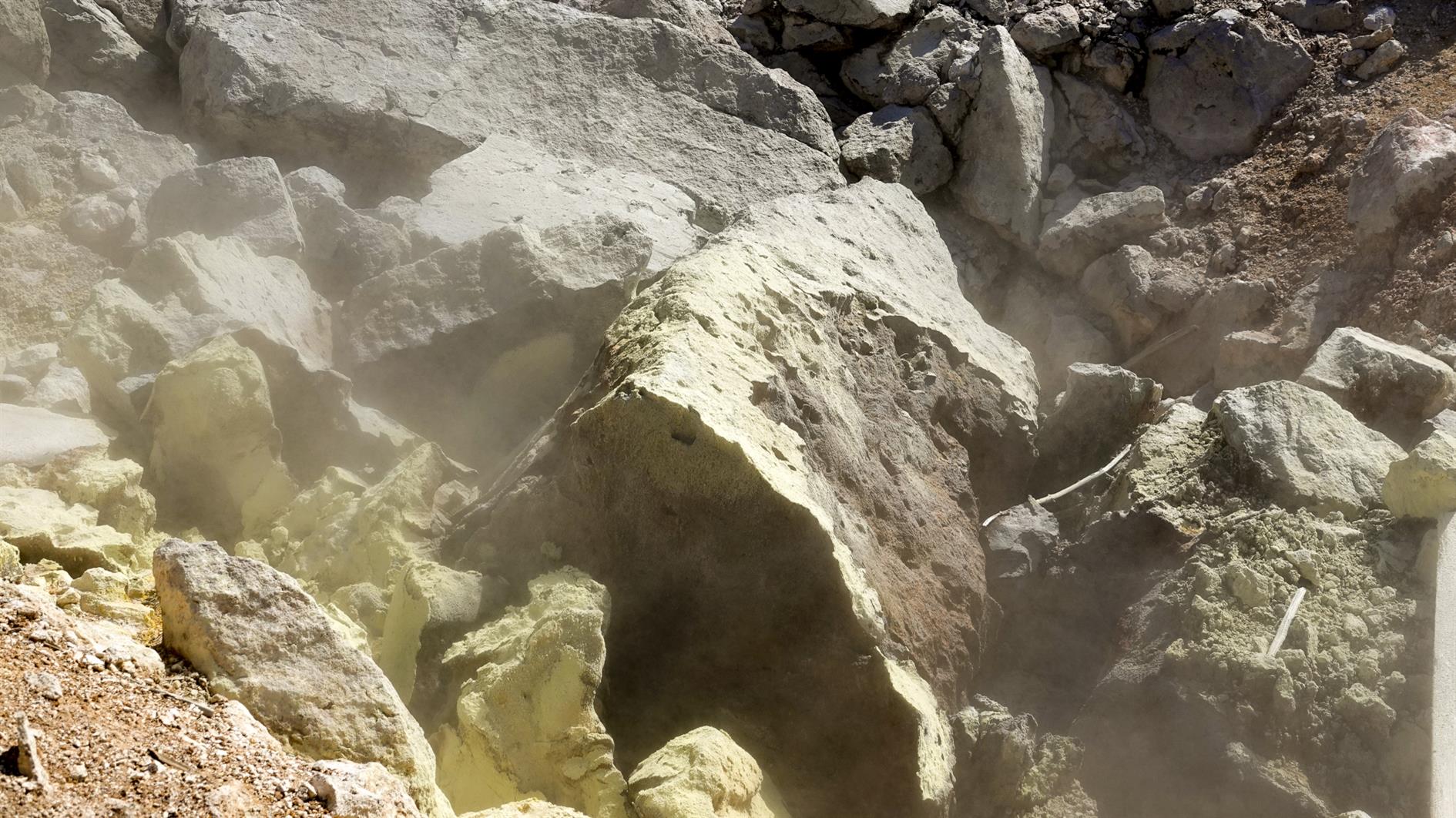
Four and a half mile out and back hike from the Warner Valley area of Lassen Volcanic National Park to the Devils Kitchen.
Hike starts at: 40.442054, -121.393882. View in Google Earth.
Related Posts
- Summit Lake to Echo Lake in Lassen
- Bumpass Hell
- Lake Helen
- Devil's Slide Trail
- Point Reyes - Divide Meadow Loop
(Hike Map)
(Published to the Fediverse as: Devils Kitchen #hike #lassen #map 4.5 mile hike to Devils Kitchen in the Warner Valley area of Lassen Volcanic National Park. )
Lake Helen
It's three quarters of a mile round Lake Helen, not really worth doing unless you're waiting for someone to finish paddling...
Hike starts at: 40.467433, -121.508604. View in Google Earth.
Related Posts
(Hike Map)
(Published to the Fediverse as: Lake Helen #hike #lassen #map Less than one mile hike around Lake Helen in Lassen Volcanic National Park, California. )
Bumpass Hell
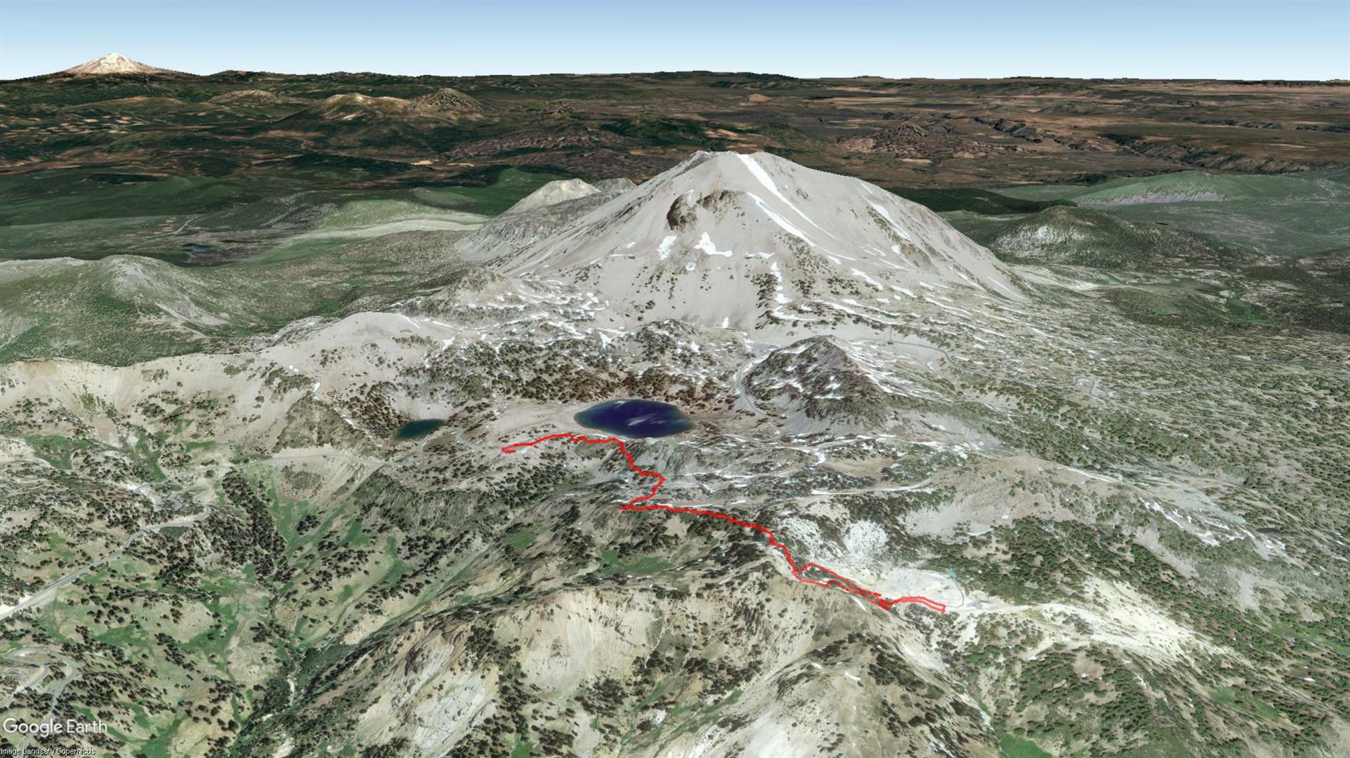
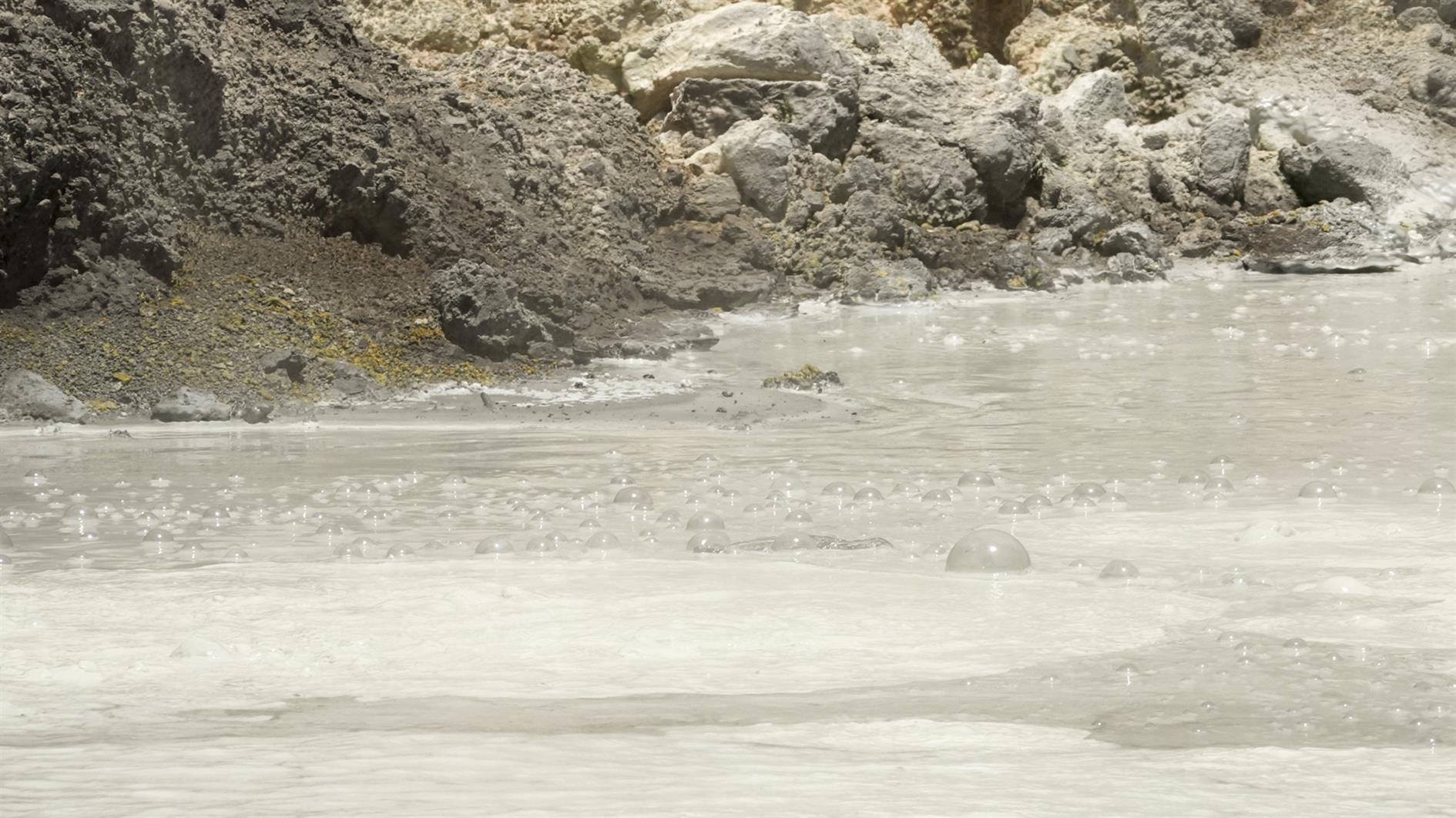
Third time lucky - Bumpass Hell was open for my third trip to Lassen Volcanic National Park. It's a three mile out and back with great views and of course a whole bunch of geothermal features at the end. The trail winds gently up to Bumpass Hell where there is a steep and surprisingly slippery descent (and an alternate route back up for a very small loop at the end of the trail). Very glad to have finally hiked it.
(Previously: Lassen Star Trails)
Hike starts at: 40.465403, -121.514653. View in Google Earth.
Related Posts
- Lassen Star Trails
- Summit Lake to Echo Lake in Lassen
- Devils Kitchen
- Lake Helen
- Las Trampas Wilderness
(Hike Map)
(Published to the Fediverse as: Bumpass Hell #hike #lassen #map Bumpas Hell )
Storm builds over Lassen Peak (Timelapse)
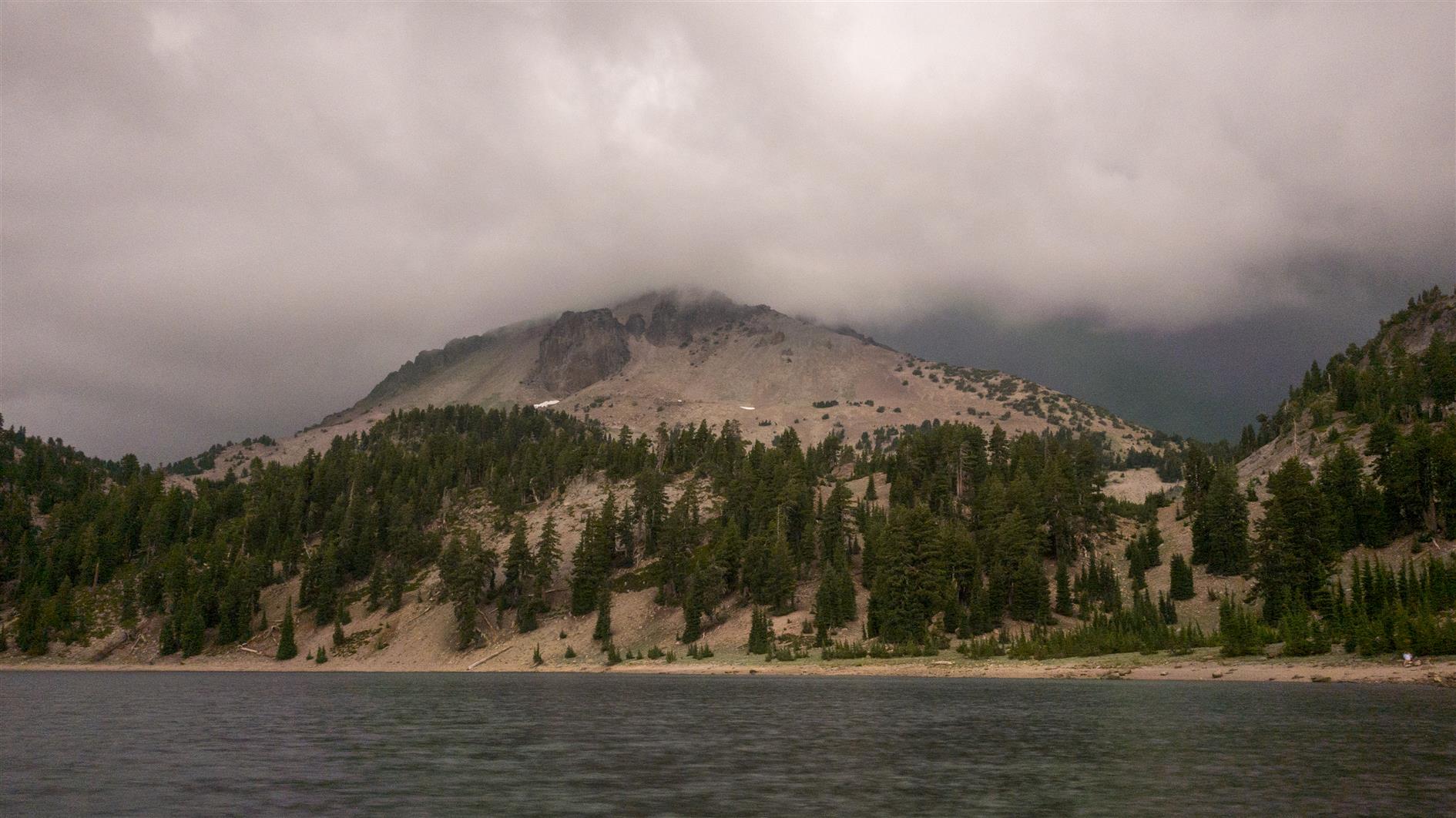
A storm builds over Lassen Peak. Filmed from Lake Helen in Lassen Volcanic National Park.
Related Posts
(Published to the Fediverse as: Storm builds over Lassen Peak (Timelapse) #timelapse #lassen #storm #video Time lapse of a storm building around Lassen Peak, shot from Lake Helen. )
Lassen Star Trails
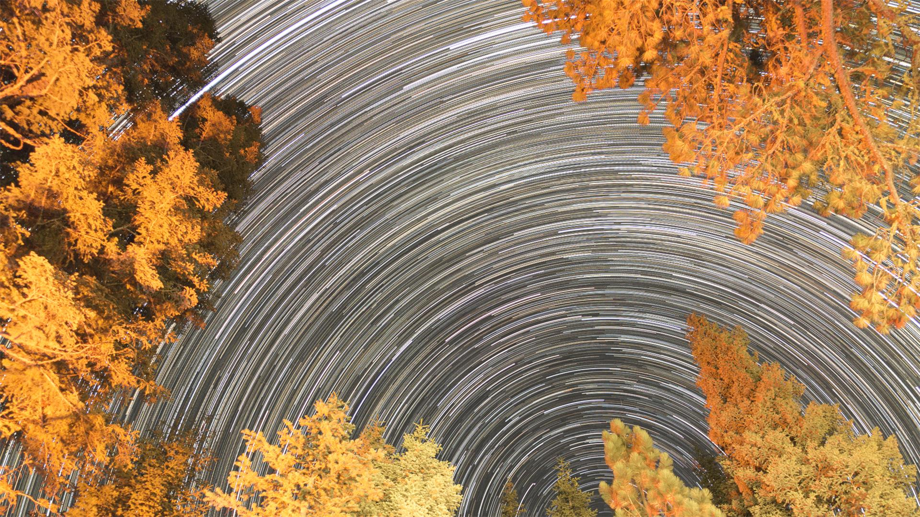
A timelapse two ways shot from the Manzanita Lake campground at Lassen Volcanic National Park (the second time I've visited and the second time that Bumpass Hell has been closed). First a regular 4K timelapse looking up from the campsite:
The second version is the same footage in HD where each frame is the cumulative maximum pixel value of all the frames up to the current frame (so it builds in star trails as the video runs):
Related Posts
- Bumpass Hell
- Storm builds over Lassen Peak (Timelapse)
- Stars over Lake Tahoe
- Milky Way Rises over South Lake Tahoe
- Sugarloaf Stars and Milky Way
(Published to the Fediverse as: Lassen Star Trails #timelapse #video #4k #lassen #stars Cumulative star trails and a regular night timelapse shot from the Manzanita Lake campground at Lassen Volcanic National Park in California. )