A relatively pleasant Sunday in San Francisco, which means the second you turn your back fog and low cloud are going to swoop in:
The first part of the video is looking west toward the ocean. Once any trace of blue is obliterated we turn south to see fog rolling over San Pedro Mountain near Pacifica and increasingly gloomy cloud cover over the French Chateau Sanatorium (which I think of as the West Portal Retirement Castle). This is a deeply strange building, nestled in a hollow and surrounded by trees. Most of the time you don't see it and then suddenly, on the right street at the right angle you're startled to realize that there is a massive chateau hiding in the neighborhood.
Update April 19, 2020: I made a longer, higher resolution version which you can find here.
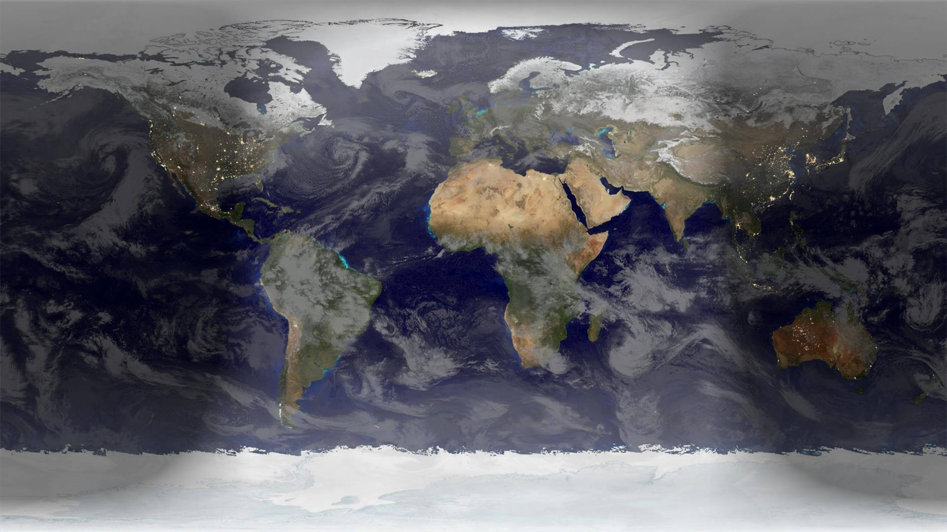
Here's an animation showing a year of global cloud cover (from July 2017 to July 2018) :
The clouds are sourced from the free daily download at xplanet. I run a Google apps script that saves a copy of the image to Google Drive every day (basically the same as this script to save Nest cam images). The hard part was waiting a year to get enough frames. Xplanet combines GEOS, METEOSAT and GMS satellite imagery with some reflection near the poles. Although I didn't need to for this project note that you can subscribe to higher quality / more frequent downloads.
As well as the clouds you can also see the terminator between day and night change shape over the course of the year. This video starts and ends with the Summer equinox when days are longest in the Northern hemisphere.
Where it's nighttime the image is based on NASA's Black Marble. The daytime is based on Blue Marble, but blended with a different older image which has better ocean colors and interpolated daily between twelve monthly Blue Marble satellite images. The result of this is that you can see snow and ice coverage changing over the course of the year. If you look closely you'll also notice vegetation growing and dying back with the seasons.
Rendered in a slightly modified build of Catfood Earth (the main release doesn't know how to access my private cache of xplanet cloud images). As well as combining day, night and cloud images Catfood Earth can also show you earthquakes, volcanoes, US weather radar, political borders, places and time zones. It has been enlivening Windows desktop wallpaper for fifteen years now (as shareware back when that was a thing, these days it's a free download for Windows and Android).
For this version each frame is built from the cumulative maximum pixel value for all the previous frames. So it's like a long exposure with nice star trails (and Jupiter, and at various points a couple of satellites and a plane).
I have a Nest camera in my backyard. So far it has caught zero criminals. It's not completely useless though as it has captured many raccoons, several skunks, eerie spiders glowing in the infrared lights, a couple of rats and one cat. Parkside police say I can stop calling now.
City elevation contours and street tree database from DataSF. I included all trees with a latitude, longitude and known planting date. On the visualization trees grow over 25 years to a generally exaggerated 25 meters radius. Each species of tree is assigned a random color.
360 spherical video of totality. This is best in a virtual reality headset.
The three timelapse videos edited into the version at the top of the page. The first one was shot on a GoPro. The second is from a Sony RX100V with an ND5 filter and the third is the Sony timelapse processed to keep the sun at the center of the frame.