Lands End
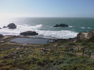
Lands End to Eagle's Point is a stunning section of the Coastal Trail. Park in or near the new lot at Point Lobos Ave and El Camino del Mar. Before or after the walk check out the ruins of Sutro Baths. I'd put some of that American Recovery and Reinvestment Act cash into rebuilding the baths, it looks like they were incredible.
If you follow the trial down the the baths then there's a short but very cool cave to explore which ends in another unique view of the pacific and the mouth of the Golden Gate.
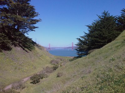
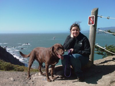
From Sutro Baths follow signs to Eagle's point. There are some very steep cliffs along the trail, so a leash is a really good idea for dogs.
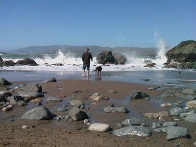
One worthwhile detour is to wonder down to Mile Rock Beach. It's a stony and impressively violent beach with a couple of lookouts on the way down with impressive views.
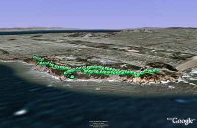
(3.16 miles, total elevation gain 457 feet, 1 hours, 24 minutes, average 2.24 mph, view in Google Earth, view in Google Maps)
Hike starts at: 37.783491, -122.510793.
Updated 2023-06-19 02:22:
Here's a video of the hike from June 18, 2023:
Related Posts
- Hill 88
- Coastal and Julian loop plus Black Sands Beach
- Point Reyes - Tomales Point
- Presidio Loop Hike
- Point Reyes - Drakes Estero
(Hike Map)
(Published to the Fediverse as: Lands End #hike #sfdogwalk #video #hikevid 3 mile hike from Lands End to Eagle's Point in San Francisco taking in Sutro Baths. )
Glen Park Canyon
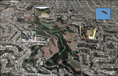
Glen Park Canyon is a short city hike — the trail gets increasingly dense as you walk into the canyon until you need to limbo your way under branches.
(1.51 miles, total elevation gain 909 feet, 47 minutes (average 1.92 mph), view in Google Earth)
Hike starts at: 37.737133, -122.442133.
Updated 2023-05-06 17:32:
Updating to add a hyperlapse video of the hike.
Related Posts
(Hike Map)
(Published to the Fediverse as: Glen Park Canyon #hike #sfdogwalk #video #hikevid 1.5 mile hike around Glen Canyon Park, a startling wilderness area in San Francisco, California. )