Creekside Trail to Big Leaf Trail Loop

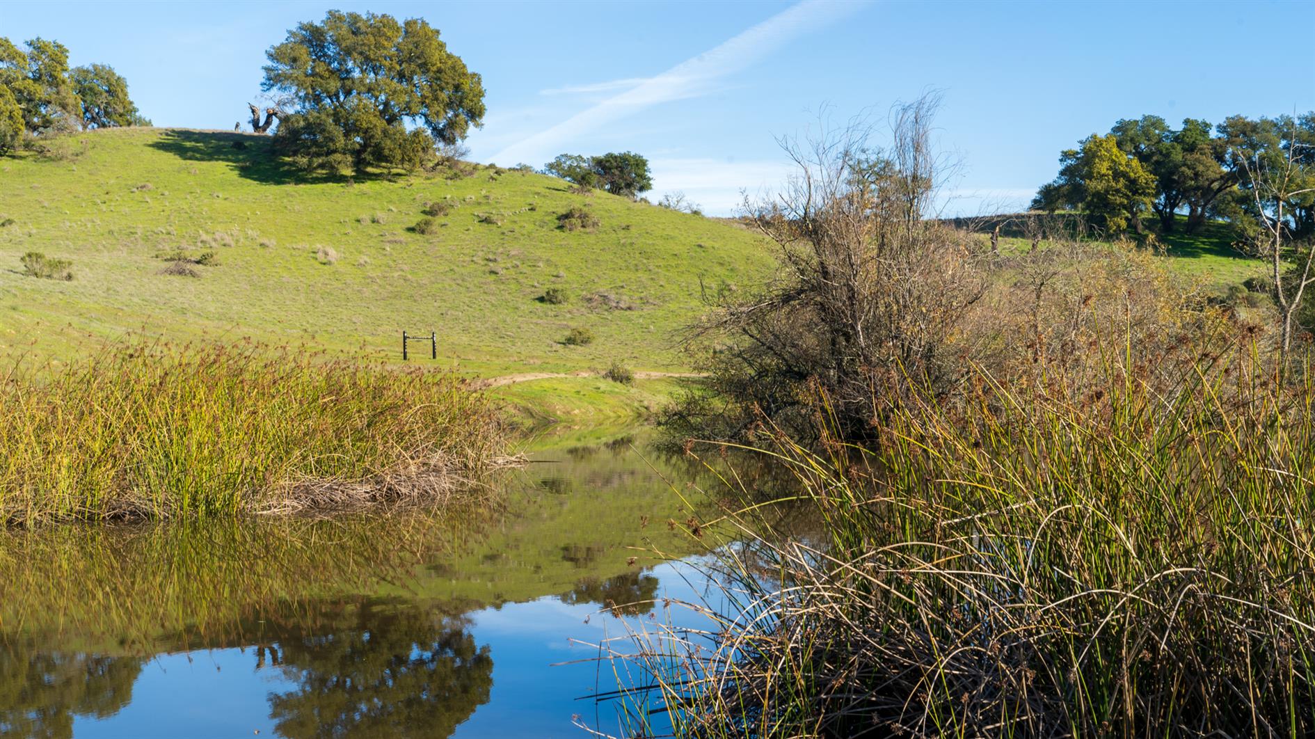
3.8 mile loop with 600 foot elevation gain in Shiloh Ranch Regional Park near Santa Rosa in Sonoma County.
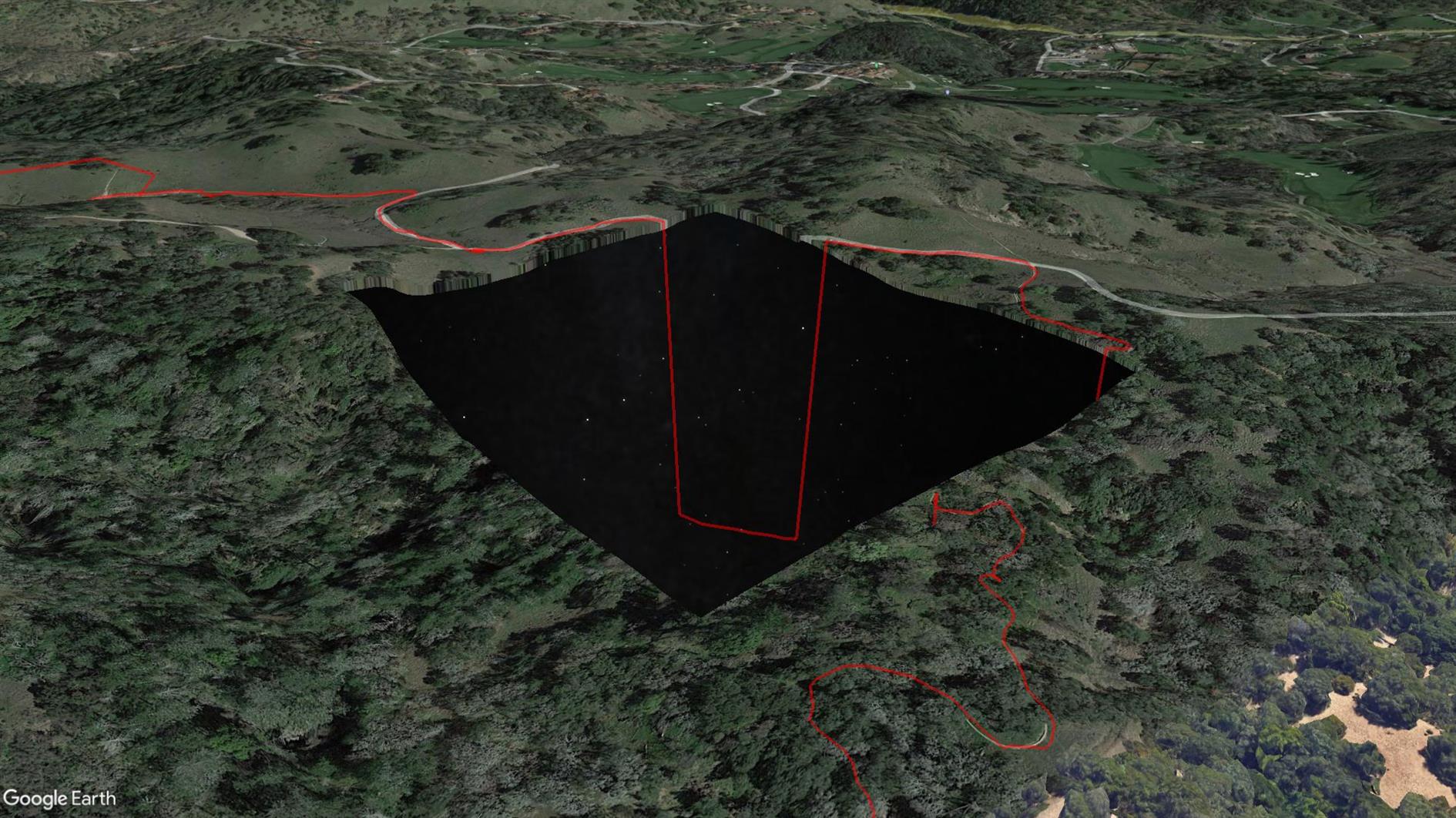
This is the first time my Pixel 4 XL GPS has failed me. Sometimes it wanders a little off trail, but this time it took a completely unauthorized trip to a Home Depot before eventually snapping back to reality. I've included it here but unlike any other track I've uploaded you might not want to use this one (see the route on AllTrails instead, distance incorrect below). The really strange thing is that when I look at the trail in Google Earth there is a missing tile around where the GPS freaks out and Google Earth sends the route plunging down into outer space (because it's clamping to its elevation model but the stars under Sonoma are not as far away as they look?) See the screenshot above. Something is odd at Shiloh Ranch...
Hike starts at: 38.525412, -122.762561. View in Google Earth.
Related Posts
You Might Also Like
(Hike Map)
(Published to the Fediverse as: Creekside Trail to Big Leaf Trail Loop #hike #hikevid #map #video 3.8 mile loop in Shiloh Ranch Regional Park, Sonoma, California. This hike includes a GPS failure and a suspicious missing tile in Google Maps that shows the stars below Sonoma. )
Sawmill Flats
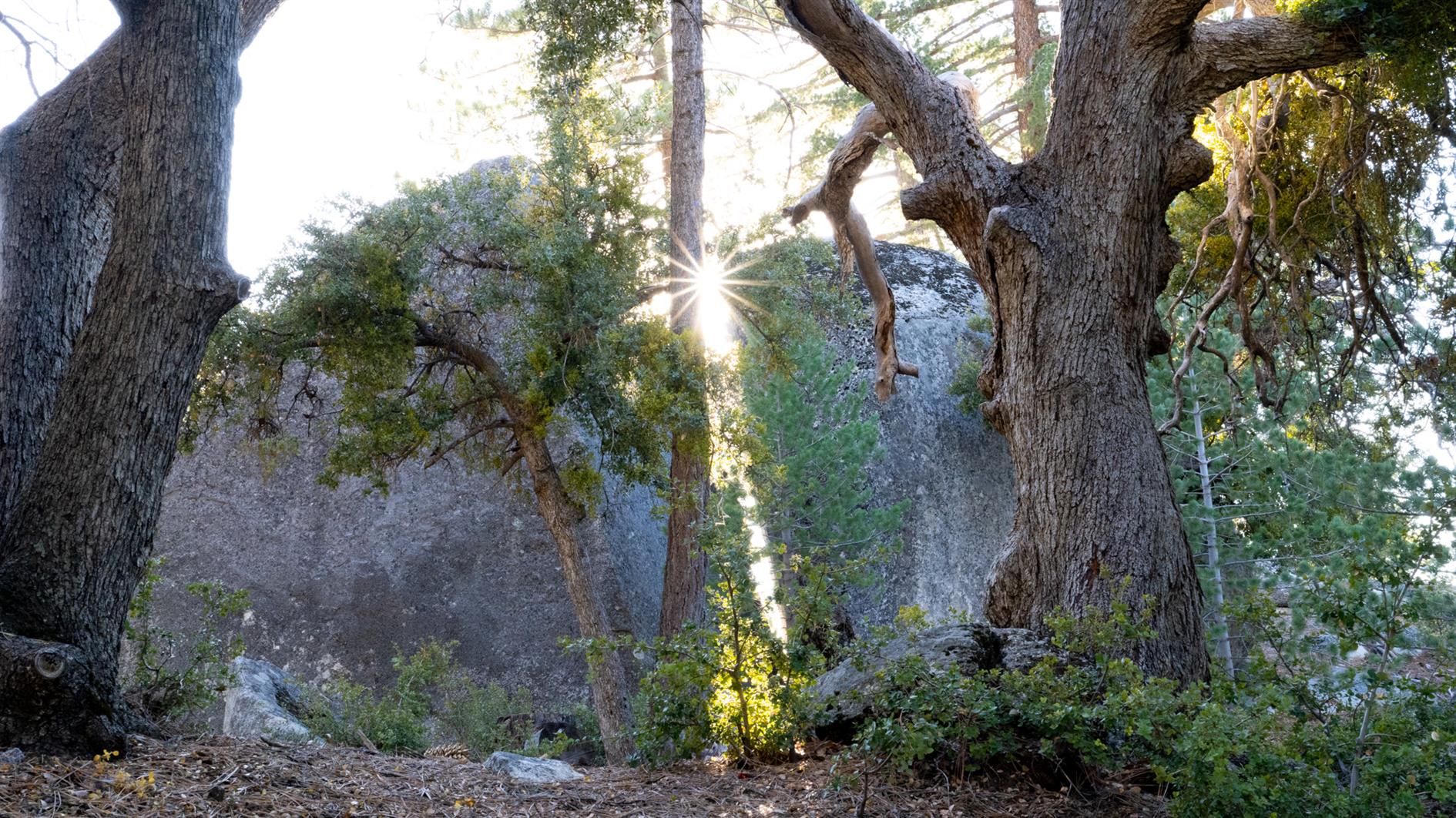
Four and a half mile hike from Stone Creek Campground in Mount San Jacinto State Park to the ruins of a sawmill and back again. The mill is hidden but watch out for a yellow sign off the trail.
The campground was closed for the season when we arrived and a permit is required. We phoned the ranger station who said the trail was off limits and to come get a permit and discuss other hikes. After much discussion it turned out the concern was illegal parking near the campground and after promising to find legal parking and walk in we were allowed to complete the hike.
I don't have a GPS track for this one. Usually I download a GPX to Gaia GPS on my phone and use this to follow the trail. Traveling without a laptop I tried to do this from the AllTrails mobile app which wanted a paid upgrade. I have used AllTrails a fair bit so was happy to pay, but even after upgrading you can only download locally to AllTrails, the mobile app won't allow you to generate a GPX. I understand the commercial desire to lock people into their app, but I have used Gaia GPS for years an trust it to not drain my battery or otherwise cause problems when off the beaten track. AllTrails also won't let you copy and paste from hike descriptions (even ones with a long URL to check for road closures in them), and you can't export the route you took either (which I do from Gaia GPS to generate maps and elevation profiles for this blog). So I'll be cancelling that AllTrails subscription and have learned to get an export from a laptop and ignore the mobile app.
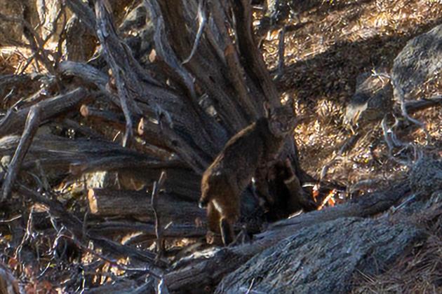
Saw a bobcat which is a first. Probably due to the trail being closed and quiet.
Related Posts
- Creekside Trail to Big Leaf Trail Loop
- Teague Hill Preserve
- Grabtown Gulch and Borden Hatch Mill in Purisima Creek
You Might Also Like
(Hike Map)
(Published to the Fediverse as: Sawmill Flats #hike #bobcat #jacinto #video Four and a half mile out and back hike to the ruins of a sawmill in Mount San Jacinto State Park near Idyllwild, California. Starts at 6,000 feet with around 800 gain. Trailhead at Stone Creek Campground. )
San Francisco Crime 2003 to 2021

San Francisco is apparently going to hell with criminals free to do as they please with no fear of consequences. I decided to take a look at the data.
The video above shows a timelapse of SFPD incidents from 2003 through yesterday. Each frame is a day and shows incidents from the previous seven days. The top left corner of the video shows the date and the seven day count of incidents.
I grouped the reported categories into a few colors. Red is used for murder and rape. Orange for arson and kidnapping. Yellow for thefts and assaults. Purple for sex and drugs. Grey for anything else. I excluded some categories from the data (recovered vehicle, traffic collision, case closure and non-criminal).
SFPD reports the location of incidents as the closest intersection. To keep everything visible I move the location randomly within a tenth of a mile where there is a specific location reported. For crimes without a location I use a random spot within half a mile of the center of the police district (or the center of San Francisco if the district is missing - this is unusual).
The volume of incidents changes a bit during the ~18 years shown in the video, but the only real outlier is the dip following the start of the coronavirus pandemic in March 2000. Crime picks back up after this but so far hasn't returned to the level it was at before the pandemic.
Police incidents come from two datasets: Police Department Incident Reports: 2018 to Present and Police Department Incident Reports: Historical 2003 to May 2018. San Francisco is plotted using Elevation Contours. The pre and post 2018 data sets use different categories but I coded both to the set of colors outlined above. There is a drop in incidents right at the end of the video which I expect is caused by incomplete data rather than any change in crime rate.
Related Posts
- San Francisco 311 Cases Animation
- San Francisco New Year's Eve Timelapse 2020
- San Francisco New Year's Eve Timelapse
You Might Also Like
- Use WPF Dispatcher to invoke event handler only when needed
- Have we Already Proved that the Simulation Hypothesis is False?
- Diary of a Living Room
(Published to the Fediverse as: San Francisco Crime 2003 to 2021 #timelapse #sanfrancisco #crime #datalapse #coronavirus #video Timelapse video animation showing crimes in San Francisco color coded by category from 2003 to 2021 using SFPD incident reports from SFData.gov. )
Fleet Week 2021 Air Show (Photos and Timelapse)

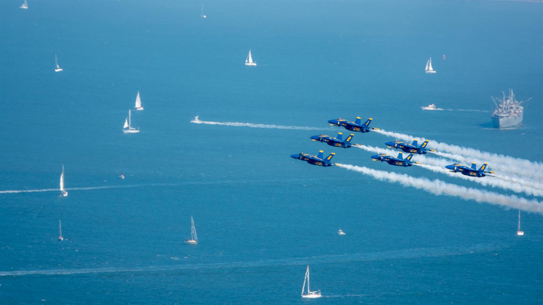
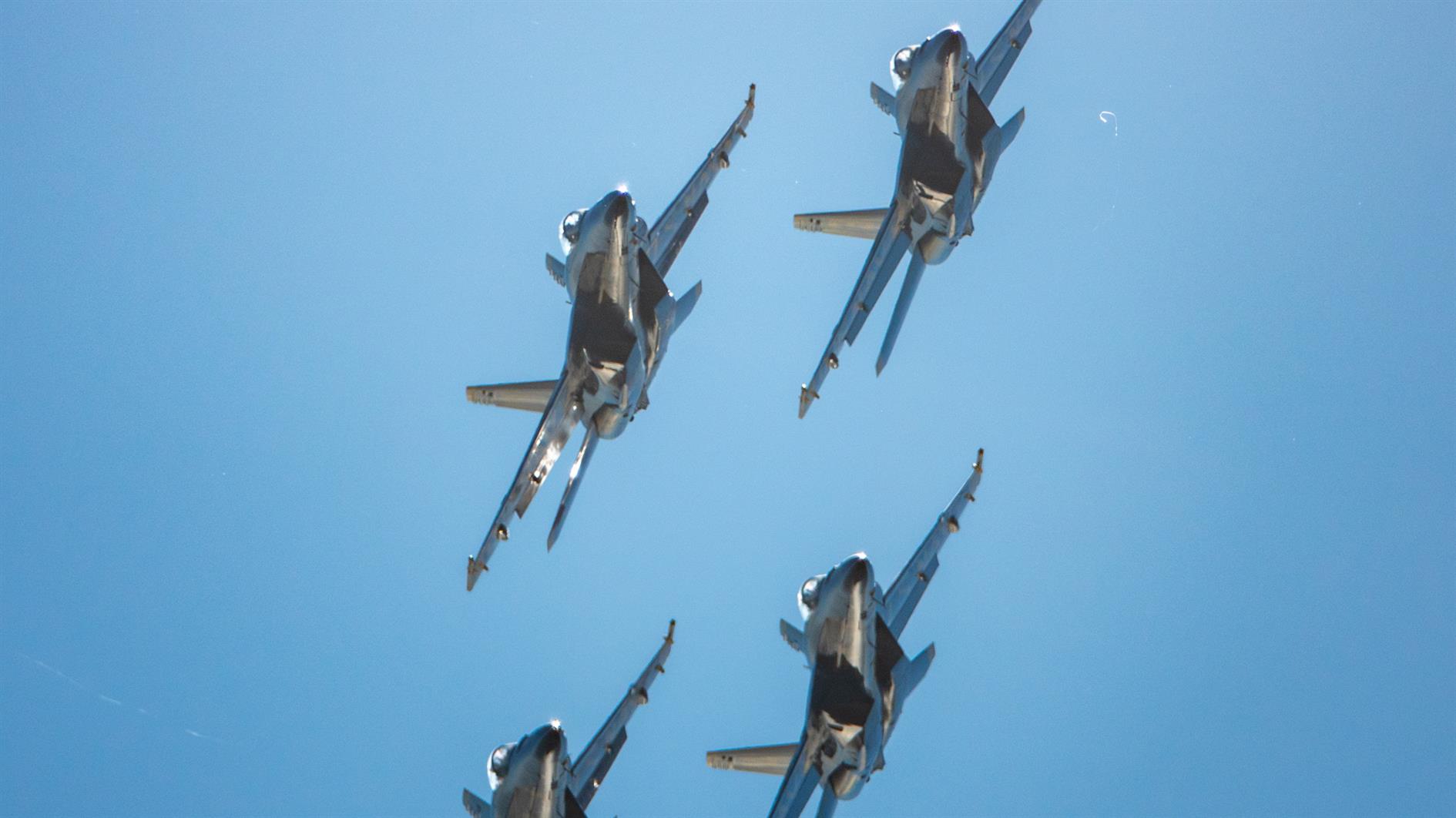
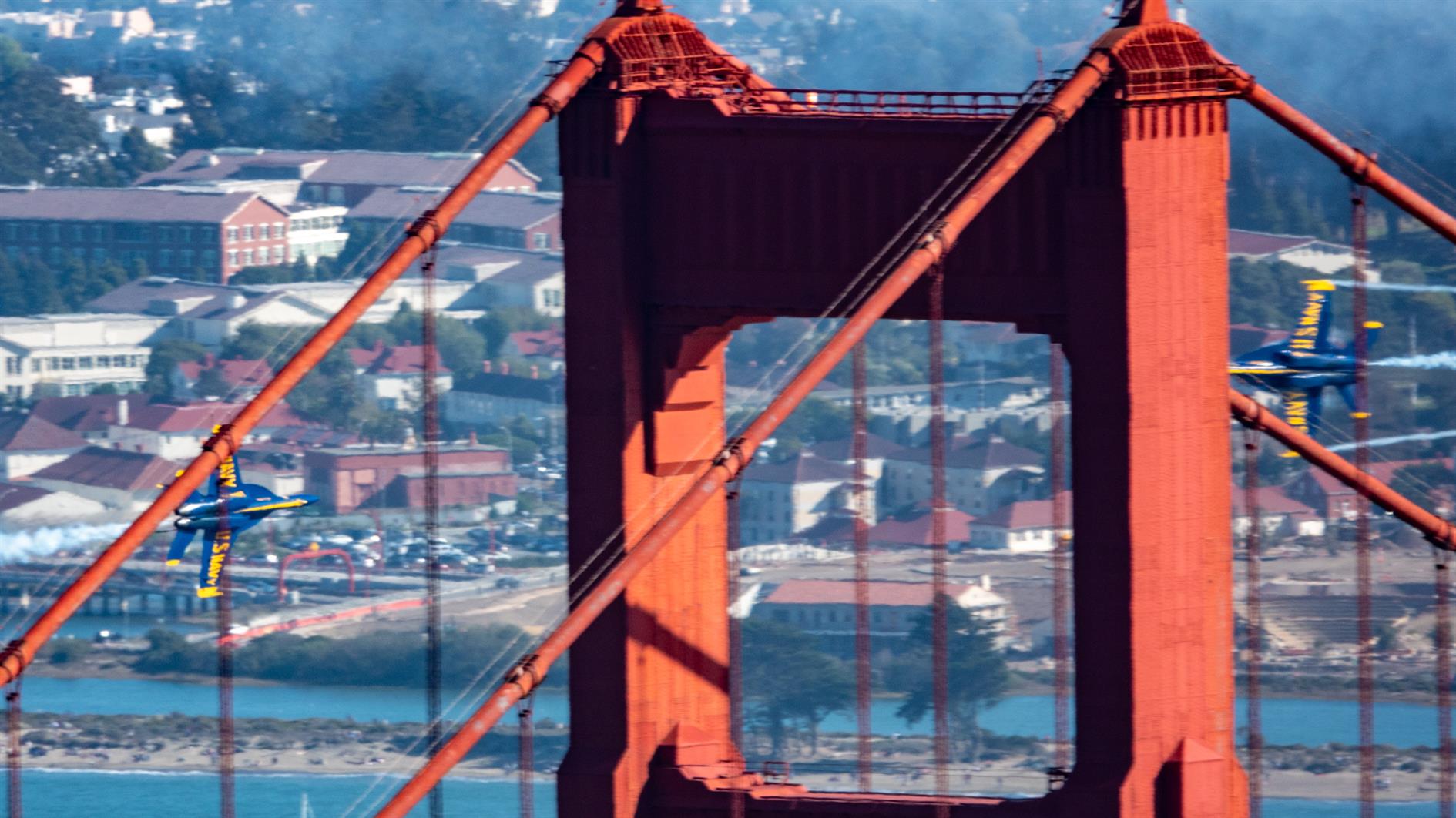
Blue Angels at the San Francisco 2021 Fleet Week Air Show.
Here's a timelapse video of the United 777, Fat Albert and the full Blue Angels performance, shot from Slacker Hill in the Marin Headlands:
(Previously: Fleet Week 2019 Air Show)
Related Posts
You Might Also Like
(Published to the Fediverse as: Fleet Week 2021 Air Show (Photos and Timelapse) #timelapse #fleetweek #sanfrancisco #ggb #video Photos and timelapse video (4k) from the San Francisco 2021 Fleet Week Air Show. )
Sugarloaf Stars and Milky Way
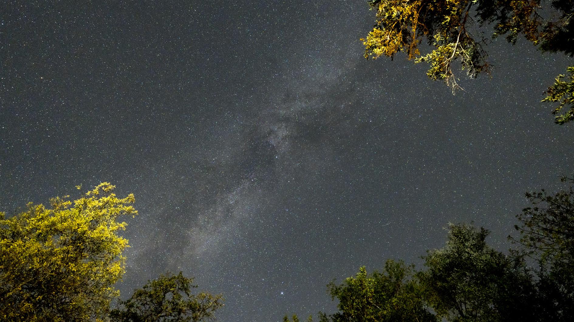
4K timelapse of stars and the milky way (and various planes and satellites) over the campground at Sugarloaf Ridge State Park. Shot while relaxing by the campfire so every time I throw on a log you can see the trees light up and then some smoke drift across the frame.
(Previously: Sugarloaf Stars)
Related Posts
You Might Also Like
(Published to the Fediverse as: Sugarloaf Stars and Milky Way #timelapse #stars #4k #sugarloaf #milkyway #video 4K timelapse of stars and the milky way over Sugarloaf Ridge State Park in Sonoma, California. )
Sunny afternoon at Fort Funston (a timelapse)

Timelapse of a pleasant sunny afternoon at Fort Funston, part of the Golden Gate National Recreation Area.
This is the first time I've tried to shoot a timelapse using my Pixel 4 XL. It's easy enough to work with, although frustratingly you can only deal in 5x's and 10x's and not actual intervals. It would be great to have a bit more control. But given time to kill and no good camera it was a lot more fun than no timelapse at all.
(Previously: Humpback Whale at Fort Funston)
Related Posts
You Might Also Like
(Published to the Fediverse as: Sunny afternoon at Fort Funston (a timelapse) #timelapse #beach #fortfunston #video Timelapse shot at Fort Funston (Golden Gate National Recreation Area) in San Francisco, California on a sunny afternoon. )
Twin Peaks Loop
I have previously described Twin Peaks as not much of a hike, which is absolutely true if you drive there. When I first moved to San Francisco I lived in Noe Valley and used to cycle up to Twin Peaks and then try to get home without pedalling. For many years after that I'd take visitors up to the top and developed a somewhat weird tradition of taking each new child there soon after they were released from the hospital.
Post lockdown I'm up there most weeks. This is my five mile loop which starts heading up Ulloa from West Portal to Portola. Portola breaks the climb briefly as you pass the striking herchurch and controversial Twin Peaks gas station before heading up Twin Peaks Boulevard to the 922 foot summits. For a while Twin Peaks Boulevard was entirely closed to traffic (although you really had to keep an eye out for high speed skateboarders). Unfortunately it's now open all the way to Christmas Tree Point. Head down the north side to Clarendon and follow this all the way down to Forest Hill and then back to West Portal.
(Previously: Twin Peaks 360 4K, Twin Peaks, San Francisco from Twin Peaks)
Hike starts at: 37.741879, -122.471354. View in Google Earth.
Updated 2023-08-10 03:02:
Hyperlapse of this hike from August 9, 2023.
Related Posts
You Might Also Like
(Hike Map)
(Published to the Fediverse as: Twin Peaks Loop #hike #sanfrancisco #twinpeaks #coronavirus #map #video #hikevid #sfdogwalk Five mile loop hike from West Portal up Ulloa and Portola to the 922 foot summits of Twin Peaks and then back down Clarendon and Forest Hill. )
Adobe Super Resolution Timelapse (Crystal Growth)
This is the third batch of crystals from our National Geographic Mega Crystal Growing Lab kit (see the previous two).
I have been meaning to experiment with Adobe's Super Resolution technology and this seemed like a good project for it. The video below has the same timelapse sequence repeated three times. If you're not bored of crystals growing yet you soon will be (don't worry, this is the last for now). The first version is a 2x digital zoom - a 960x540 crop of the original GoPro footage. The second version uses Super Resolution to scale up to full 1920x1080 HD. Finally I added both side by side so you can try to tell the difference.
Super Resolution generates a lot of data. I tried to use it once before for a longer sequence and realized that I didn't have enough hard drive space to process all the frames. In this case I upscaled the 960x540 JPEGs which went from 500K to 13MB, quite a jump. I don't see a huge difference in the side by side video though and wouldn't go through the extra steps based on these results. It's possible that going to JPEG before applying super resolution didn't help with quality. It's also possible that Adobe doesn't train its AI on a large array of crystal growth photos so I can imagine it might work better for a more traditional landscape timelapse. I'll test both these hypotheses together the next time I 10x my storage.
Related Posts
You Might Also Like
- Methyl L-α-aspartyl-L-fucking-phenylalaninate
- Maybe Elon really is playing three-dimensional chess
- Zeno's Watermelon
(Published to the Fediverse as: Adobe Super Resolution Timelapse (Crystal Growth) #timelapse #crystals #ml #video Time lapse using Adobe Super Resolution to upscale each frame before creating the video (source is crystals growing over two weeks with photos every five minutes). )
Crystal World
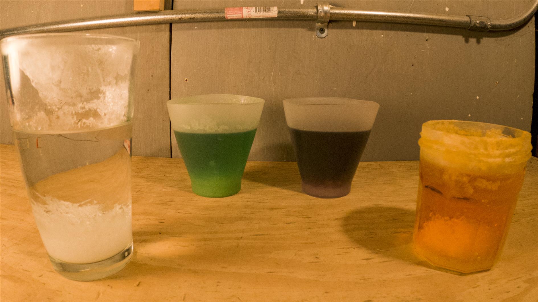
A timelapse of four containers growing crystals from the National Geographic Mega Crystal Growing Lab. The sequence was shot over two weeks (one frame every four minutes, running at 60 frames per second).
It should have taken less time. They recommend a growing area that is at least 68 degrees. This shouldn't be a problem with most of the country suffering record temperatures under heat domes if not actively burning in record breaking wildfires, but San Francisco is experiencing its coldest summer in more than five decades so two weeks seems like the minimum.
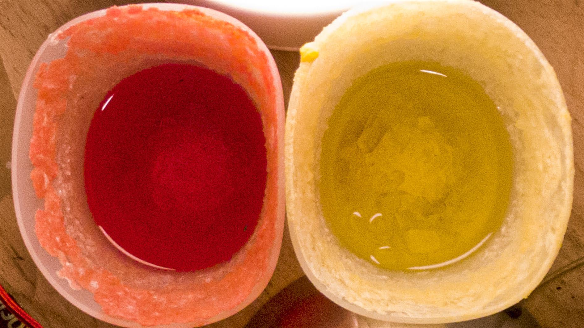
Other than not attempting to grow crystals in San Francisco, the other lesson learned is that you really want to use the two silicone cups included in the kit. We tried a pint glass that just grew fuzz (possibly due to the age and pitted nature of the glass) and a jam jar that grew cute small crystals that then made a decent attempt at escaping down the outside. I think three weeks and it would be a full J. G. Ballard situation.
Updated 2021-09-04 18:54:
Second batch. This time shot from above. It's still cold, so this is three weeks, 5 min interval and 60 frames per second for the timelapse:
Updated 2021-09-12 12:57:
Third batch. We're well into September but San Francisco is still bathed in fog. This is still at 5min per frame, but only took two weeks as I moved the lights closer in. For this timelapse I experimented with Adobe Super Resolution so the video has the same sequence three different ways (I wrote a separate post on the Super Resolution experiment).
Related Posts
- Adobe Super Resolution Timelapse (Crystal Growth)
- Timelapse, Week of Jan 10
- Super Flower Blood Moon Eclipse
You Might Also Like
(Published to the Fediverse as: Crystal World #timelapse #crystals #video Timelapse of growing crystals from the National Geographic Mega Crystal Growing Lab shot over two weeks (photo every 4 mins, video at 60fps). )
Milky Way and stars over Redding

Time lapse of stars and the milky way over Redding, California. Nice to have got the milky way as there is still a fair bit of light pollution in this area. Shot over three nights in July 2021. Shot on a Sony A7C with 20mm f1.8 G lens. Post processed in Lightroom, LRTimelapse, Resolve and Filmstro Pro.
Related Posts
You Might Also Like
(Published to the Fediverse as: Milky Way and stars over Redding #timelapse #stars #milkyway #video 4K time lapse of stars and the milky way over Redding, California. )