Hill 88

By Robert Ellison. Updated on Tuesday, September 7, 2021.

Hill 88 Hike

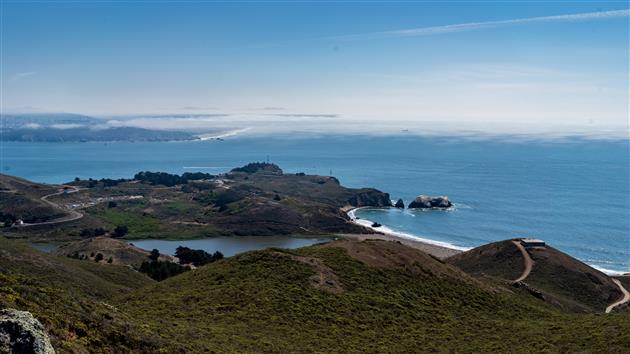
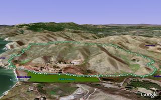
Hill 88 is a favorite walk when the Marin headlands are free from fog. Starting from Fort Cronkhite the Coastal Trail winds up to Hill 88 at 960ft, past various WWII era coastal defenses. Cross the ridge and descend down Wolf Ridge Trail and Miwok Trail to complete a 4.5 mile loop.
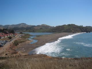
Rodeo Beach

Rodeo Beach viewed from the Coastal Trail. As you ascend there are views of the Golden Gate Bridge and San Francisco.
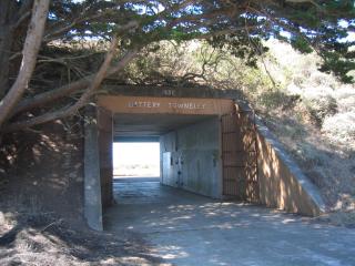
Battery Townsley

Battery Townsley, one of several coastal defenses passed on the walk.
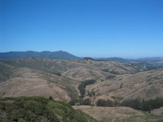
Mount Tamalpais from Wolf Ridge Trail

View of Mount Tamalpais as you begin to descend Wolf Ridge Trail.

(4.56 miles, total elevation gain 1,142 feet, 1 hour 38 minutes (average 2.79 mph), view in Google Earth)

Hike starts at: 37.832683, -122.526217.

Updated 2021-09-07 17:55:

Hill 88

Having done this walk many times I would now recommend doing it counterclockwise. You get a nice flat stretch to warm up, a fairly steady climb to the top and then can enjoy the ocean views on the way down if the fog is cooperating.

Updates

San Francisco from Hill 88

San Francisco from Hill 88

This panoramic photograph offers an expansive view from Hill 88, showcasing the undulating terrain of the Marin Headlands with the sprawling cityscape of San Francisco in the hazy distance. The foreground is a tapestry of rolling hills, painted in muted earth tones of greens and browns, interspersed with patches of wild shrubs. The midground reveals the glint of a waterway catching the light, possibly the entrance to the San Francisco Bay, its surface a mirror to the softly veiled sky above. The distant city is shadowy against a palette of diffused sunlight and cloud cover, creating a gentle contrast between nature's ruggedness and the urban sprawl. A vast sky, dappled with tendrils of clouds, stretches endlessly above, adding a sense of infinite possibility to this serene landscape.

The composition of the photograph adheres to a beautifully balanced panoramic style, capturing the sweeping scope of the scene from left to right in a continuous flow. The use of leading lines formed by the ridges of the hills guides the viewer’s gaze naturally across the landscape and toward the distant shore. The asymmetrical placement of the horizon enhances the sense of openness, allowing the sky to occupy a significant portion of the frame and imparting an airy quality. However, one minor drawback is the slightly muted color tones, which, while adding subtlety, might benefit from a bit more vibrancy to bring the natural textures into sharper focus. Despite this, the photograph successfully captures the serene majesty of the landscape, inviting viewers to immerse themselves in the tranquil expanse that stretches from the hills to the sea.

Add your comment...

Related Posts

(Hike Map)

(Published to the Fediverse as: Hill 88 #hike #hill88 #marinheadlands #sanfrancisco Marin Headlands hike up Hill 88, a loop of just under 5 miles and a little over 1,000 feet of elevation gain. )

Map

Comments

Joseph

Hill 88:
37.842,-122.532

Add Comment

All comments are moderated. Your email address is used to display a Gravatar and optionally for notification of new comments and to sign up for the newsletter.