I Thought He Came With You (ITHCWY) is Robert Ellison's blog.
Assassination Coordinates
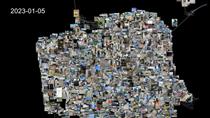
Testing out some shapefile code with a zoom into San Francisco. This uses five different shapefiles:
Country borders are from Eric Muller's fips-10 shapefile.
States and US Counties come from the United States Census Bureau.
San Francisco 5 foot elevation contours from DataSF.
Finally the street map for San Francisco is from data.gov.
These are almost all based on different projections and I did my best to actually line everything up but if you're heading over for coffee it's probably best to stick with Google Maps.
Related Posts
- San Francisco 311 Cases Animation
- San Francisco Street Tree Datalapse
- San Francisco Crime 2003 to 2021
- Coronavirus Hikes: March 2020
- Timelapse, Week of Jan 17 2022
(Published to the Fediverse as: Assassination Coordinates #etc #video #sanfrancisco #shapefile #animation Animation that zooms from a global map to the streets of San Francisco using five different shapefiles. )
Add Comment
All comments are moderated. Your email address is used to display a Gravatar and optionally for notification of new comments and to sign up for the newsletter.