Route Map
I have been in the habit of posting each plane I fly on for a long time.
This started on Twitter, where for a while there was this #boarding hashtag so you could chat with people in transit from the same airport by IATA code (like #boarding #sfo). That dropped out of usage, because why would you do that, but I continued on Facebook until I deleted social media in 2018. After a brief lapse I started posting to my blog. I have a vague intention to resurrect some older flights with AI and build out a more complete history.
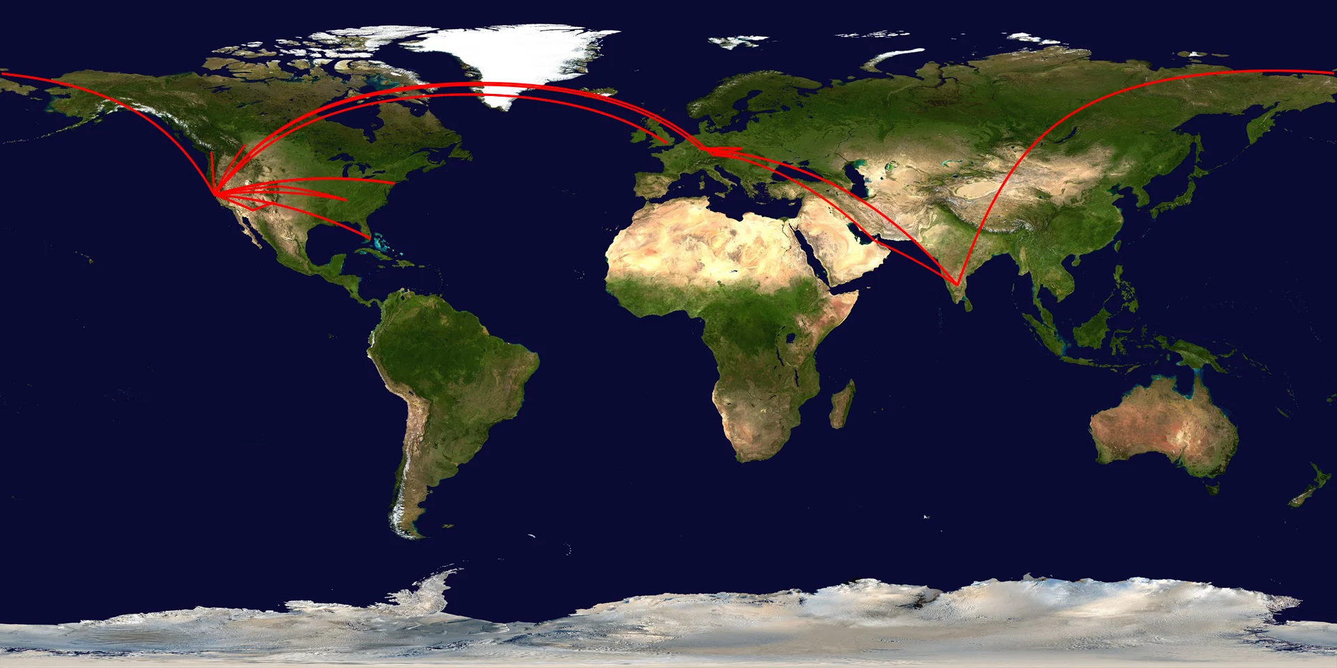
After adding flights here for a few years it seemed like a good idea to do some visualization. The image above (click for a larger version) is my current route map, updated after each flight. The routes are great circles rather than the actual track (created via the .net version of GeographicLib and this geolocation of airports). You can view individual flights here. I could probably use a carbon offset or two (unless this).
Required disclaimer:
This site or product includes IATA/ICAO List data available from https://github.com/ip2location/ip2location-iata-icao.
Updated 2026-02-07 23:07:
The vague intention turned into a mild obsession and so I mined email for more flights. I have email going back to 1996 and quickly whipped up two scripts via GitHub Copilot and Claude Sonnet 4.5 to process them. The first searched and downloaded any likely candidates from gmail and converted the HTML email to markdown to save on tokens. The second ran all the candidates through GPT 5 mini to extract the details. I then added a few older flights from memory resulting in the image above. There are some work emails I don't have access to so I'm sure it's not totally comprehensive, but I'm now up to 277 flights and approximately 779,883 miles.
Add Comment
All comments are moderated. Your email address is used to display a Gravatar and optionally for notification of new comments and to sign up for the newsletter.