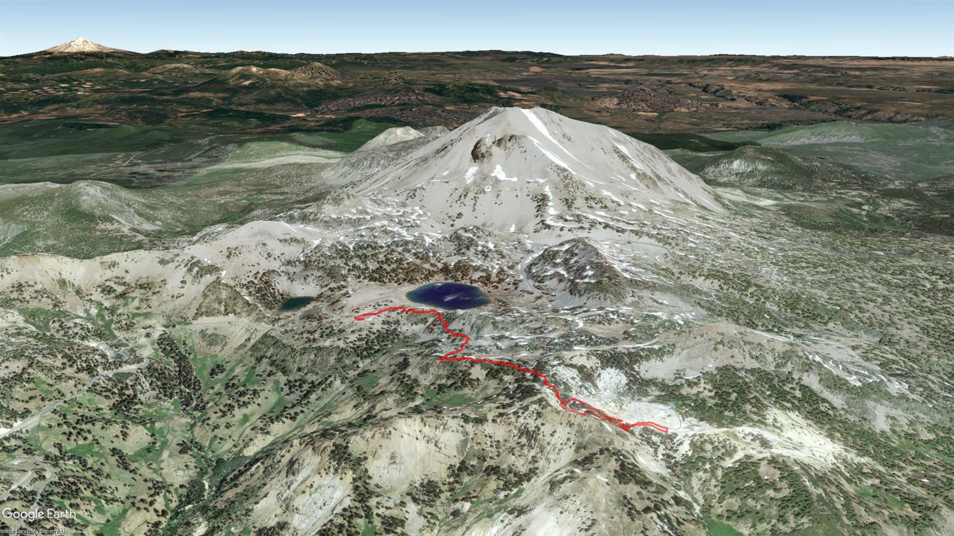
Devils Kitchen
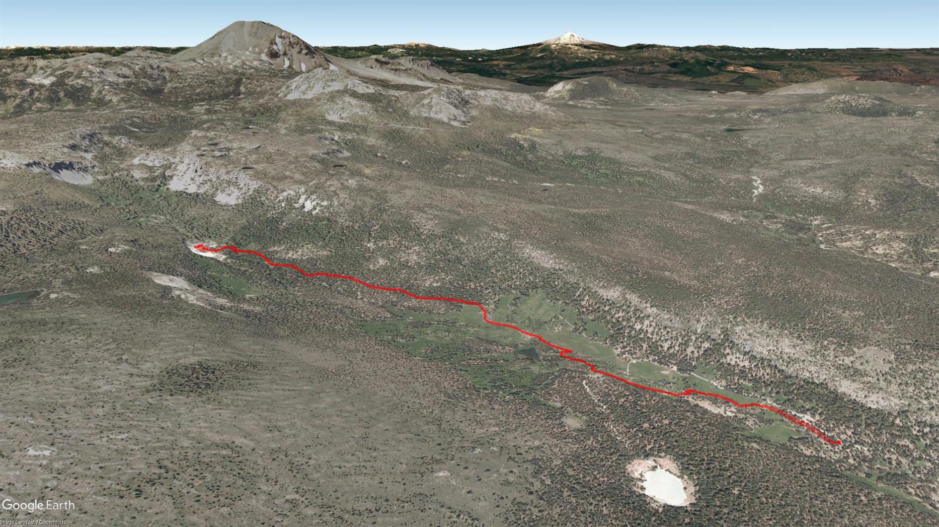
Four and a half mile out and back hike from the Warner Valley area of Lassen Volcanic National Park to the Devils Kitchen.
Hike starts at: 40.442054, -121.393882. View in Google Earth.
Related Posts
- Summit Lake to Echo Lake in Lassen
- Bumpass Hell
- Lake Helen
- Devil's Slide Trail
- Point Reyes - Divide Meadow Loop
(Hike Map)
(Published to the Fediverse as: Devils Kitchen #hike #lassen #map 4.5 mile hike to Devils Kitchen in the Warner Valley area of Lassen Volcanic National Park. )
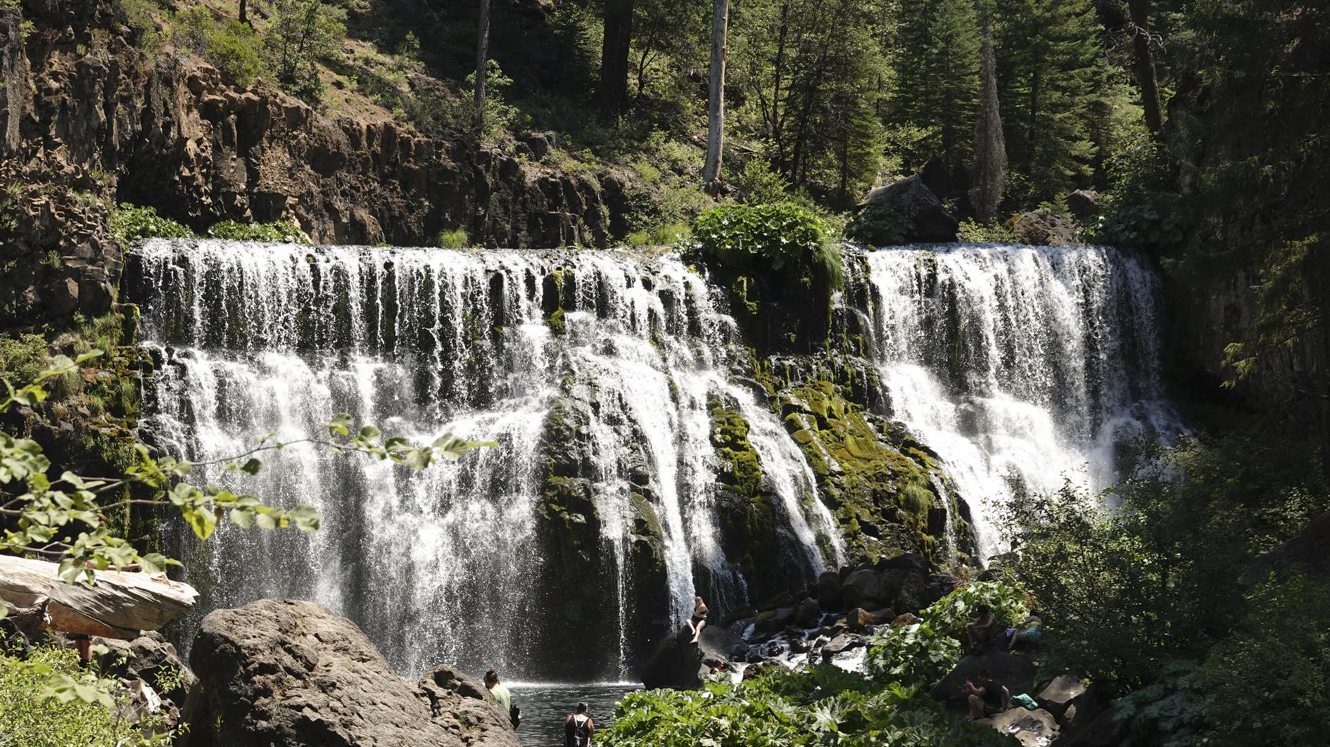
McArthur-Burney Falls
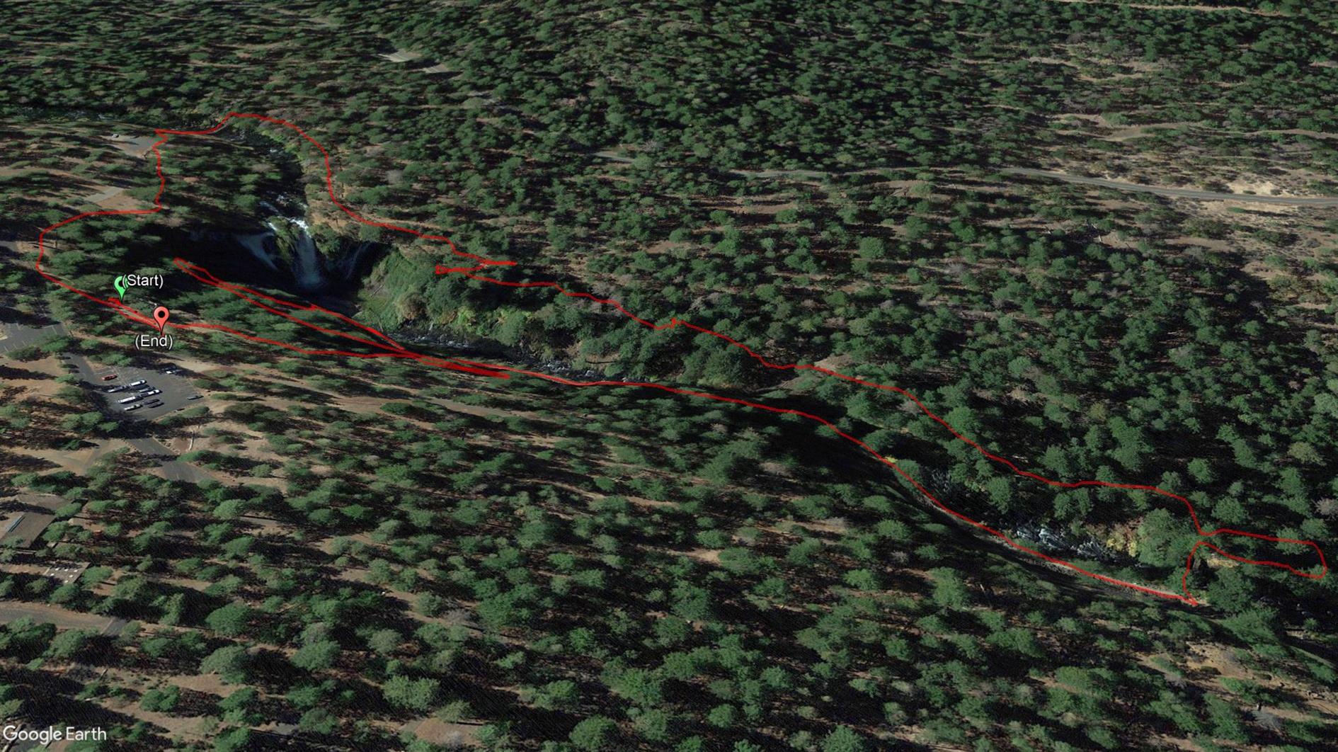
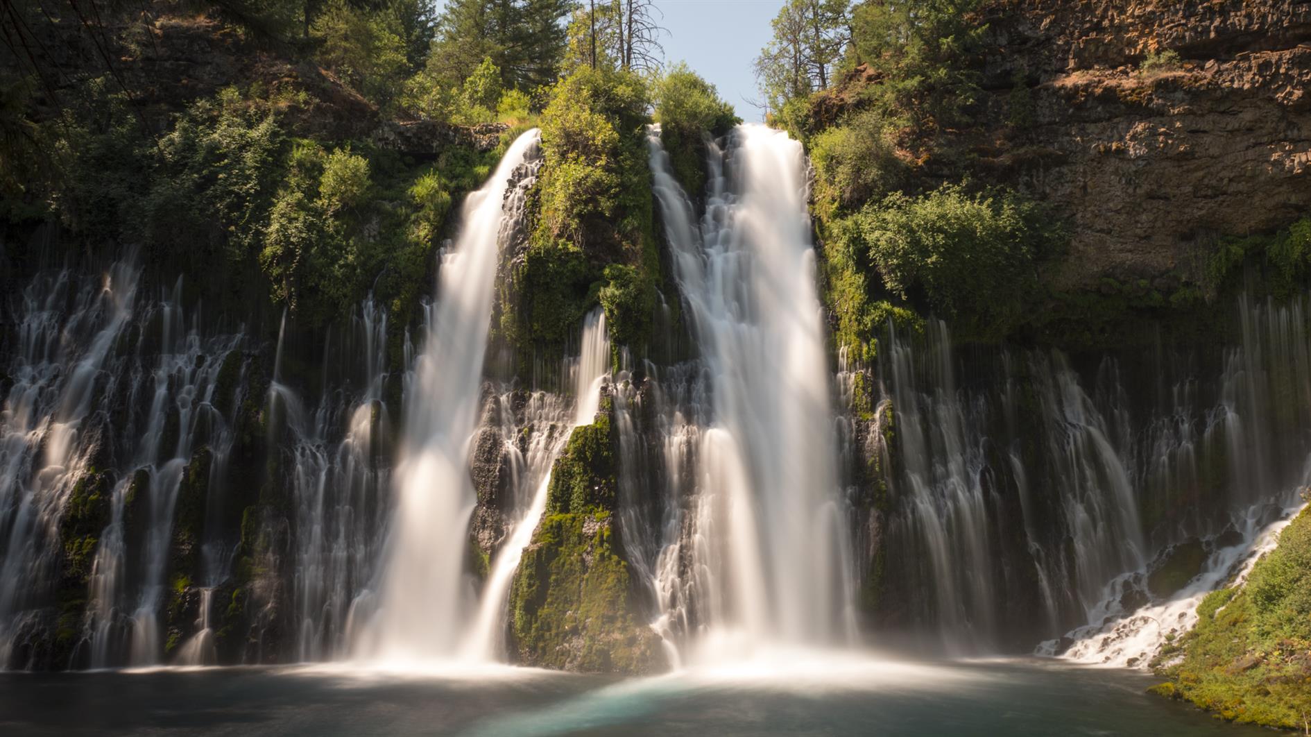
Short hike taking in the spectacular McArthur-Burney Falls.
Hike starts at: 41.01255, -121.650831. View in Google Earth.
Related Posts
- McCloud River Trail (Three Waterfalls)
- San Pedro Valley Park Waterfall Loop
- Coronavirus Hikes: July 2020
- Richards Fire Road
- Devil's Slide Trail
(Hike Map)
(Published to the Fediverse as: McArthur-Burney Falls #hike #waterfall #map A short walk to take in McArthur-Burney Falls near Burney, California. )
Lake Helen
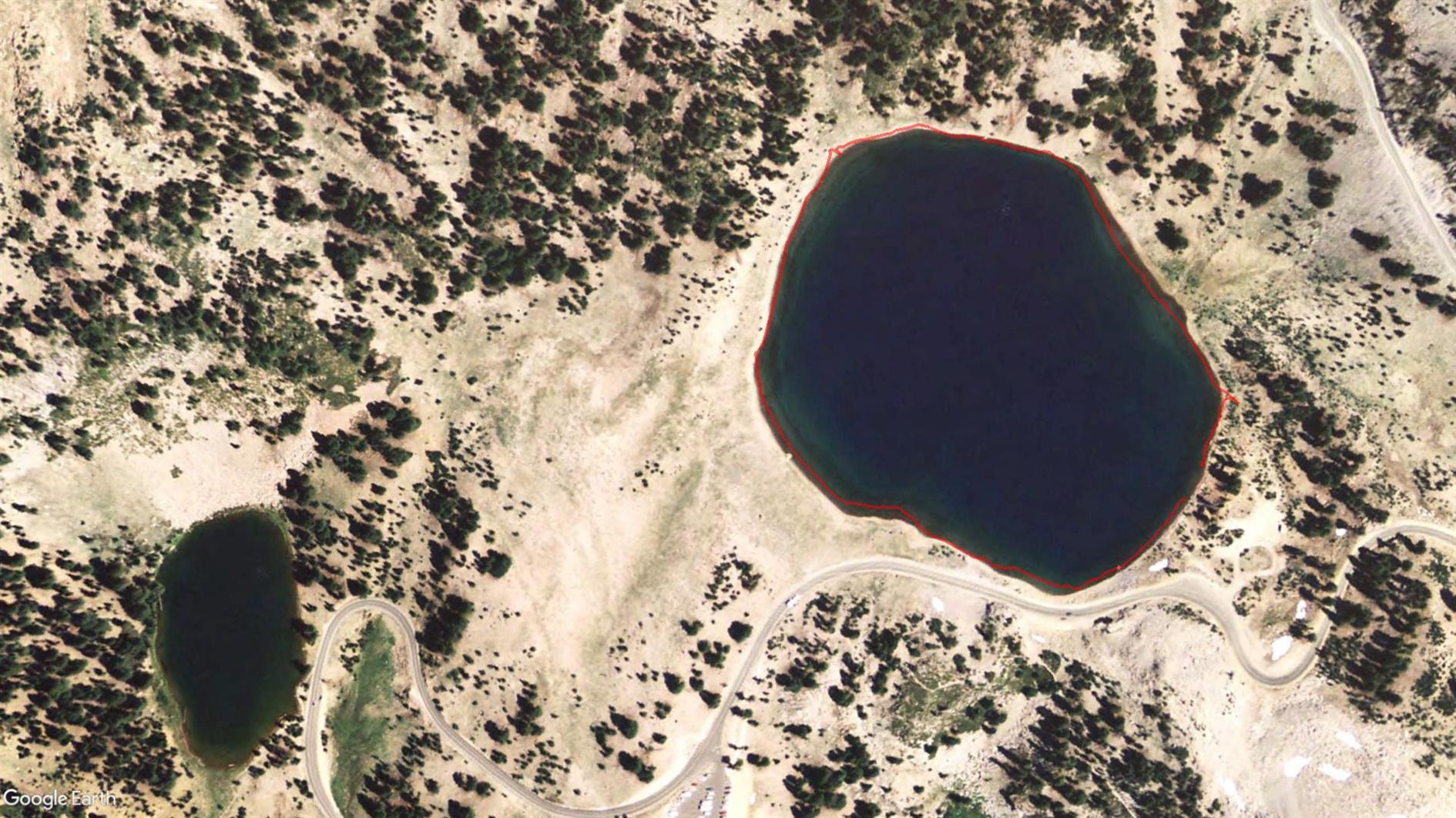
It's three quarters of a mile round Lake Helen, not really worth doing unless you're waiting for someone to finish paddling...
Hike starts at: 40.467433, -121.508604. View in Google Earth.
Related Posts
(Hike Map)
(Published to the Fediverse as: Lake Helen #hike #lassen #map Less than one mile hike around Lake Helen in Lassen Volcanic National Park, California. )
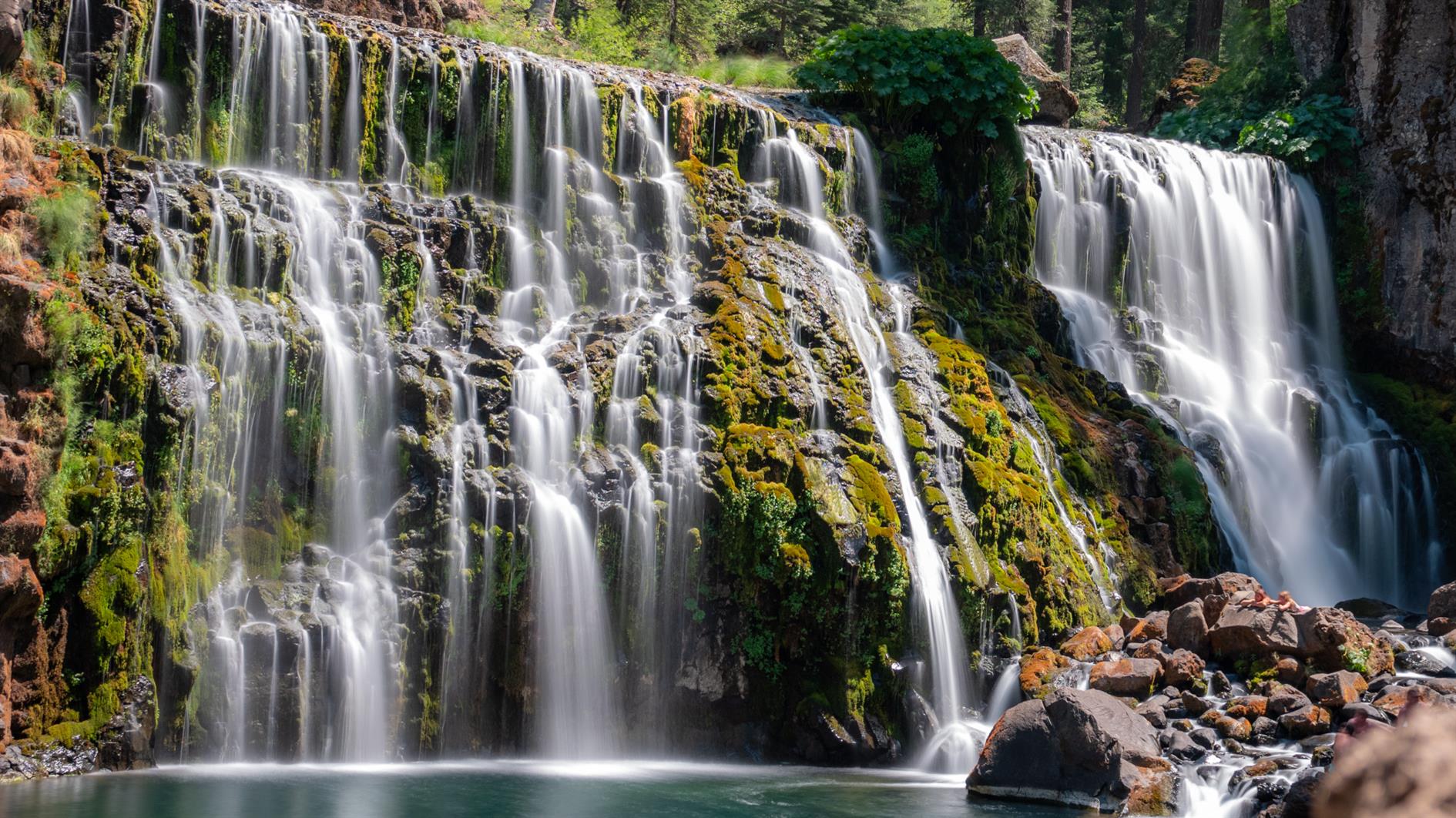
McCloud River Trail (Three Waterfalls)
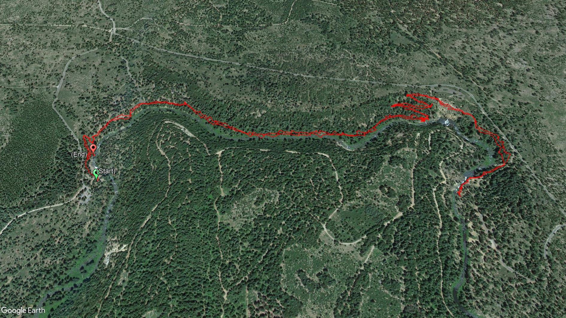
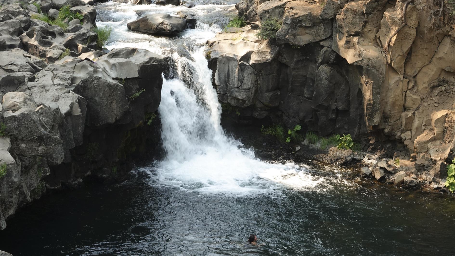
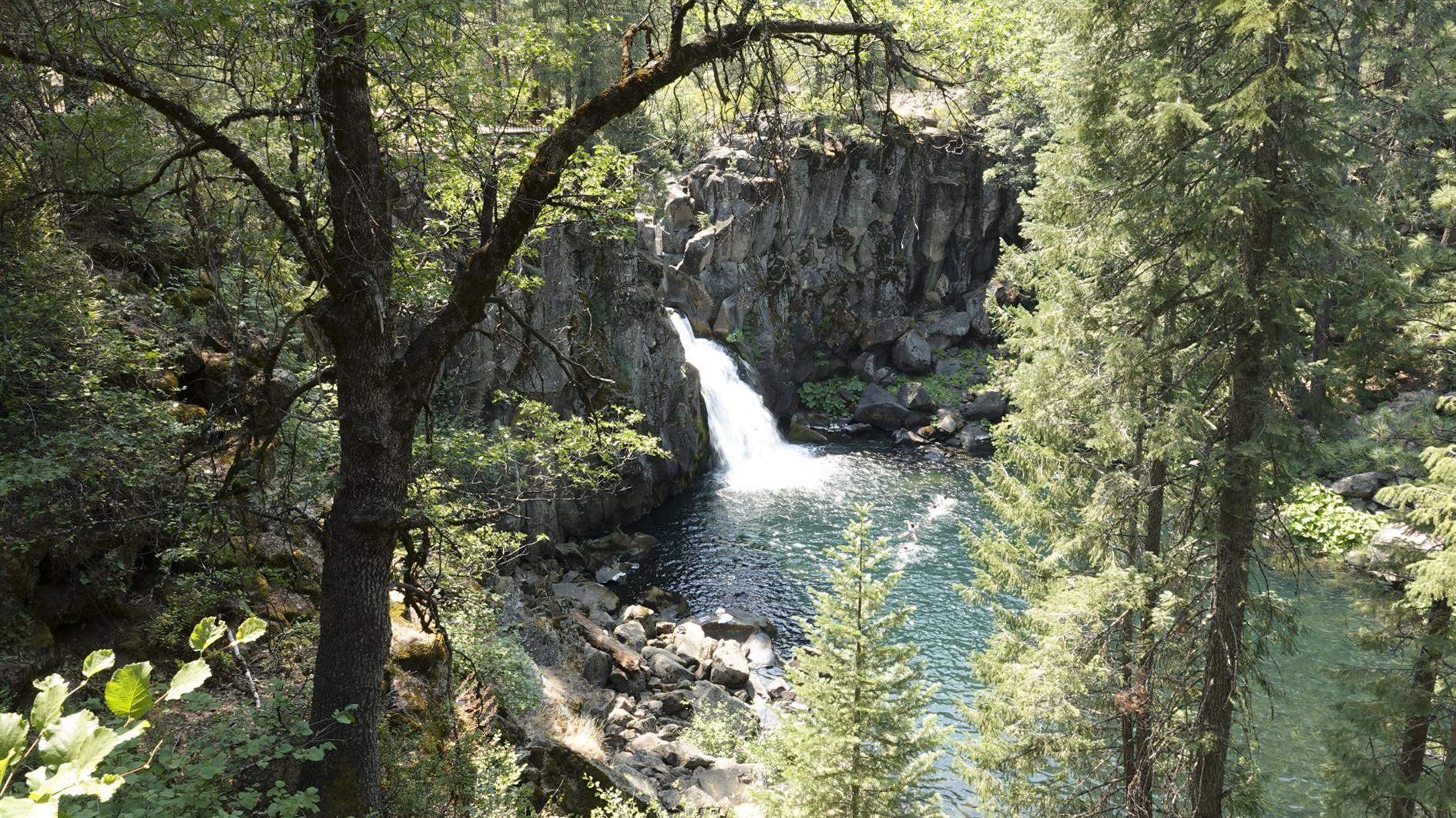
A four mile out and back hike taking in three waterfalls along the McCloud River near Mt Shasta.
Hike starts at: 41.240749, -122.024747. View in Google Earth.
Updated 2021-07-22 12:45:
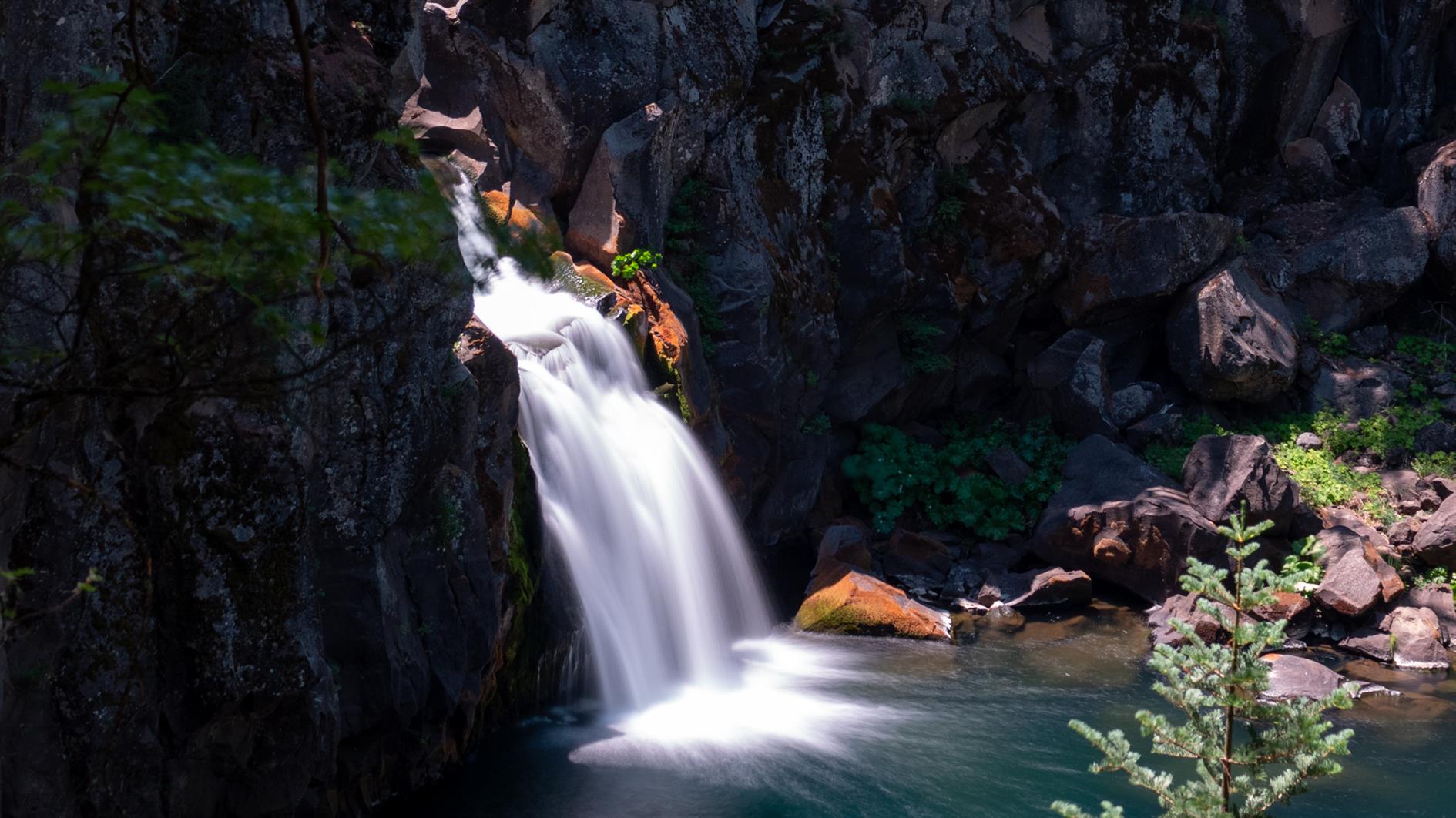
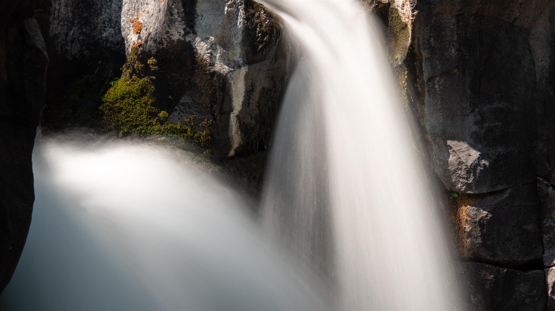
Did the same hike again this year - it's worth repeating. Here are some long exposure shots of the three waterfalls.
Related Posts
(Hike Map)
(Published to the Fediverse as: McCloud River Trail (Three Waterfalls) #hike #map #waterfall #shasta 4 mile out and back hike taking in three waterfalls on the McCloud River Trail near Mount Shasta in California. )
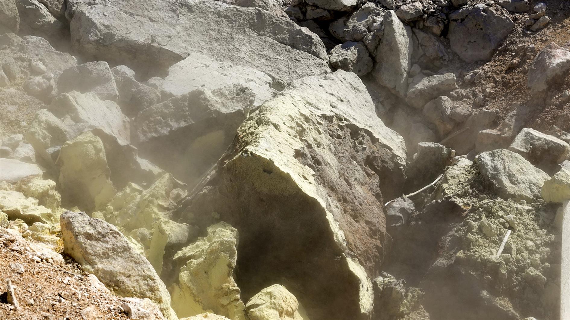
Bumpass Hell
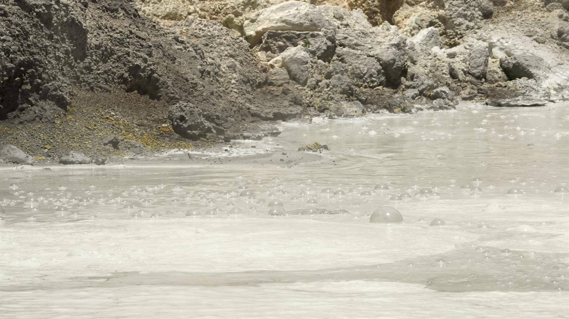
Third time lucky - Bumpass Hell was open for my third trip to Lassen Volcanic National Park. It's a three mile out and back with great views and of course a whole bunch of geothermal features at the end. The trail winds gently up to Bumpass Hell where there is a steep and surprisingly slippery descent (and an alternate route back up for a very small loop at the end of the trail). Very glad to have finally hiked it.
(Previously: Lassen Star Trails)
Hike starts at: 40.465403, -121.514653. View in Google Earth.
Related Posts
- Lassen Star Trails
- Summit Lake to Echo Lake in Lassen
- Devils Kitchen
- Lake Helen
- Las Trampas Wilderness
(Hike Map)
(Published to the Fediverse as: Bumpass Hell #hike #lassen #map Bumpas Hell )
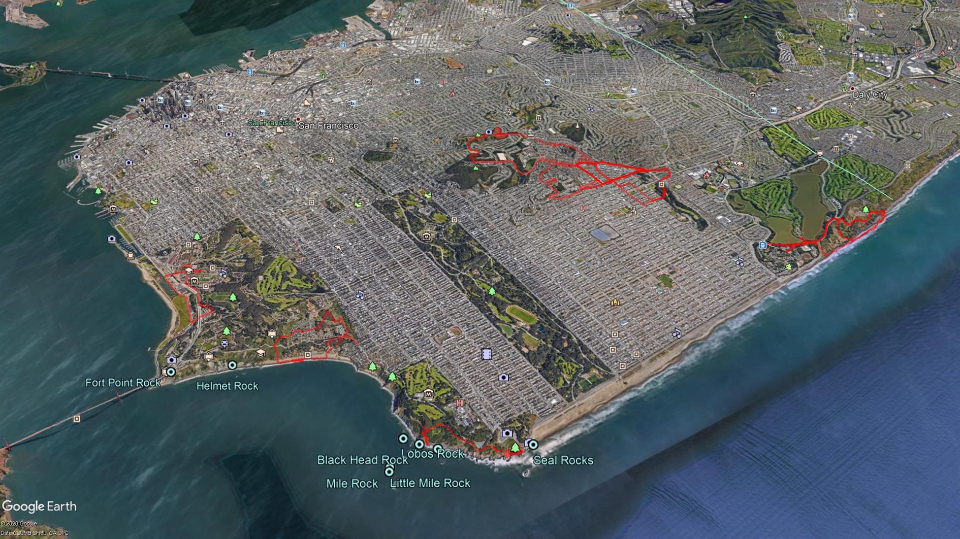
Coronavirus Hikes: June 2020
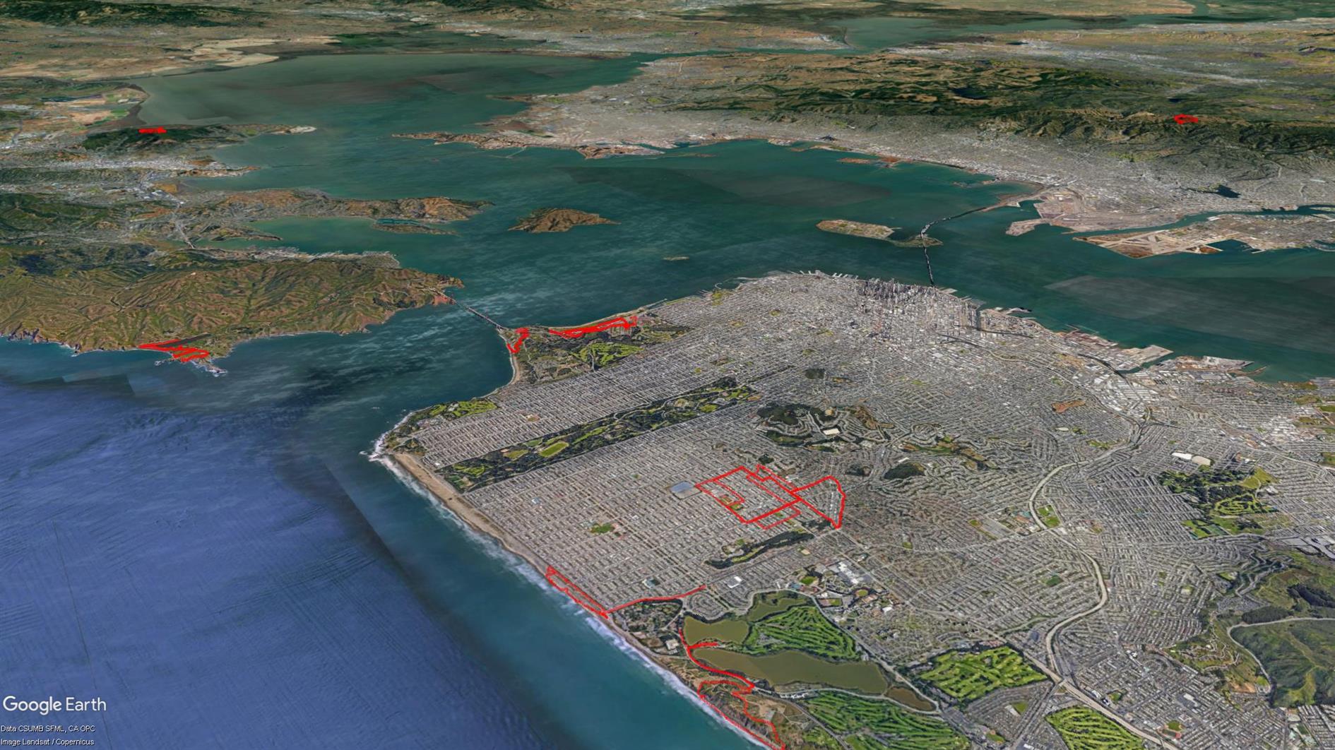
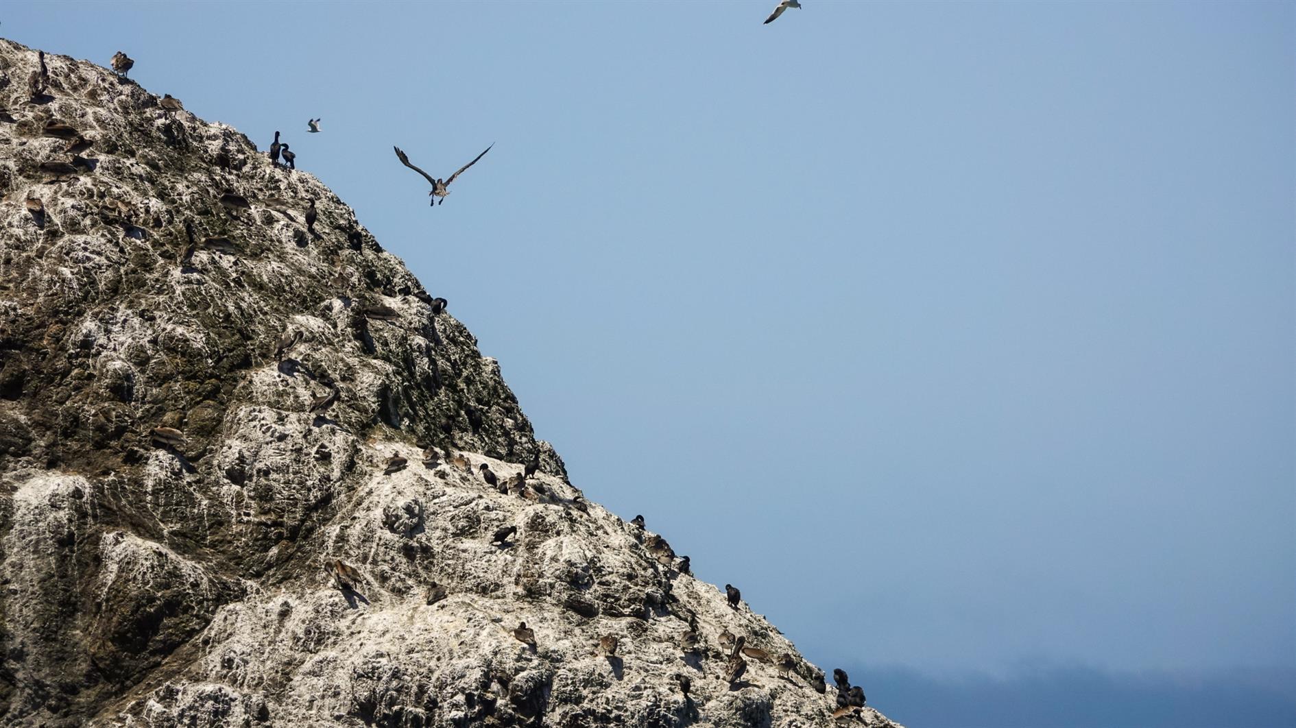
Starting to leave San Francisco. Photo is of Bird Island in the Marin Headlands. 39.1 unique miles.
Hike starts at: 37.741862, -122.471579. View in Google Earth.
Related Posts
- Coronavirus Hikes: May 2020
- Coronavirus Hikes: July 2020
- Coronavirus Hikes: March 2020
- Coronavirus Hikes: April 2020
- Coronavirus Hikes: Done
(Hike Map)
(Published to the Fediverse as: Coronavirus Hikes: June 2020 #hike #coronavirus #map Lockdown hikes around San Francisco for June 2020. )
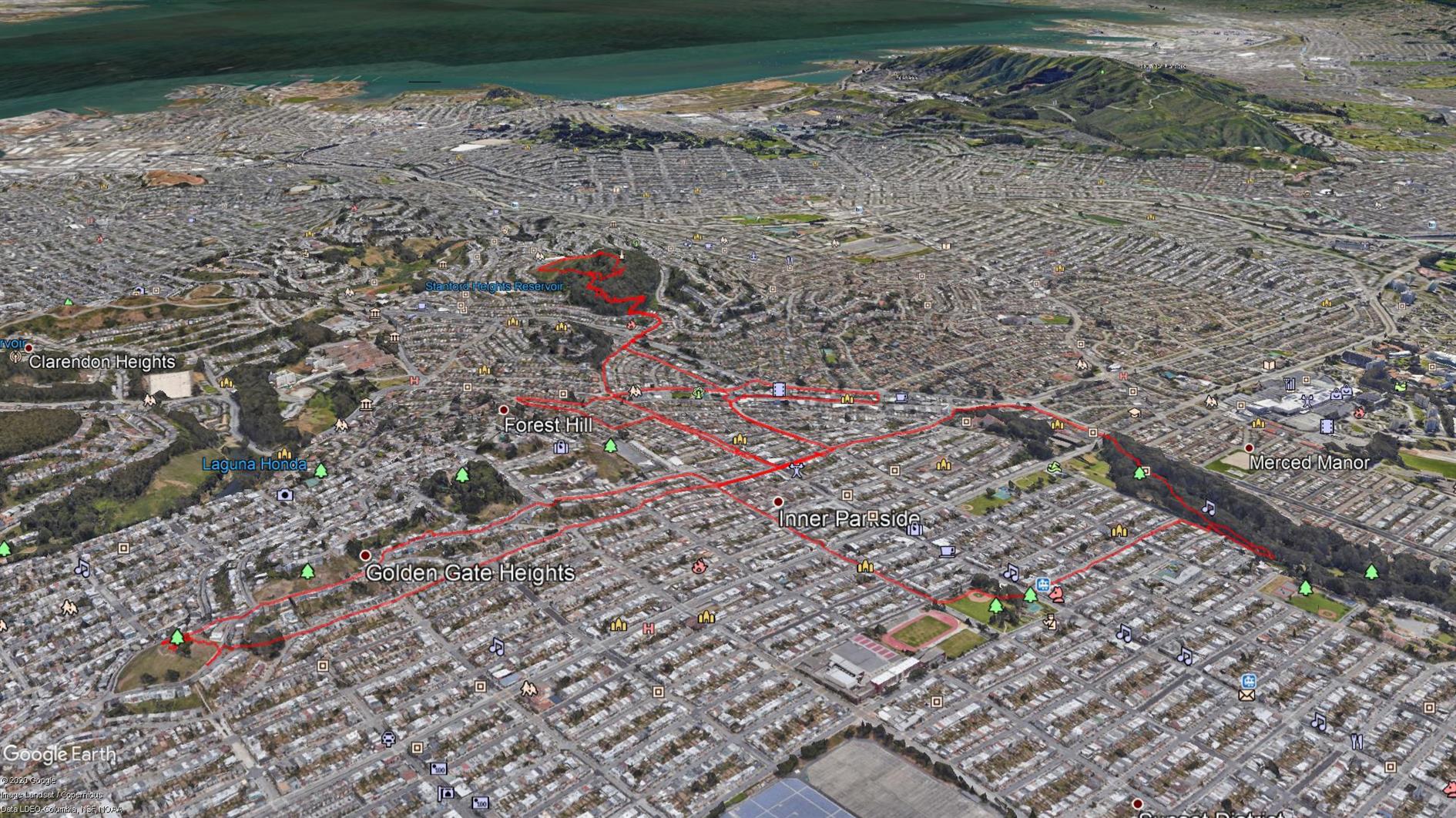
Coronavirus Hikes: May 2020
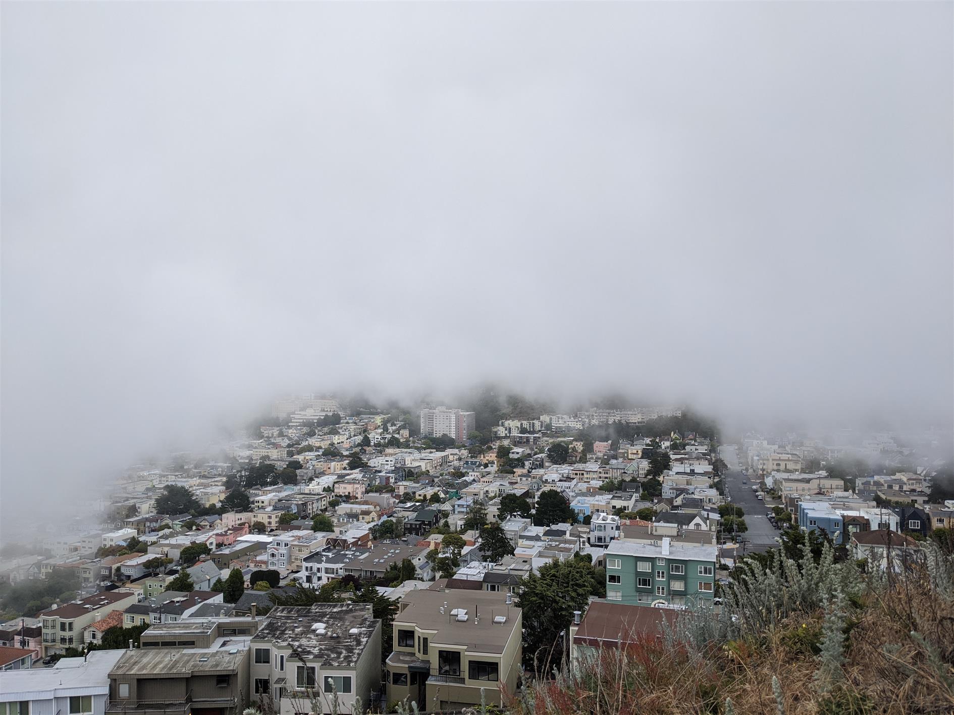
37.2 unique miles in May. Photo is the fog shadow behind Grand View Park.
Hike starts at: 37.741726, -122.471298. View in Google Earth.
Related Posts
- Coronavirus Hikes: June 2020
- Coronavirus Hikes: July 2020
- Coronavirus Hikes: April 2020
- Coronavirus Hikes: March 2020
- Coronavirus Hikes: Done
(Hike Map)
(Published to the Fediverse as: Coronavirus Hikes: May 2020 #hike #sanfrancisco #coronavirus #map Pandemic lockdown hikes around San Francisco for May 2020. )
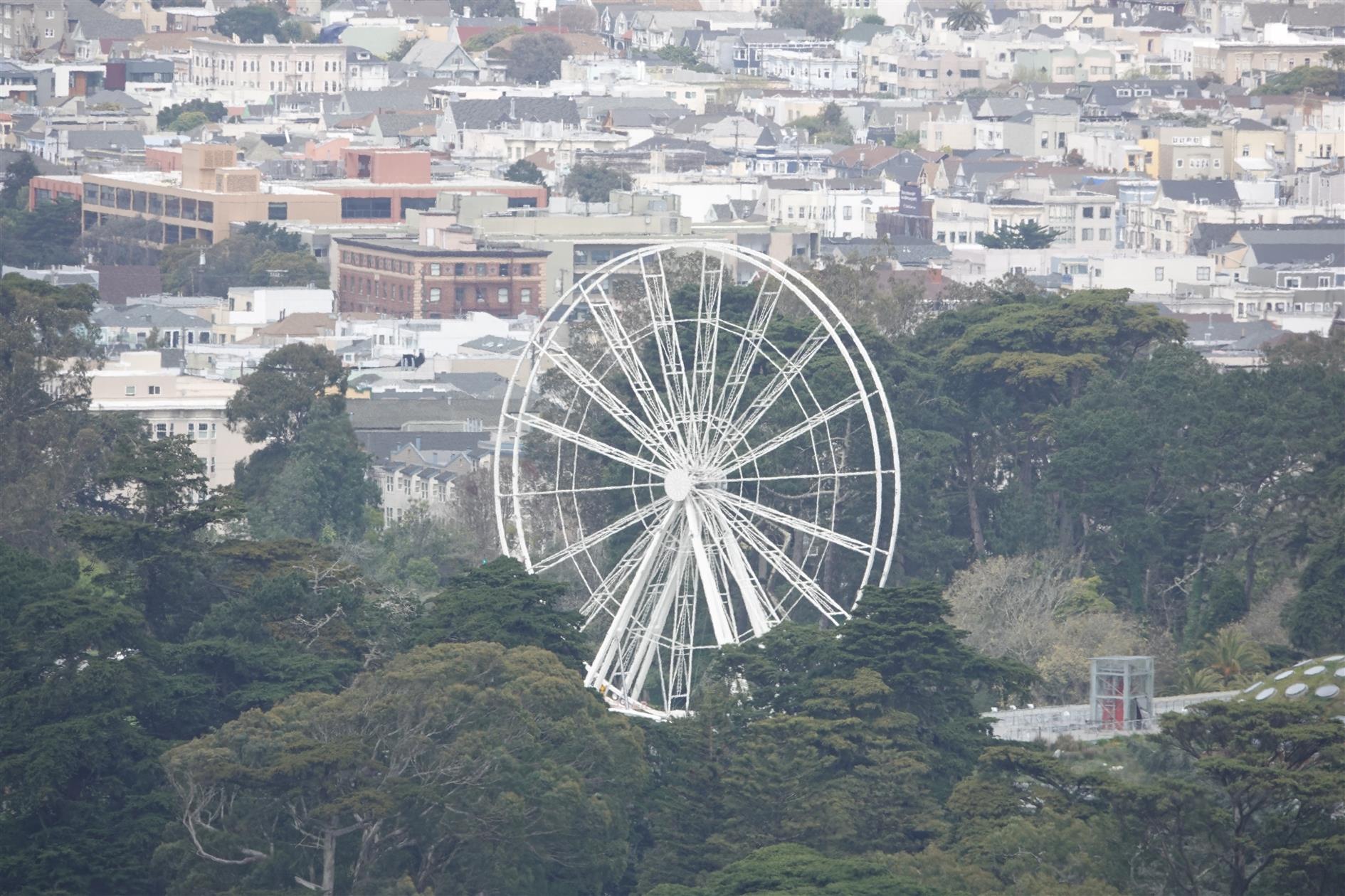
Coronavirus Hikes: April 2020
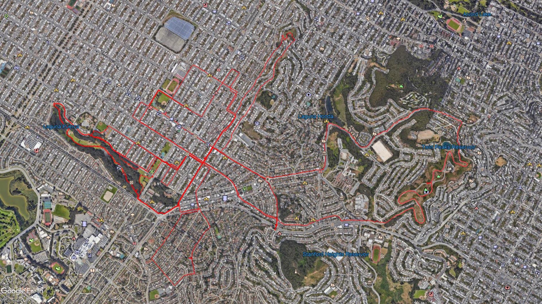
36.4 unique miles in April (I'm not using the GPS for repeat hikes). Bagged Twin Peaks, wider paths than Mount Davidson.
Related Posts
- Coronavirus Hikes: May 2020
- Coronavirus Hikes: June 2020
- Coronavirus Hikes: Done
- Coronavirus Hikes: March 2020
- Coronavirus Hikes: July 2020
(Hike Map)
(Published to the Fediverse as: Coronavirus Hikes: April 2020 #hike #sanfrancisco #coronavirus Map of hikes around San Francisco during the Coronavirus lockdown: April 2020 )
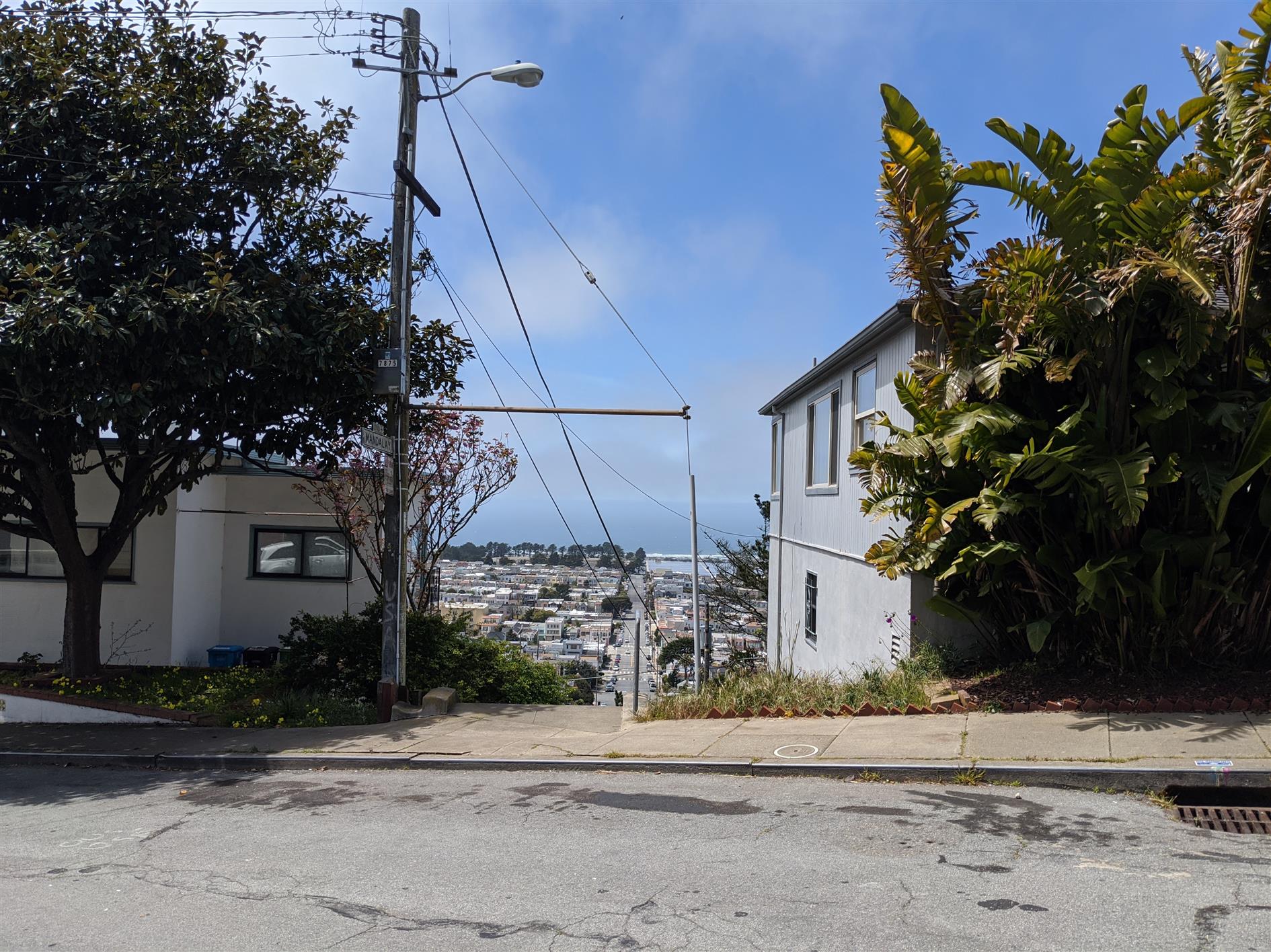
Coronavirus Hikes: March 2020
Not getting far from home any time soon so all hikes for now will be local. I found a great web app, Routeshuffle, that will generate a random hike from the starting location of your choice. It's a great way of seeing streets you'd never venture down normally. The map is generated with some software I wrote to combine multiple KML files for easy rendering in Google Earth (oh, and Google Earth, I guess that does the heavy lifting). I'll post these every month while we're locked down. March is 15.6 miles total.
Hike starts at: 37.800778, -122.455943. View in Google Earth.
Related Posts
- Coronavirus Hikes: May 2020
- Coronavirus Hikes: June 2020
- Coronavirus Hikes: July 2020
- Coronavirus Hikes: Done
- Coronavirus Hikes: April 2020
(Hike Map)
(Published to the Fediverse as: Coronavirus Hikes: March 2020 #hike #coronavirus #sanfrancisco #map Pandemic lockdown hikes around San Francisco from March 2020 )
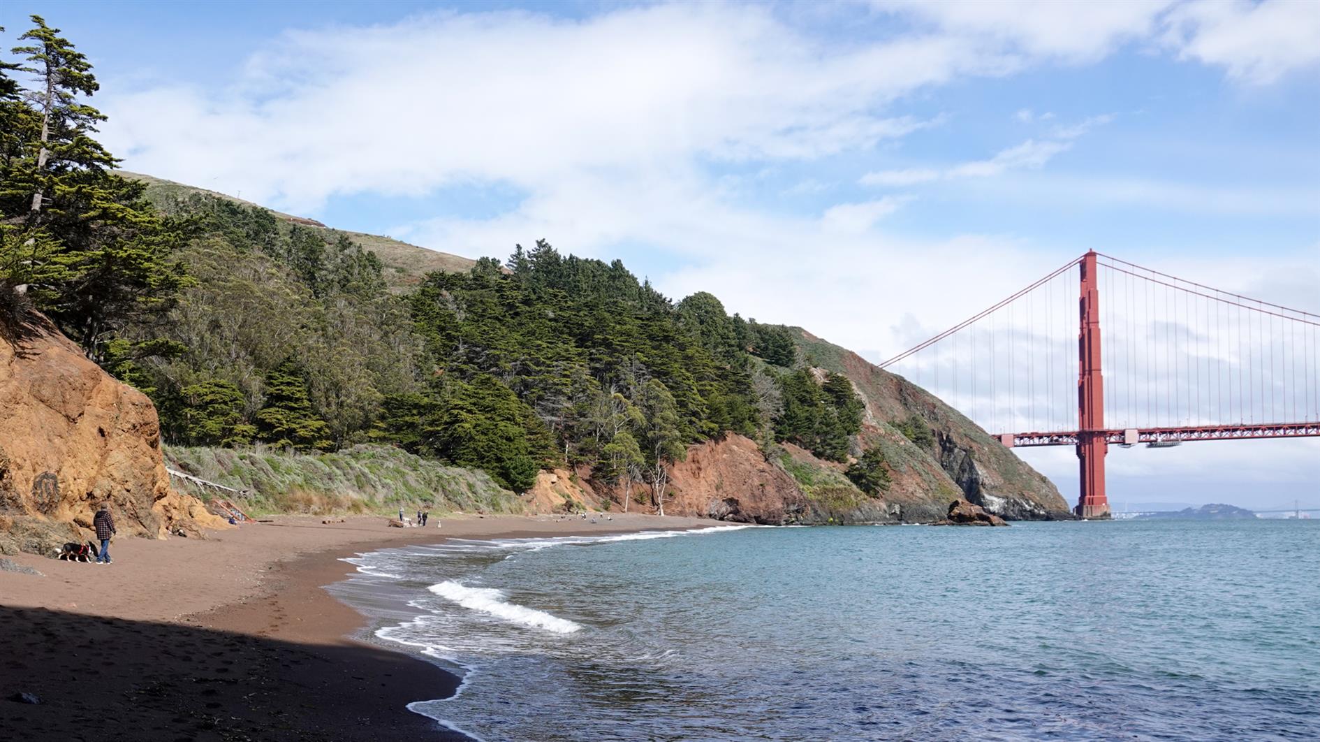
Kirby Cove
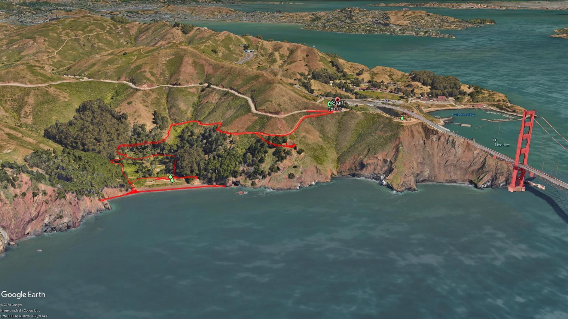
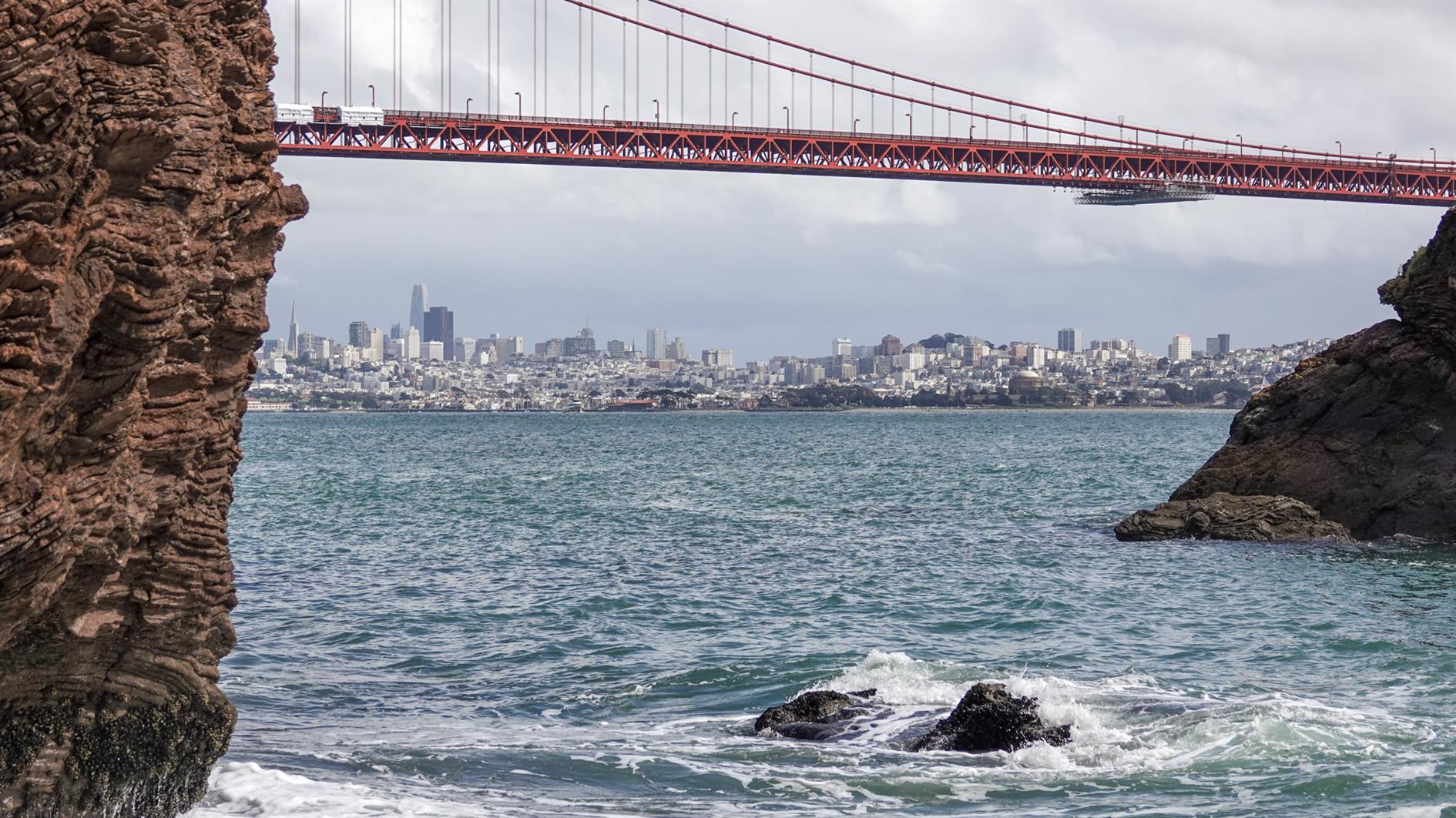

A short two mile out and back from the Battery Spencer parking area on Conzelman Road to Kirby Cove.
The Marin Headlands have had a bit of a traffic management change recently so you need to go through the tunnel to get in and Conzelman Road is now one way back to highway 101. The advantage is that there is way more parking then there used to be. I think I've only ever managed to park near Battery Spencer once in 20 years.
The walk is my least favorite profile, downhill to start and uphill on the way back and also not a loop. It's worth it though because it's short and Kirby Cove beach is quiet and has wonderful views of San Francisco through the Golden Gate Bridge. You can also visit Battery Wagner and Battery Kirby on the way back up.
Hike starts at: 37.829459, -122.48401. View in Google Earth.
Related Posts
- Hill 88
- Batteries to Bluffs
- Golden Gate Park - Stow Lake, Strawberry Hill and Museum Concourse
- Coastal and Julian loop plus Black Sands Beach
- Fort Funston
(Hike Map)
(Published to the Fediverse as: Kirby Cove #hike #sanfrancisco #ggb #map Two mile hike to Kirby Cove Beach in the Marin Headlands with outstanding views of San Francisco through the Golden Gate Bridge. )