Bolinas Point Loop
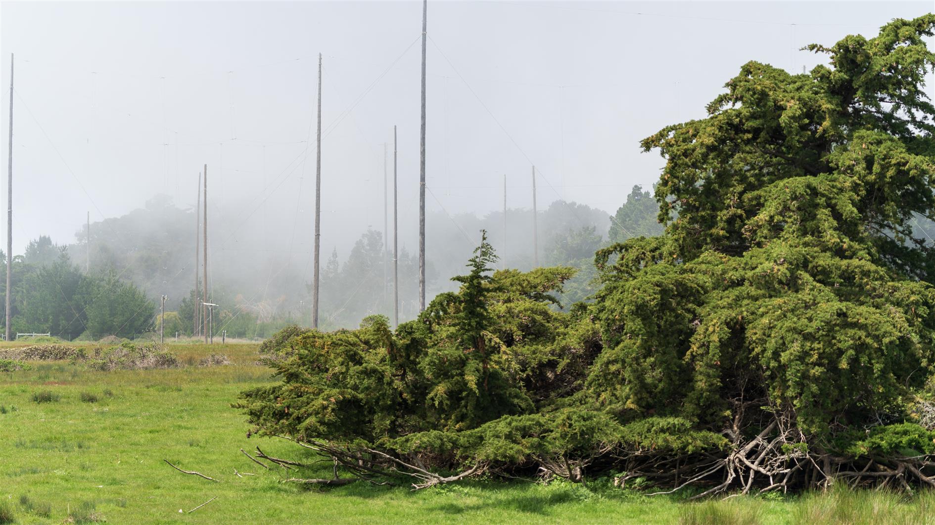
Short and fairly flat loop above Bolinas in California. Plenty of cows. Comes back past Commonweal which is a retreat center. The area used to be a Marconi Telegraph transmitting station and there are a lot of poles and concrete anchor points dating from that.
Hike starts at: 37.918301, -122.720442. View in Google Earth.
Related Posts
- Bull Valley Trail to Port Costa
- Point Reyes - Tomales Point
- Point Reyes - Divide Meadow Loop
- Lands End
- Presidio Loop Hike
(Hike Map)
(Published to the Fediverse as: Bolinas Point Loop #hike #bolinas #commonweal #map 2.5 mile loop trail in Bolinas, California )
Sutro Island
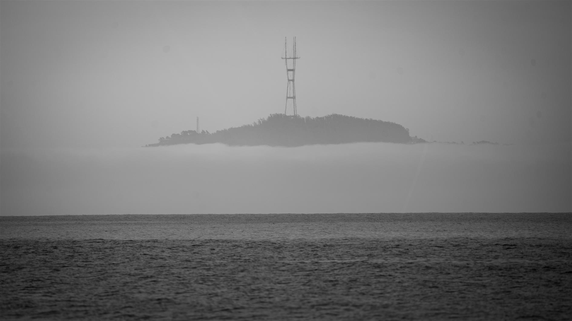
SONY ILCE-7C 500mm f6.7 1/800s ISO100
Sutro Tower looks like it lives on a mysterious island in the fog. Shot from Bolinas Beach.
Related Posts
- Sutro Tower, Moon, and Plane
- Crow, Sutro Tower
- After the Storm
- Moon, Sutro Tower (from Bernal Heights)
- Rocky Outcrop Park
(Published to the Fediverse as: Sutro Island #photo #sutrotower #sanfrancisco #bolinas Photo of Sutro Tower appearing to be on a mysterious island, from Bolinas Beach in Marin County, California. )