Never Ending Fog
Updated on Saturday, October 1, 2022
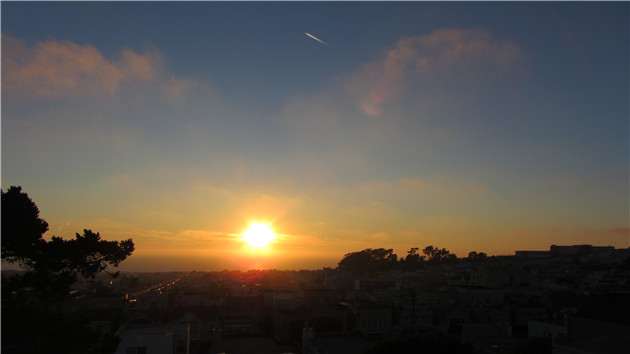
Sunset over the Sunset district in San Francisco. There is also the start of moonset at the start of the video and then clouds roll in and, unusually, out before the sun goes down.
(Published to the Fediverse as: Sunset sunset #timelapse #sanfrancisco #sunset #moonset #video Time lapse of sunset over the Sunset District in San Francisco, California. )
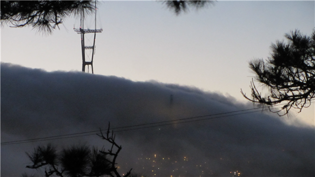
Fog sweeps in over Twin Peaks in San Francisco.
(Published to the Fediverse as: Fog over Twin Peaks #photo #timelapse #video Timelapse of fog sweeping over Twin Peaks in San Francisco, California. )
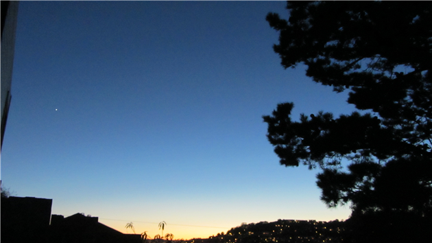
Time lapse of Venus setting as seen from Bernal Heights in San Francisco.
(Published to the Fediverse as: Venus Sets #timelapse #venus #video Video (time lapse) of Venus setting from Bernal Heights in San Francisco, California. )

Photo and video of Gray Whales at Fort Funston in San Francisco.
(Published to the Fediverse as: Gray Whales at Fort Funston #photo #whales #video Gray Whales at Fort Funston, photo and video. San Francisco, California. )
Gill found these instructions for making plasma in a microwave by carefully cutting up a grape and then nuking it. I finally got around to trying it yesterday, and it’s awesome. Even better than microwaving a light bulb in a glass of water. Check it out:
Making plasma in a microwave!
(Published to the Fediverse as: Grape Plasma #etc #grape #plasma #microwave #video Video of grape plasma in a microwave (be careful if you try this from home). )
I've just made a new time lapse video using web cams from the Catfood WebCamSaver directory:
If you haven't seem the time zone version it's a completely different take.
(Published to the Fediverse as: World Time Lapse #timelapse #webcamsaver #webcam #webcam #video Timelapse made from public security cameras all around the world. Accompanying music is "Black Rainbow" by Pitx (feat. ERH, acclivity) )
The video below shows twenty-four hours from noon UTC to noon UTC on June 7, 2010 using webcams from the Catfood WebCamSaver database. It proves that I really will do anything to avoid finishing off the new Catfood web site.
You can probably figure out that the three blocks of cams are the US, Europe and Japan. The position doesn't reflect the latitude in this version, it's just a random selection of cams for the timezones represented in the database. As it's July and most of the cams are in the northern hemisphere you'll see long days and short nights. I'll try to remember to create an updated version around the autumnal equinox.
The program that generated the frames ended up being simpler than i thought. Because it's fetching images from a lot of different sources I had a timer creating and then saving a frame once a minute and lots of worker threads fetching the images. Each worker thread is assigned a frame number and once it's got the image it locks the main frame and tries to paints it's own area. If the frame number has moved on the image is abandoned. You can see some of the cams flickering on and off in the video — these went down while the frames were rendering or just took longer than a minute to respond.
(Published to the Fediverse as: Time Zone Time Lapse #timelapse #timezone #catfood #webcamsaver #video Time Zone time lapse showing twenty four hours around the world with webcam images from Catfood WebCamSaver. )
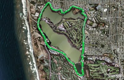
Lake Merced is a natural lake near Fort Funston. It used to be San Francisco's main fresh water supply but is now the emergency reserve (somewhat worrying as a previous earthquake caused much of Lake Merced to drain into the Pacific).
The lake is also the site of the Terry/Broderick duel where in 1859 the Chief Justice of the California Supreme Court (Terry) killed a US Senator (Broderick) in an argument over slavery.
The loop around the lake is a flat five mile path, unfortunately marred by heavy traffic and constant gunfire from clay pigeon shooting and/or the SFPD firing range.
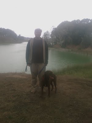
Rob and Rudy at Lake Merced.
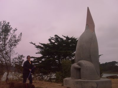
Gill and Rudy next to a sculpture called "Penguin's Prayer". Given the latitude I expect the penguin is praying for the next ice age.
(4.85 miles, total elevation gain 0 feet, 1 hour, 39 minutes, average 2.93 mph, view in Google Earth, view in Google Maps.)
Hike starts at: 37.712302, -122.489232.
Updated 2023-06-20 01:27:
Video from a trip round Lake Merced on June 19, 2023.
(Hike Map)
(Published to the Fediverse as: Lake Merced #hike #sfdogwalk #video #hikevid Five mile hike around Lake Merced in San Francisco, California. )
We decided to visit Año Nuevo State Natural Reserve today because it's one of the hundreds of California state parks threatened with closure by Governor Arnold Schwarzenegger's proposed cuts.
The main attraction of Año Nuevo is the presence of a large colony of elephant seals. At this time of the year you walk a couple of miles where volunteers are available to answer questions and lend binoculars. In the breeding season between December and March you need to book a guided walk at least a day in advance - or at least you will if the park survives.
(As well as my video, check out the streaming Sealcam on Año Nuevo Island.)
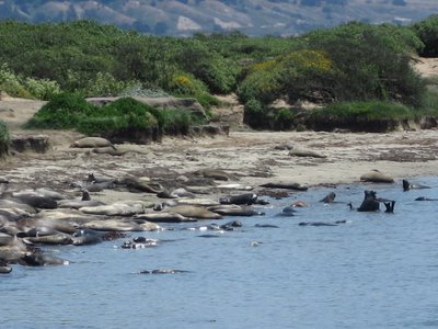
Elephant Seals at Año Nuevo.
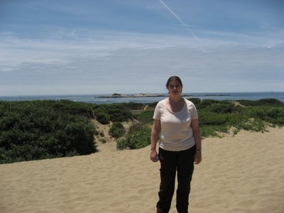
Gill, with Año Nuevo Island in the background. You can see the ruins of a lighthouse on the island (click the image for a larger version). The original name dating back to 1603 is La Punta de Año Nuevo or New Year's Point (much erosion since then).
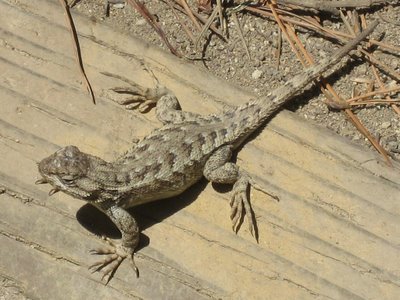
One of many lizards encountered on the trail.
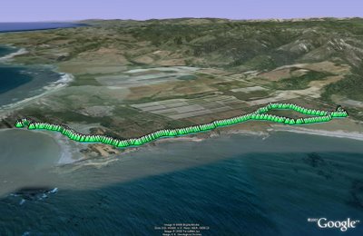
(4.18 miles, total elevation gain 268 feet, 1 hour, 48 minutes, average 2.32 mph, view in Google Earth, view in Google Maps.)
Hike starts at: 37.12086, -122.307237.
(Hike Map)
(Published to the Fediverse as: Año Nuevo #hike #anonuevo #lizard #seal #elephantseal #video Four mile hike to see Elephant Seals at Año Nuevo State Park in San Mateo County, California. )
Export Google Fit Daily Steps, Weight and Distance to a Google Sheet
Accessing Printer Press ESC to cancel
Monitor page index status with Google Sheets, Apps Script and the Google Search Console API
Download a Sharepoint File with GraphServiceClient (Microsoft Graph API)
Upgrading from word2vec to OpenAI
International Date Line Longitude, Latitude Coordinates
Enable GZIP compression for Amazon S3 hosted website in CloudFront
Scanning from the ADF using WIA in C#
Is it safe to open securedoc.html (Cisco Registered Envelope)?