Barker Dam and Wall Street Mill
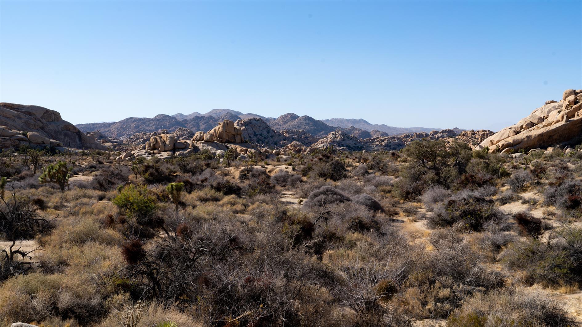
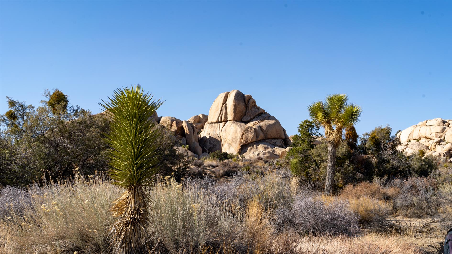
Double feature in Joshua Tree National Park. Barker Dam is just over a mile, a short loop that takes in rock art, the dam, and a nice mix of boulders and desert. Wall Street Mill is two miles out and back and the mill extracted gold to send to the US Mint in San Francisco.
Hike starts at: 34.025005, -116.142098. View in Google Earth.
Related Posts
- San Pedro Valley Park Waterfall Loop
- Grabtown Gulch and Borden Hatch Mill in Purisima Creek
- Ladder Canyon and Painted Canyon
You Might Also Like
- Space and multibyte character encoding for posting to Twitter using OAuth
- Save Mount Davidson
- Stable Diffusion Global Stereotypes
(Hike Map)
(Published to the Fediverse as: Barker Dam and Wall Street Mill #hike #map #joshua wo hikes from the same parking lot in Joshua Tree National Park, a one mile loop (Barker Dam) and a two mile out and back (Wall Street Mill). )
Ladder Canyon and Painted Canyon
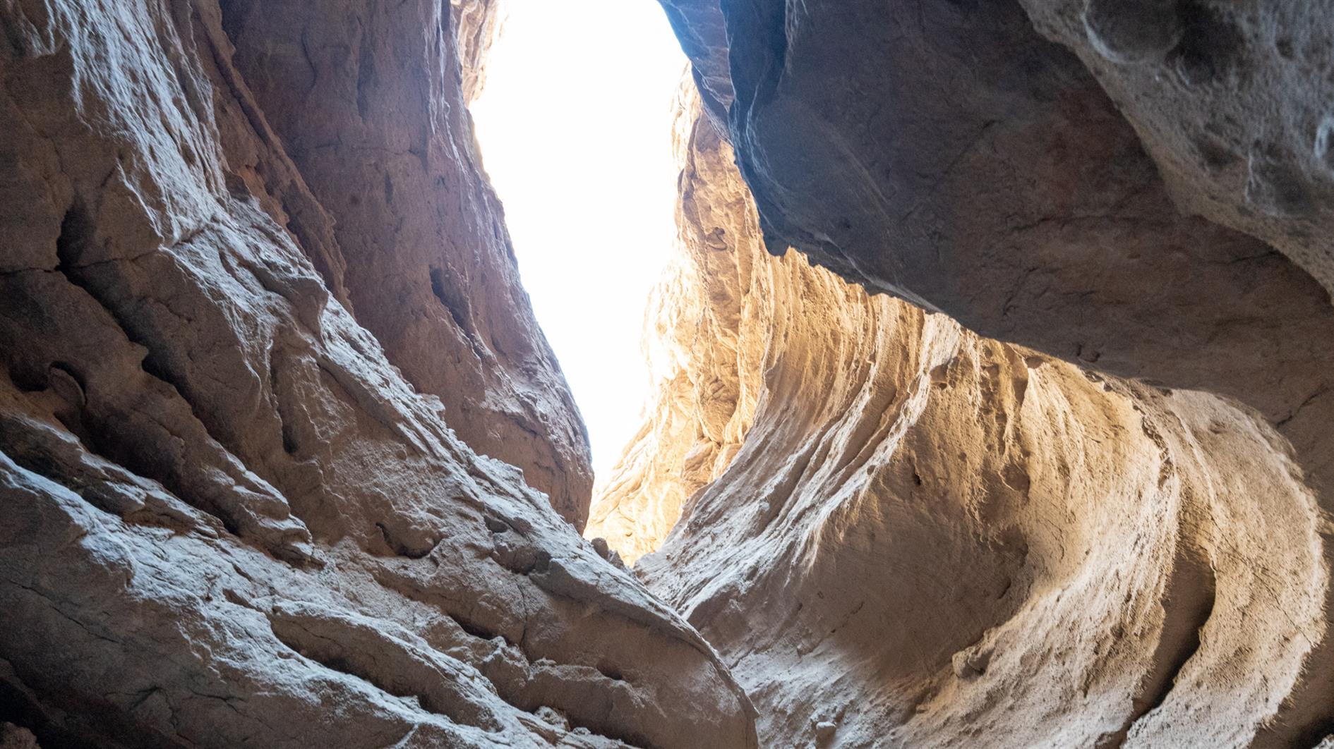
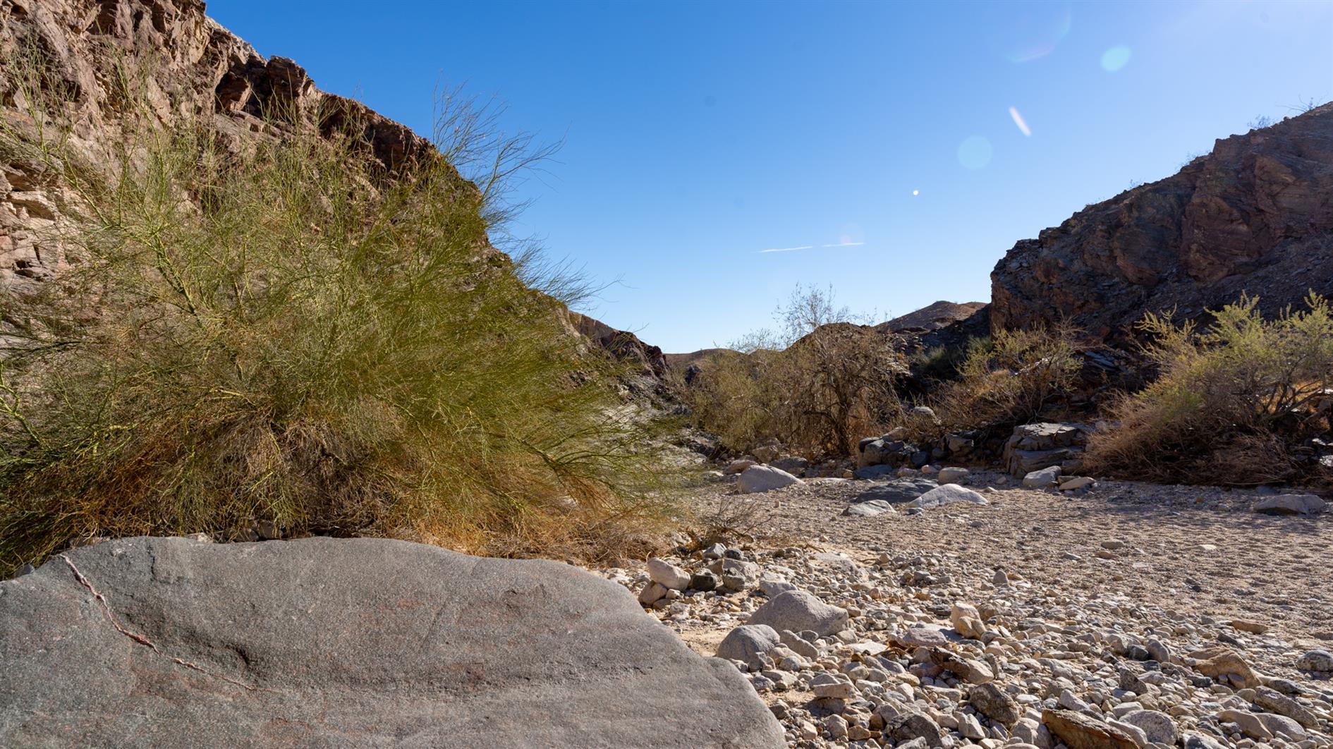
Amazing 4.5 mile hike in the Mecca Hills Wilderness in Riverside County, California. You ascend a slot canyon with ladders of various difficulty helping you up and down along the way. There is a sunny section on a ridge at the top with views back to the Salton Sea and then you return along the wash at the bottom of Painted Canyon. A must do hike if you can handle a few ladders and are in the area.
Hike starts at: 33.618781, -115.99902. View in Google Earth.
Related Posts
You Might Also Like
(Hike Map)
(Published to the Fediverse as: Ladder Canyon and Painted Canyon #hike #ladders #canyon #map 4.5 mile loop hike that includes ladders and canyons in Riverside County, California. )
Sawmill Flats
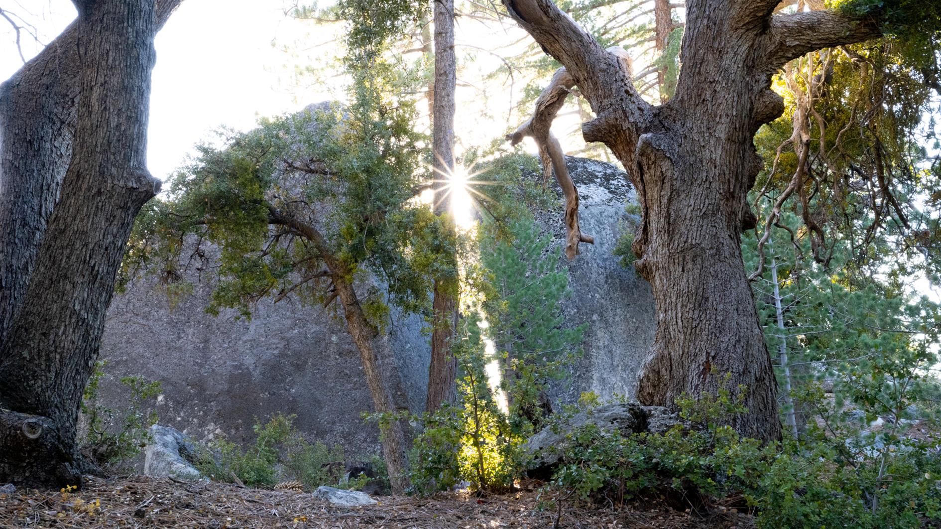
Four and a half mile hike from Stone Creek Campground in Mount San Jacinto State Park to the ruins of a sawmill and back again. The mill is hidden but watch out for a yellow sign off the trail.
The campground was closed for the season when we arrived and a permit is required. We phoned the ranger station who said the trail was off limits and to come get a permit and discuss other hikes. After much discussion it turned out the concern was illegal parking near the campground and after promising to find legal parking and walk in we were allowed to complete the hike.
I don't have a GPS track for this one. Usually I download a GPX to Gaia GPS on my phone and use this to follow the trail. Traveling without a laptop I tried to do this from the AllTrails mobile app which wanted a paid upgrade. I have used AllTrails a fair bit so was happy to pay, but even after upgrading you can only download locally to AllTrails, the mobile app won't allow you to generate a GPX. I understand the commercial desire to lock people into their app, but I have used Gaia GPS for years an trust it to not drain my battery or otherwise cause problems when off the beaten track. AllTrails also won't let you copy and paste from hike descriptions (even ones with a long URL to check for road closures in them), and you can't export the route you took either (which I do from Gaia GPS to generate maps and elevation profiles for this blog). So I'll be cancelling that AllTrails subscription and have learned to get an export from a laptop and ignore the mobile app.
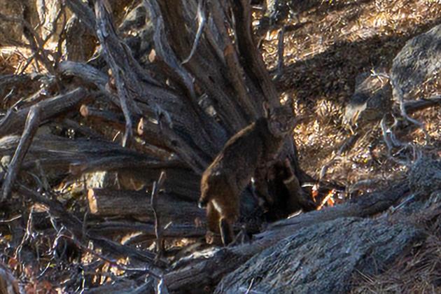
Saw a bobcat which is a first. Probably due to the trail being closed and quiet.
Related Posts
- Creekside Trail to Big Leaf Trail Loop
- Teague Hill Preserve
- Grabtown Gulch and Borden Hatch Mill in Purisima Creek
You Might Also Like
(Hike Map)
(Published to the Fediverse as: Sawmill Flats #hike #bobcat #jacinto #video Four and a half mile out and back hike to the ruins of a sawmill in Mount San Jacinto State Park near Idyllwild, California. Starts at 6,000 feet with around 800 gain. Trailhead at Stone Creek Campground. )
Bald Mountain, Vista and Meadow Trails Loop (Sugarloaf Ridge State Park)
Pleasant 4.5 mile loop hike from the campground at Sugarloaf Ridge State Park in Sonoma. Head up Lower Bald Mountain Trail, hang a right onto Vista Trail and then return to the campground via Meadow Trail. The last part of the walk takes you past Saturn, Jupiter, Mars, Earth Venus and Mercury on the Robert Ferguson Observatory's Planet Walk. This spaces the planets proportionally distant from the observatory and if you took a right on Brushy Peaks Trail you can reach Uranus, Neptune and (don't tell anyone) Pluto, the prospect of which really makes me feel sorry for the New Horizons probe.
Hike starts at: 38.436996, -122.515446. View in Google Earth.
Related Posts
You Might Also Like
(Hike Map)
(Published to the Fediverse as: Bald Mountain, Vista and Meadow Trails Loop (Sugarloaf Ridge State Park) #hike #sugarloaf #map 4.5 mile loop hike in Sugarloaf Ridge State Park, Sonoma, California. Includes part of the Robert Ferguson Observatory Planet Walk. )
Twin Peaks Loop
I have previously described Twin Peaks as not much of a hike, which is absolutely true if you drive there. When I first moved to San Francisco I lived in Noe Valley and used to cycle up to Twin Peaks and then try to get home without pedalling. For many years after that I'd take visitors up to the top and developed a somewhat weird tradition of taking each new child there soon after they were released from the hospital.
Post lockdown I'm up there most weeks. This is my five mile loop which starts heading up Ulloa from West Portal to Portola. Portola breaks the climb briefly as you pass the striking herchurch and controversial Twin Peaks gas station before heading up Twin Peaks Boulevard to the 922 foot summits. For a while Twin Peaks Boulevard was entirely closed to traffic (although you really had to keep an eye out for high speed skateboarders). Unfortunately it's now open all the way to Christmas Tree Point. Head down the north side to Clarendon and follow this all the way down to Forest Hill and then back to West Portal.
(Previously: Twin Peaks 360 4K, Twin Peaks, San Francisco from Twin Peaks)
Hike starts at: 37.741879, -122.471354. View in Google Earth.
Updated 2023-08-10 03:02:
Hyperlapse of this hike from August 9, 2023.
Related Posts
You Might Also Like
(Hike Map)
(Published to the Fediverse as: Twin Peaks Loop #hike #sanfrancisco #twinpeaks #coronavirus #map #video #hikevid #sfdogwalk Five mile loop hike from West Portal up Ulloa and Portola to the 922 foot summits of Twin Peaks and then back down Clarendon and Forest Hill. )
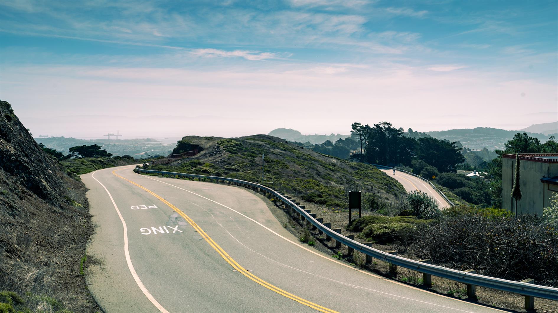
Remnants in the Sunset
During the pandemic induced lockdowns last year we started hiking locally using random trails generated by Routeshuffle. Sometimes these were repetitive death marches along indistinguishable avenues (my kids would say 100% of the time). A few have emerged as favorites that I walk regularly and I'm going to add these to the ITHCWY hike collection.
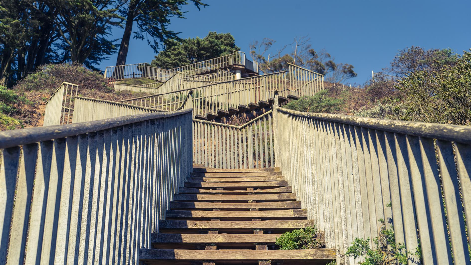
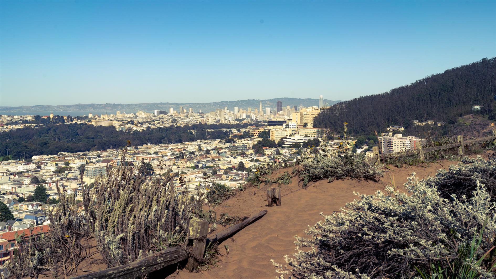
Remnants in the Sunset is a three mile loop named for the islands of rock and dunes visited along the way. The west of San Francisco used to be all dunes and these parks are now all that remains of that original ecosystem.
Walk up 15th Avenue from Taraval to Grandview Park. Go up the steps, admire the view and then down the other side and follow 14th Avenue to Rocky Outcrop Park. This is a wind tunnel with houses on one side and cliffs on the other. Then head up to Golden Gate Heights Park and Larsen Peak at 755 feet. The return leg down Pacheco and Magellan provides views of Hawk Hill which has some unofficial trails but is closed to the public.
(Previously: Grand View of Fog, Post Storm Sunset)
Hike starts at: 37.741905, -122.471336. View in Google Earth.
Related Posts
You Might Also Like
(Hike Map)
(Published to the Fediverse as: Remnants in the Sunset #hike #sanfrancisco #coronavirus #map Three mile loop hike visiting the Remnants in the Sunset: Grandview Park, Rocky Outcrop Park, Golden Gate Heights Park and Hawk Hill in San Francisco, California. )
Adobe Creek
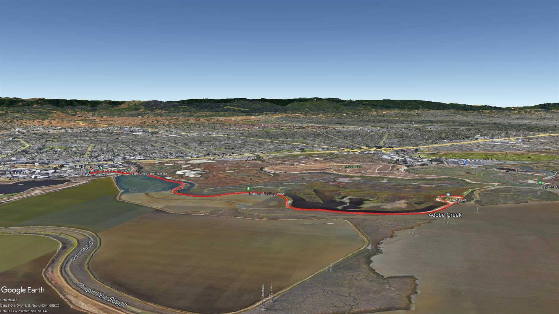
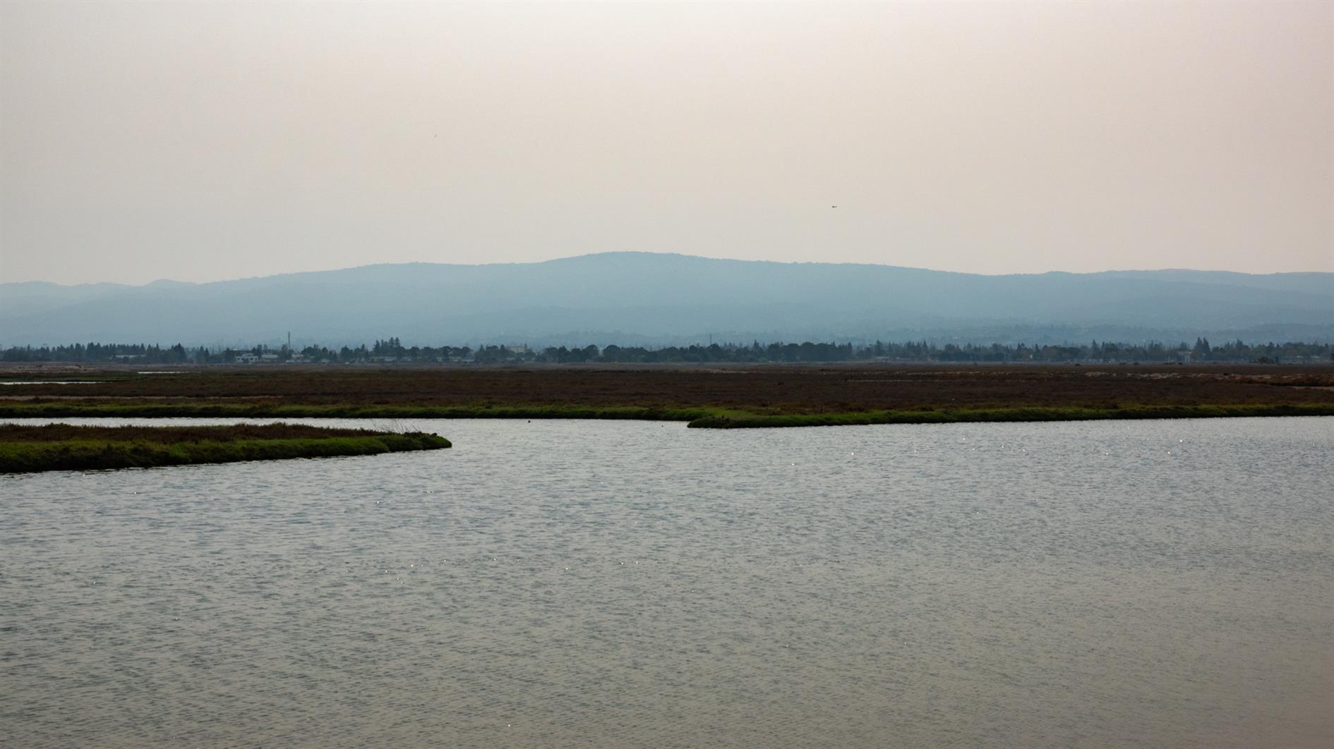
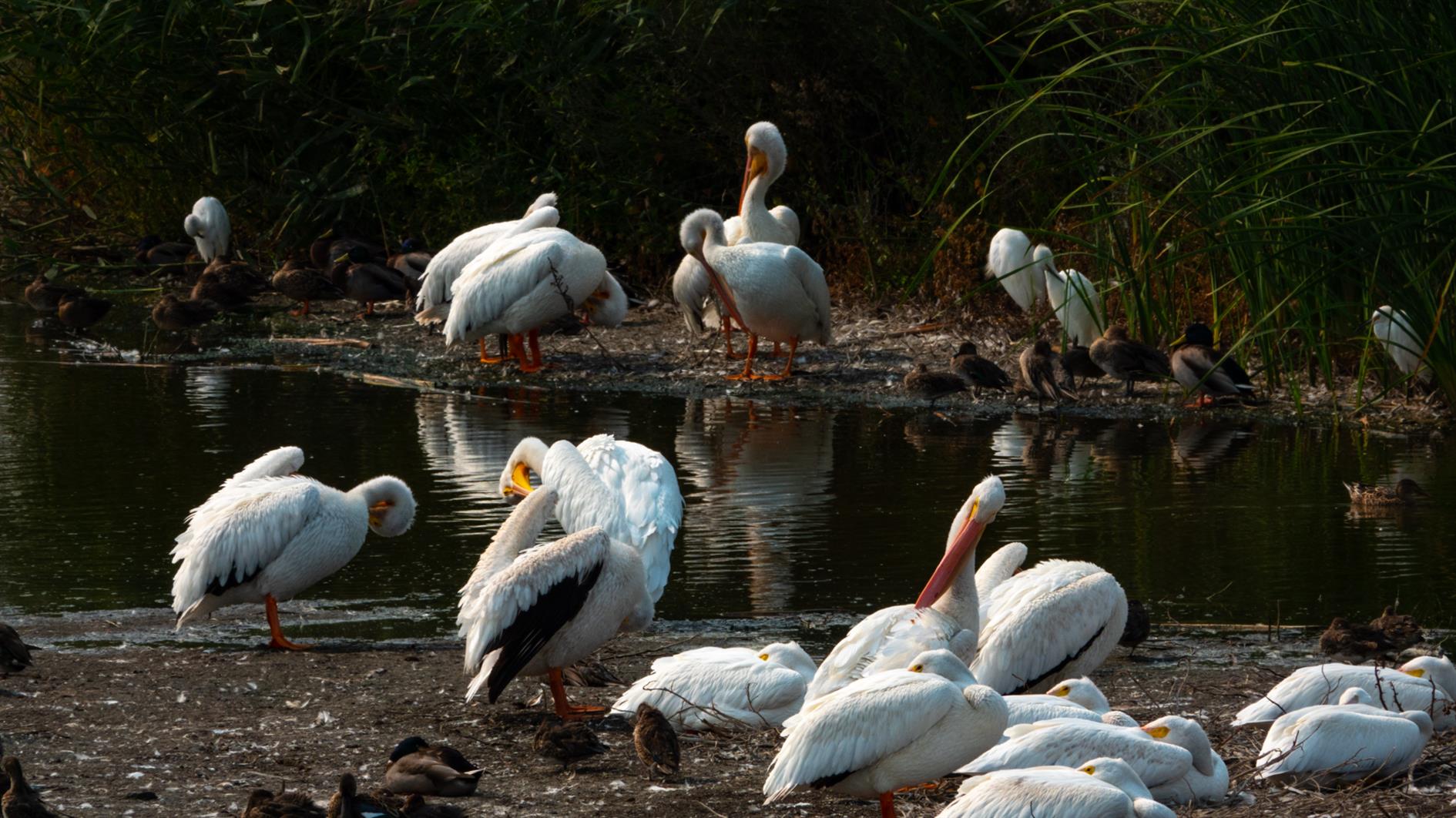
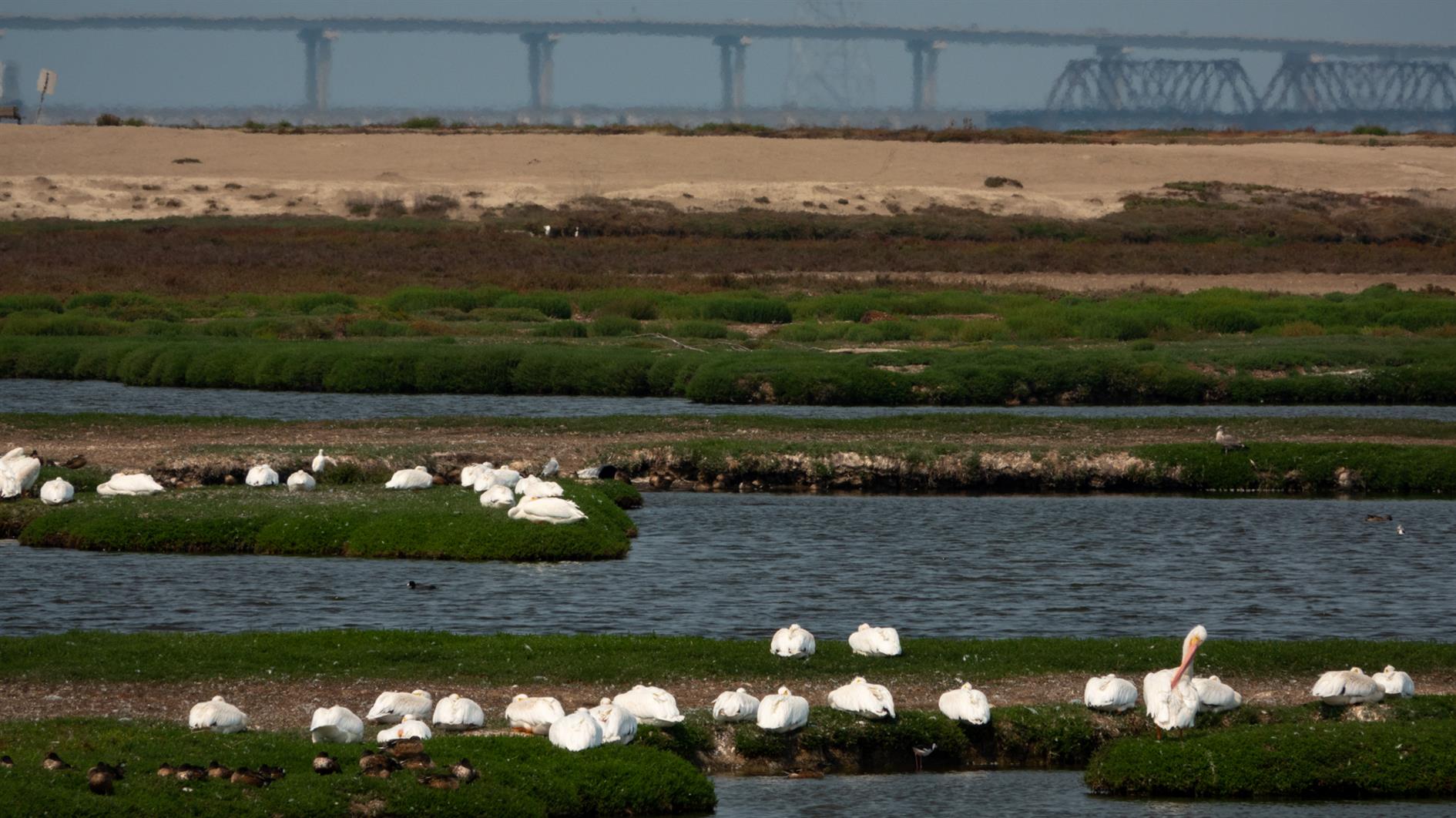
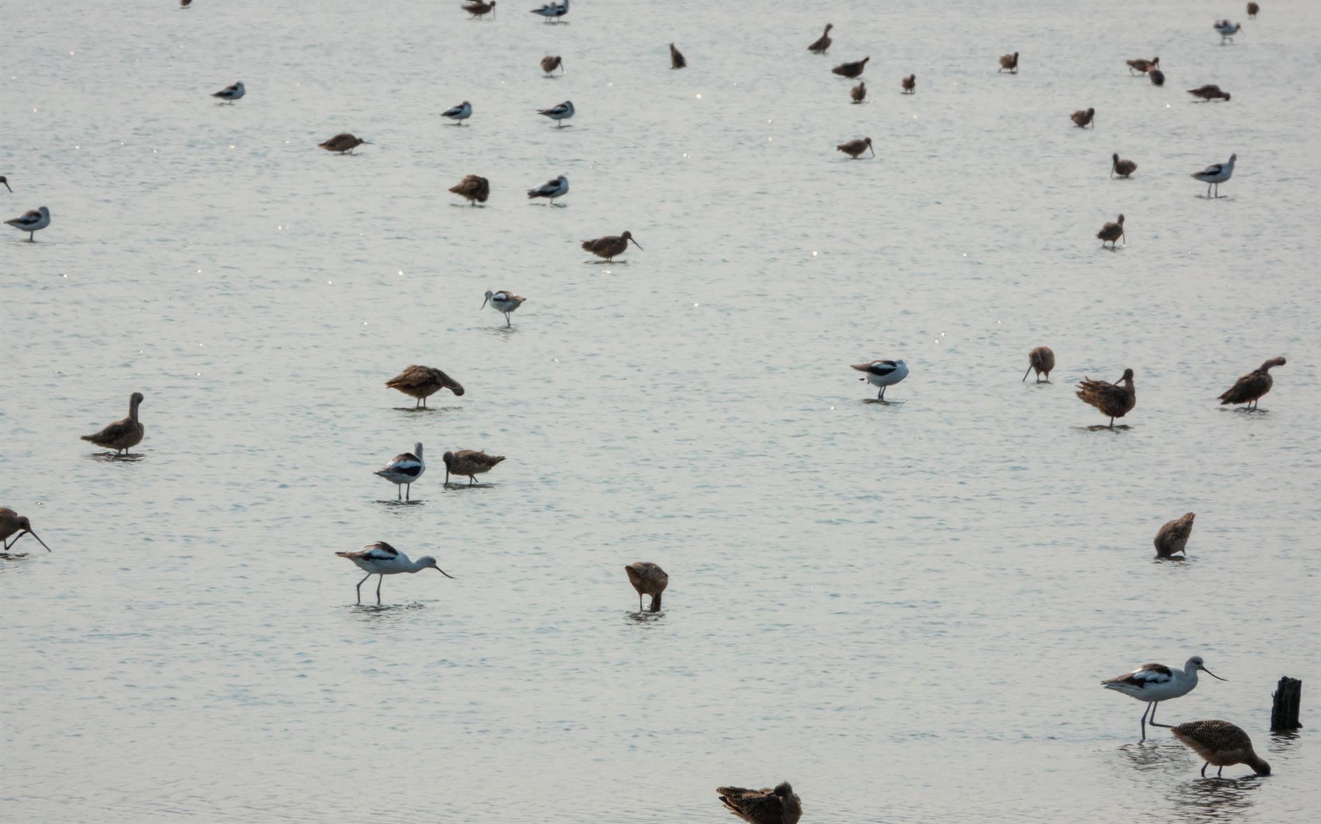
A four mile out and back hike from the Palo Alto Baylands Nature Preserve trailhead. Interesting wetlands with lots of birds and some good views over the bay.
Hike starts at: 37.433507, -122.098799. View in Google Earth.
Related Posts
You Might Also Like
- Clockwise - Meeting Defragmenter
- Bayview Rise
- Three reasons the dream of a robot companion isn't over
(Hike Map)
(Published to the Fediverse as: Adobe Creek #hike #paloalto #pelican #map Four mile hike in the Palo Alto Baylands Nature Preserve, California. Wetlands with many birds and bay views. )
Angel Island Perimeter Road
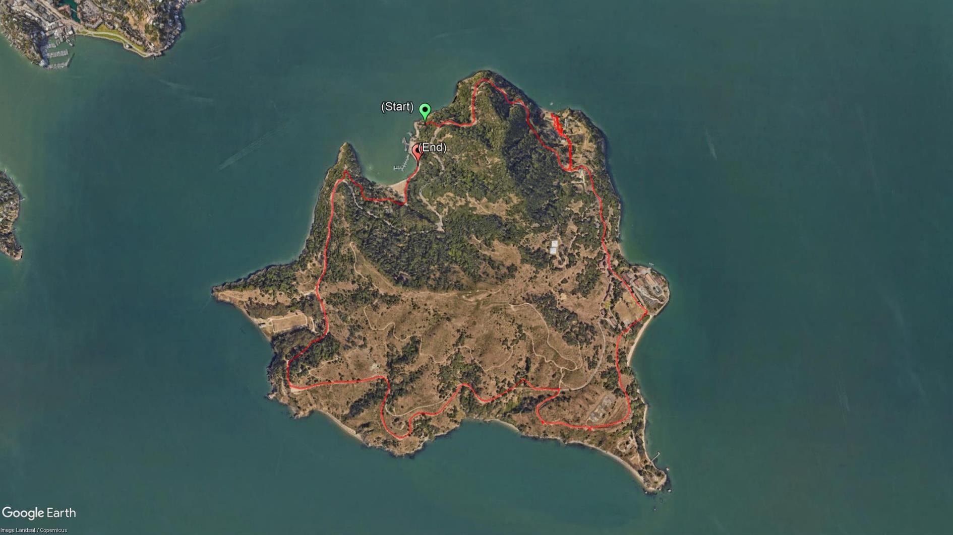
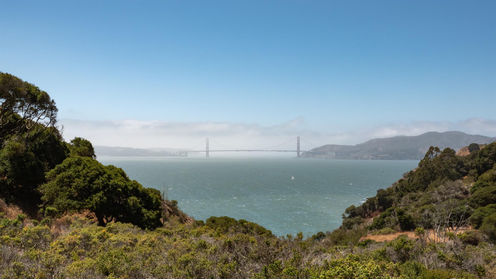
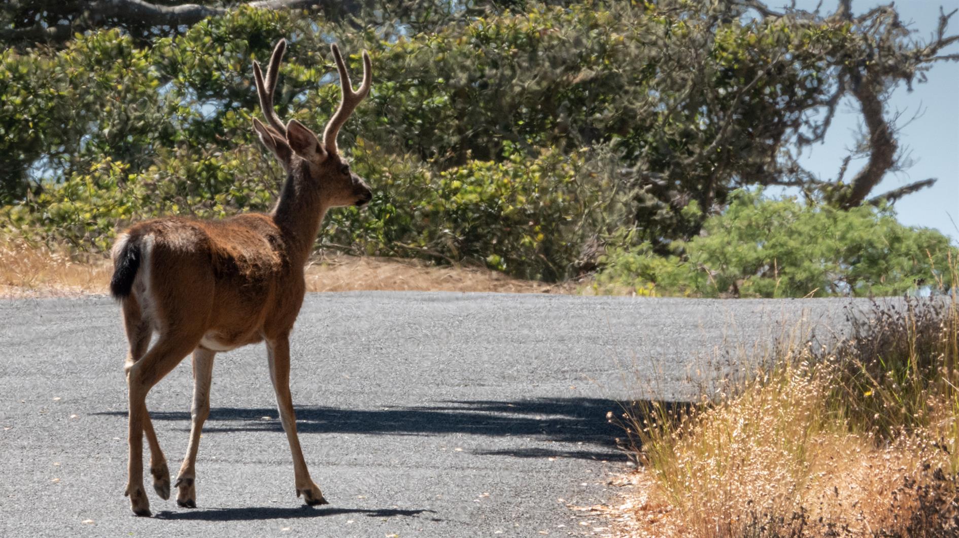
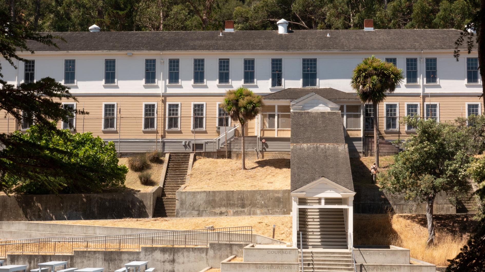
Easy and spectacular hike around the perimeter road of Angel Island. Around five and half miles, although gets a bit longer if you add a detour or two, and there is something interesting around every corner. Just make sure you don't miss the last ferry back.
(Previously: Mt. Livermore on Angel Island)
Hike starts at: 37.869421, -122.433996. View in Google Earth.
Related Posts
You Might Also Like
(Hike Map)
(Published to the Fediverse as: Angel Island Perimeter Road #hike #angelisland #map 5.5 mile hike around the perimeter road of Angel Island State Park in California. )
Summit Lake to Echo Lake in Lassen
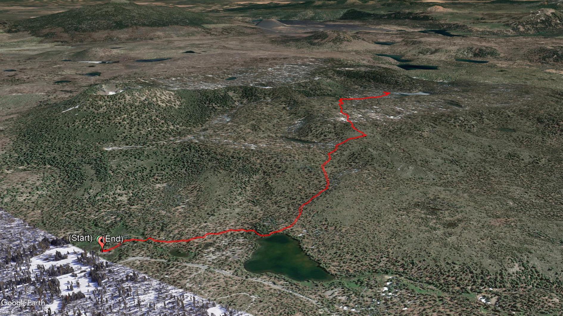
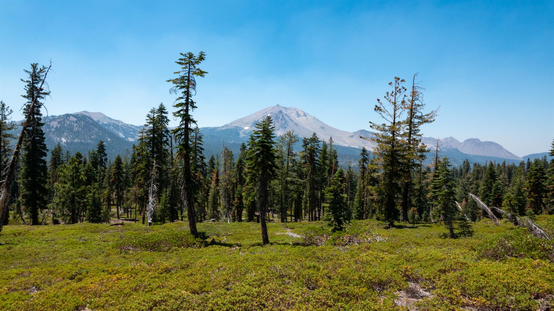
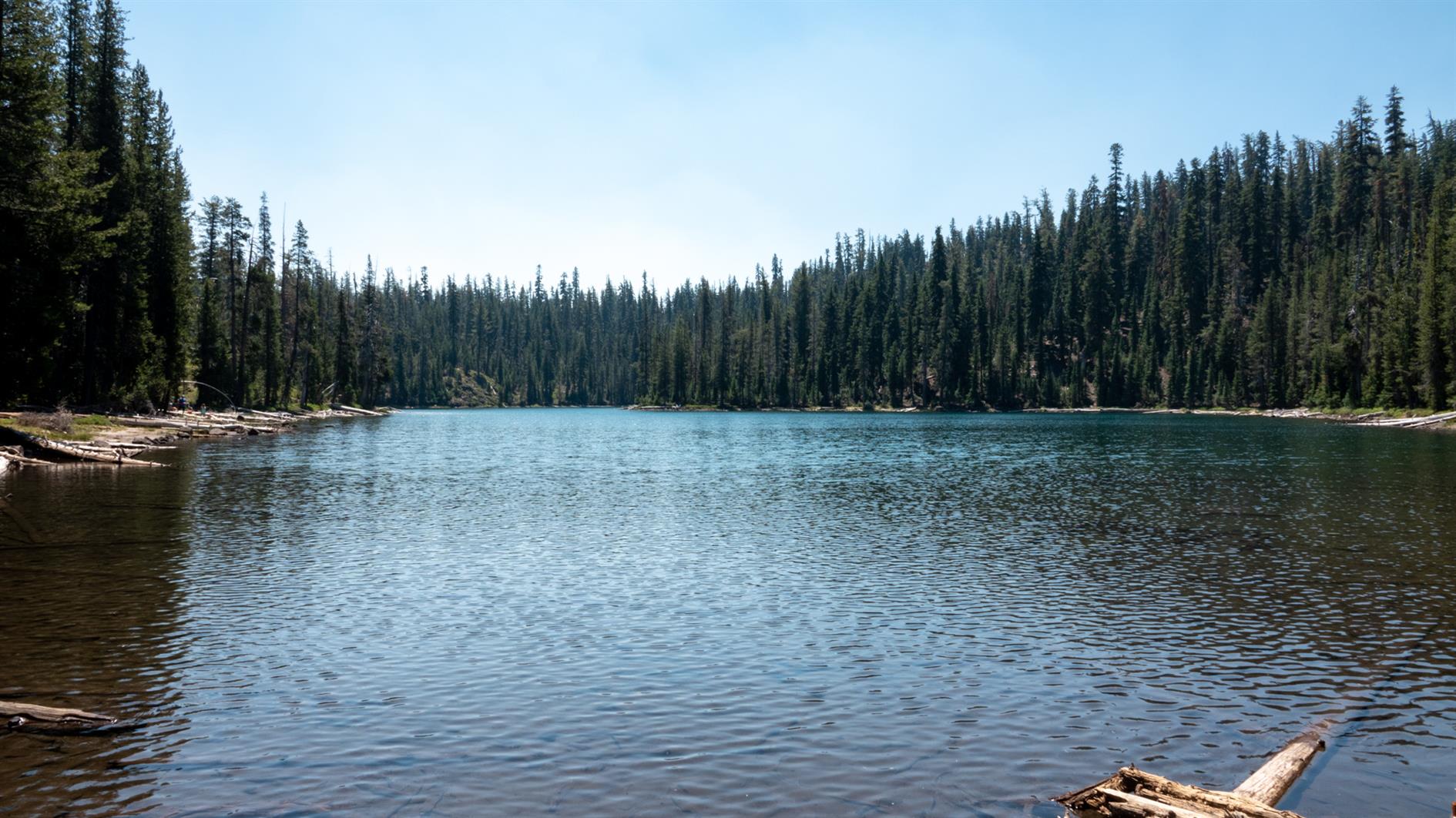
A 4.5 mile out and back hike to Echo Lake in Lassen Volcanic National Park. Start at the Summit Lake Ranger Station, take the short trail to Summit Lake and then follow signs to Echo Lake.
Hike starts at: 40.498228, -121.42711. View in Google Earth.
Related Posts
You Might Also Like
- Washington Post Misleads With Statistics On First Republican Debate
- Mission:Explore Food - Get It Now
- bye, bye, Miss Deprecated API
(Hike Map)
(Published to the Fediverse as: Summit Lake to Echo Lake in Lassen #hike #lake #lassen #map Hike from Summit Lake to Echo Lake in Lassen Volcanic National Park. 4.5 miles out and back. )
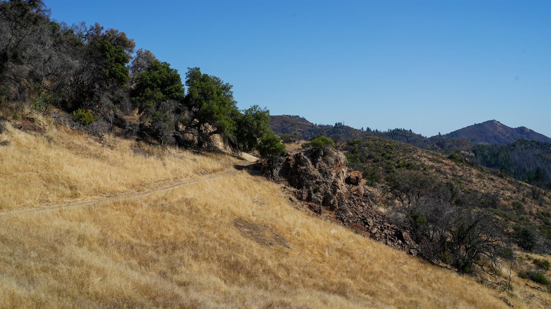
Teague Hill Preserve

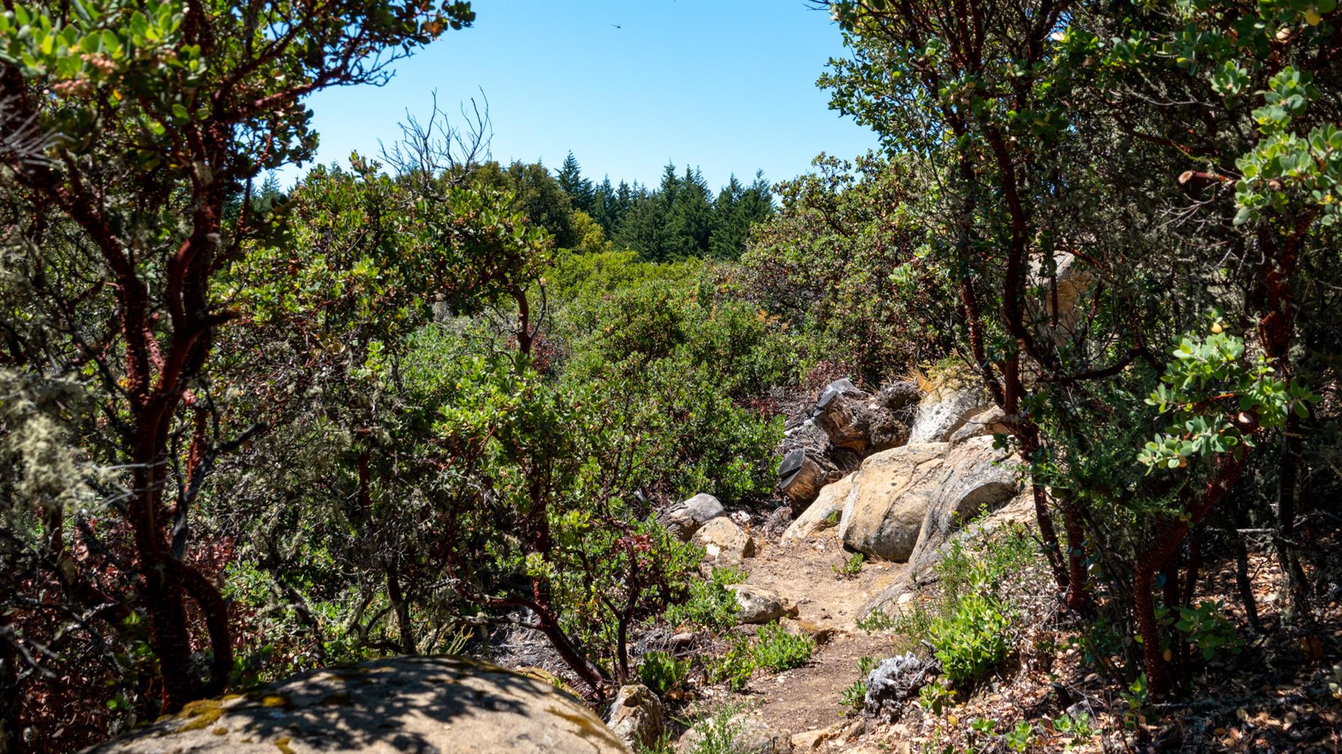
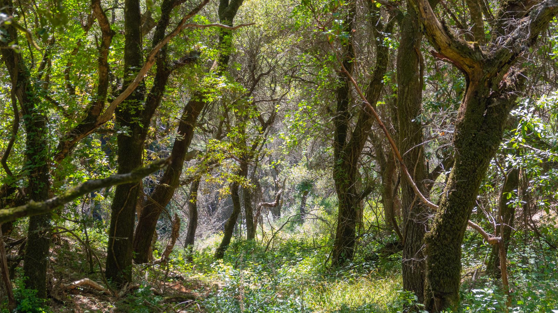
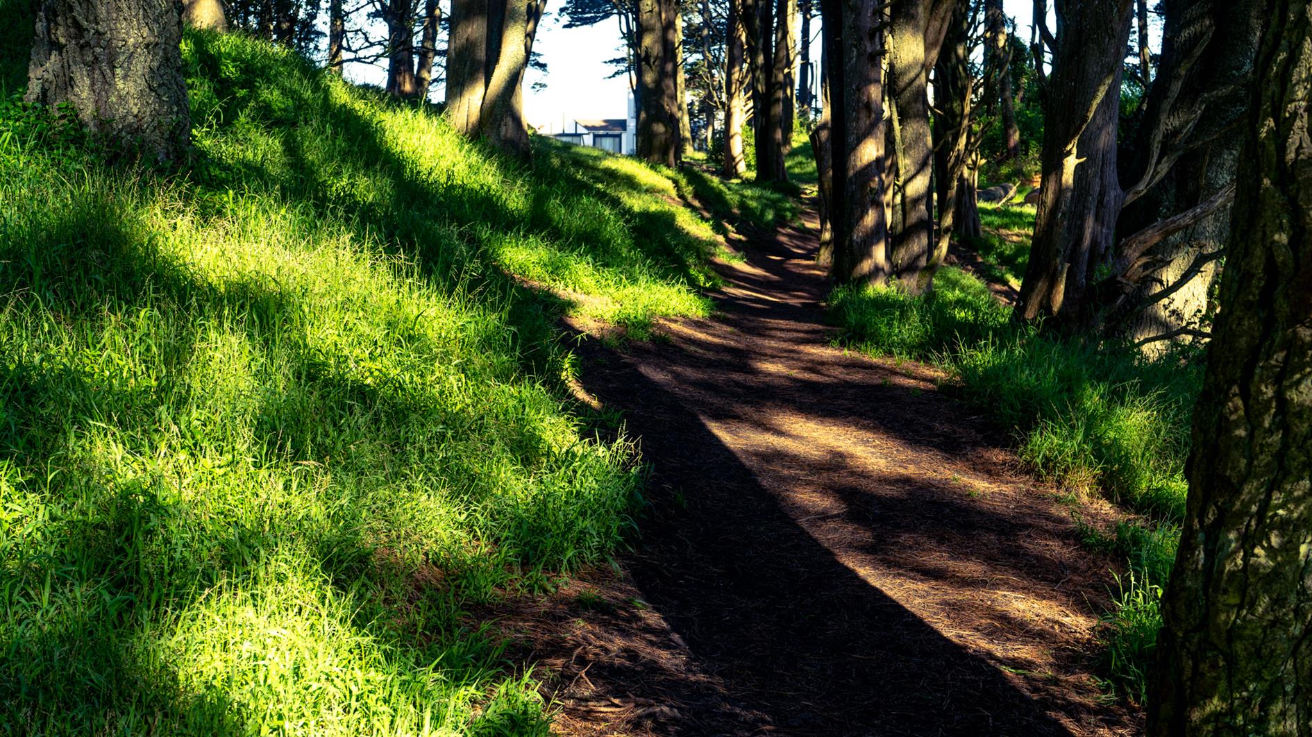
A four mile, 1,400 foot hike into the Santa Cruz Mountains from just above Woodside. The trail is almost entirely under canopy but with a lot of variety and the occasional snatch of a view of the bay as you climb. The Bear Gulch section is very steep in places, if I did this route again I'd try Marker 3 to Marker 11 to see if the descent is more forgiving. Oh, and make sure you have a map or a downloaded route, there are a lot of trails with multiple entrances so it would be pretty easy to get lost here.
Hike starts at: 37.424658, -122.281739. View in Google Earth.
Related Posts
You Might Also Like
- Change in Presidential Vote from 2000 to 2020 by US County
- International Date Line Longitude, Latitude Coordinates
- High Roller Timelapse
(Hike Map)
(Published to the Fediverse as: Teague Hill Preserve #hike #map 4 mile hike with 1,400 foot elevation gain in the Santa Cruz Mountains near Woodside, California. Bring a map. )