San Francisco from Hill 88
Updated on Monday, September 6, 2021
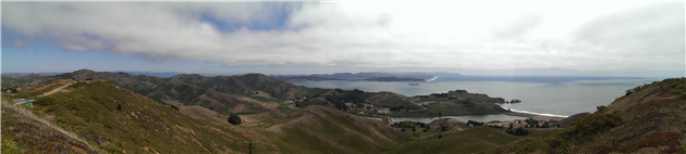
Hill 88 is a favorite walk when the Marin headlands are free from fog. Starting from Fort Cronkhite the Coastal Trail winds up to Hill 88 at 960ft, past various WWII era coastal defenses. Cross the ridge and descend down Wolf Ridge Trail and Miwok Trail to complete a 4.5 mile loop.
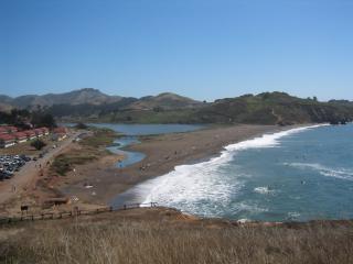
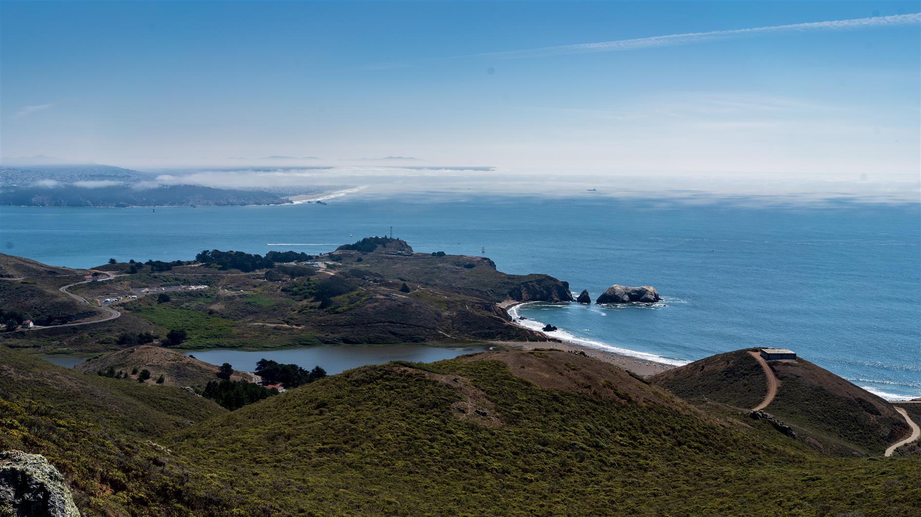
Rodeo Beach viewed from the Coastal Trail. As you ascend there are views of the Golden Gate Bridge and San Francisco.
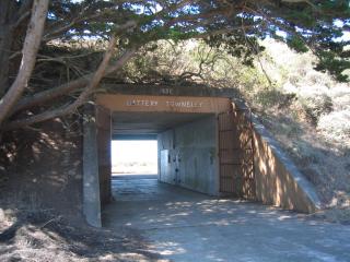
Battery Townsley, one of several coastal defenses passed on the walk.
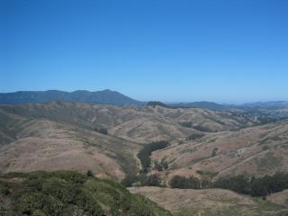
View of Mount Tamalpais as you begin to descend Wolf Ridge Trail.
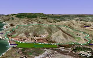
(4.56 miles, total elevation gain 1,142 feet, 1 hour 38 minutes (average 2.79 mph), view in Google Earth)
Hike starts at: 37.832683, -122.526217.
Updated 2021-09-07 17:55:
Having done this walk many times I would now recommend doing it counterclockwise. You get a nice flat stretch to warm up, a fairly steady climb to the top and then can enjoy the ocean views on the way down if the fog is cooperating.
(Hike Map)
(Published to the Fediverse as: Hill 88 #hike #hill88 #marinheadlands #sanfrancisco Marin Headlands hike up Hill 88, a loop of just under 5 miles and a little over 1,000 feet of elevation gain. )
Export Google Fit Daily Steps, Weight and Distance to a Google Sheet
Accessing Printer Press ESC to cancel
Upgrading from word2vec to OpenAI
International Date Line Longitude, Latitude Coordinates
Monitor page index status with Google Sheets, Apps Script and the Google Search Console API
Download a Sharepoint File with GraphServiceClient (Microsoft Graph API)
Scanning from the ADF using WIA in C#
Automate Google PageSpeed Insights and Core Web Vitals Logging with Apps Script
Enable GZIP compression for Amazon S3 hosted website in CloudFront
User scoped custom dimensions in Google Analytics 4 using gtag